Slovakia & The Czech Republic – June 2026
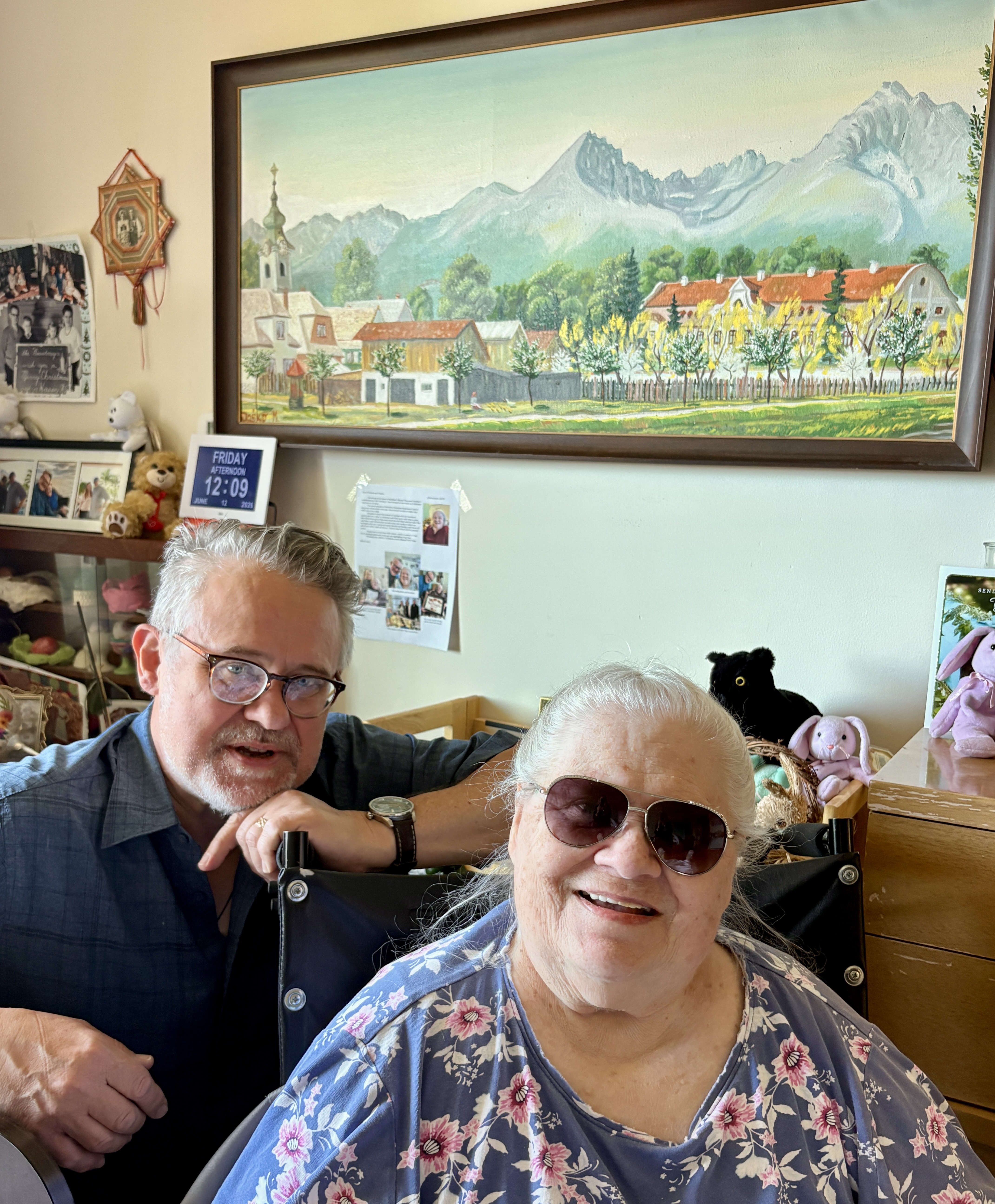
This journey starts close to home. Two days before Mary and I flew out for Prague, we drove down to Illinois to visit my elderly mother Anna, who grew up in the Slovakian village Batizovce. Mom lived there under Nazi occupation and later under the Soviet regime. The last time she visited was in the late 1970s. I’ve never been there. Next week Mary and I will retrace my mother’s steps, as well as visit the sites of some of my ancestors. Thanks for joining my story.
Batizovce – My Mom’s Origin Story
On the morning of our visit to my Mom’s hometown village, we awoke to a grand breakfast buffet. In my experience, hotel breakfast buffets are heaven on earth. I’m talking about more than just 4 star hotels.
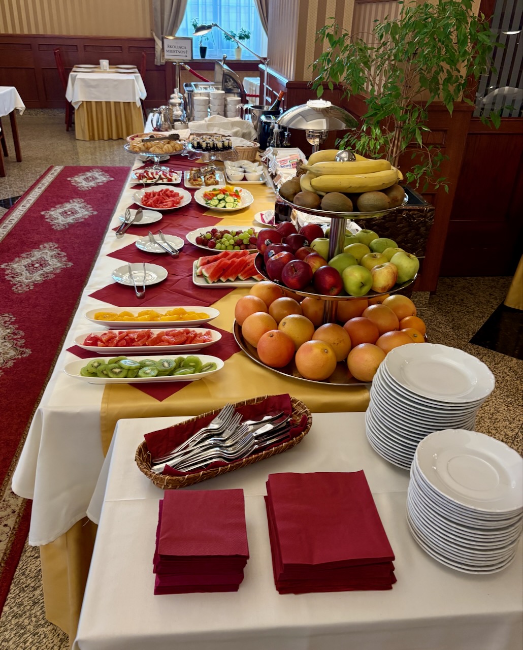
The “free breakfasts” so common hotels in the United States are garbage. My theory is that rampant, unfettered capitalism has ruined the American breakfast buffet because corporate hotel owners are trying to squeeze every last dime out of their franchises to line the pockets of their stockholders. In Europe? They still care about hospitality and this morning’s Slovakian breakfast was excellent.
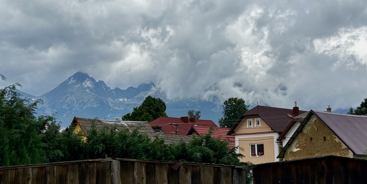
The day was full of clouds and sun and you had to be quick to catch glimpses of the High Tatra Mountains. This range looms over the village of Batizovce, where my mom grew up. The Tatras are part of the Carpathian Mountains.
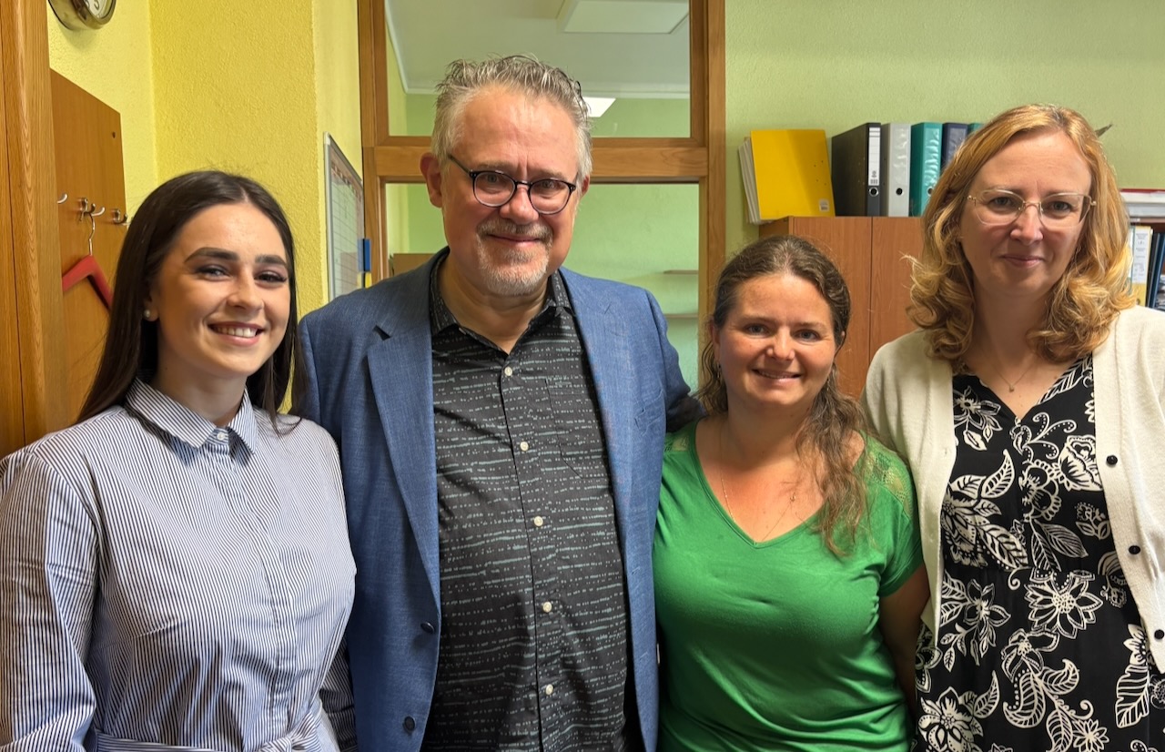
True story: Mary and I took a 10 minute taxi into Batizovce to the village’s municipal office. We came here to drop off a thank you gift for Mária Hudakova, who I had corresponded with; weeks ago she helped me identify the graves of my great grandparents. When Mary and I entered, Mária called in her younger colleague, Zuzana, to translate.
Lo and behold Zuzana soon realized that she is my second cousin twice removed! (her grandma’s dad was my great grandpa’s brother).
In 1938, when my mother was 4 years old, my grandma Zuzka traveled from New York to Czechoslovakia on an Atlantic steamer to visit her relatives. Meanwhile, my grandpa, Andrei Faber, remained in the United States to work. During Zuzka’s stay in Batizovce, Hitler invaded Czechoslovakia—15 March 1939. My mom and grandma were trapped in Czechoslovakia for the rest of the war and beyond.
Zuzka soon discovered that she was pregnant with her and Andrei’s second child. My aunt Susan, conceived in Younkers, was born in Batizovce.
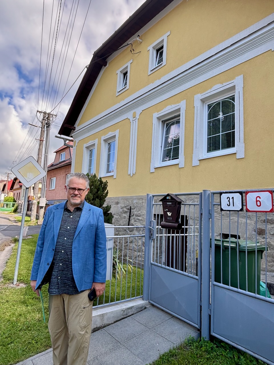
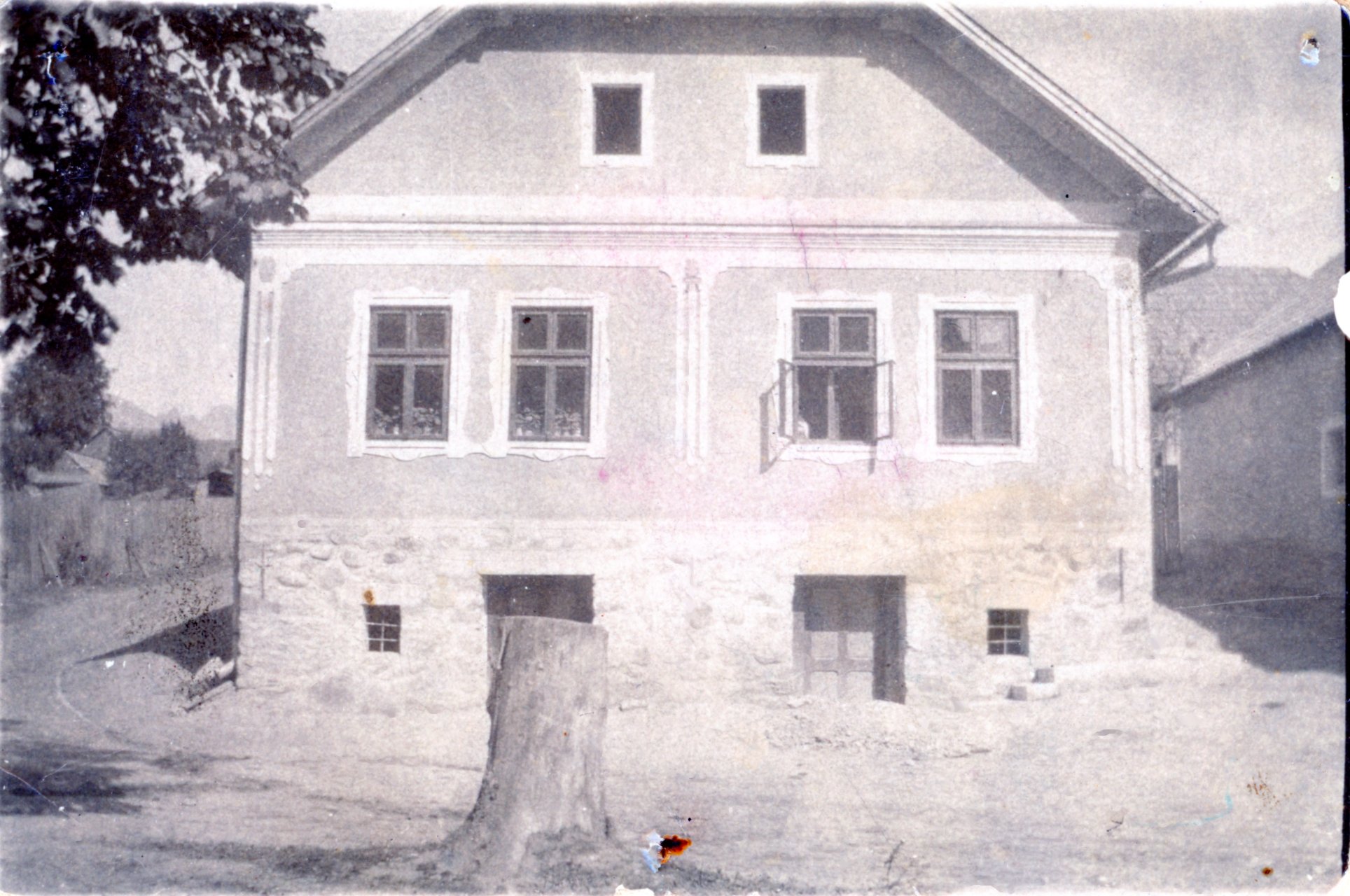
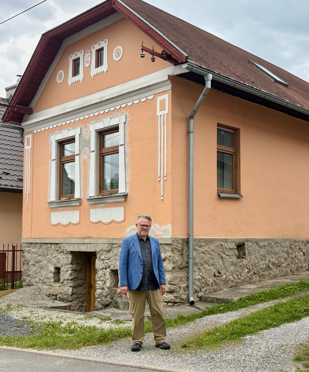
For about the next 13 years my Mom, Grandma and my Aunt lived in this and one other house.
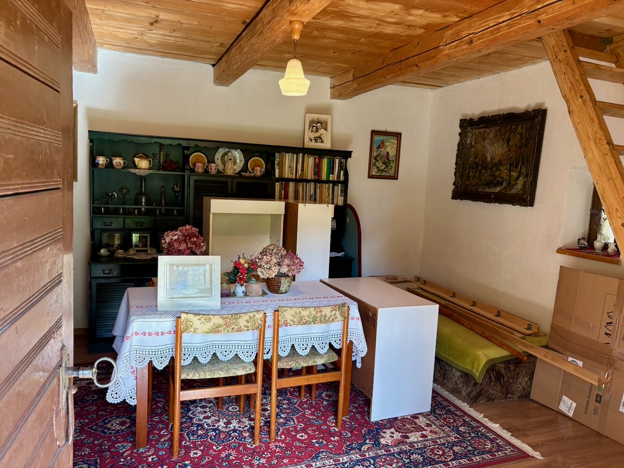
As luck would have it, a relative of mine still lives in this house! Michal Fabar. He remembered my grandma and said this was one of the rooms my mother lived in as a child.
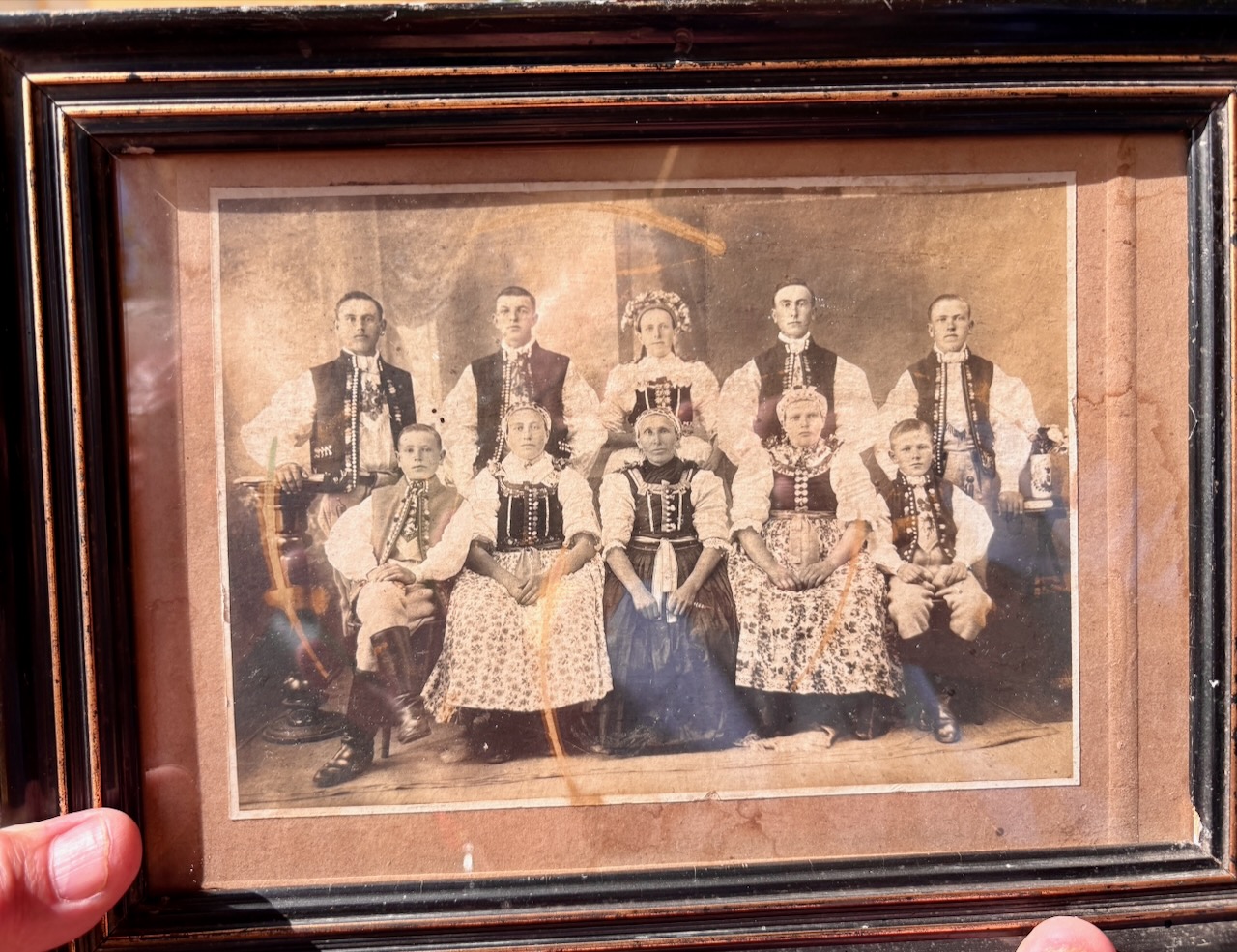
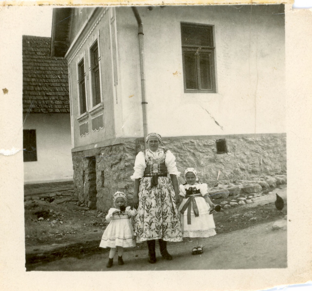
Michal showed me a photo of my grandpa Andrei’s family. Andrei is on the upper far right. Note the boy just under him—Pavel, my great uncle, whose grave I’d see later today.
Michal’s grandfather Jan was my grandfather’s brother. This makes Michal and me second cousins.
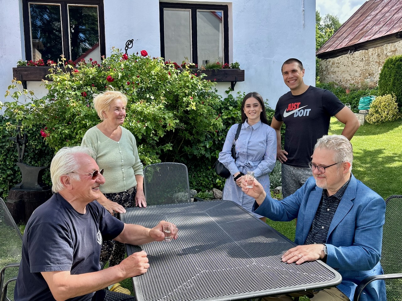
When Michal realized he and I were second cousins, he insisted I drink vodka with him in his back yard. He explained to me the vodka was made right here in Batizovce. Michal is seated to the left.
This movie captures the family explaining to me that the apples in the tree behind me helped make the vodka we were drinking.
During WW II, grandma Zuzka took pity on a Jewish man fleeing the Nazis. She hid him in their barn and fed him. The Jewish man left after a few days, telling grandma Zuzka he didn’t want to endanger their lives by staying.
In those following months, all of my mom’s Jewish playmates were kidnapped by Nazis to be taken away and murdered in concentration camps.
Not long after the Jewish man fled, the Nazis came looking for him. Inside one of the two houses I stood next to today (I’m not sure which one) the Nazis held a Lugar to Grandma Zuzka’s head, threatening to blow out her brains if she didn’t tell the truth. My 8 or 9 year old mom and her toddler sister got down on their knees and begged the Nazis not to kill their mother.
The Nazi said, “I don’t think the girls would lie.” They left.
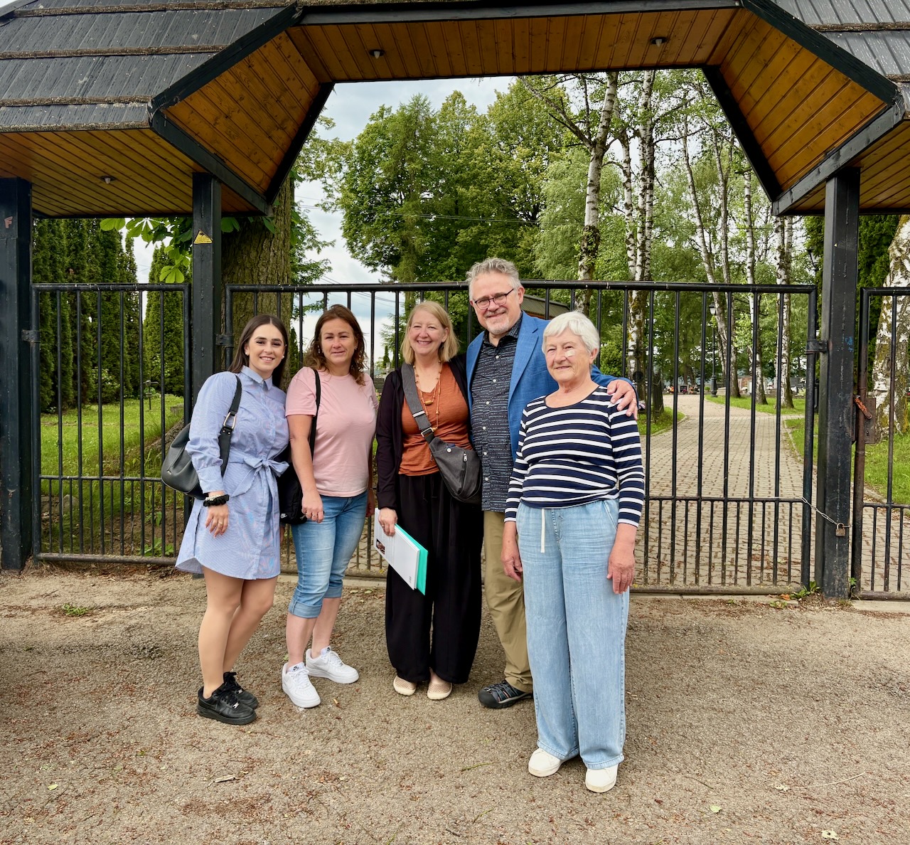
Next, our growing entourage of newly discovered relatives escorted us to the village cemetery to pay our respects to some of my ancestors.
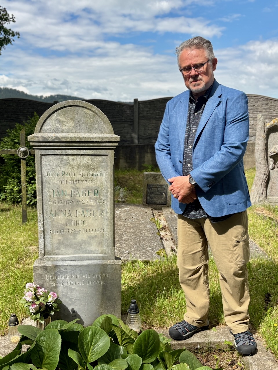
Here is the grave of my grandpa Andrei’s parents, Jan and Anna Faber. Great-grandparents I never met and never learned much about. My grandpa never talked about his parents. I can only imagine the hardship of their daily lives, raising 8 children. I believe it was the stark living conditions in early 20th century Batizovce that impelled my grandparents to emigrate to America. They were stoic and never explained.
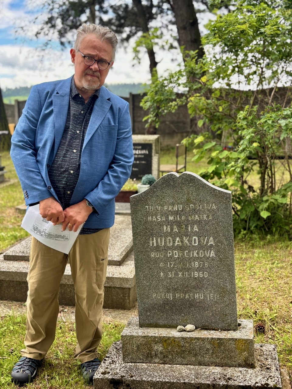
The grave of my grandma’s mother, Maria Hudak. She lived for many years past her husband, passing away just one year after my birth. Like Andrei, Zuzka never talked about her mother or father. I wonder if Maria ever learned she had a great-grandson. I was happy I could pay my respects.
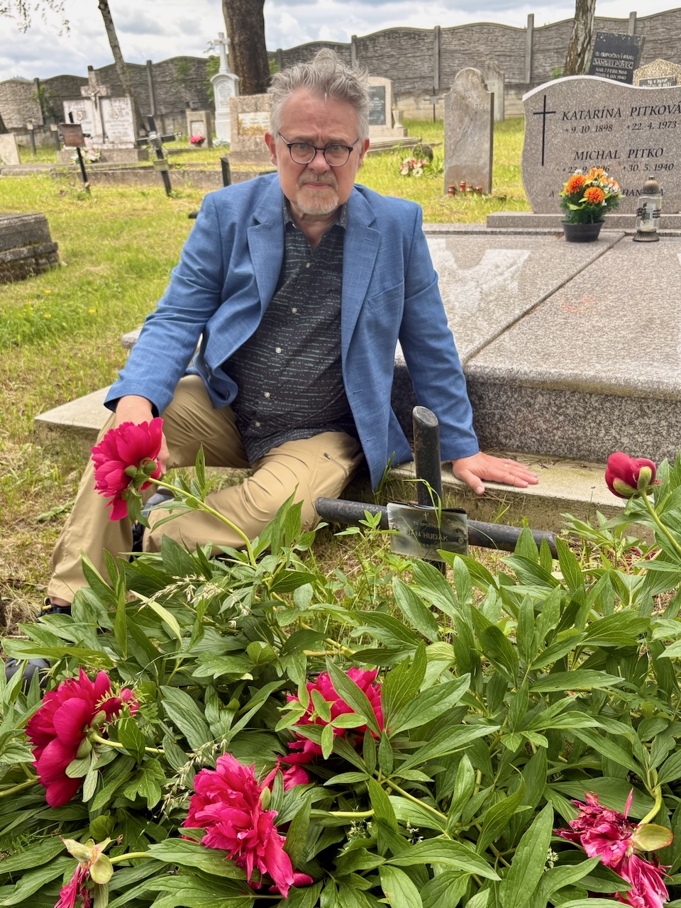
The grave of my grandma’s father, Jan Hudak, was not easy to find. A large peony plant is growing atop him, hiding his tiny marker. He died at a fairly young age, and I know nothing about him. Oddly, peonies have always been my favorite flower. Is this why?
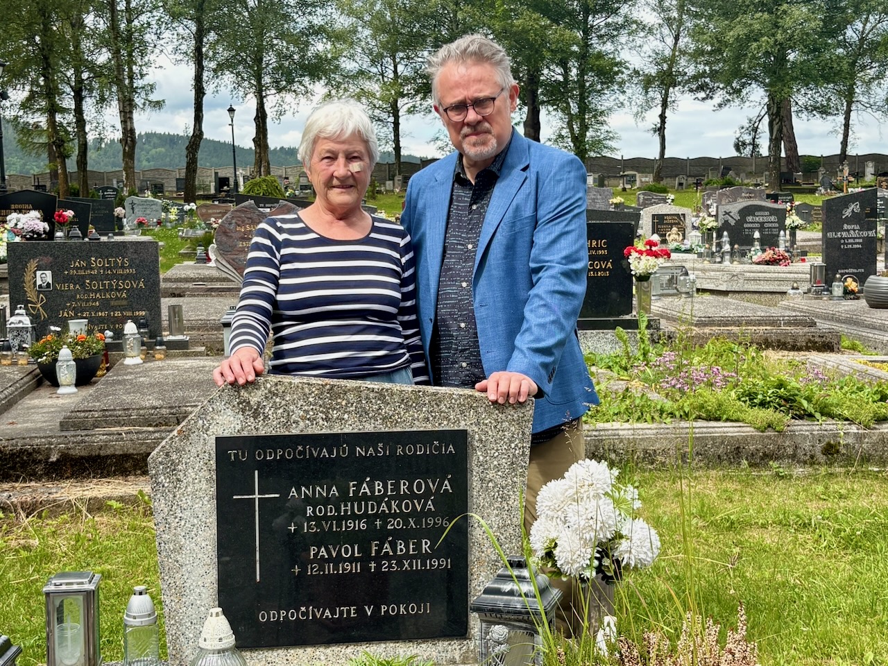
Finally, here is the grave of Pavol Faber, my great uncle. With me is another Maria, a second cousin who I discovered just today. The cemetery here is full of Fabers and Hudaks, and everyone in town, I suspect, is related to one another. Maybe that’s why my grandparents left for America: they wanted to open up the prospective gene pool for their future daughters.
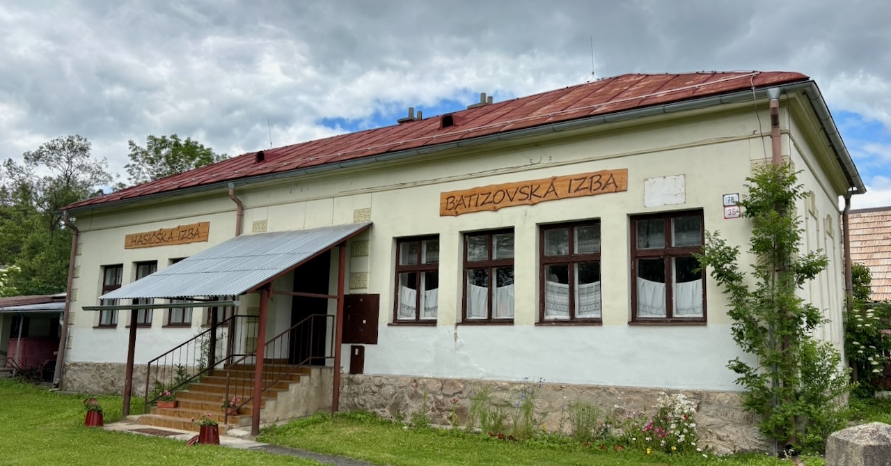
My second cousin twice removed, Zuzana, arranged to open the town’s museum. Turns out, this building was the school house where my mom went to school.
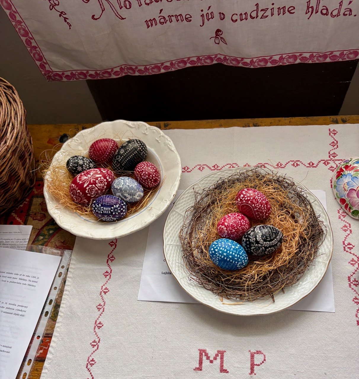
Inside the school I found some traditional Slovak Easter eggs decorated the way my mom used to make them. When my mom got too old to make them anymore, there was no one left except for my sister who knew how to make them. I thought the art was all but lost.
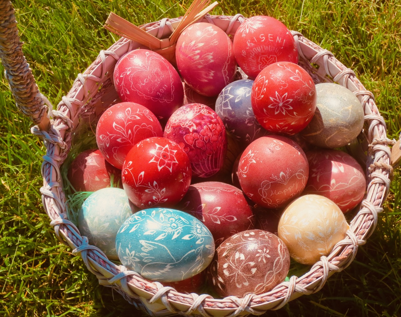
Here’s an old photo of some of the Easter eggs my mom made years ago, Slovak style.
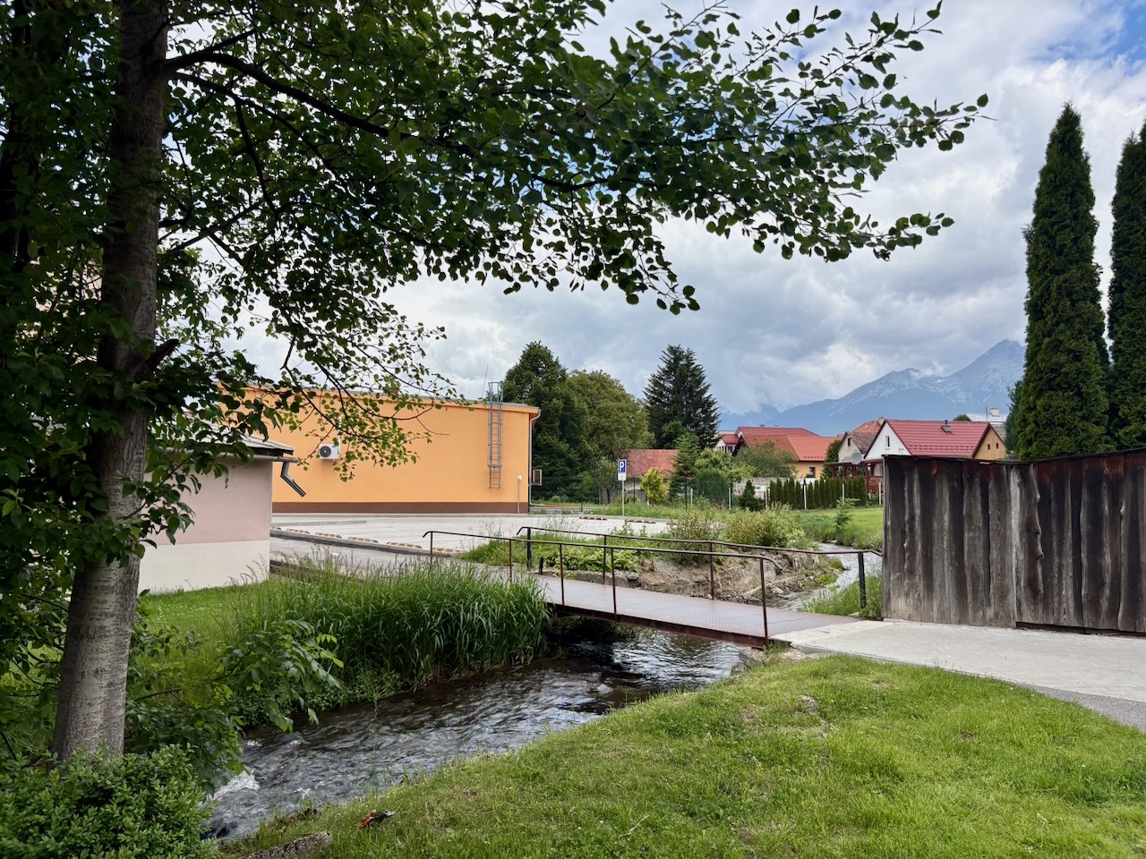
One more horrid WW II story: This stream, called Velicky Potok, runs through the village.
When my mom was between 8 or 9 years old, Nazi soldiers took my mom’s cat, tied a brick around its neck and forced her to watch it drown in this stream.
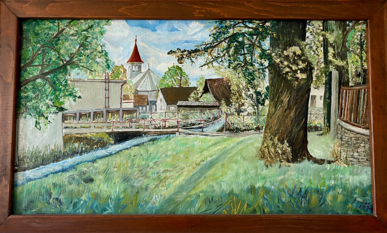
Here is a painting my mom has had for decades, showing approximately the same scene as I photographed today.
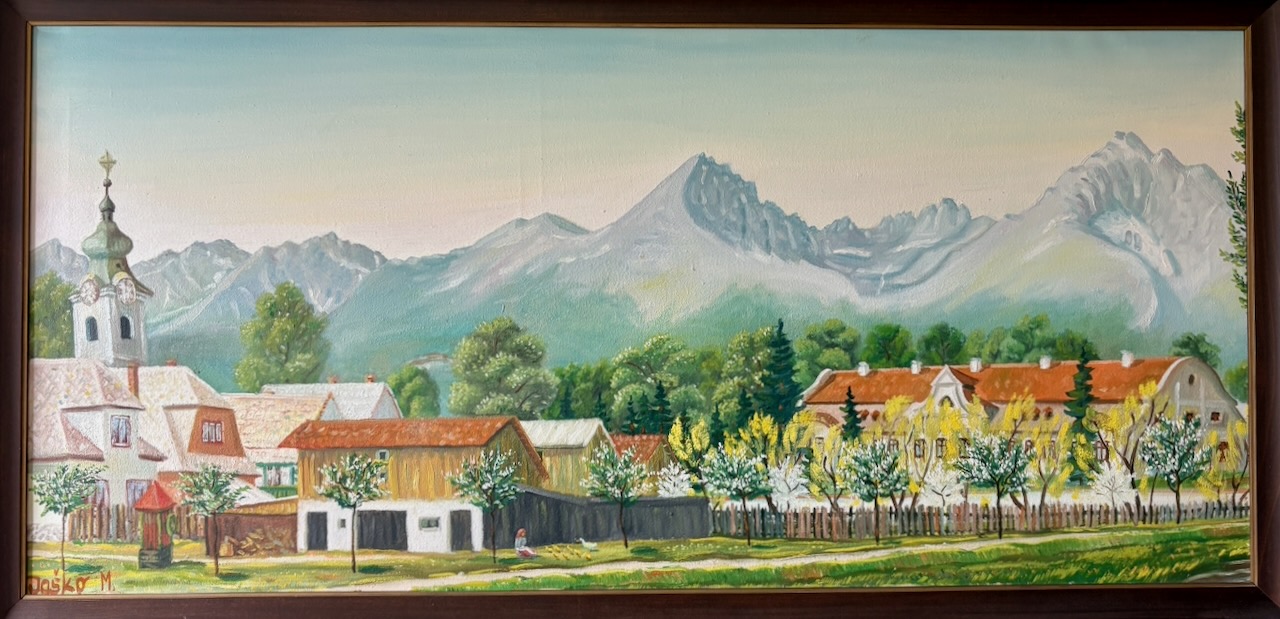
Here’s another painting by the same Slovak artist. I have no idea of his name. My mom acquired this painting back in 1970s when she last visited Slovakia. For decades it hung over my parents’ fireplace. It’s a painting of Batizovce.
Today I tried to recapture this painting’s perspective of the village via my iPhone. But years of development and tree growth and, I suspect, some poetic license on the part of the artist, made it impossible. But see the next shot.
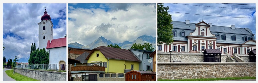
Here…I’ve matched up three separate shots that sort of mimic the panorama of the painting. Left to right, the Catholic church, the High Tatras over the village, and a large social center for developmentally disabled adults.
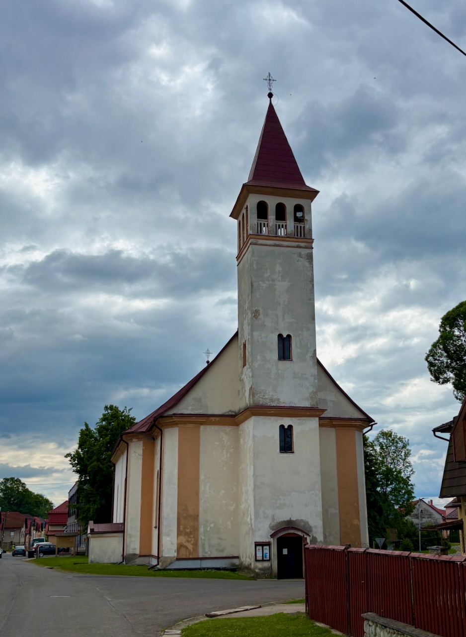
My grandparents, Andrei and Suska, were married in this Batizovce Lutheran church in 1928. Sometime in the next 4 years they immigrated to the United States. In 1934 my mom was born in Younkers, New York.
In 1938, Zuzka returned to Slovakia with her young daughter. Hitler invaded Czechoslovakia in 1939. It would take 13 or so years for Andrei to get his family back to America. Andrei eventually gave up all his property as a bribe to the Soviet regime, who then authorized travel visas for my grandma, my mom and my aunt. And now you know the rest of the story.
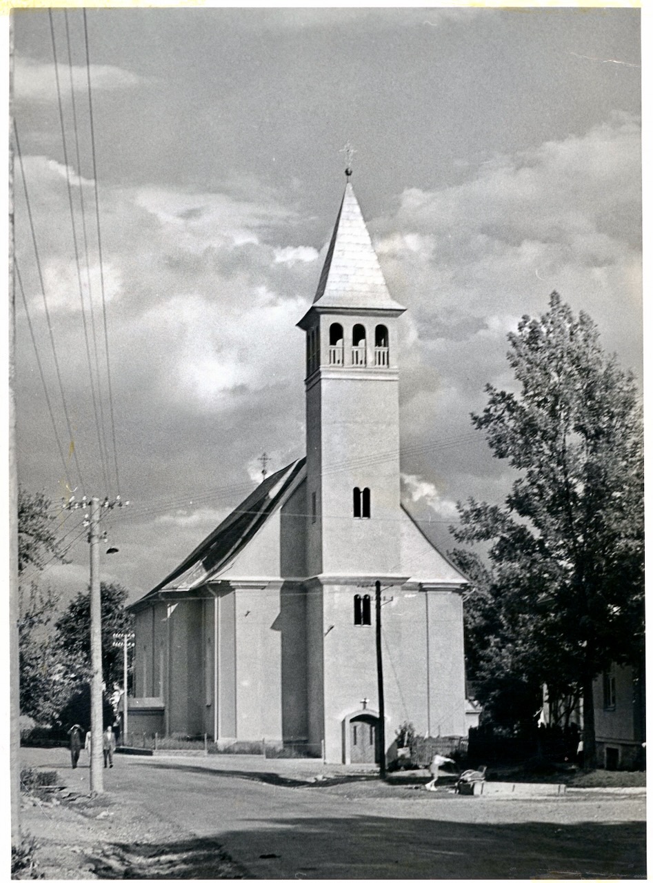
The same church, circa 1940. Batizovce had two churches: the catholic one was built in the 13th century and this Lutheran one was built in the 18th century.
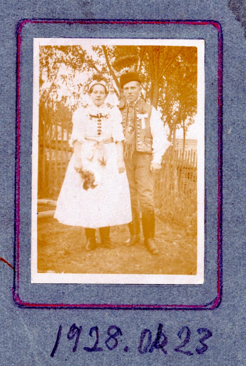
My grandparents on their wedding day in 1928. Soon after they headed for America.
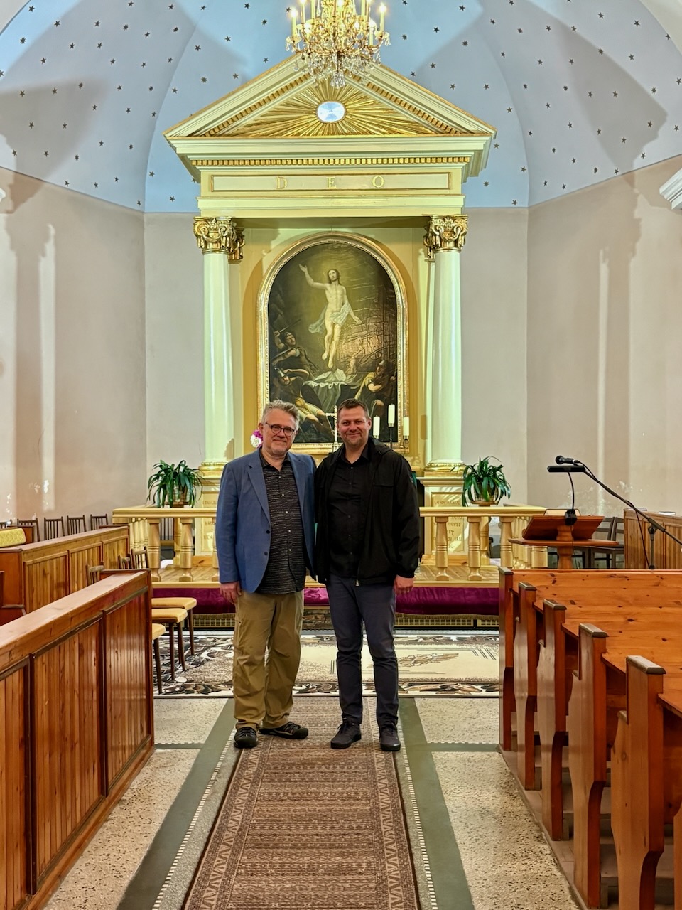
Pastor Miroslav Mato gave us a tour of the church where my great-grandparents were married. This is also the church my mom attended during her childhood.
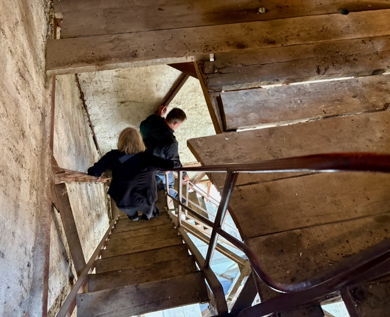
I suspect Pastor Mato somehow sensed I’m an apostate, because he insisted we ascend and then descend this insanely steep and decrepit church steeple. It was a straight up a horror thrill from the movie Vertigo.
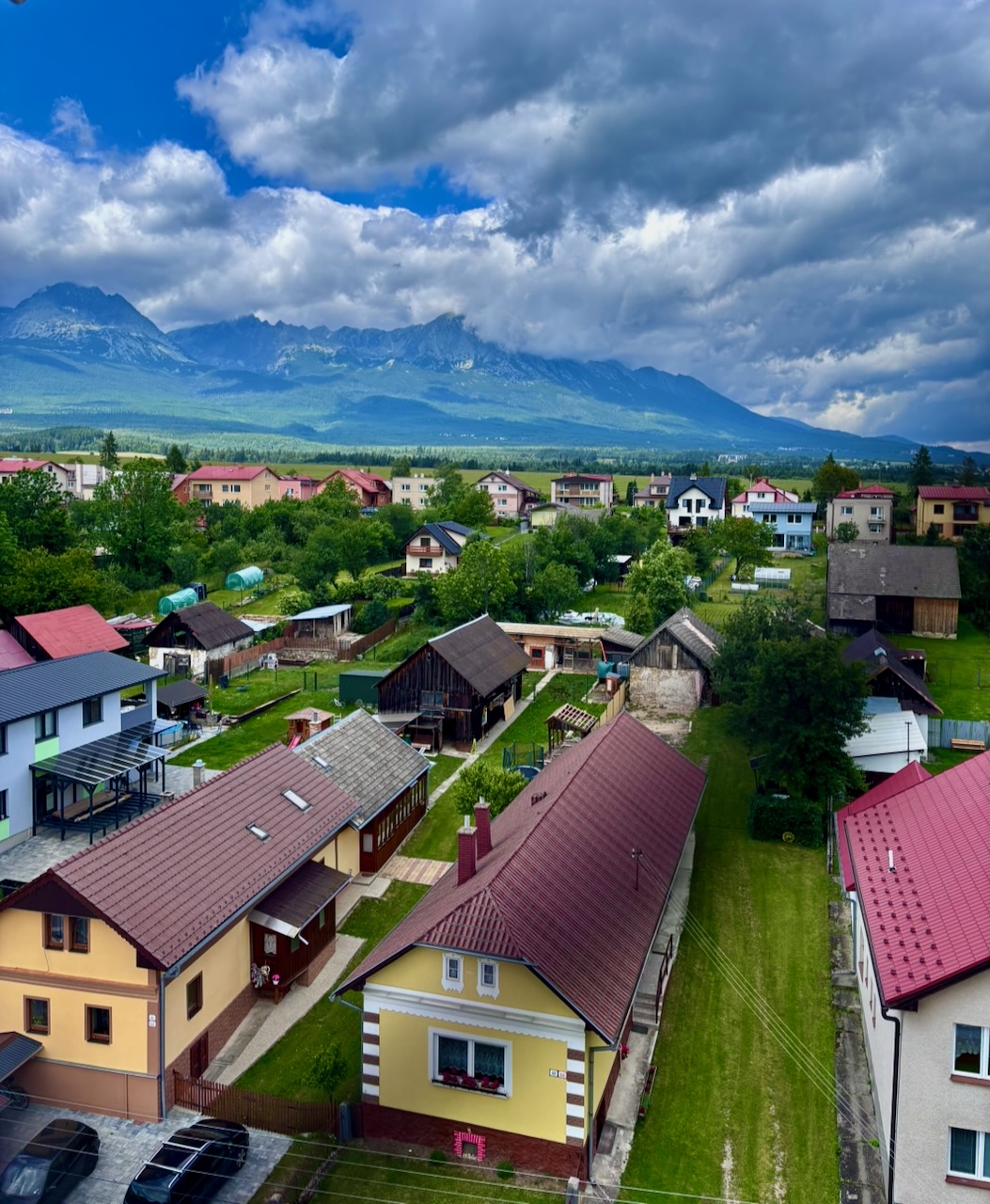
Up atop the steeple, Mary was able to grab this great shot through the protective chain link of the village reposed beneath the High Tatras.
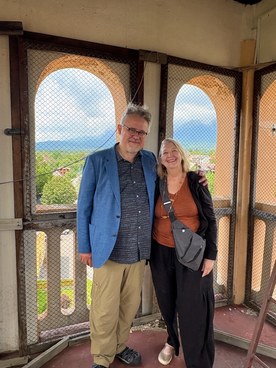
Mary and Yours Truly atop the church, thankful not to God, but to luck and to the good will of my distant relatives for an amazing day of discovery. I suspect I might be related to every soul in this village! Despite the way that sounds, everyone here was absolutely lovely and have invited us back. And yes, they all hate our American president.
Today my heart is full.
