Songs of the Portuguese – Part I of Our 2023 Journey to Portugal…OR, PORTUGAL AS THE OPPOSITE OF THE TROUBLES OF MY HOMELAND
Mary’s and my second trip to Portugal brought us on a journey to sample Portuguese lifestyle differently than we did a year ago. Back in the winter of 2021-2022, we stayed mostly in the southern region, the Algarve. This time we decided to split our time between the so-called “Silver Coast” region and, later, Madeira Island. This installment is about our Silver Coast travels.
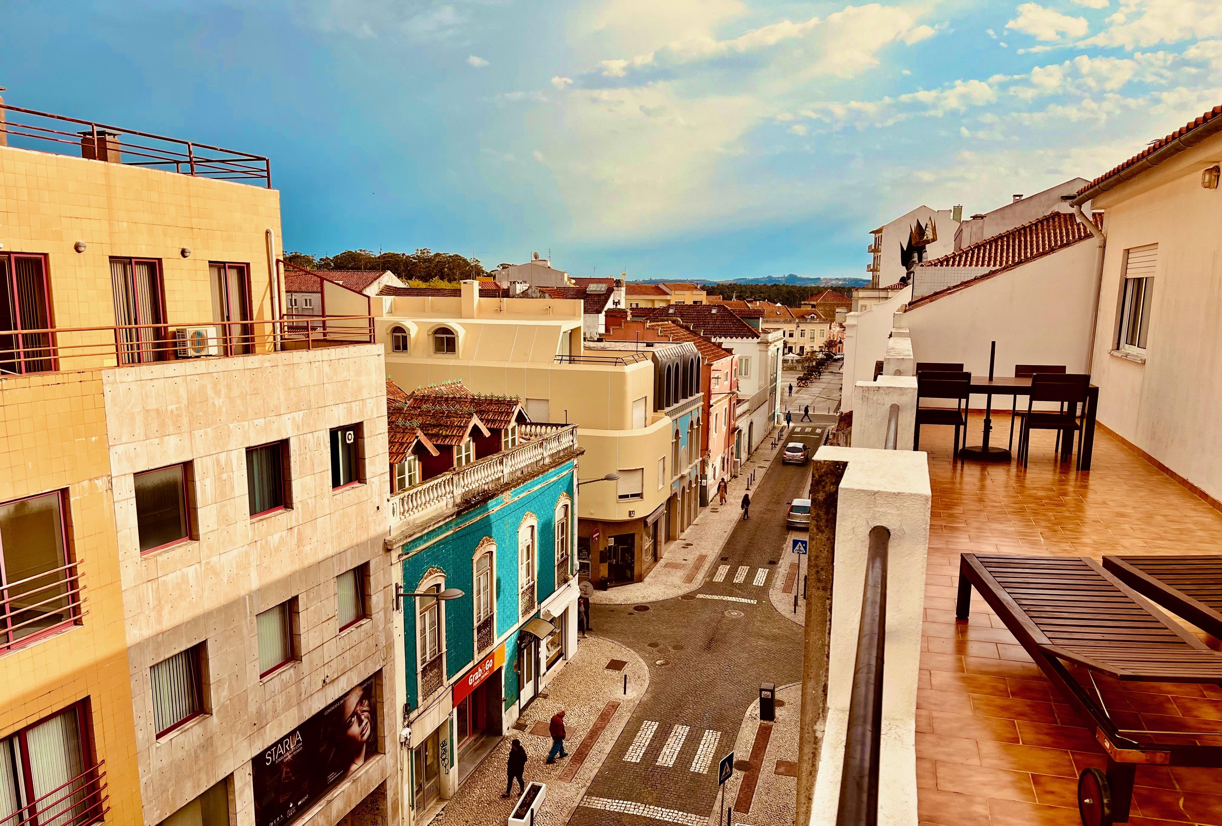
We first chose to stay in the town of Caldas da Rainha. This is the view of town from the balcony of our VRBO. Most Portuguese towns on the mainland date back into medieval times, and so the roads are narrow and lined with a mix of old and new, refurbished and falling down.
The “Silver Coast” is the stretch of coastal territory between north of Lisbon and south of the city of Porto. Named for the silver of the fog and mist that’s common in many of the micro-climates in this region. A couple of our mornings here we found fog obscuring sunrise until it burned off.
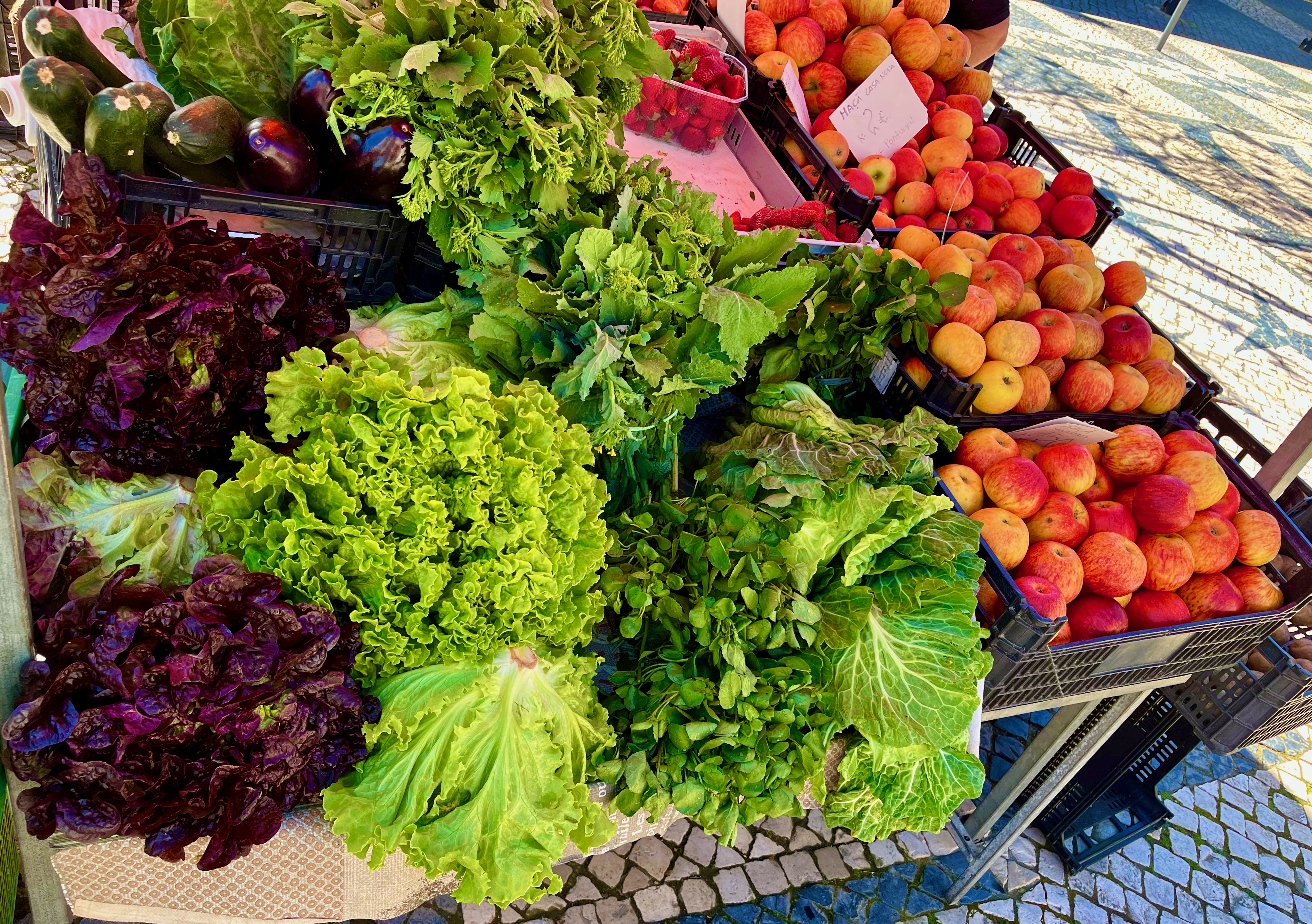
Caldas da Rainha features an expansive local farmer’s market in its main square. Unlike my home town of Madison, this farmer’s market is not once a week, but every morning.

This is a Mediterranean climate and so the vegetables and fruits grown locally are amazing and sumptuous. And because it’s Portugal, they’re ridiculously inexpensive. The farmers at the stands were very kind of to us Americans. I still haven’t completely figured out Euro coins, and the farmers tend to mumble or quickly speak the prices in Portuguese. They’ve become used to the custom of foreigners holding out a palm of coins; they pick out the needed amount. All of them have been very gracious. “Thank You” in Portuguese is Obrigato (or Obrigata if the speaker is female). You learn that word very quickly. And they respond, “De nada.”
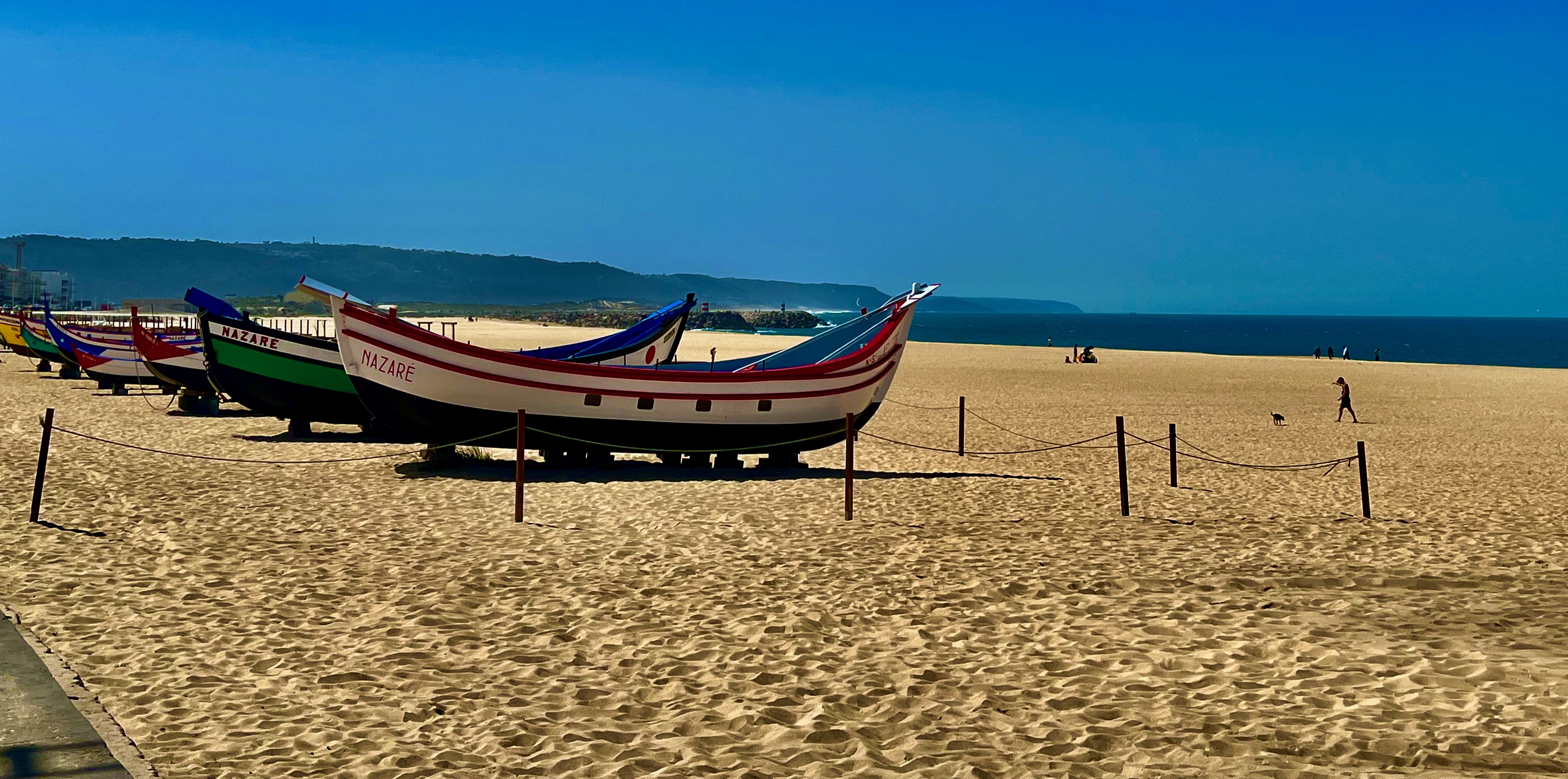
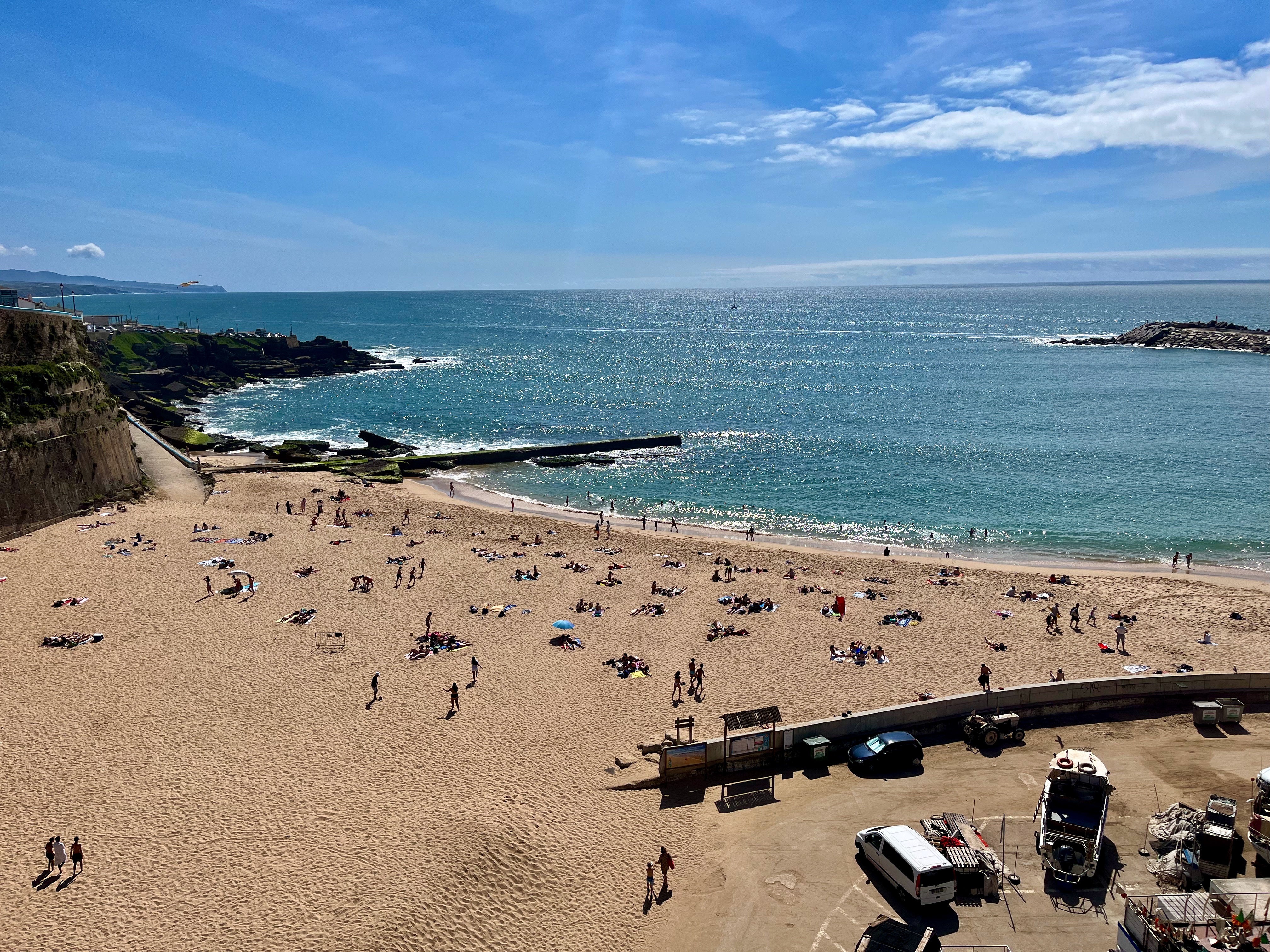
Mary and I took a day trip to drive to some local towns. Here’s a shot of the beach at Nazaré. You might recognize the name. Nazaré is world famous for its killer surfer waves. We did not visit that exact spot; those monster waves crash about half a kilometer north from this serene stretch. Below the surface of the ocean beyond some oceanside cliffs lies a deep rift in the ocean floor which helps create waves over one hundred feet high. No thanks.
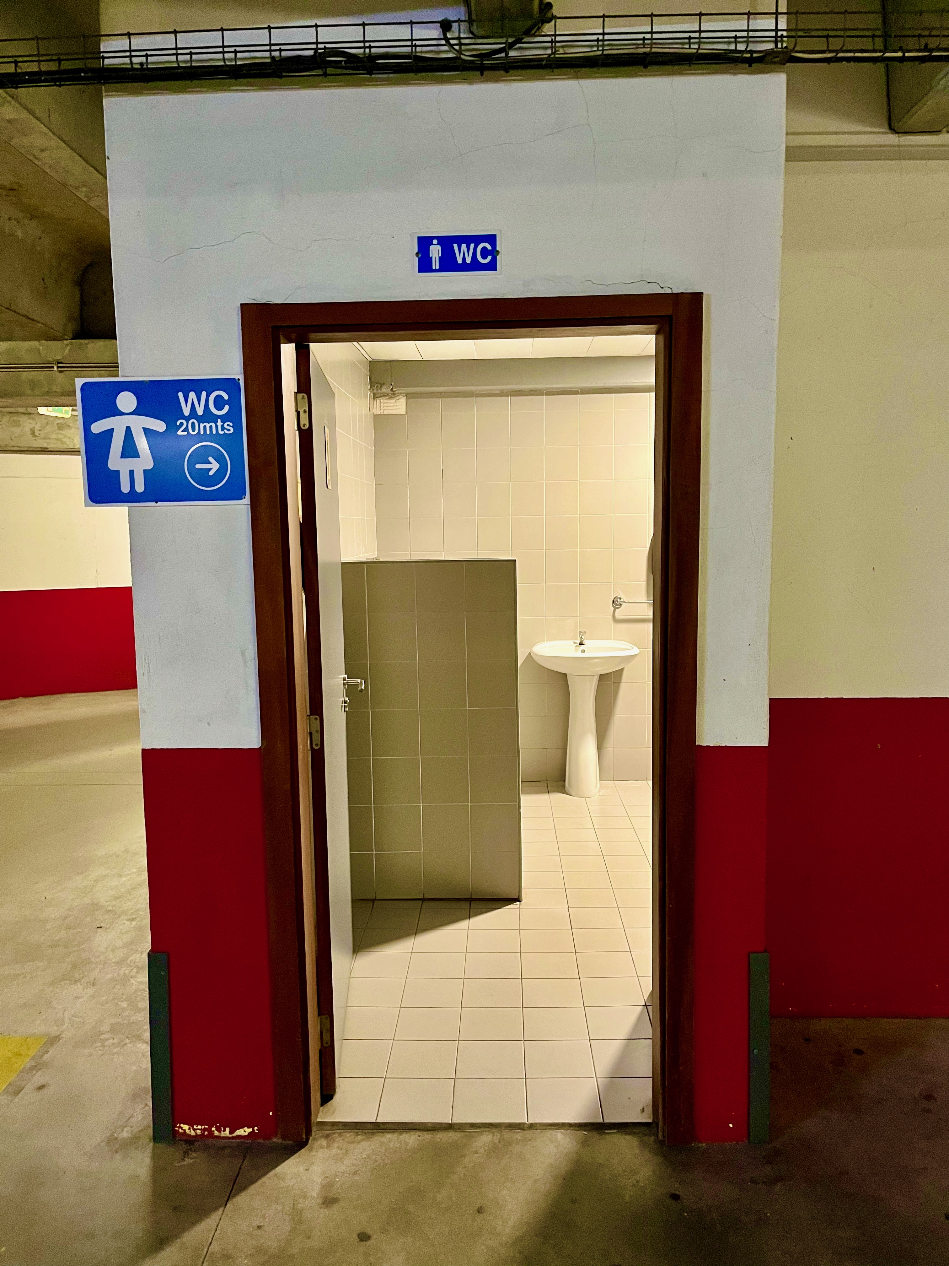
A public toilet in a parking garage in Nazaré. I’m sharing this as a way of illustration.
As time moves on Portugal is becoming more socialist; in the last election in 2022 the democratic socialists won a controlling majority in Parliament. What does this mean? The country and the populace as a whole are moving more toward a society that wants to take care of everyone; that each and every citizen should care for their fellow citizens. This manifests itself in strange tell-tale ways. Beyond the big deal of free healthcare for all or a base living wage, you find that they provide clean public restrooms in the most unlikely of places.
The country has a long way to go–Portugal’s percent of undereducated workers is higher than in most EU countries, and the country is struggling to work its way out of debt. But the attitude of the people you meet on the streets makes it clear what kind of society they aspire to.
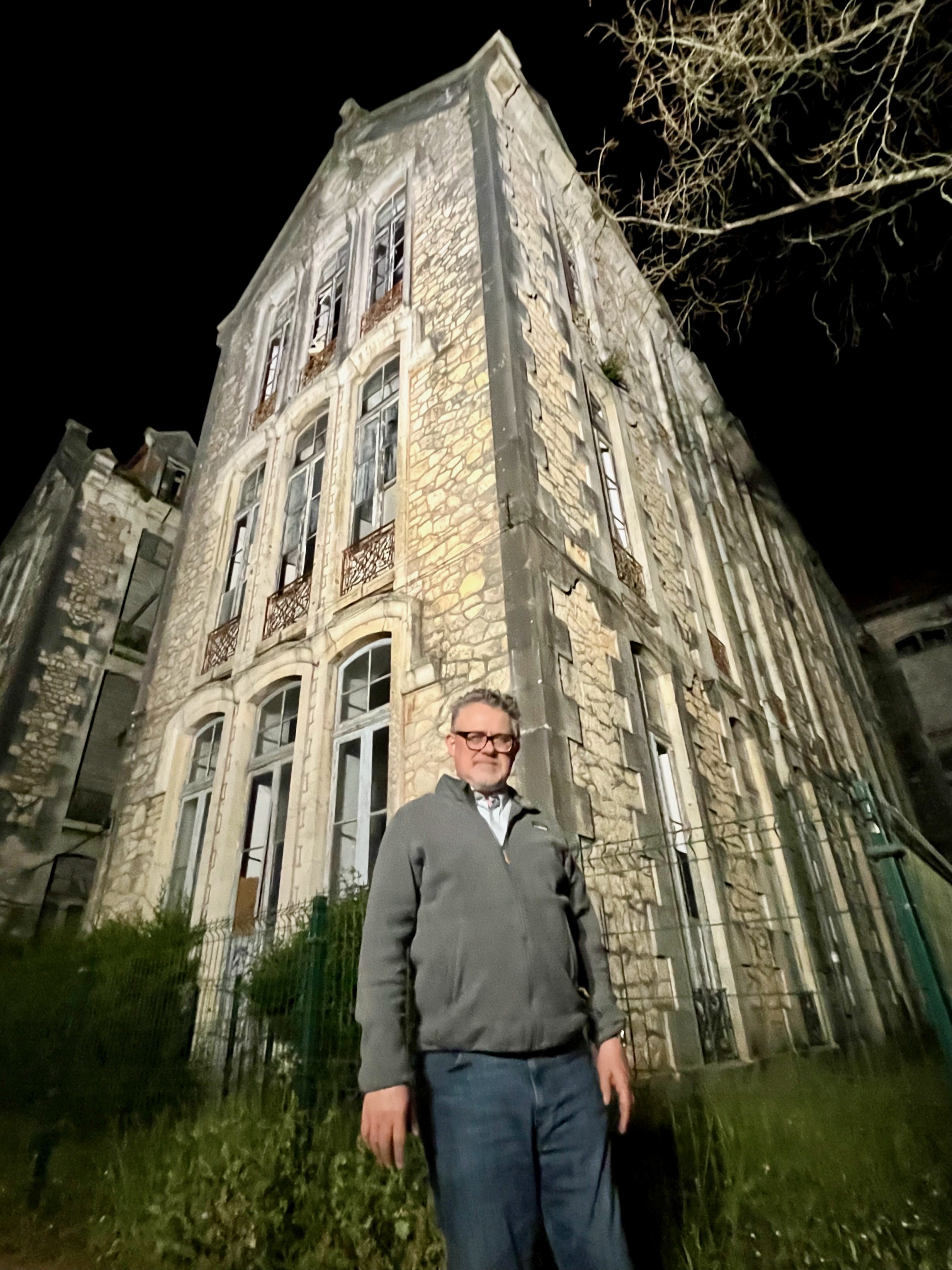
Don Carlos Park in Caldas da Rainha. In the background you can barely see the ruins of an old building.
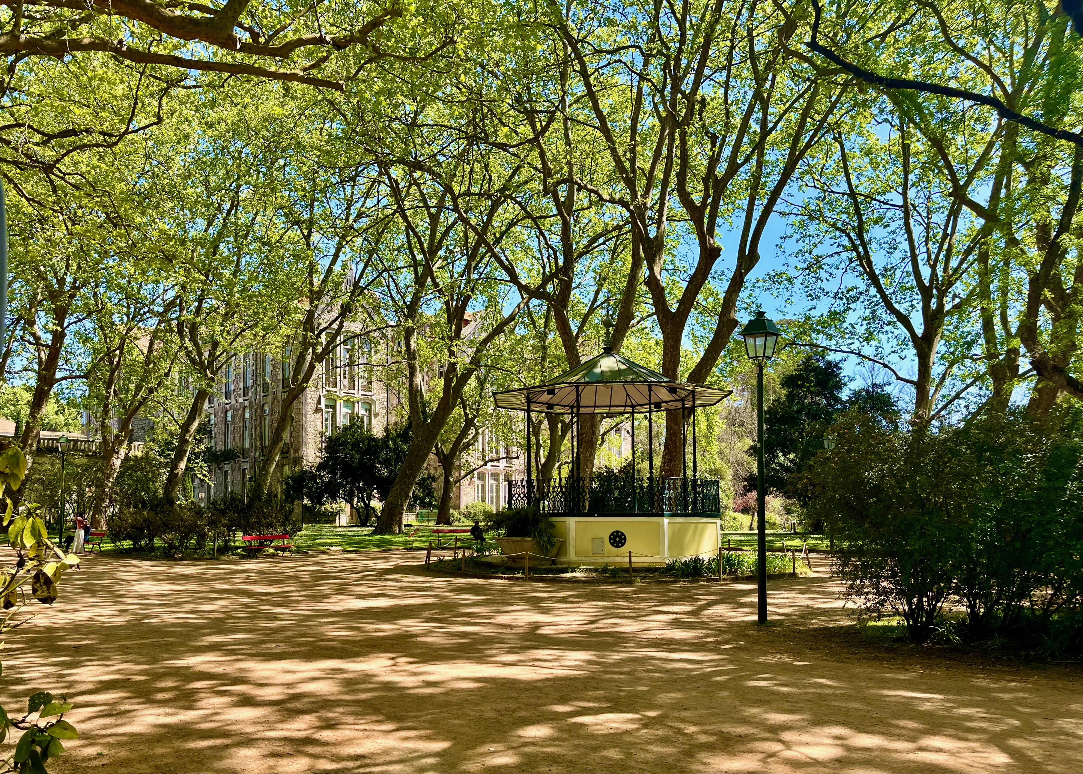
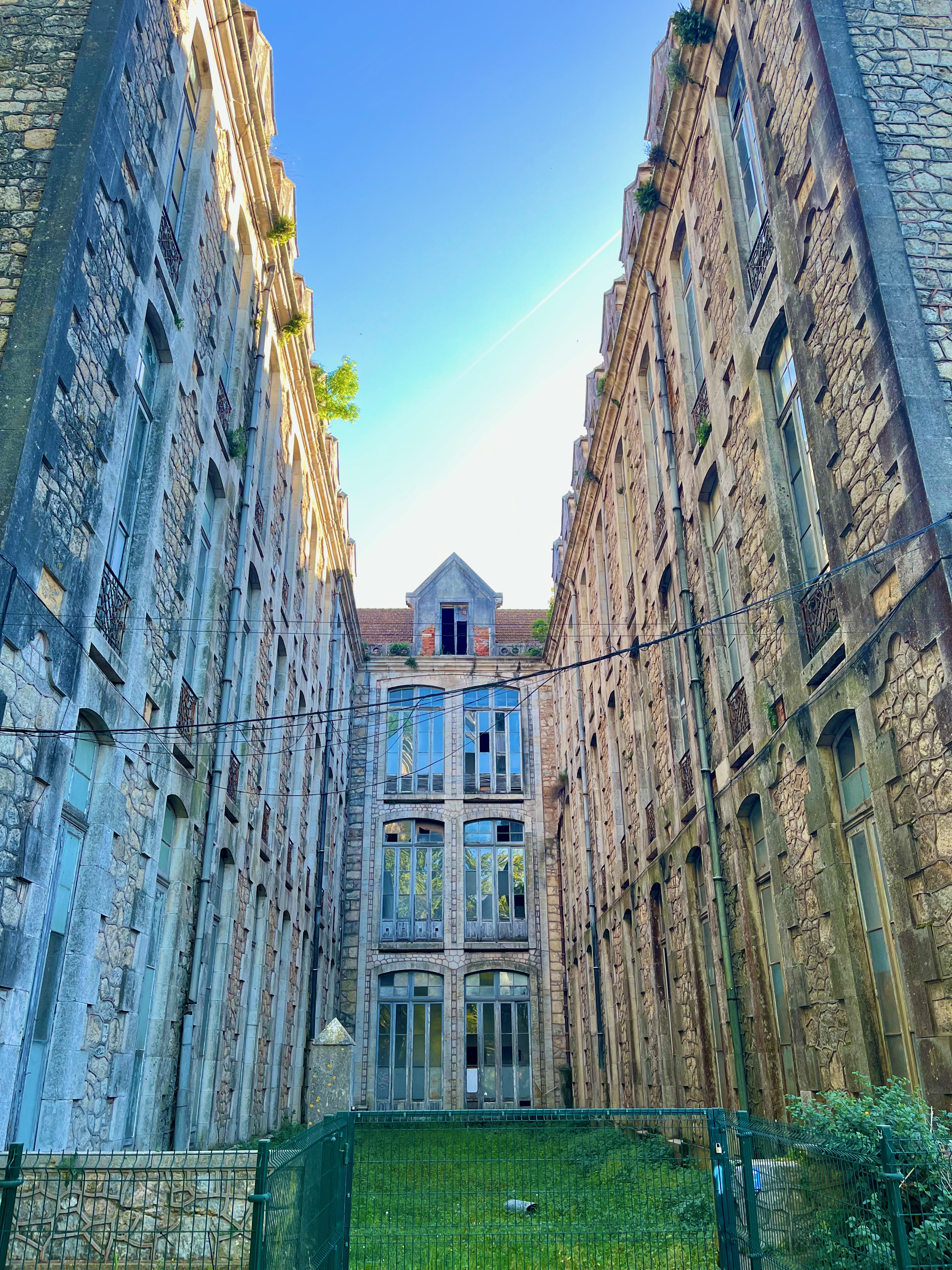
The strange ruins in Don Carlos Park. This was originally built in the 1800’s to be a hospital, but ended up as military barracks, then a police station and finally a school…until it was abandoned.
I couldn’t uncover why it’s just standing here in disuse. It may be connected to Portugal’s byzantine inheritance laws. These laws stipulate that when an owner passes away their property is divided up among ALL of their descendants…and the descendants of those descendants. This explains why many places in Portugal you’ll see new construction standing cheek-to-cheek with ruins. The authorities are unable to trace down every last descendant with a piece of inherited ownership. And so one is unable to take control of the property and it ends up abandoned in legal limbo.
Mary and I met with our expat friend Marla. She and her husband moved to Portugal a few years ago, and she always has great advice for us about what it’s like for Americans to live in Portugal. A few things that delight her are inexpensive but world class healthcare, the distinct lack of guns and the absence of prevalent racism.
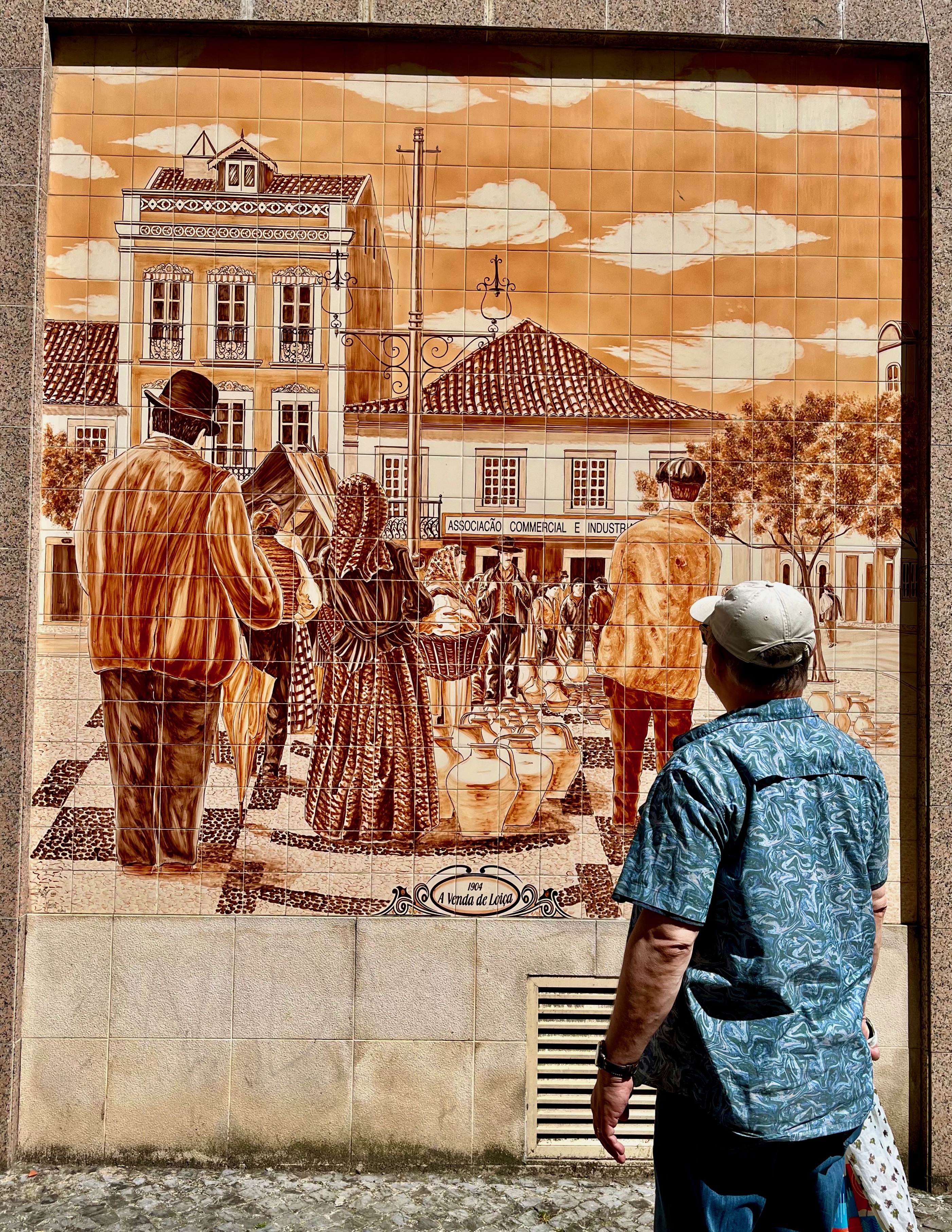
Everywhere you go in Portuguese towns and cities you’ll find the roadways, walkways and sidewalks beautifully paved. Be careful; they are not always evenly paved, and sometimes an unwary foreigner trips because they’re staring at their smartphone.
This photo was taken at night. Mary, Sam and I have done plenty of walking around at night, and it’s safe. There is very little crime in Portugal and violent crime is almost nonexistent. This is directly related to the low level of abject poverty. And it’s also related to the fact that Portugal does not have a diseased fetish for guns. People don’t own guns here like in the United States. And the fact that they don’t have guns has not impinged upon their personal freedoms one bit.
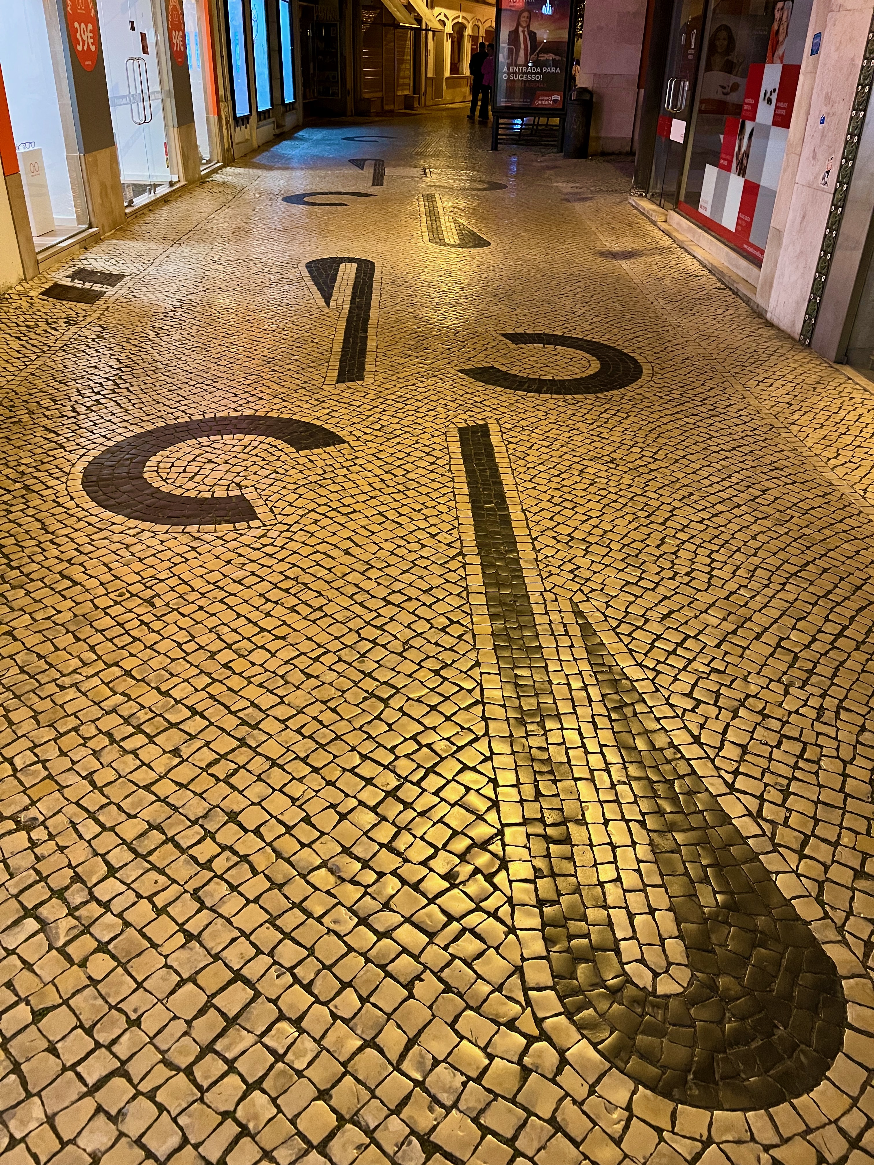
The Portuguese believe in the importance of Art. There are museums everywhere, ancient historical relics are preserved, and in the public places you’ll find gorgeous mosaics at unexpected turns.
A nighttime shot of Yours Truly in front of Don Carlos’ magnificent ruined hospital.
Coffee shops.
In terms of coffee, Portugal is very European. Little cafes are everywhere and they all serve espresso. However, in Portugal you can enjoy their national pastry, the pastel de nata, which is an egg custard tart (in the photo, they are are the top). If you ever visit, you’ll find them everywhere, but the quality varies. Try them at the small mom & pop shops early in the day. Avoid them at airports and supermarkets.

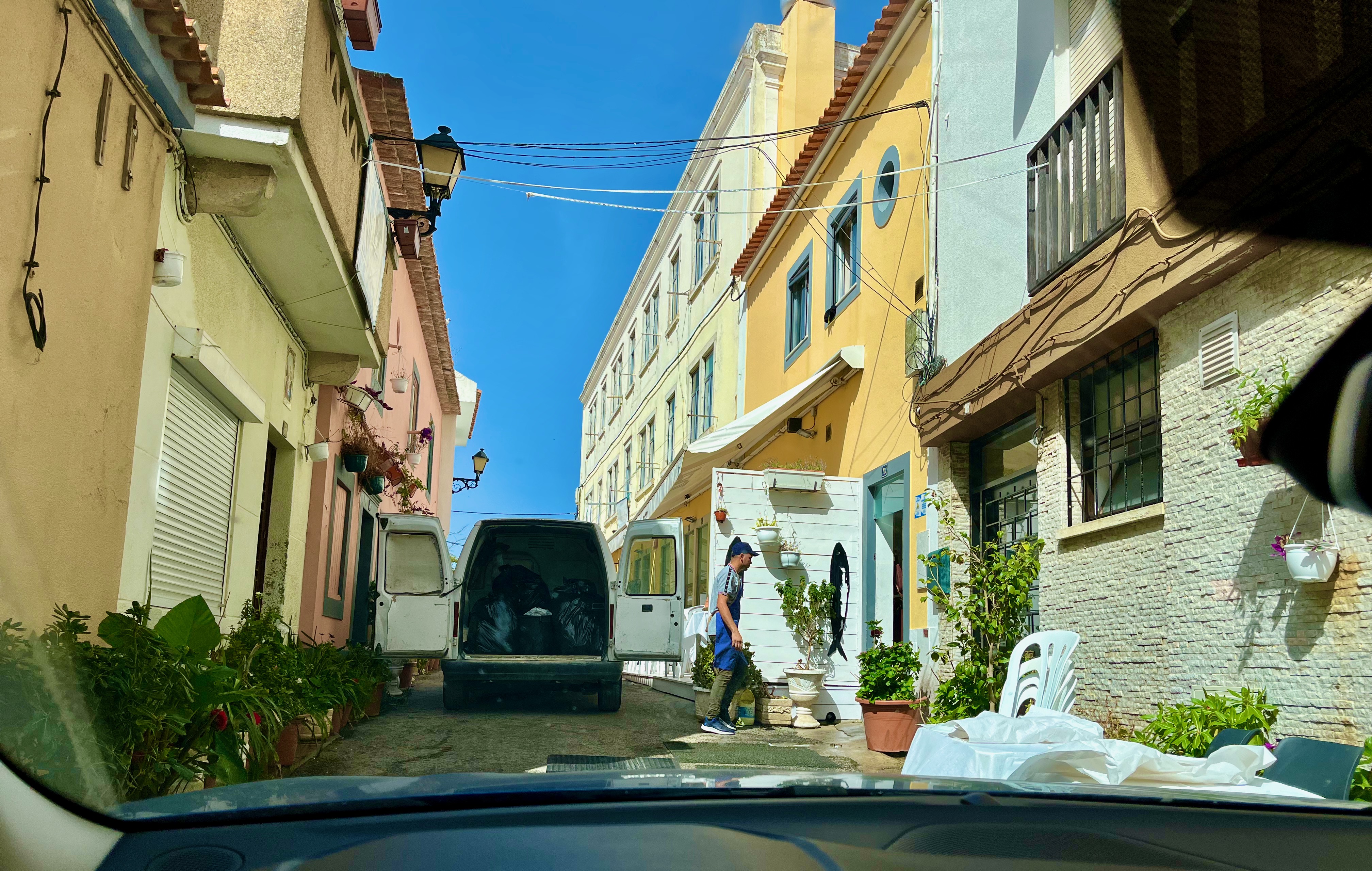
Here’s an example of how narrow and congested streets can get in town. These Portuguese towns are older than my country’s founding, and so the streets are carryovers from an era well before before cars. When you’re driving around you must be be aware that most streets are one-way (and Google doesn’t always know that) and are utilized not only as a street, but as a sidewalk and often as space café chairs and tables. And from time to time you’ll just have to wait while somebody unloads a delivery.
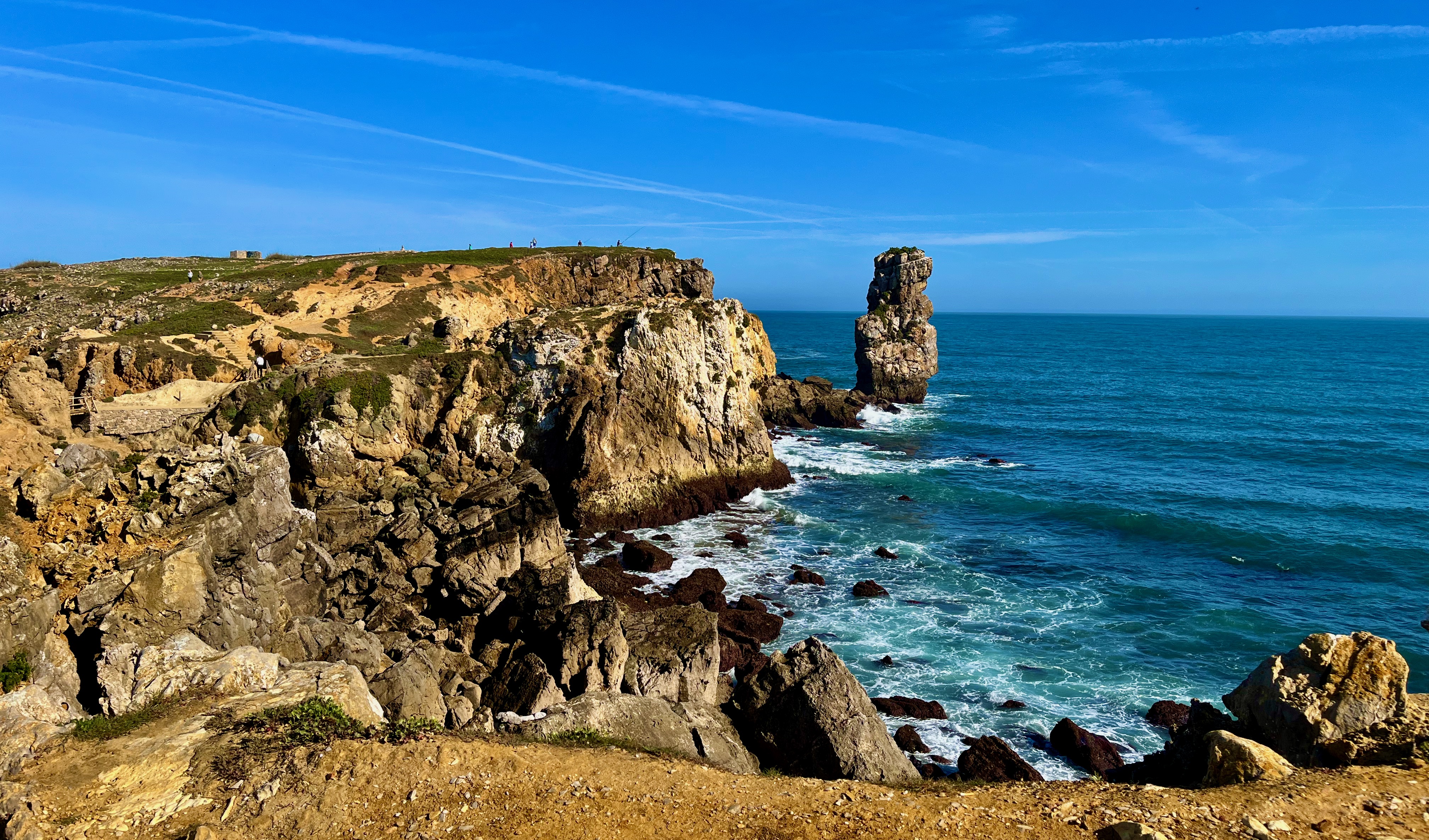
The rough coastline at Peniche. This site is notorious for a number of shipwrecks. I suppose it’s also notorious for its shape and name. Peniche is a big peninsula that juts out into the ocean. Alas, the word peniche comes from the French, which means a flat bottomed boat.
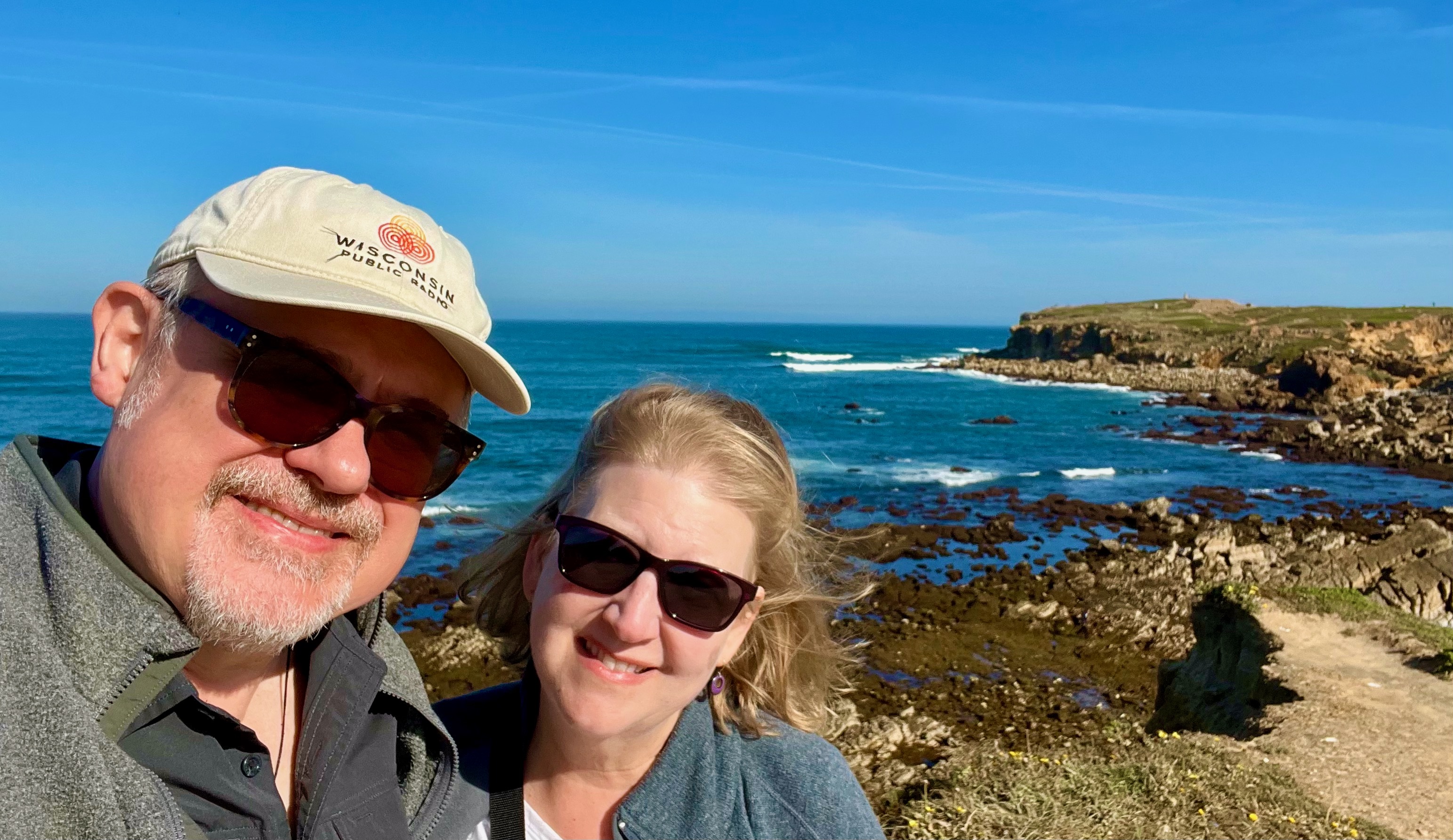
Mary and I enjoying a morning stroll along the shore of Peniche.
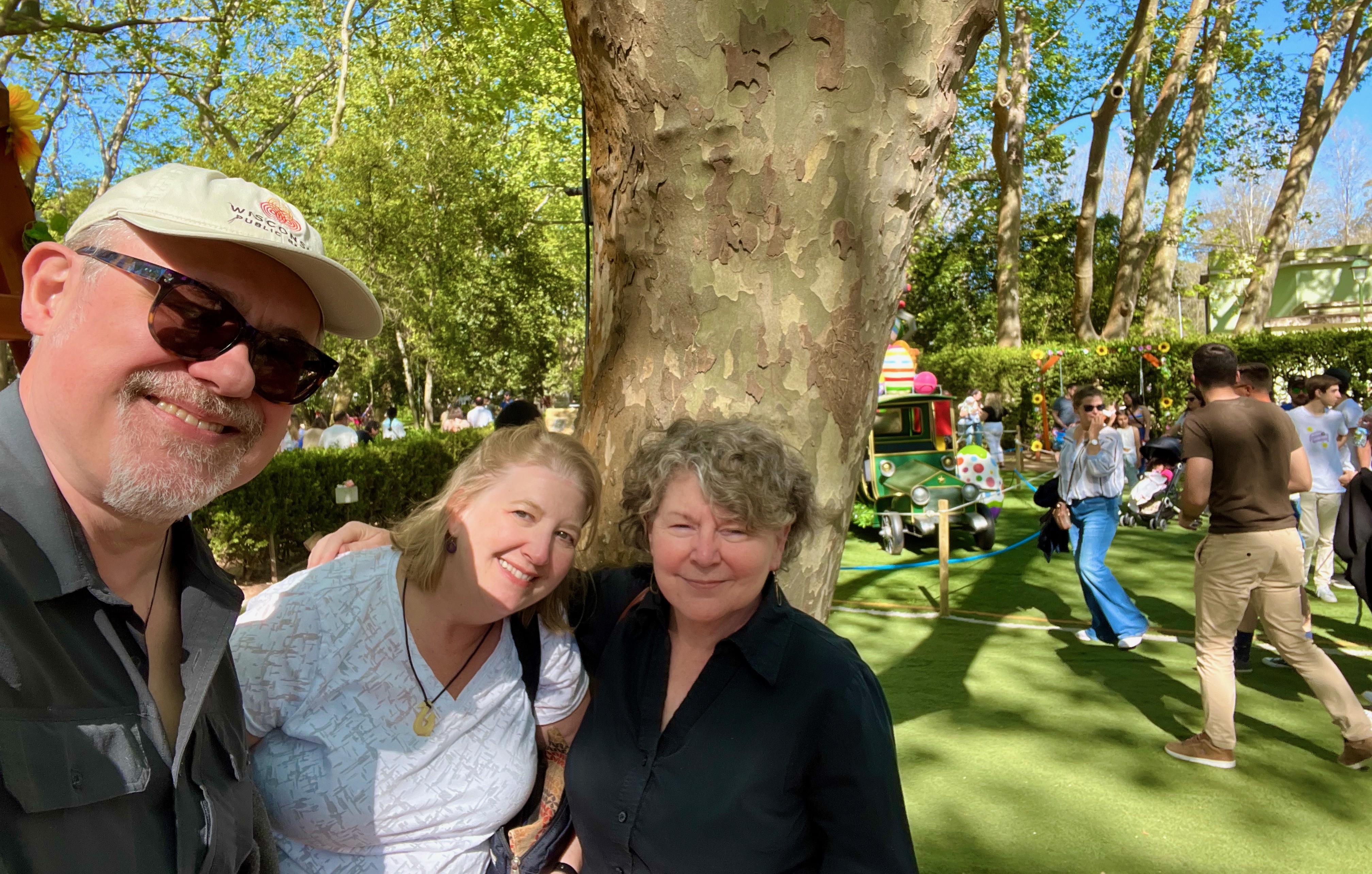
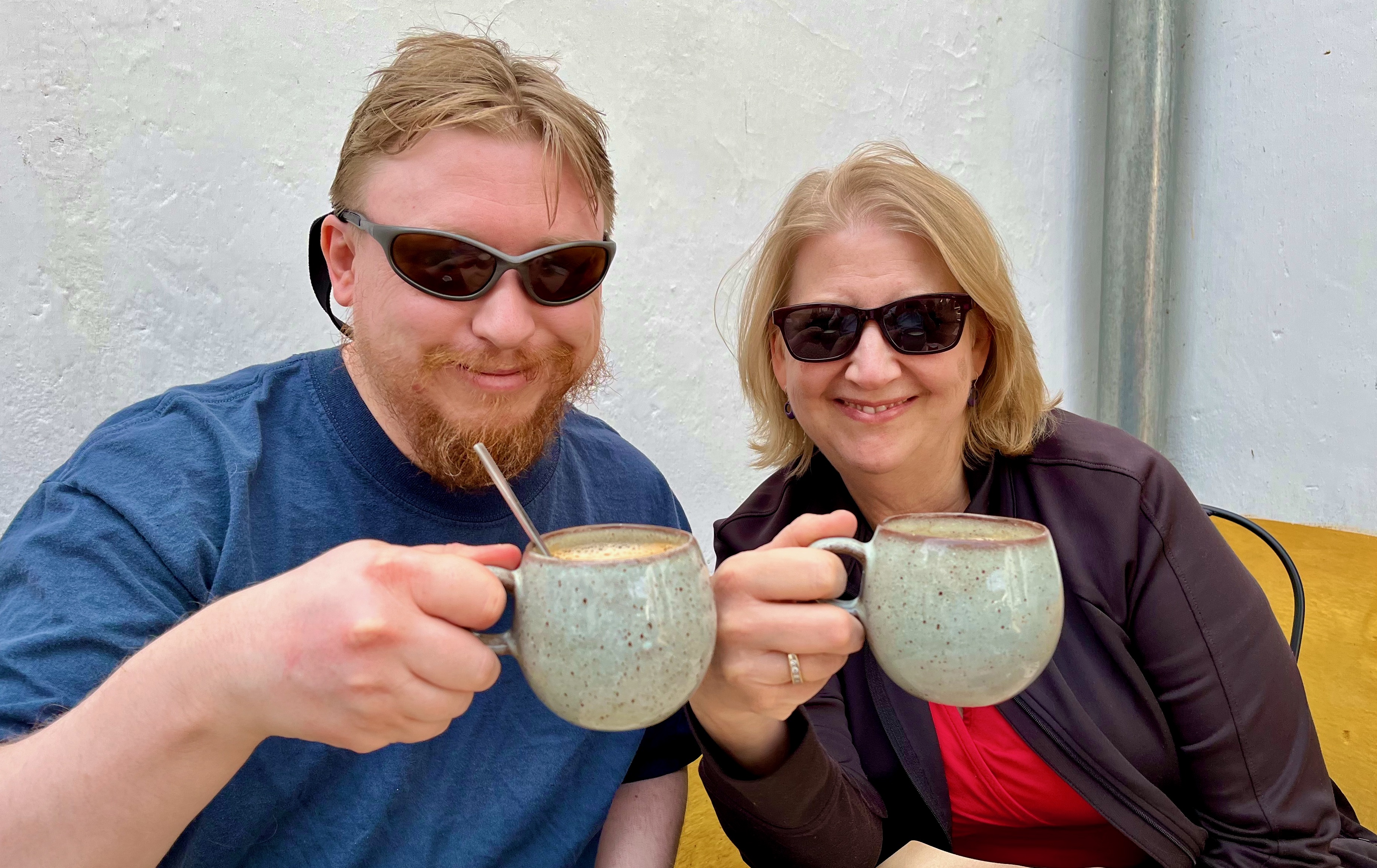
After several days in the Silver Coast, Mary’s son Sam flew in to spend a few days with us. Here’s Sam with Mary taking in additional caffeine infusion to ward off the effects of jetlag.
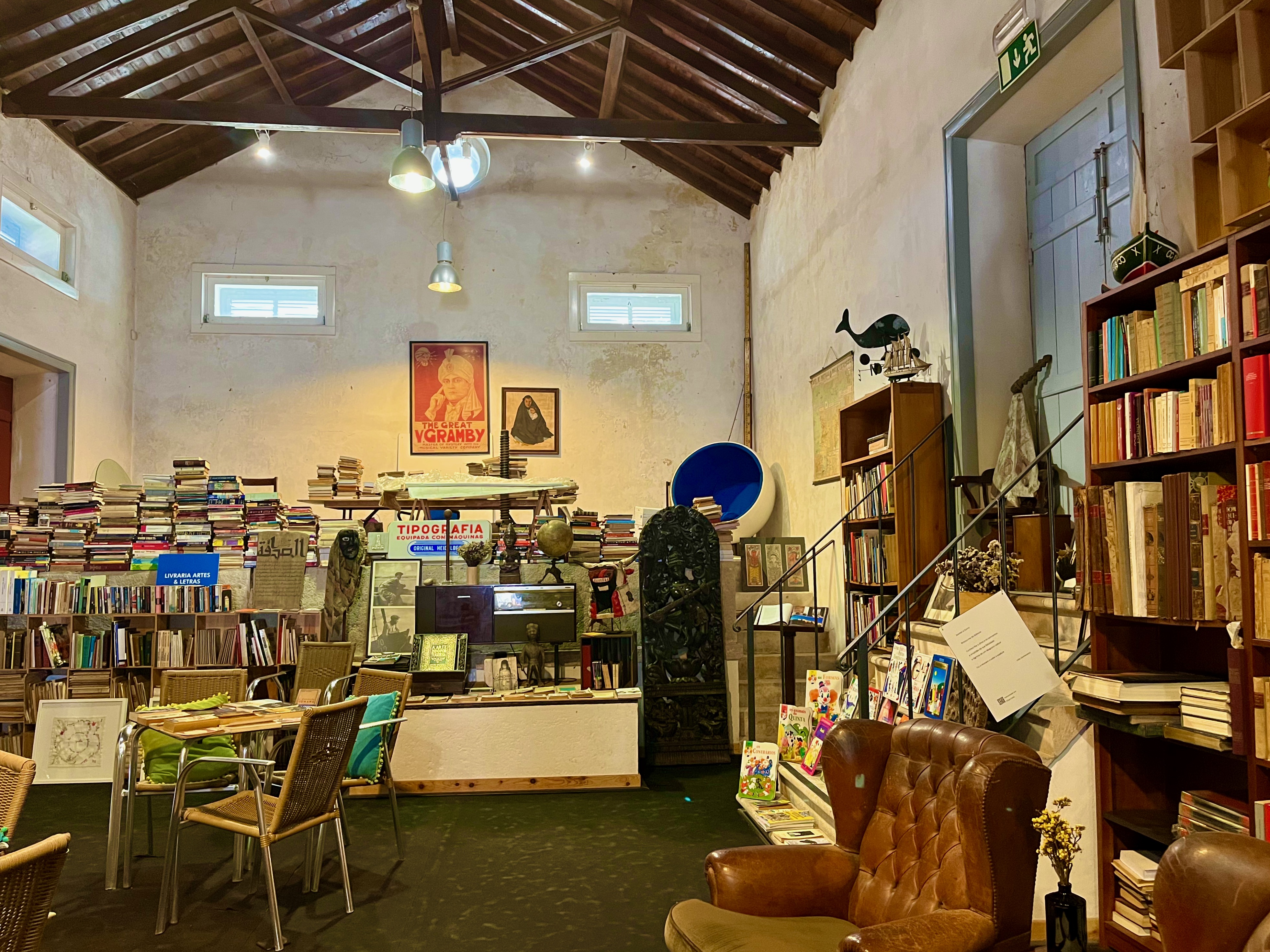
In the town of Obidos we found this lovely used bookstore. You will find a lot of book shops in Portugal. Portuguese society believes in literacy and the value of the written word. A couple of interesting finds in this shop: a first edition memoir from the early 20th century, signed by the author, in English, and Hillary Clinton’s autobiography, in Portuguese. Even translated into Portuguese, everything she said is still correct.
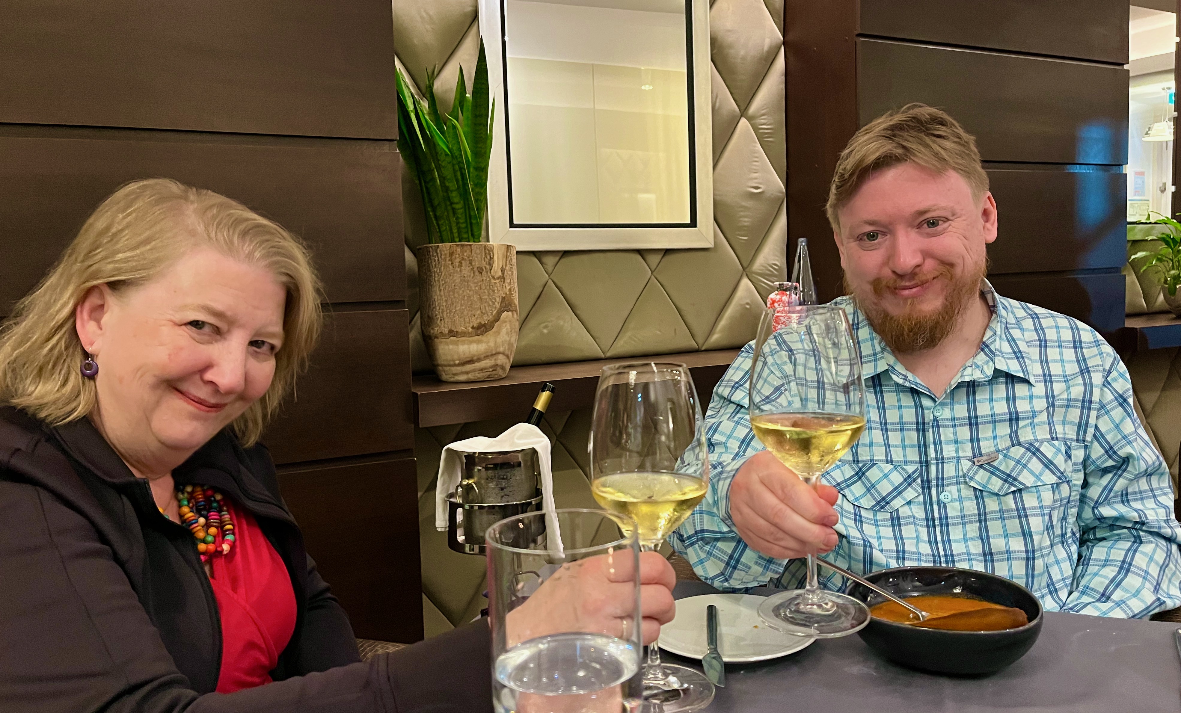
We took Sam out for a birthday dinner at the finest restaurant in Caldas da Rainha. Google translator on your smartphone is often very helpful with menus. We are toasting with a Portuguese specialty wine, vinho verde.
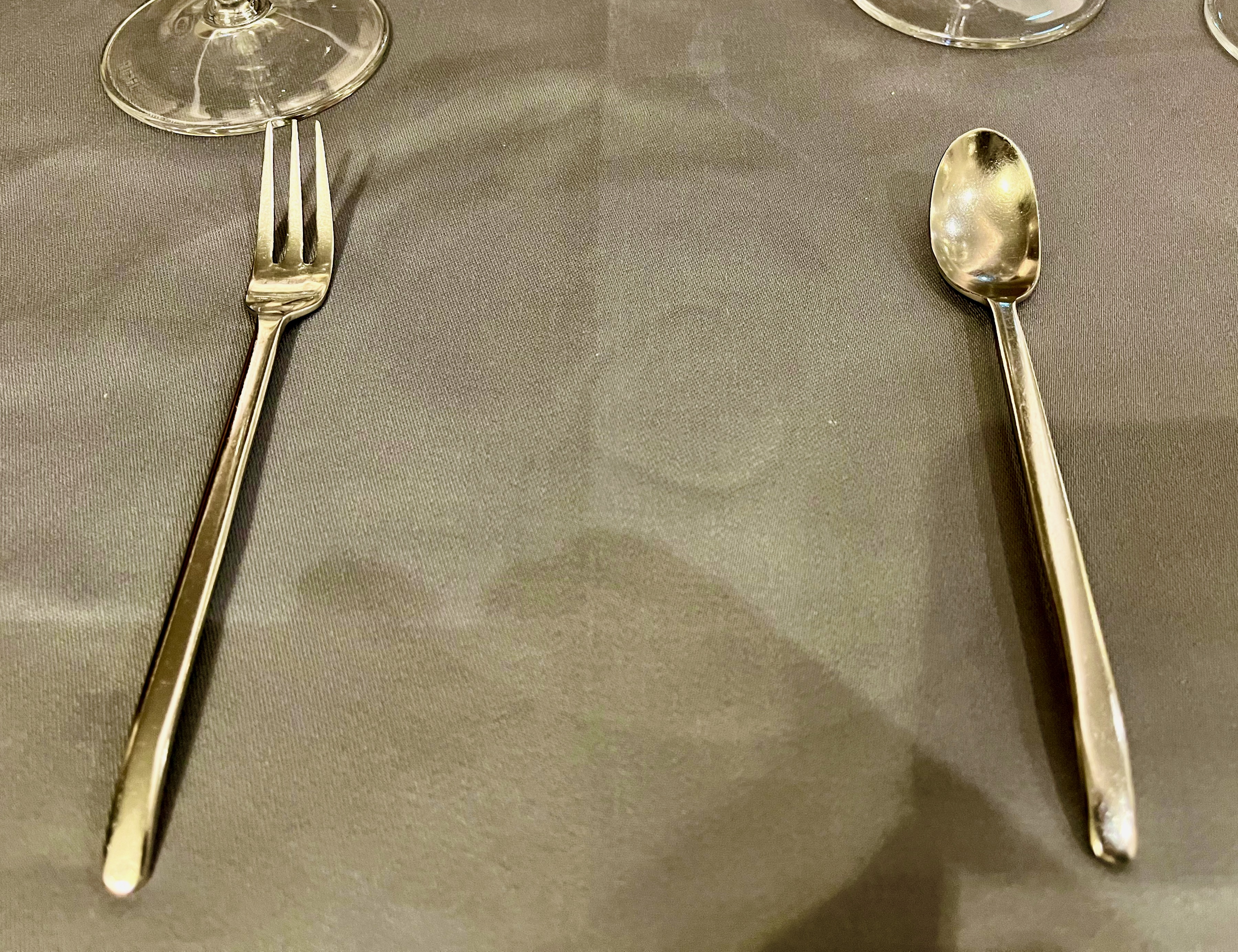
The utensils offered me prior to delivering my dessert. Yes, I’m making a point here, thank you for bearing with me.
Unlike in American restaurants, in Portugal they often give you a choice of which utensil you want to use for your dessert. Why do American restaurants give you a spoon to eat cake? Anyhow, my point is that Portugal believes in choice. That choice ranges from whom you choose to love, what you do with your own body, or which utensil you want to use to eat your cake. Unlike in so many places in my home country.
The beach in the seaside town of Sao Martinho do Porto. Purely at random we walked into a little seafood restaurant here in town and enjoyed some delicious shellfish.
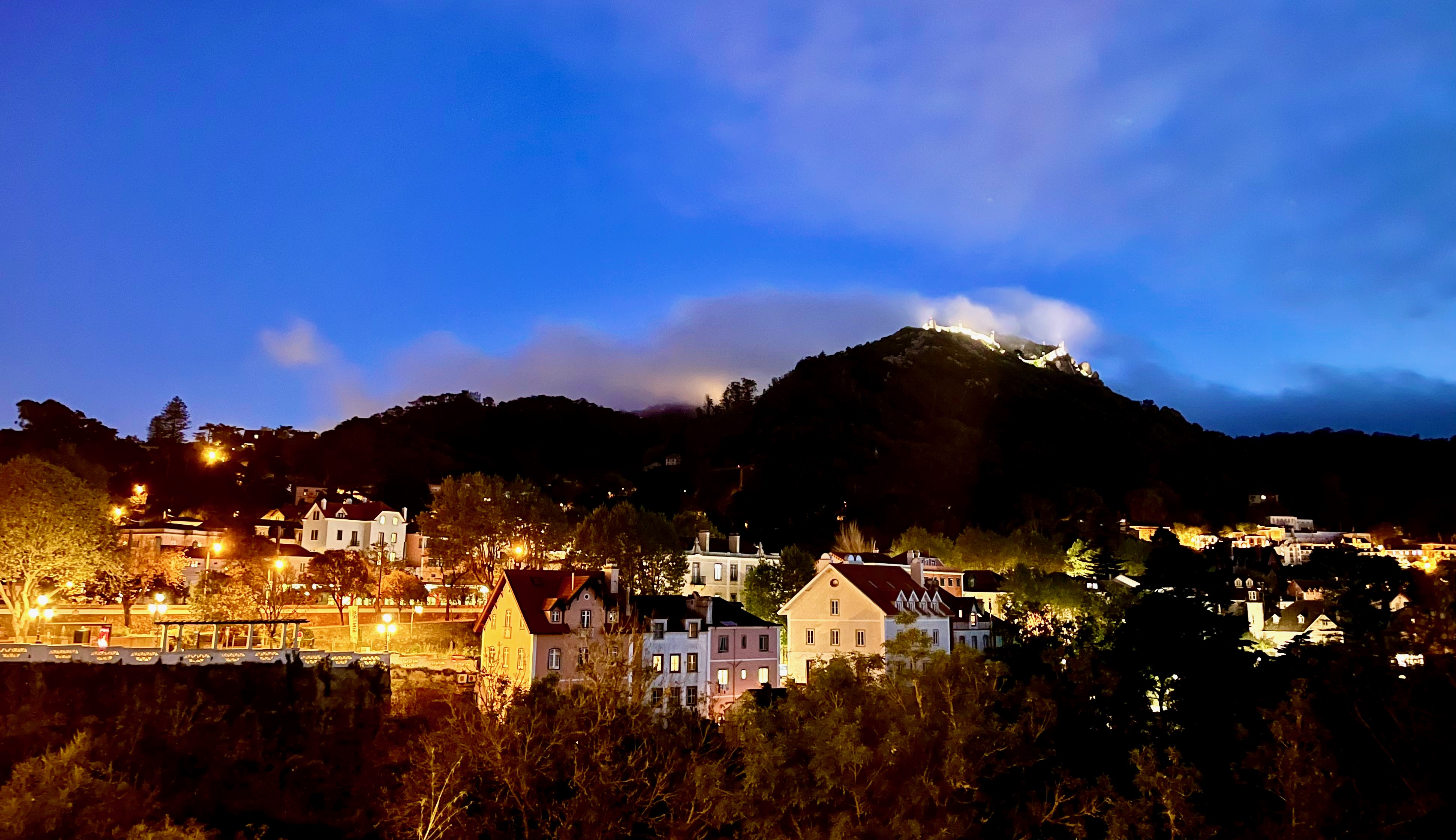
A nighttime view of the town of Sintra.
At the top of the mountain shines the the Pena Palace. We visited there a year ago, and if you ever come to Portugal, it’s worth seeing. It’s the one castle in the country that is not authentic; it’s very Disneyesque. And so it gets lit up at night, which has this unintended otherworldly effect when the mountaintops mist over.
Our second place of residence on the mainland was in Mafra, just a couple blocks down from Palácio Nacional de Mafra. Constructed from 1717 to 1755, under King John V of Portugal. We toured the place and saw all the royal residences. Honestly, I’ve grown weary of seeing how all of these ultra wealthy rulers through history lived in opulence while substantial portions of their subjects lived in poverty.
Still, preserving these buildings is an important way of recording how the history of social and political inequality goes way, way back. This is not something new. It’s important for young people to see monarchal societies existed and the people in power are still doing the same thing, just in a different guise.

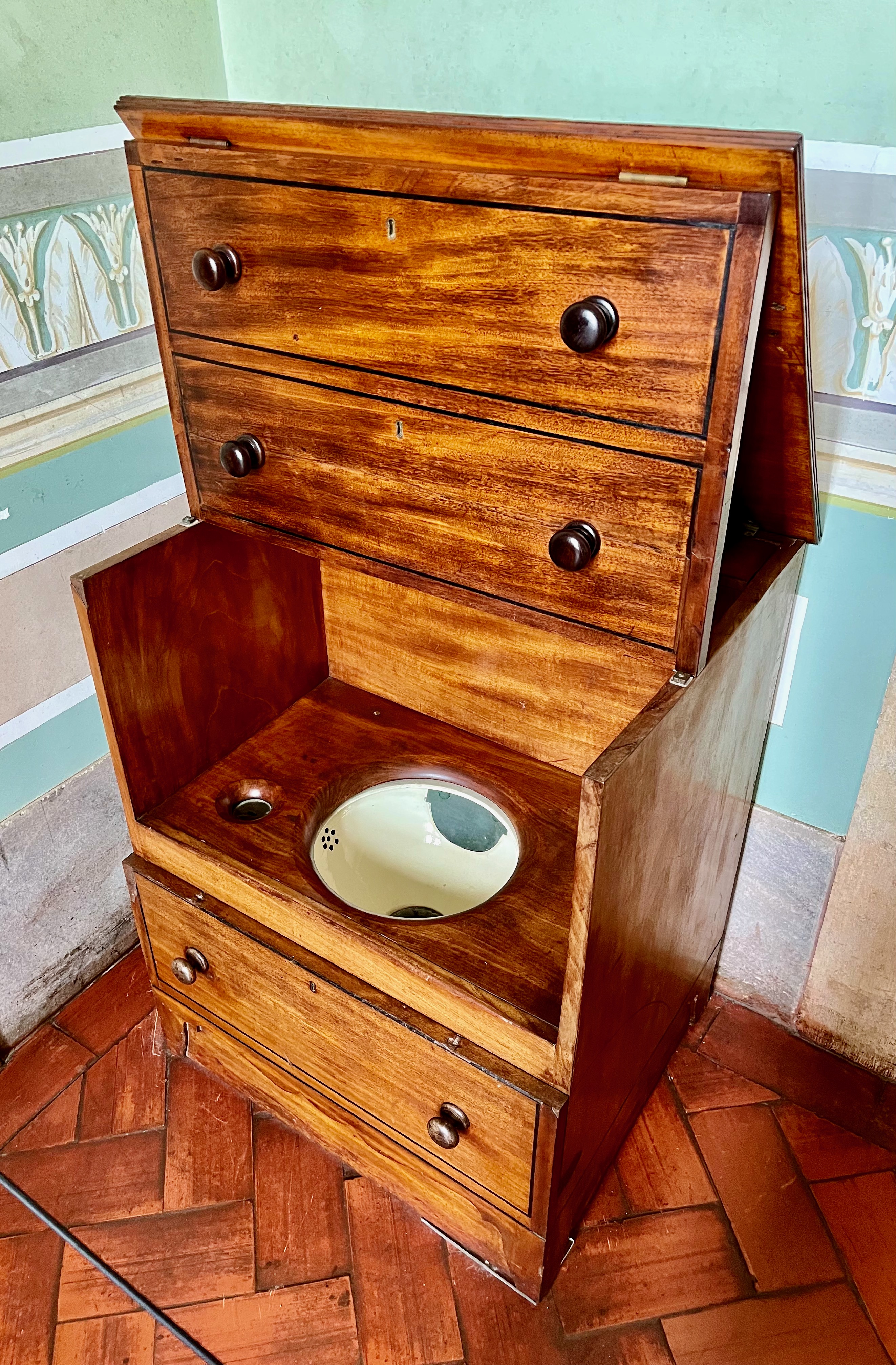
King John V’s personal commode. As the King, he got to use a lovely cabinet to do his business in, and had servants or chambermaids carry away his mess. Most commoners did their business in pots which were then dumped into cesspits in their gardens. In the cities, “Night Soil Men” were tasked with hauling the waste to dumps outside of cities. Kings and Queens didn’t have to bother with any of this.
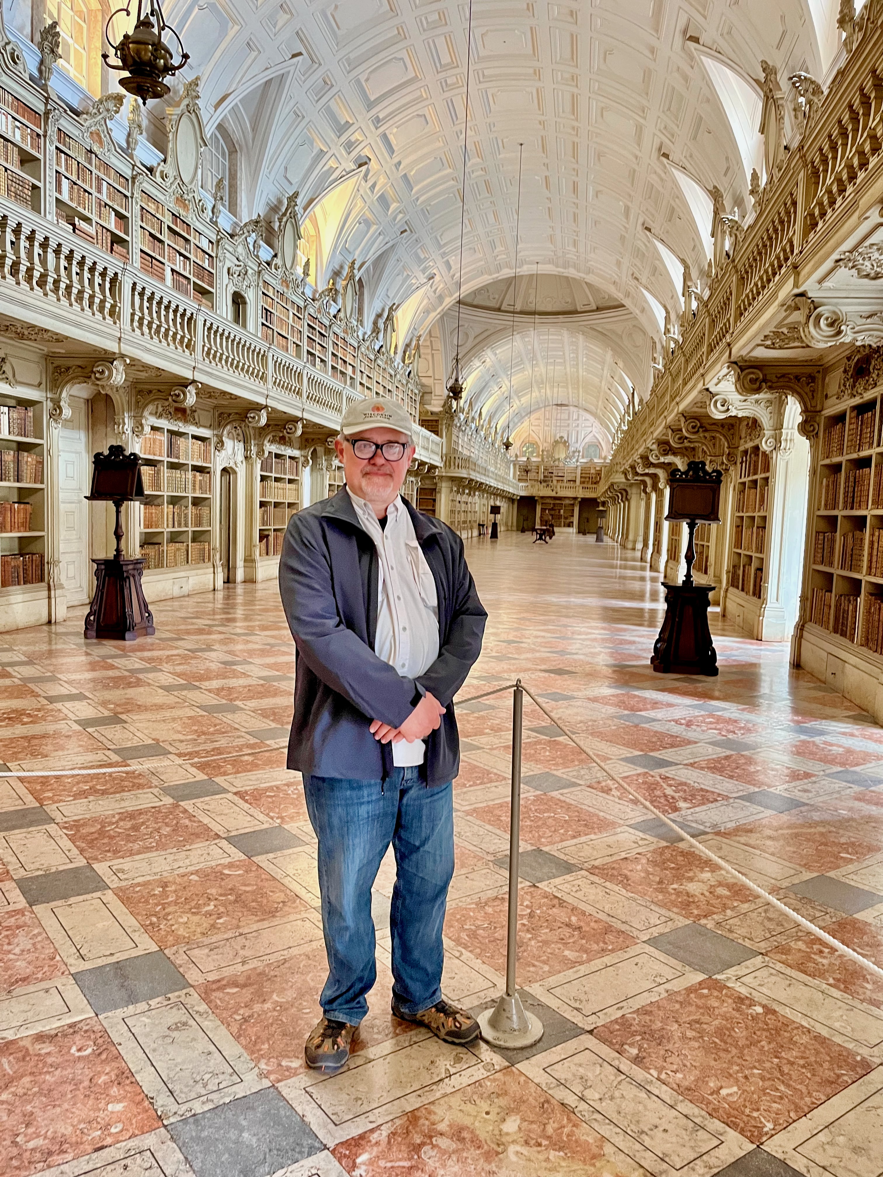
Yours Truly in the Mafra Palace Library. This library holds 36,000 volumes of rare books spanning from the 14th to the 19th centuries. Old books like these are susceptible to paper-eating insects. Not to worry, hundreds of bats live here. At night they scurry about eating the vermin. In the morning, workers come in and sweep away all the bat guano.
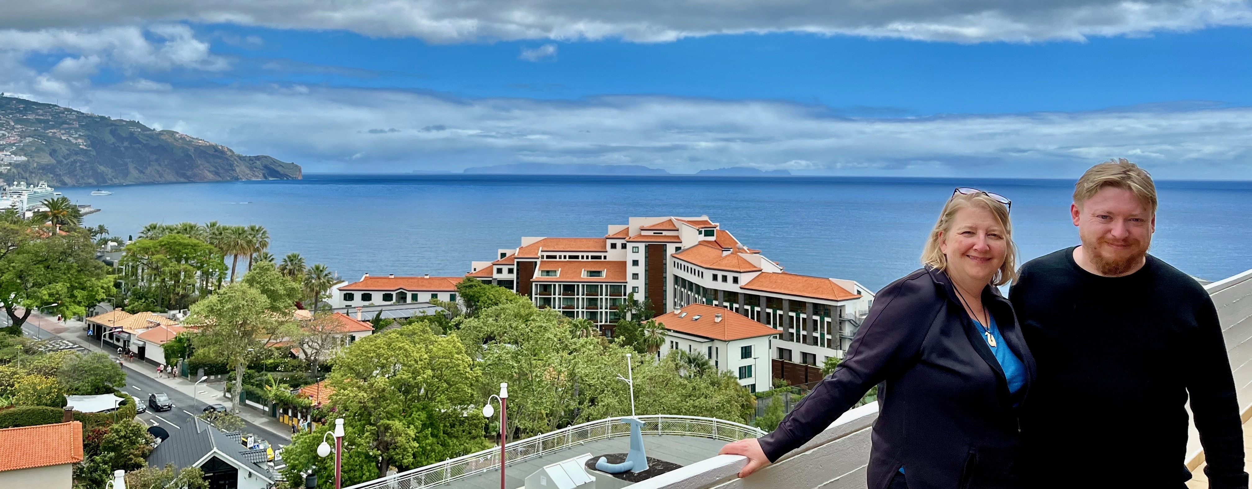
On the 10th day of our trip the three of us took a flight to the island of Madeira for the second half of our journey. Here are Mary and Sam on our balcony overlooking the city of Funchal. We’ll spend the next week and a half exploring this island and my next travelogue will cover those adventures.
Thanks for reading. Obrigado!