Songs from the Portuguese – Continued Meanderings
Our long stay in Portugal is winding down and we’re becoming used to the curious juxtaposition of urban and rural. Our villa is in the city of Lagos, but it stands on the edge of a cow pasture. In fact, just before the entrance to our parking space is a cow-crossing. On any day you might find Bessie crossing our driveway in front of our car.
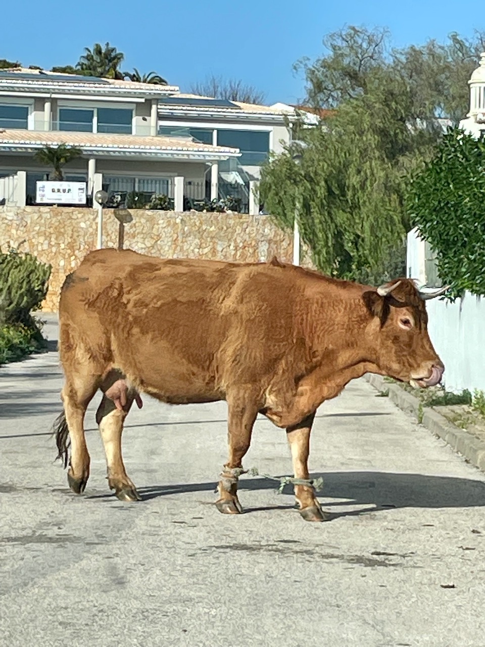
The photo below I took from our villa’s patio next to our pool. Almost daily an entire cow family crosses the driveway to munch grass and defecate behind our villa.

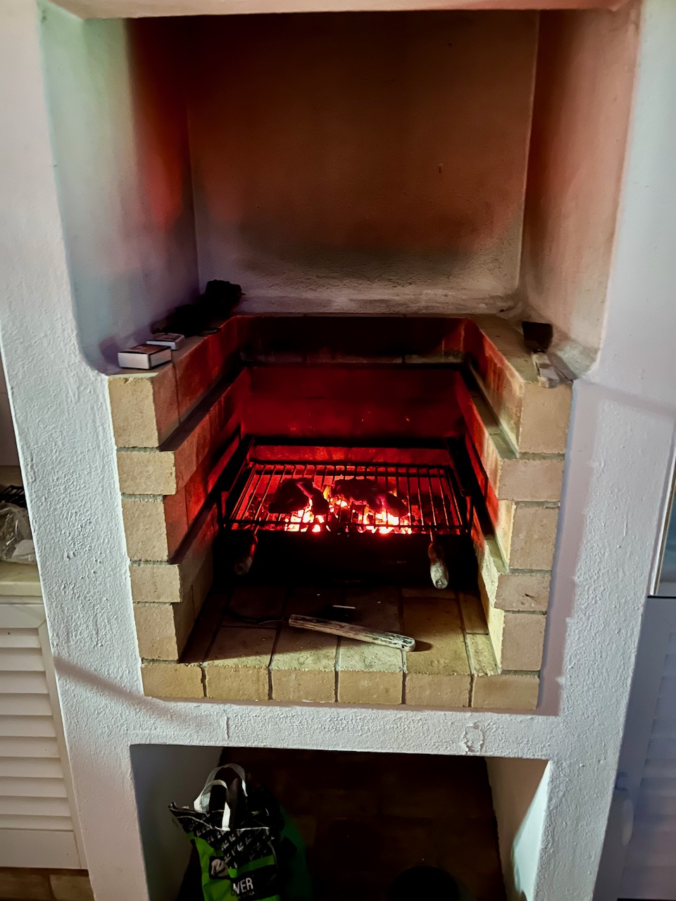
Seeing all this cattle in town prompted me to want to sample some Portuguese beef. So I bought a couple steaks to grill for Mary and me. This is the grill at our villa, which came complete with charcoal, lighter and matches.
It was a challenge getting the coals to burn. Portugal has a lot of environmental laws, and I suspect that these coals, which would hardly burn, are not made of coal, wood or anything flammable. Likely it’s soylent green. Anyhow, after a lot of work and some help from the broiler inside, we had grilled Portuguese steaks for dinner.
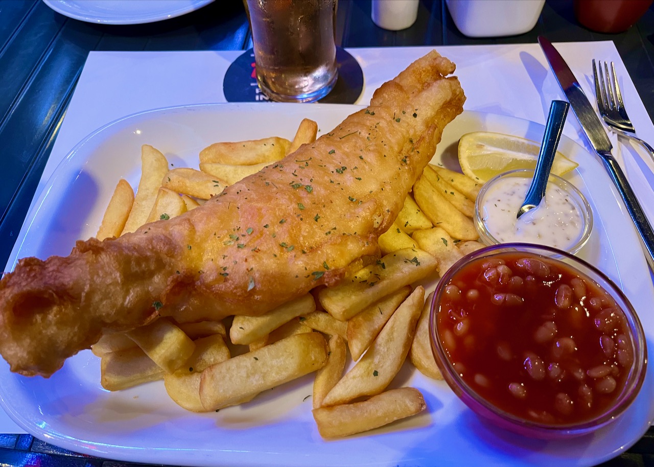
After our steak dinner, the next night we returned to our favorite local cafe, the Marina Bar. The sun always sets gorgeously on the harbor outside our favorite bar.

Fish ’n’ Chips, Portuguese ex-pat style at our local ‘Marina Bar.’ The beans are a staple provided because there are so many freaking British expats here. So the beans weren’t so good, but the fish was amazing.
Here’s a view of Lagos from the east on a path to the beach. The path crosses the railroad tracks, which is a commuter train. We’re in Europe, of course, and there’s mass transit crisscrossing the country. This train that glides into downtown Lagos you can take all the way to Lisbon and Porto.
They place guard rails on the path not to stop you from crossing, but simply to slow you down enough so that you look both ways first. Remember, most people walking around here have been drinking port wine all day.

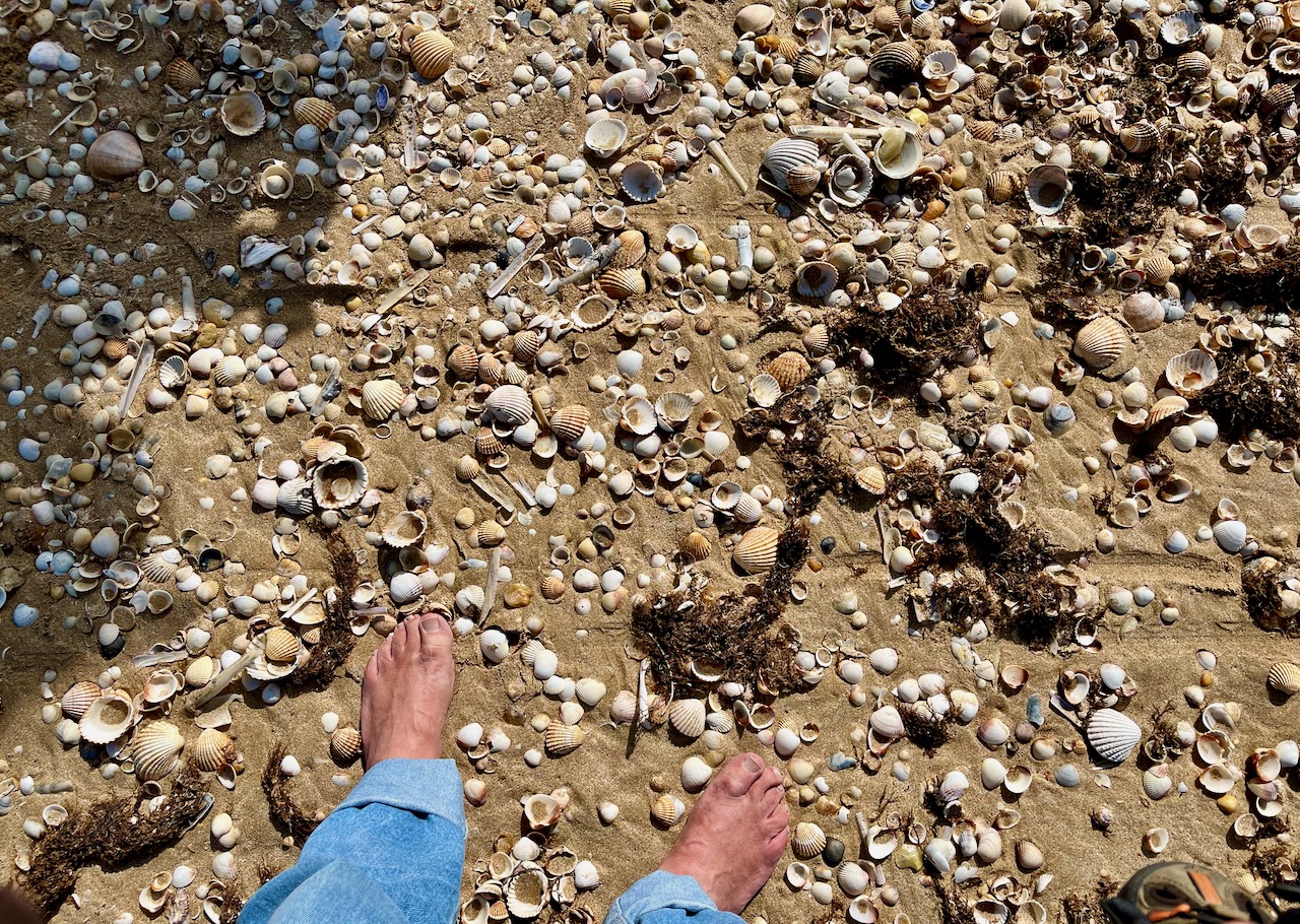
On the beach again. Our big beach here in Lagos is about a 10 minute walk from our villa and is called Meia Praia Beach. The tides wash up some of the most varied profusion of seashells I’ve ever seen. And yes, those are the feet of a sea monster.
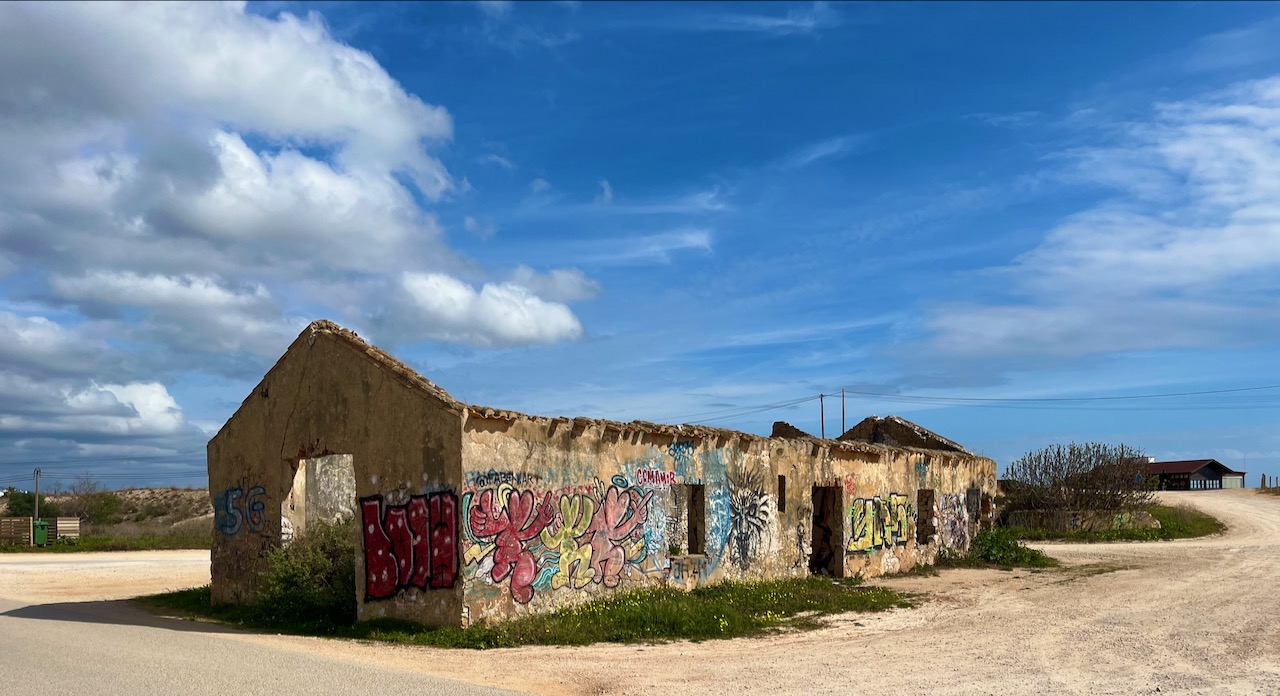
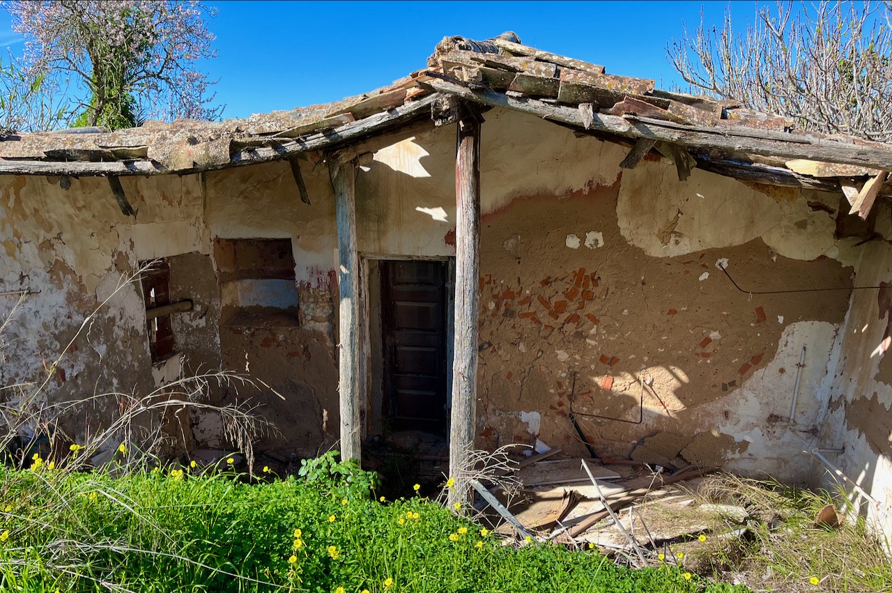
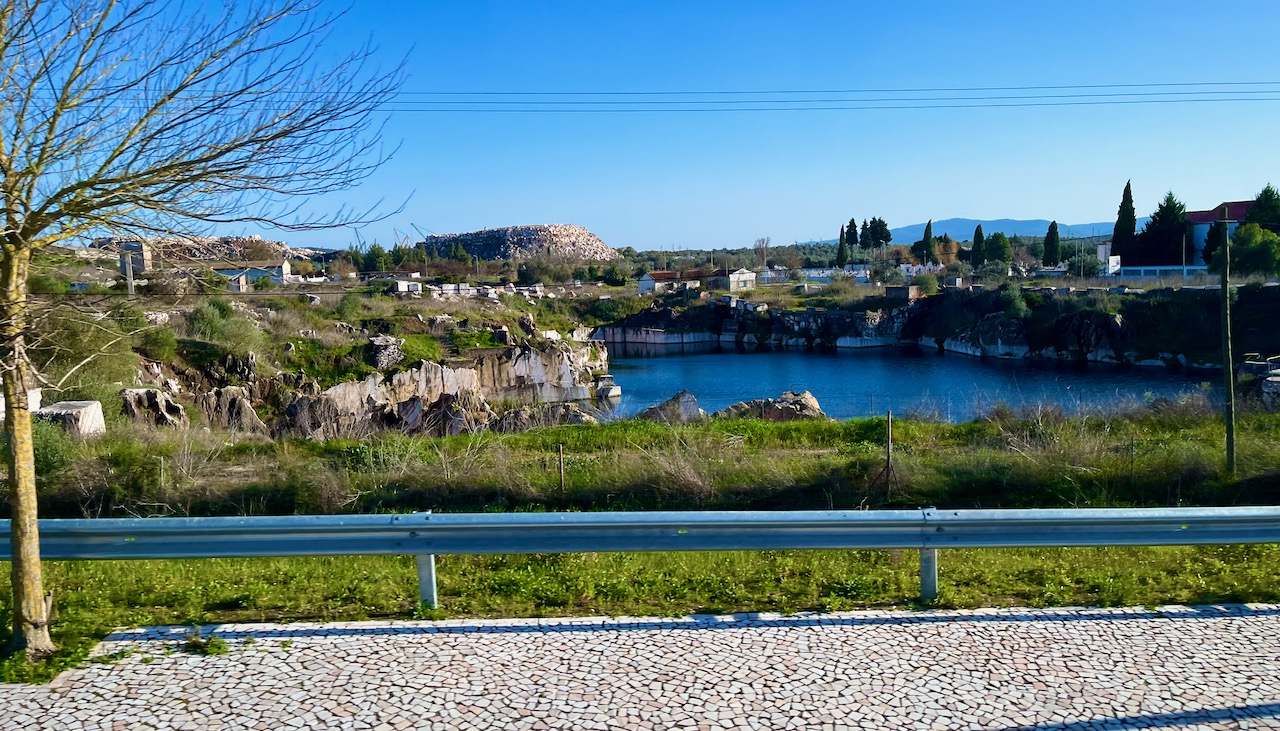
Mary and I passed this abandoned structure on one of our walks to lunch. These ruins are pretty common in Portugal, often standing in the most unlikely of places: that is, both urban and rural and sometimes right next to new or pristine-looking buildings.
Why is this? Is there rampant poverty? No, our new Portuguese friend Marla explained this is an unintended result of Portugal’s inheritance laws. When both halves of a couple die, property goes equally to all children. Sometimes not all of the children can be chased down because of relocating to different countries. The remaining heirs are not allowed to take control and do something with the property until all parties are discovered.
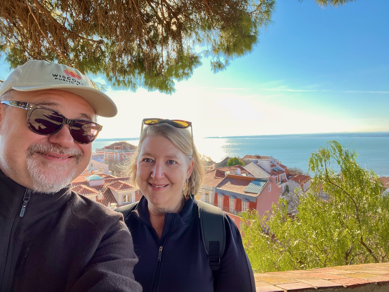
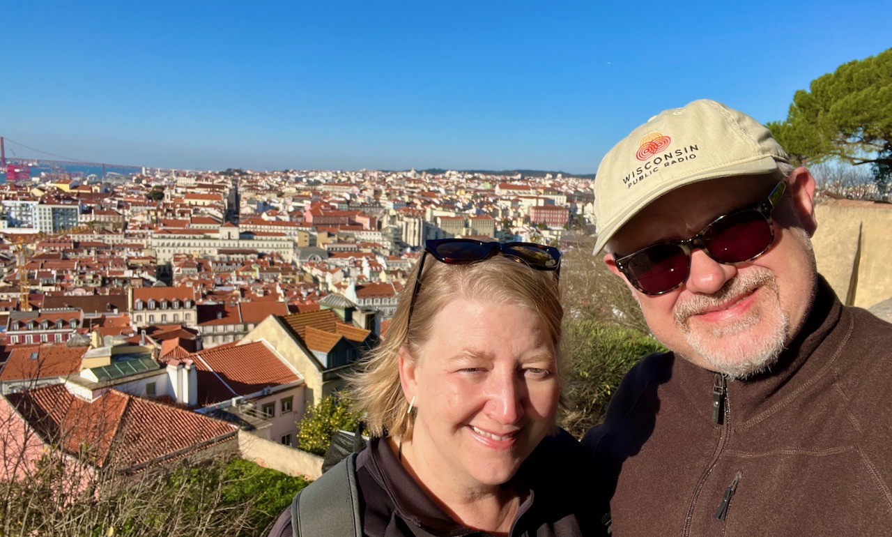
Mary and Yours Truly basking in the winter sun on Lagos Harbor.
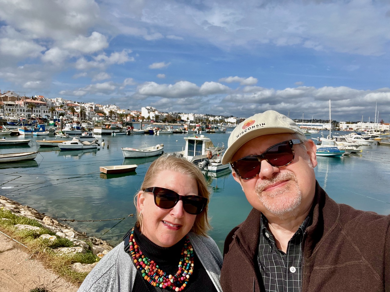
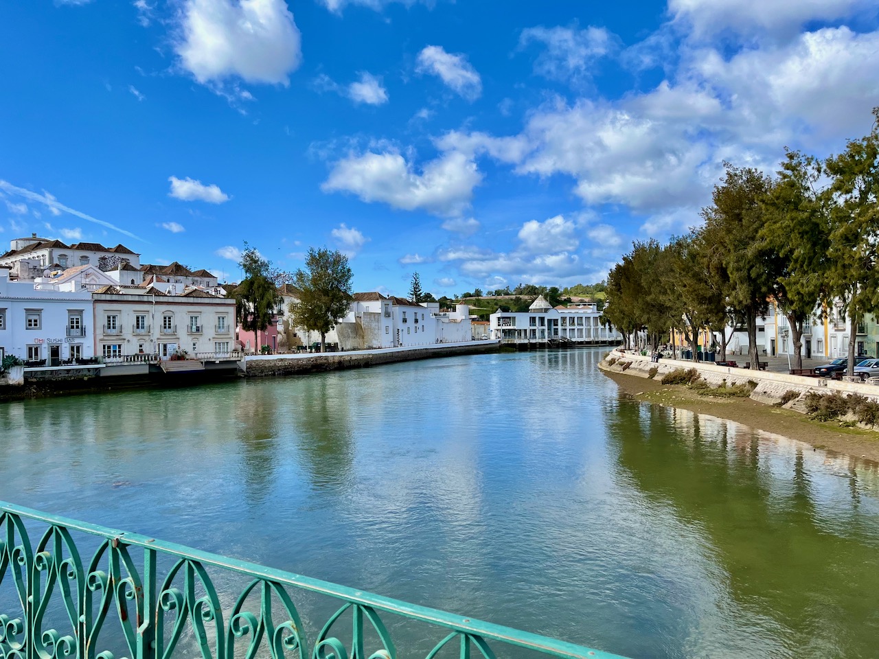
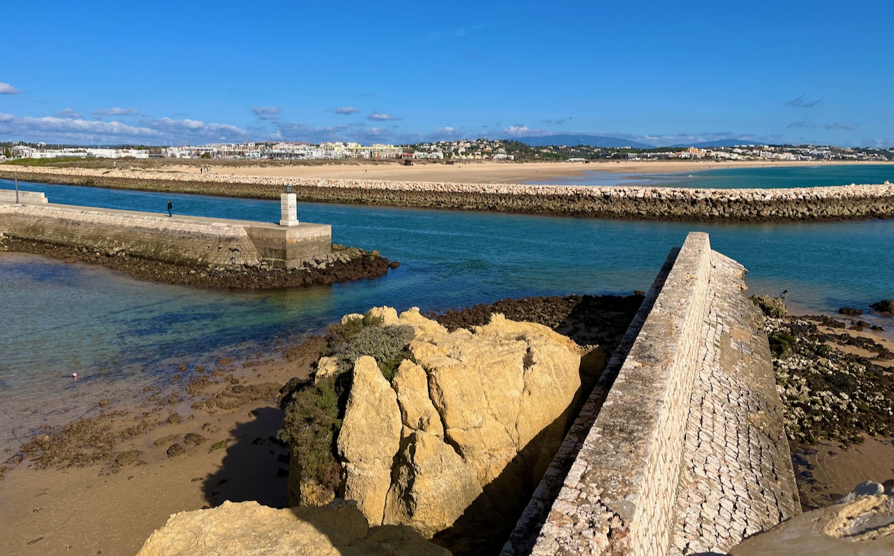
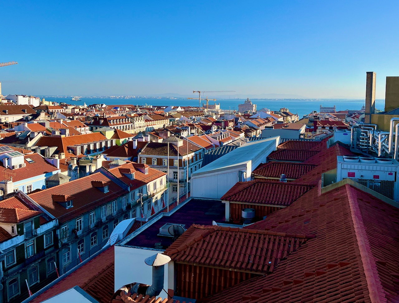
Below, a nice view of the medieval section of Lagos from across the canal that feeds the harbor.

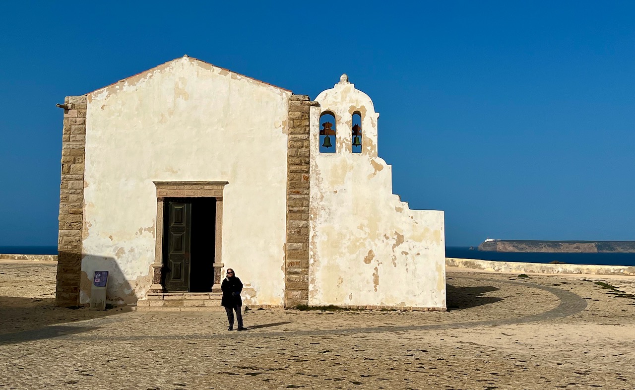
A few days ago Mary and I took a day-trip westward to the southwestern tip of Portugal, where the western and southern coasts meet. Here is Mary standing in front of an old chapel on Sagres Point, the Igreja de Nossa Senhora da Graça, built in 1570. This chapel is part of the compound that makes up the old Fortress of Sagres.
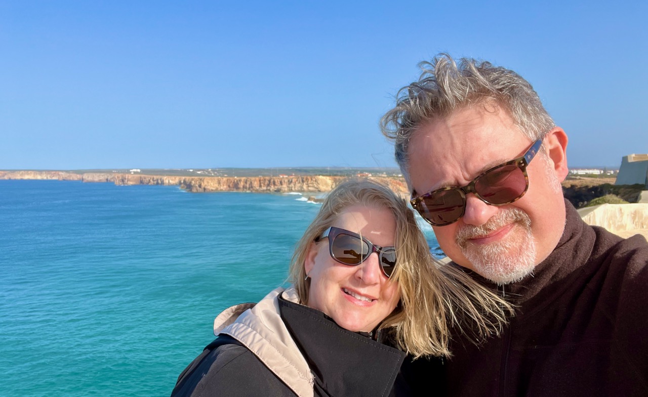
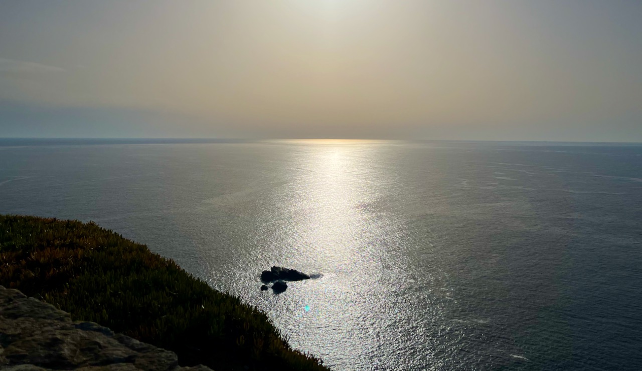
Just behind the Igreja de Nossa Senhora da Graça, the cliffs on this peninsula plunge almost 200 feet to the Atlantic Ocean. Here’s Mary and I welcoming the sun, as the wind off the sea on this flat promontory was harsh.
This promontory is the southernmost part of Portugal.
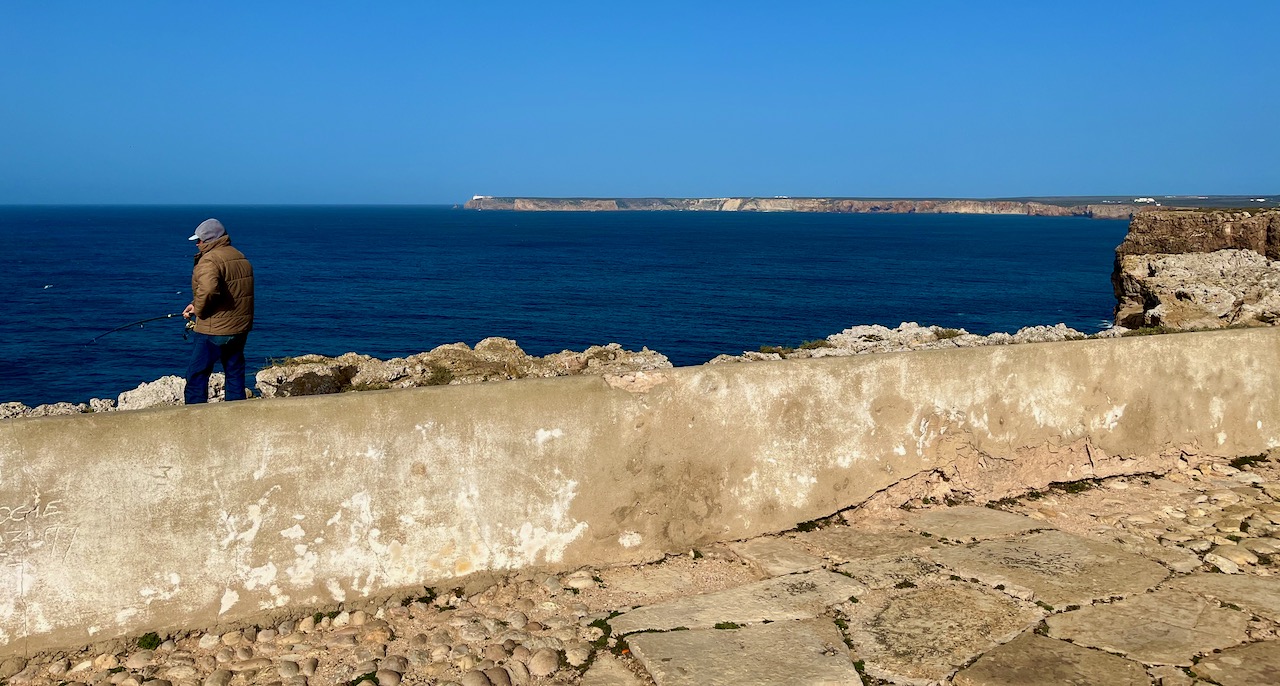
On this peninsula we passed several Portuguese anglers fishing for bream and sea bass. They teeter on the precipices of these 200 foot cliffs with very long poles. Daring!
This entire flat limestone promontory has been battered by sea and wind for ages–as well as the occasional earthquake every half millennium–and so it’s honeycombed with caves and crevices. Here you can just catch a peek of the ocean through a narrow tunnel in the ground.

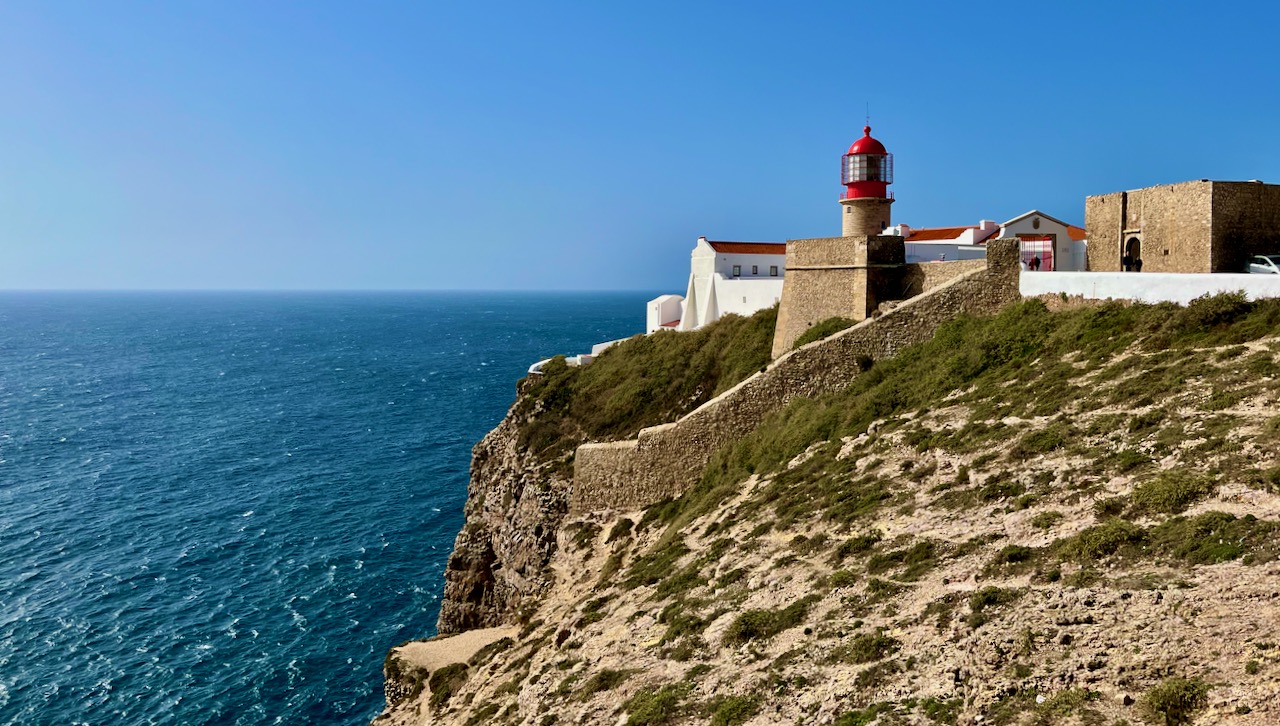
Next we drove about 10 minutes to the next peninsula up the coast, Cabo de São Vicente, that contains this lighthouse. This peninsula is the westernmost part of Portugal.
A few weeks ago I posted a photo of Mary and me up north of Lisbon, stating that we were at the westernmost point of Europe. That was, evidently a lie. For a long time many people believed that, but once maps and navigation got better, it was confirmed that Cabo de São Vicente is indeed the westernmost point.
Mary and me above the cliffs at Cabo de São Vicente.

Next we drove to the sleepy little surfer town of Salema. You have to take a narrow, winding road down a river valley, which eventually empties out here. Honestly, there’s not much to see here, but we wanted to experience a small Portuguese seaside village. It’s tidy, almost pristine with winding streets and cobbled walks.

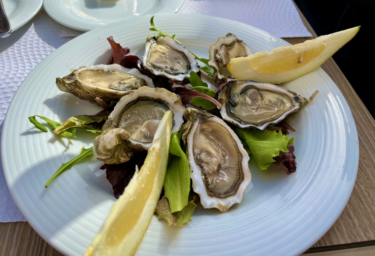
Salema was small but it had places to eat! Here I am enjoying raw oysters that were likely hauled out of sea just that morning. Yummy.
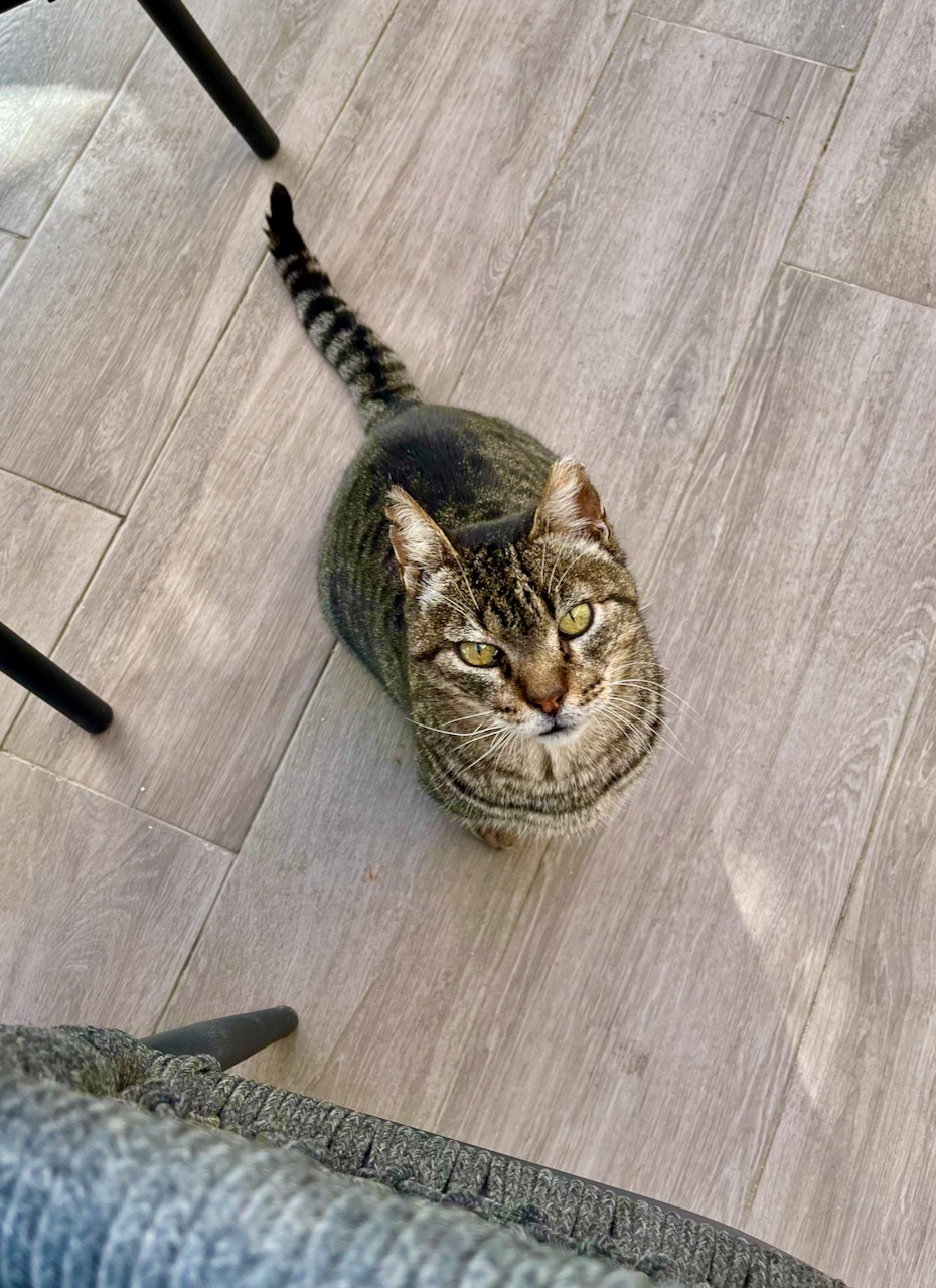
The ‘cafe cat’ at our restaurant in Salema. Mary and I have noticed that many of the cafes and restaurants here in Portugal have what I call ‘cafe cats’. These opportunistic felines have pretty good lives. They stroll from table-to-table, begging. And they’re not stupid. They know just when a table has been served food. This little beggar targeted upwards of a dozen tables during our lunch, and only came to ours right after our main courses were delivered.
Mary, of course, fed this beastie.
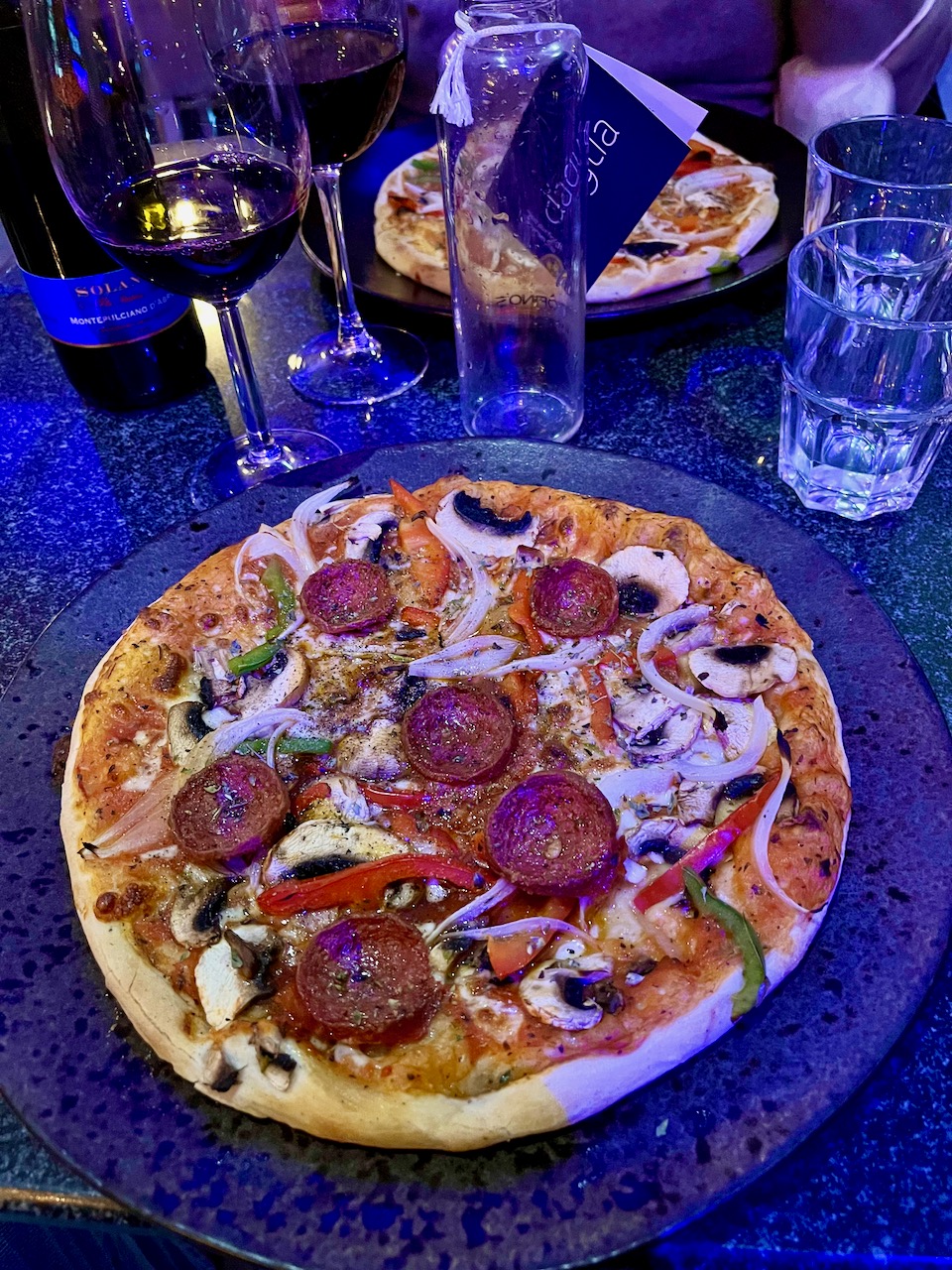
That night, back in Lagos, we were too tired to cook. So we finally decided to try out Portuguese pizza. The truth: as a country Portugal has a tremendous list of advantages over the United States: lower cost of living, higher life-expectancy, gun-control, low-cost health-care, they believe in science and they are glorious socialists. But their pizza? America’s got you beat, Portugal! This pizza’s crust was soggy in the center, didn’t have enough cheese and the pepperoni was a bit tough–like I was chewing through poker chips. At least there was wine.
Be proud my fellow Americans! Our democracy is failing but at least we know how to do pizza!
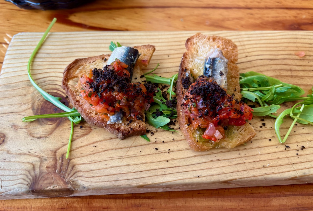
The next day Mary and I had lunch in a shipyard. And here’s something that Portugal does know how to do: sardines. These sardine crostini were delectable. If you love sardines, that’s almost reason enough to move to Portugal.
Since I’m on a culinary bend here, I’d like to highlight one more important thing. See the fork and spoon below? This is typical of the kinds of utensils you get served when you order dessert. You are give a CHOICE of utensil.
One of my pet peeves is how in the United States, no matter what you order for dessert, the philistines running the restaurant will only give you a spoon. One does not eat cheesecake with a spoon. One does not eat triple-layer chocolate cake with a spoon. And if you dare ask for a fork, the waitstaff considers you to be some kind of heartless Gorgon. This simple practice clinched it for me: Mary and I are moving to Portugal!

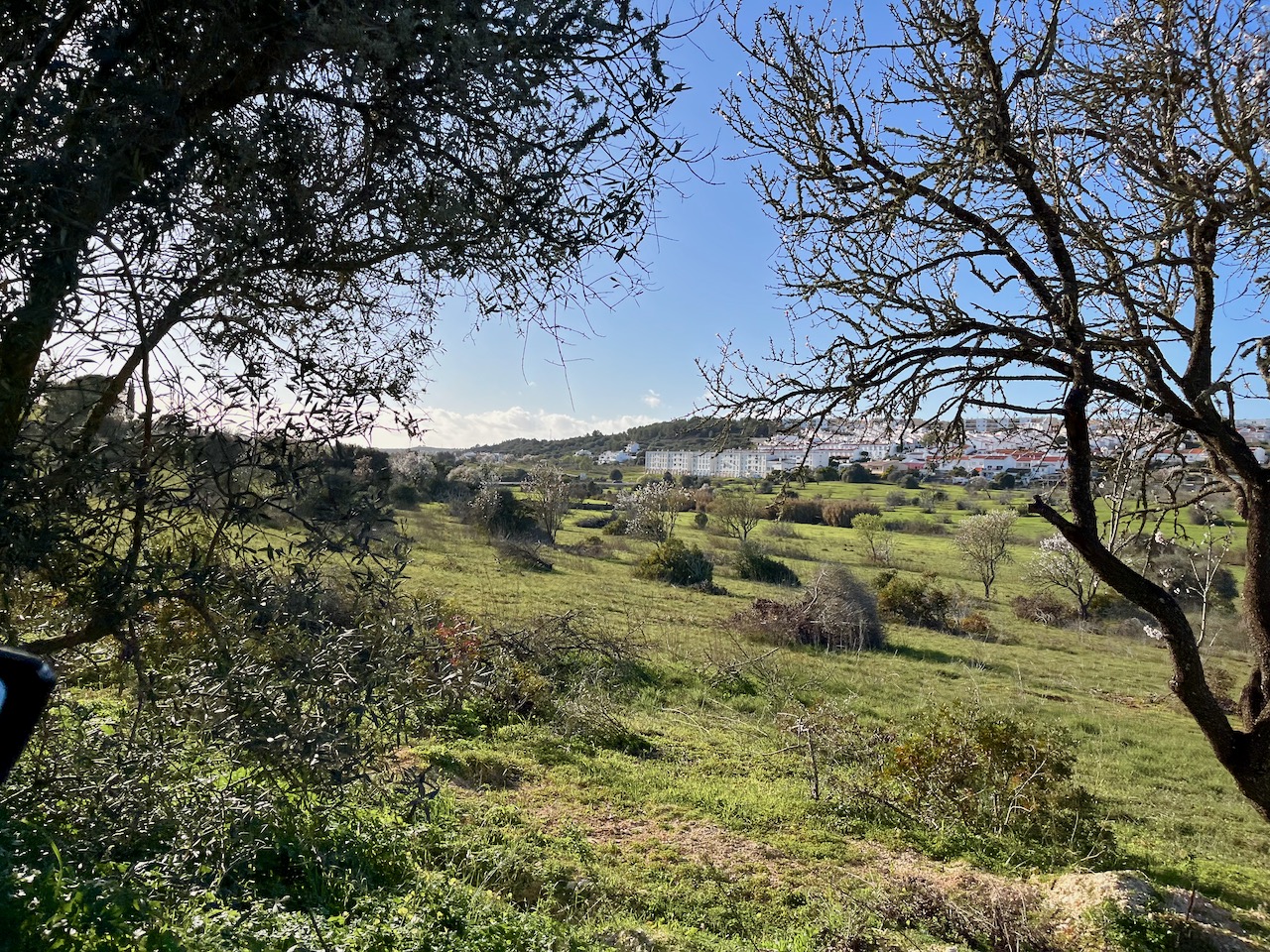
On another day we took another outing, this time driving east toward Spain. I haven’t had the chance to take many photos off the countryside, but this southern Algarve region of Portugal–even in the throes of a drought–is lush and green. Lot’s of countryside with olive trees, cork trees, vineyards and citrus orchards.
Our big stop for the day: the seaside city of Tavira. Our new Portuguese friend recommended we scout out this town as a possible place where an ex-pat might want to spend part of the year.
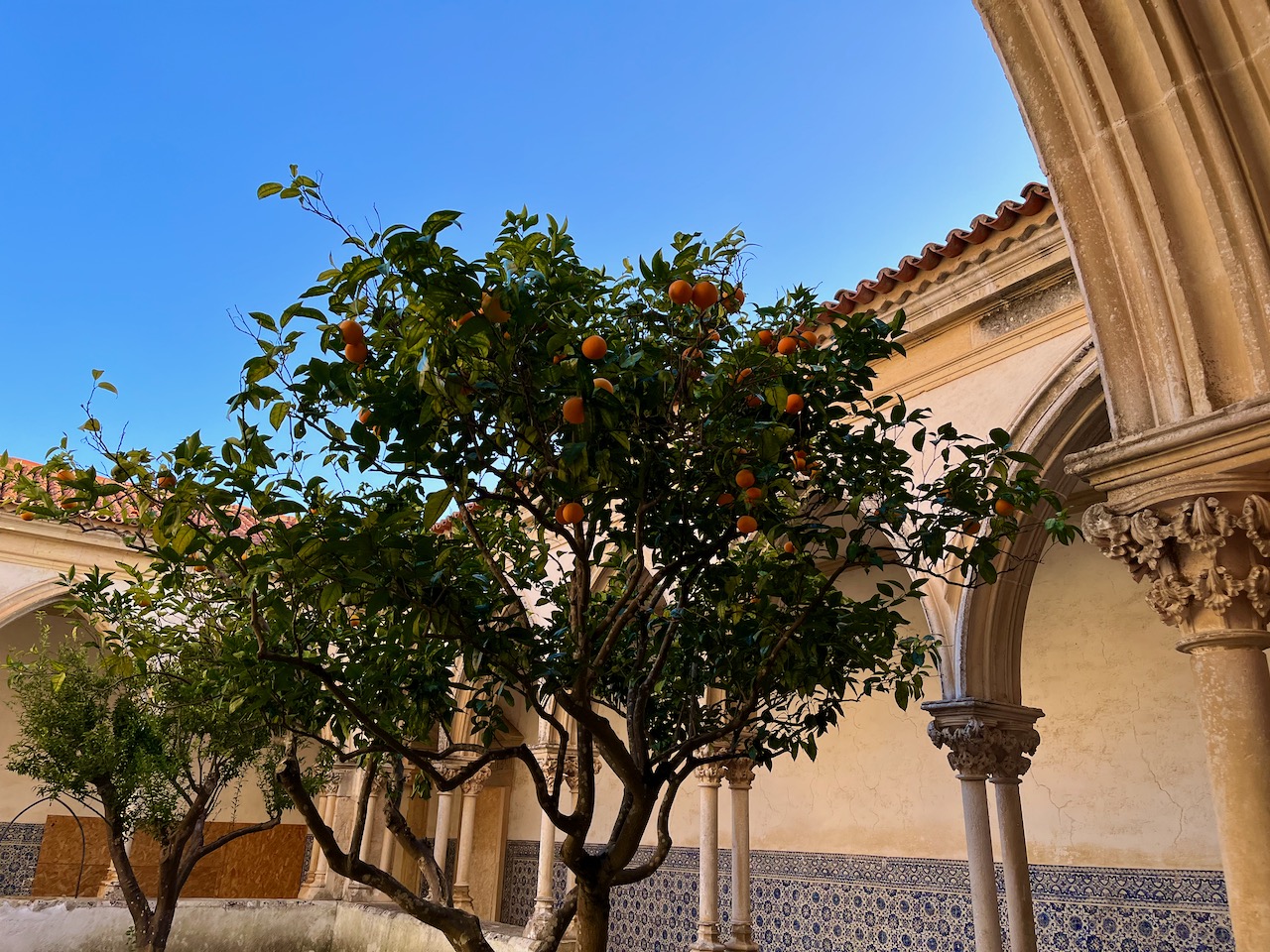
We parked our car on the outskirts of town and walked into town center. This is an example of how you find citrus trees everywhere in the south of Portugal. Out in the rural areas, they are in orchards; in town, groomed trees filled with fruit line the walkways and parks.

One of the narrow medieval streets of Tavira. Espresso and wine are available in every nook and cranny.

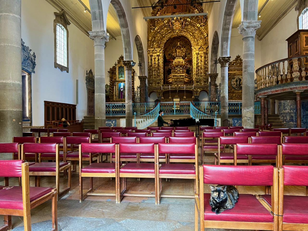
Mary and I were drawn to a medieval church because through its open doors we could hear piano music. I believe it was Chopin. Sure enough, in this ancient church a man was playing solo piano. And the entrance of the church was guarded by a…cat!
What is there not to love about this place?
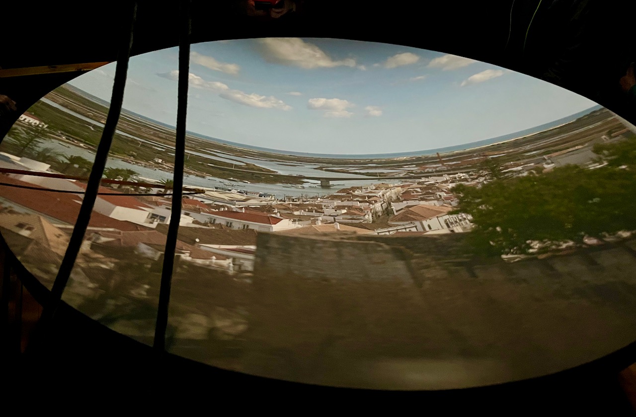
Tavira hosts a restored Camera Obscura. In the shot below you can see the gorgeous white stucco Santiago Church and to the left you can see part of a water tower. A Camera Obscura is housed in that water tower.
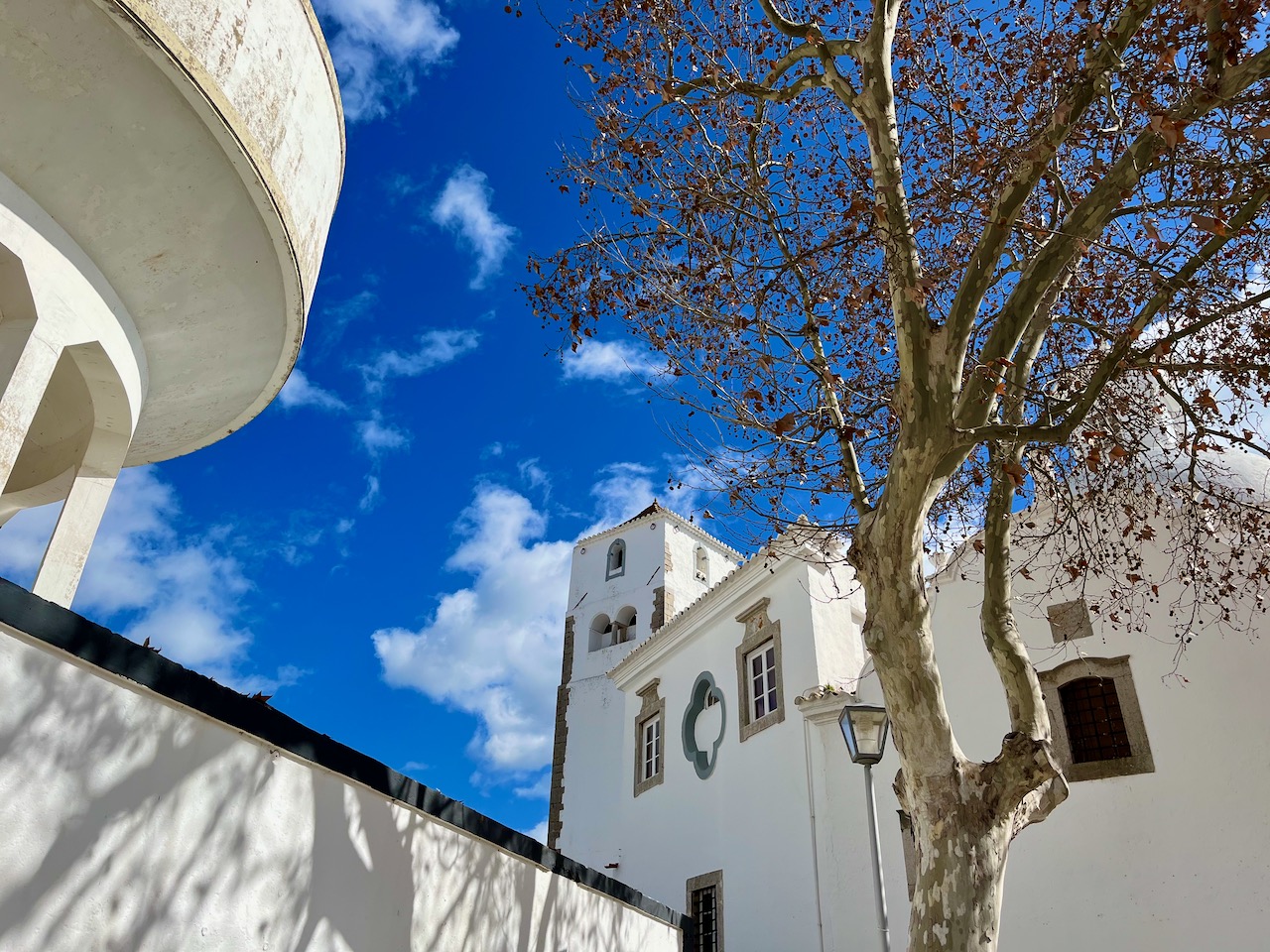
A Camera Obscura was first described by Leonardo DaVinci in the early 16th century; its use is considered the precursor to the invention of the camera. This particular Camera Obscura has its aperture at the top of a water tower. Mirrors, lenses, pulleys, ropes and levers all control aspects of it. Down in the dark well of the water tower, a reflected image of the city outside shines on a bowled surface. It was incredibly detailed and bright, and reflected things in live action.
So very cool to see one of these in action in an ancient city dating back to the time of the Romans.
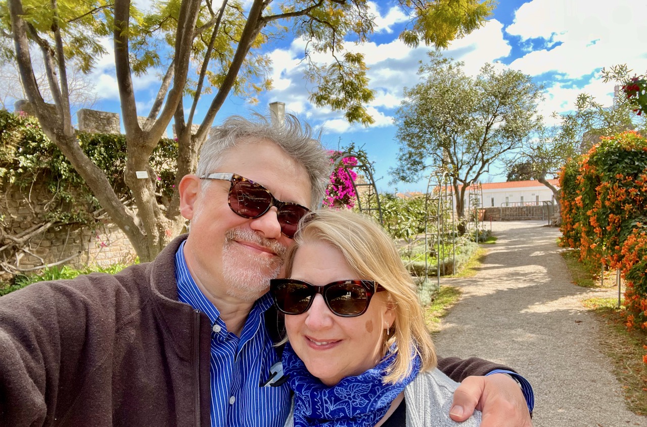
Afterwards, Mary and I took a stroll through the remains of Tavira’s old castle, where a lush garden is now kept.

It was Valentine’s Day, and so Mary and I took a selfie in this beautiful garden. Behind us (not pictured) an old Portuguese guitarist was strumming songs of unrequited love.
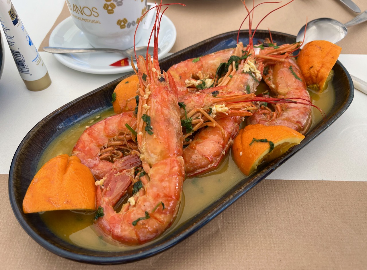
Before leaving Tavira, Mary and I enjoyed lunch on a riverside cafe. Though perhaps ‘enjoy’ is not the best word. This photo is an example of how food is prepared and served in Portugal, especially seafood. You get the entire product. The parts you can eat, the skeleton, tail, fins, head and eyes all end up on your plate. Each of these shrimps pictured Mary had to clean herself at the table as she ate.
So if you come to dine in Portugal and want freshly prepared seafood, don’t be squeamish!
Note: my photo way above of the Fish ’n’ Chips was definitely an exception, but that cafe was catering to local British expats.
A final shot of Tavira’s town center on the Gilão River.
Songs from the Portuguese – Wanderings & Observations
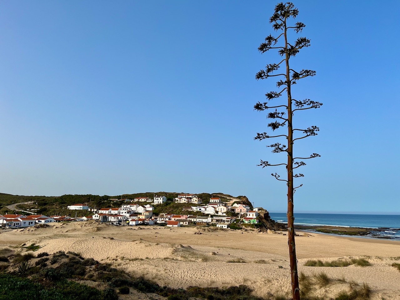
Our Globus motor-coach tour of middle and northern Portugal ended over a week ago and I’m finally catching up to share a few photos since that tour. After a night in the small town of Aljezur, Mary and I headed to a couple of beaches on the southern Atlantic coast along Portugal’s southern tip. This is Praia de Monte Clérigo.
Mary walking along Praia de Monte Clérigo.

Praia de Monte Clérigo at low tide reveals rock formations and tide pools that you can wander through. I tried to find some history of this place, but it’s tough to unravel. I know the Portuguese authorities are considering demolishing some of the buildings in the little surfer village atop the bluff (behind where I took this photo) in order to preserve the natural beauty of this place, but the locals are fighting it.

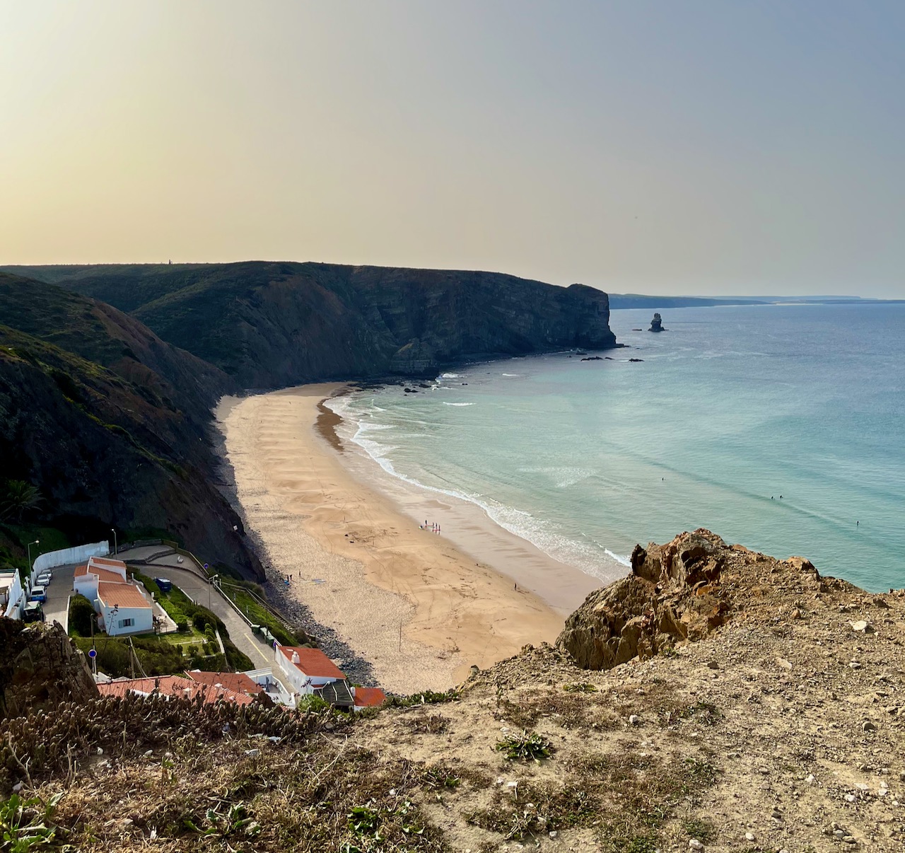
Next Mary and I stopped at Praia da Arrifana. Another beach, another community. We hiked down to near the beach and watched a surfing class in progress. The beaches of Portugal have become huge surfing destinations.
We’ve arrived at our villa in Lagos! Here’s Mary in the back patio. It’s a beautiful place, walking distance from the beach, the harbor, the yacht club with a really fabulous bar and a giant grocery store.

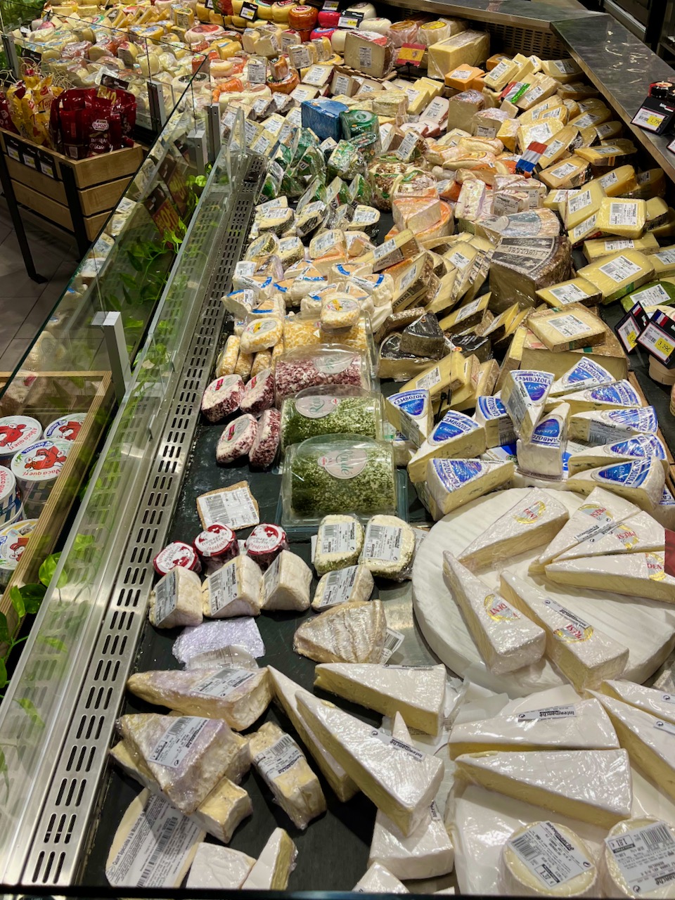
The grocery stores in Portugal rival the best ones you can find in the states. And just like Wisconsin, the Portuguese love their cheese. This photo shows only about one quarter of the cheese selection in this store. Heaven.
The marvels of this Portuguese grocery store are endless. Here’s a jar of hot dogs.

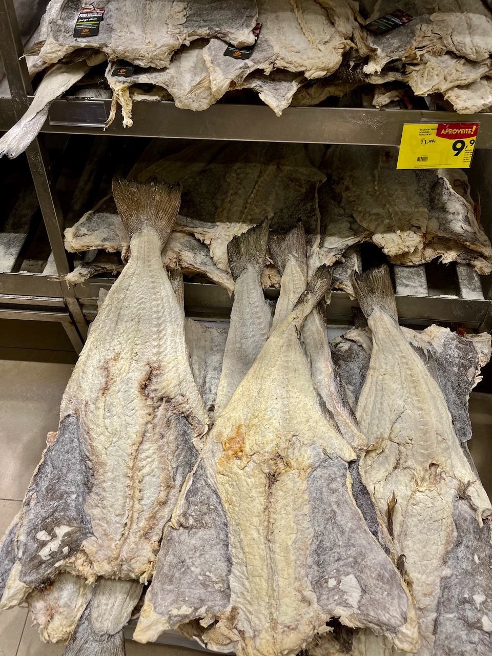
Note: Buying fresh meats and fish is not the same as in the US. Things are not as processed here. Fish come whole, and much of the poultry, beef and other unidentifiable ‘meats’ come barely butchered. Pictured here: some kind of dried and salted fish, stacked like cardboard.
The Portuguese like coffee and they LOVE espresso. They love it so much that our villa comes with a tiny automatic espresso machine. The automatic drip coffee maker had been shoved onto a back shelf in the pantry to collect dust. We went to the grocery store and discovered it’s almost impossible to find filters for automatic drips. It’s all espresso now.
We were concerned about the waste involved (like Kurigs in the US), but realized the little packets are made of aluminum and are recyclable.

The city of Lagos is a bit sprawling and a mix of urban and rural. You can be walking down a street with cafes and apartments, and in the next turn find yourself in a cow field. Pictured: what I believe is a White Dogwood. These trees are blooming all over the place right now.
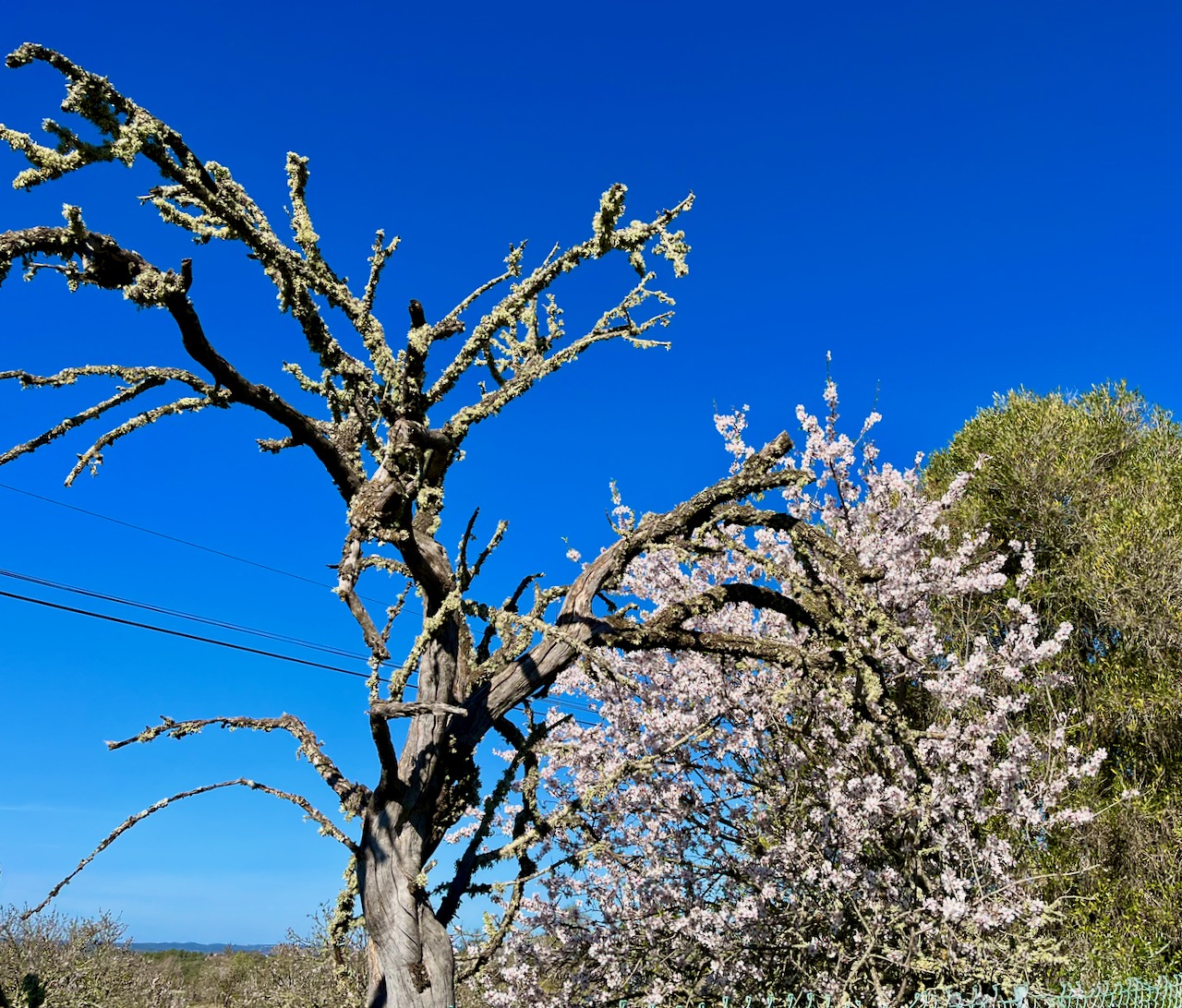
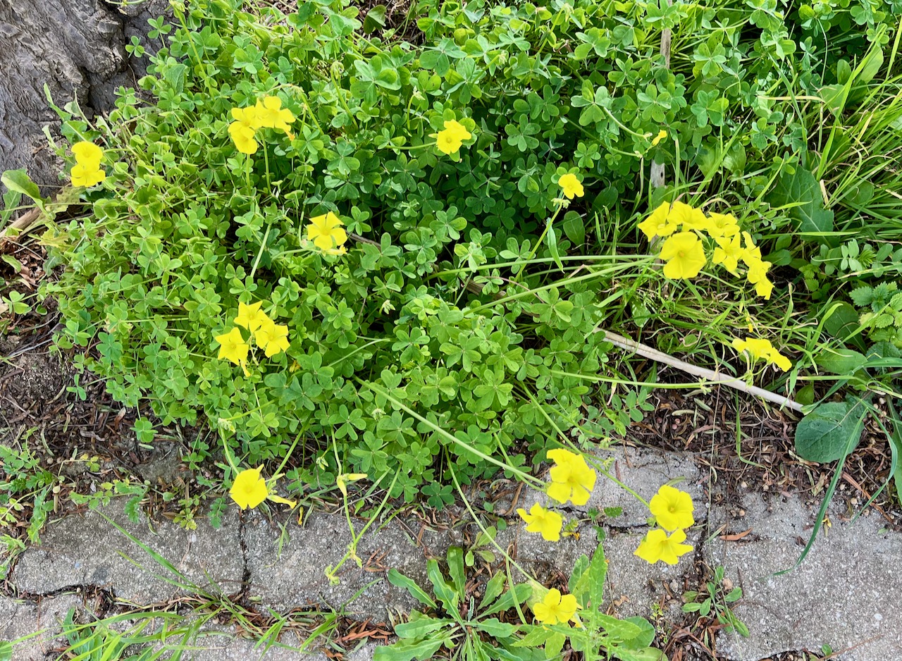
In addition to the White Dogwoods, these winter Yellow Buttercups bloom in legion across the fields, along roadways, in empty lots, everywhere. Gorgeous in their splendor.
Seriously, flowers are everywhere. This old boy likes flowers and isn’t ashamed to admit it.

People have lived in this land for thousands of years, and the countryside is shitting history from its pores. Much of that history is chronicled, but there’s so much that’s lost. What did this roadside gate–in the middle of town no less–once lead to?

On our way to ship a package, Mary and I passed this old abandoned ruin. Maybe we could buy it and fix it up?
Another feature of Portugal is their Port Wine, which I’ve written about previously. As a visitor, after you’re here for a while it just gets under your skin. So now the buffet in our villa has a few bottles of tawny port awaiting sundown.
Here’s something about Portugal that surprised me: the preponderance of cigarette smoking. Many restaurants still provide ashtrays, where smoking is still allowed at the outdoor tables. Our villa has ashtrays. And here, in a hotel lobby, I ran into something I haven’t seen in decades: a cigarette vending machine. Look closely, and you’ll see you can get Marlboro, Camel, Winston and Chesterfield. American exports we can be so proud of.
I suppose this is more of a European thing, and not just Portugal.

Another common feature of Portugal and Europe: roundabouts. Roundabouts everywhere. Sometimes there are conjoined roundabouts that swerve you into a kind of infinity symbol roadway, literally and metaphorically entrapping you. There are rules about lanes, which Mary and I are still not clear on. Keep your wits about you, and save the tawny port for after you’ve gotten home for the night.

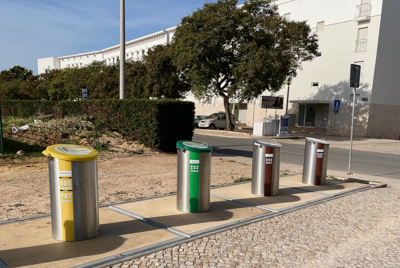
The Portuguese recycle, and these recycling centers are all over the place in Lagos. They evidently don’t pick it up from house-to-house with your trash, and so it’s up to each citizen to truck their recycles over. People do, because it appears most Portuguese citizens actually give a shit about the environment and about each other.
One of the oddities of Portugal is the practice of shuttering every window and door. These shutters aren’t hurricane shutters, but typically thin, vented aluminum or wood. The practice is that you always shut these at night over every window and door in your house. The sweet old lady watching our villa has warned us several times now to remember to close our shutters!
The thing is, Portugal has a low crime crate, and it’s very safe to walk around at night. And I’ve noticed that these shutters are in use in tall buildings too, where no one could hope to gain egress. It’s just a custom, one that everyone follows.

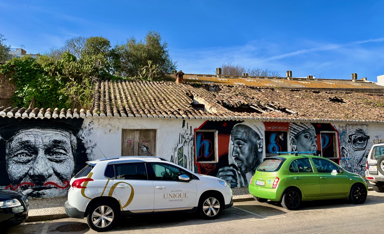
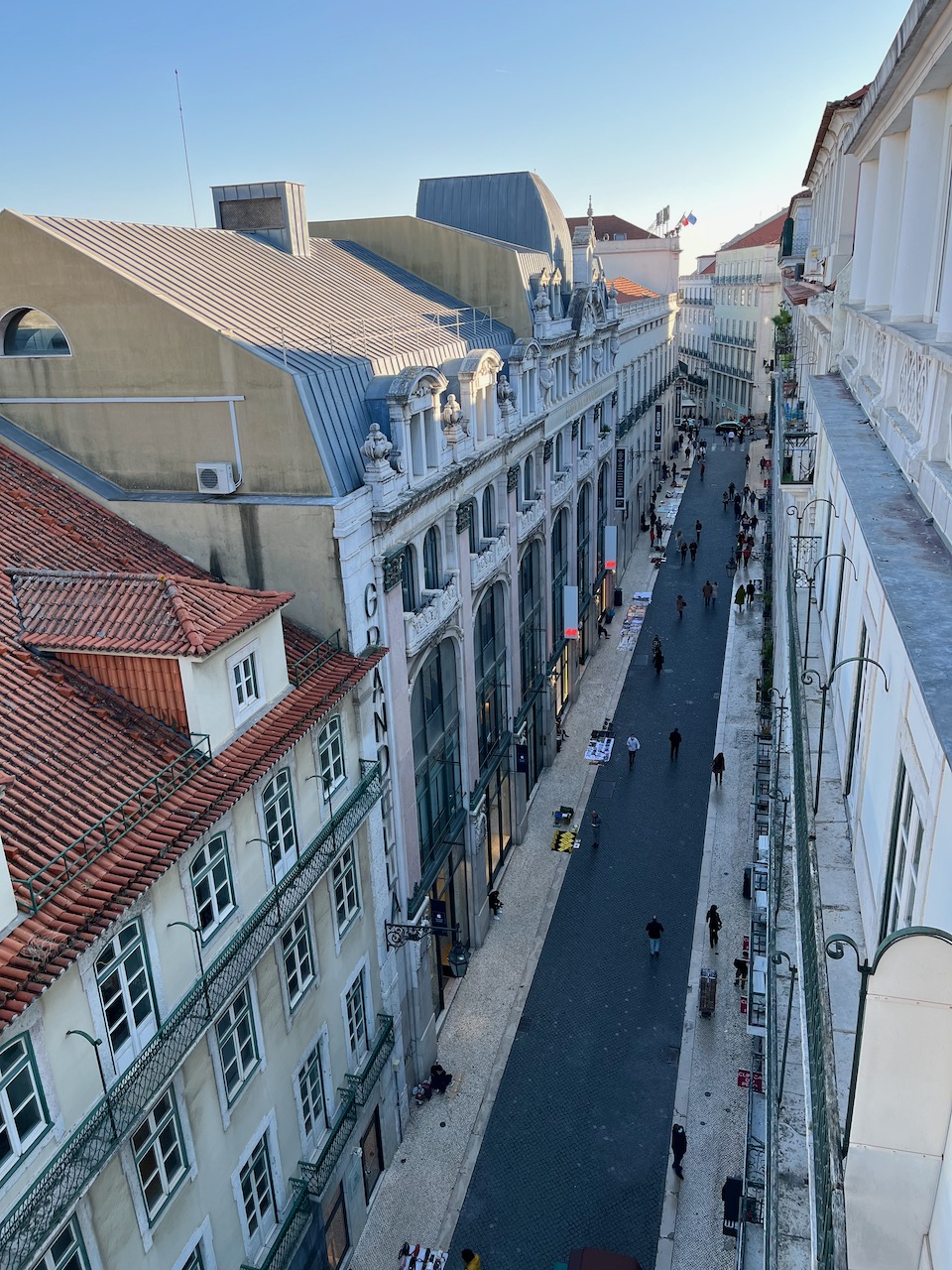
Mary and I have now walked into old town Lagos (that is, the part of Lagos from medieval times) a couple of days now, and there’s always things to see and marvel at. The street art or graffiti is often astounding. Pictured: a line of gorgeous street art on a ruined building. I only wish the cars hadn’t been parked here so I could photograph the whole thing.
I love this because it’s a beautiful juxtaposition of old and new. Portugal in a nutshell.
A view of the harbor canal along old town Lagos. This big harbor kind of separates old town from new town. Our villa is in the newer area, but we are only a 15 minute walk away. Things around here are very pedestrian friendly. We’re able to cross this canal over a pedestrian bridge.

Below: The Mercado de Escravos.
Pictured below is an ugly snippet of Portuguese history. You can’t read it in this shot, but there’s a small white sign in the lefthand archway announcing that the Mercado de Escravos has closed. What was this? This used to be where slaves were auctioned off. In recent years this building was turned into a museum: ‘The Slave Market Museum’ stands on a major square in old town, right near the ocean, where ships would dock. Starting in 1444, humans abducted from Africa were displayed fully naked right on this spot and then sold to wealthy Europeans. This building wasn’t built until the early 1600’s, but it’s on the actual spot of slave trade.
In 2016 The Slave Market Museum was created on this site to educate people on this dark aspect of Portugal’s ‘Age of Discovery.’ Evidently not enough people cared, as this place is now shut down.
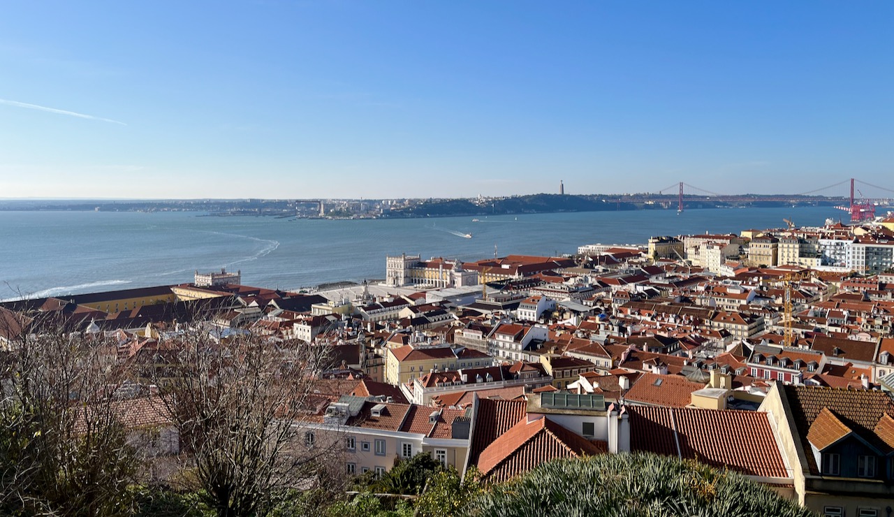
Mary and Yours Truly at the Fort of Ponta da Bandeira on the Atlantic Ocean in Lagos. The fort dates back to 1690.

A view of the Lagos harbor from Fort of Ponta da Bandeira. See the long stretch of beach in the distance? That’s the beach right near our villa.
Meia Praia Beach, Lagos, just a few minutes’ walk from our villa. We’ve come here twice now and it’s generally pretty empty. It’s off season, but with the warm sun, 70 degrees feels quite delightful.

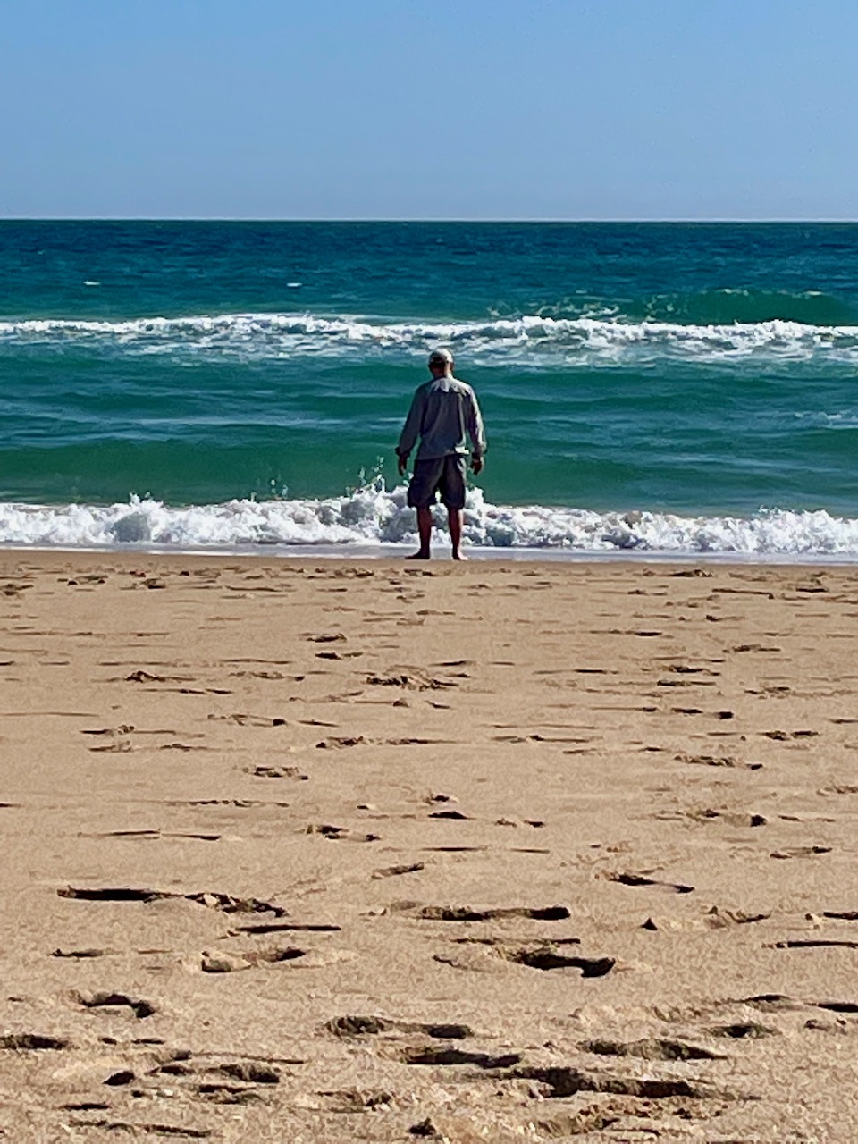
Yours Truly contemplating the ocean at Meia Praia Beach. About two hundred kilometers southeast of me stands Gibraltar.
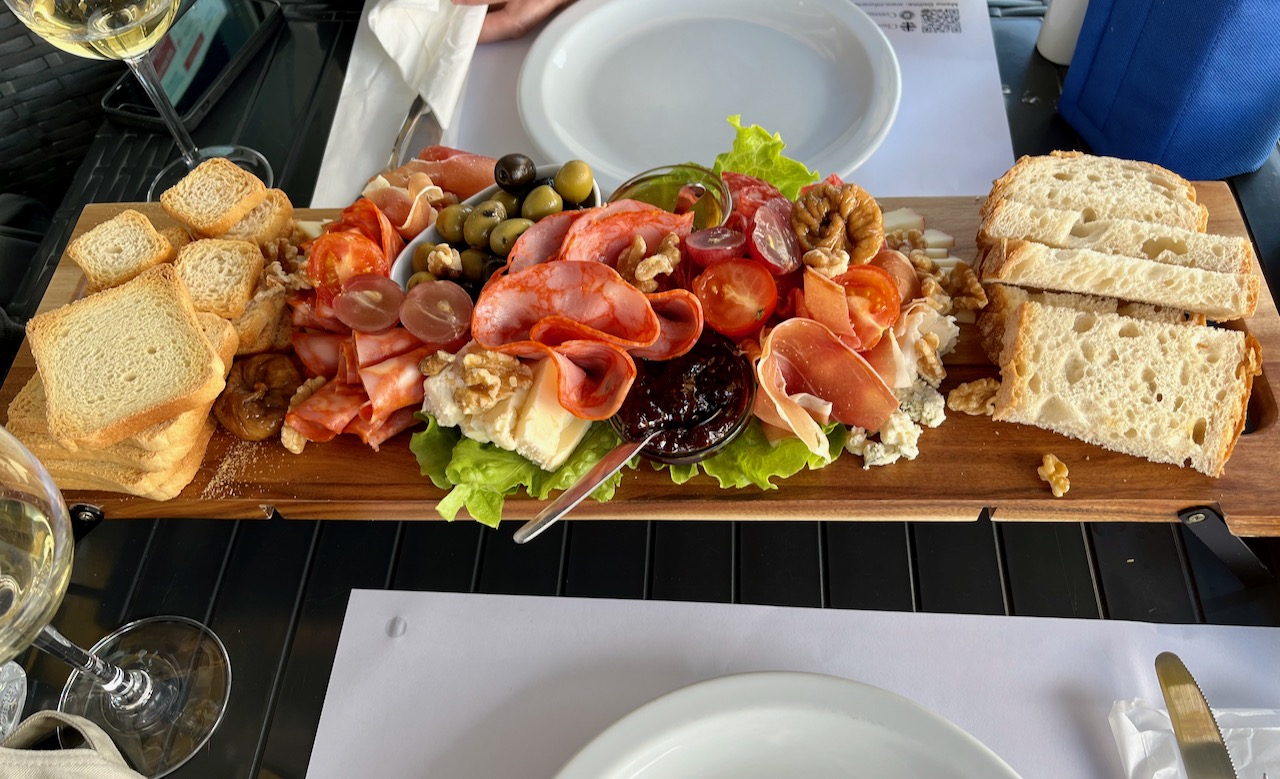
At our favorite marina bar. The green wines of Portugal are to die for.

An example of the kind of fare Mary and I can enjoy at the marina ‘bar.’ Yes, it calls itself a bar, yet serves gourmet charcuterie boards like this. Bom appetite!
an idiot in iberia – Chapter 9
The last day of our tour began in the early morning in downtown Evora, Portugal. First stop, a thousand year old Roman ruin, Templo Romano, which archeologists now believe was not a temple to any Roman god, but to the ‘Cult of the Emperor.’
Seeing this was a big deal for me, as I’ve never been to Italy (yet) and have never seen a true Roman ruin. I’ve only seen roads and some crumbling walls. A great way to start the day.

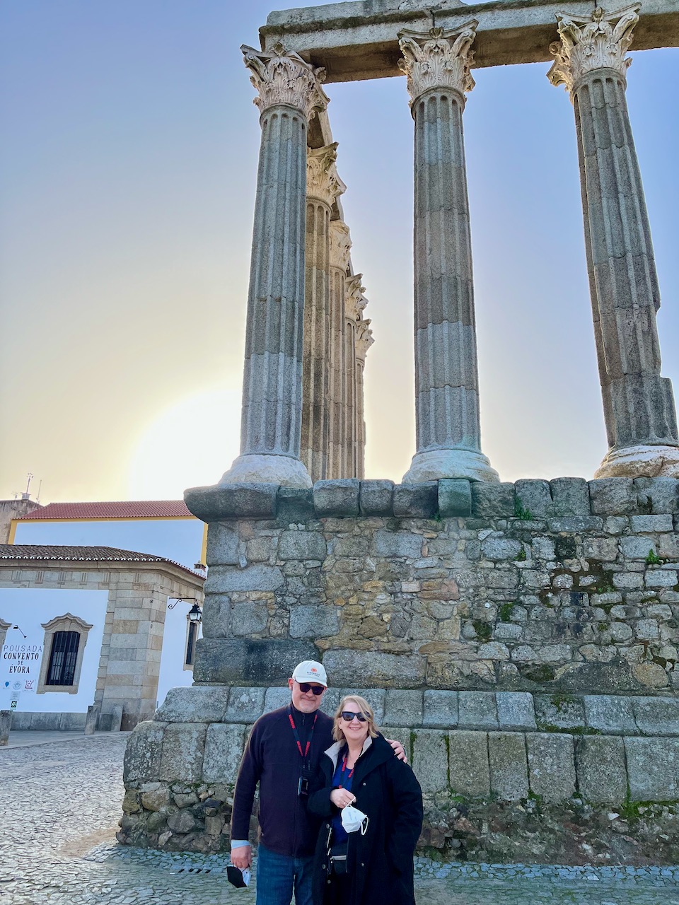
Mary and Yours Truly in front of the Roman temple to the Cult of the Emperor.
Our next stop was the Cathedral of Evora. At its entrance three beggars greeted us. Portugal is a socialist country and in 2019 passed a law making the government responsible for housing the homeless. Any homeless person has access to housing, but in order to get that they have to comply with some rules, namely accept treatment for addiction. Some are unwillling. Compared to the rest of the world, per capita Portugal has a low homeless rate of 8 people per 10k (by comparison the United States has over 60 per 10k).
Anyhow, two different guides we had (both women) were not sympathetic to the homeless we saw, telling us that the ‘beggars’ have options for free lodging, free medical care and free food. Alcoholism and mental illness are the chief reasons, exacerbated by the Covid pandemic.
At least the government here has policies in place to try and address this problem. Not solved, but they’re working on it.

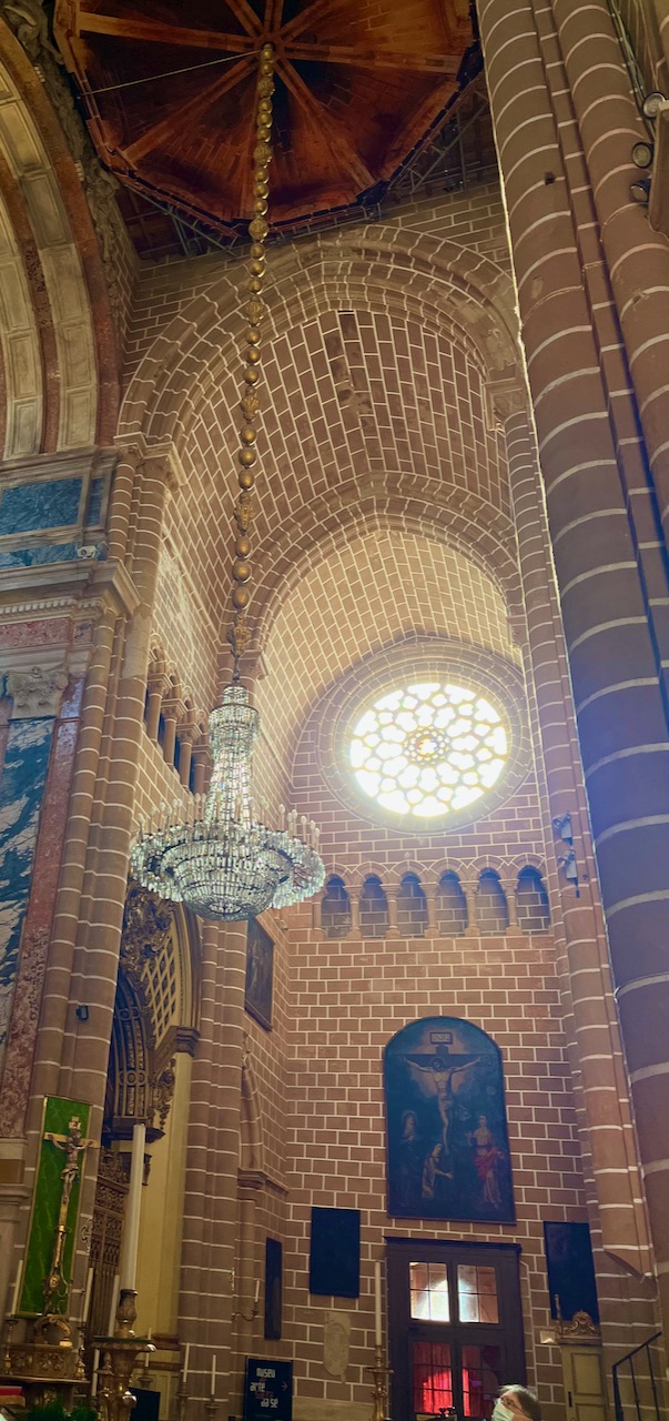
Inside the Cathedral of Evora. By this time in our guided trip, I had grown tired of cathedrals. But this one was exceptionally beautiful: gothic, romanesque and baroque. Perhaps it’s because this one is largely built of granite instead of limestone. This place is considered a historical landmark, constructed in the 1100 and 1200’s, and now preserved with funds from both the state and the Catholic church.
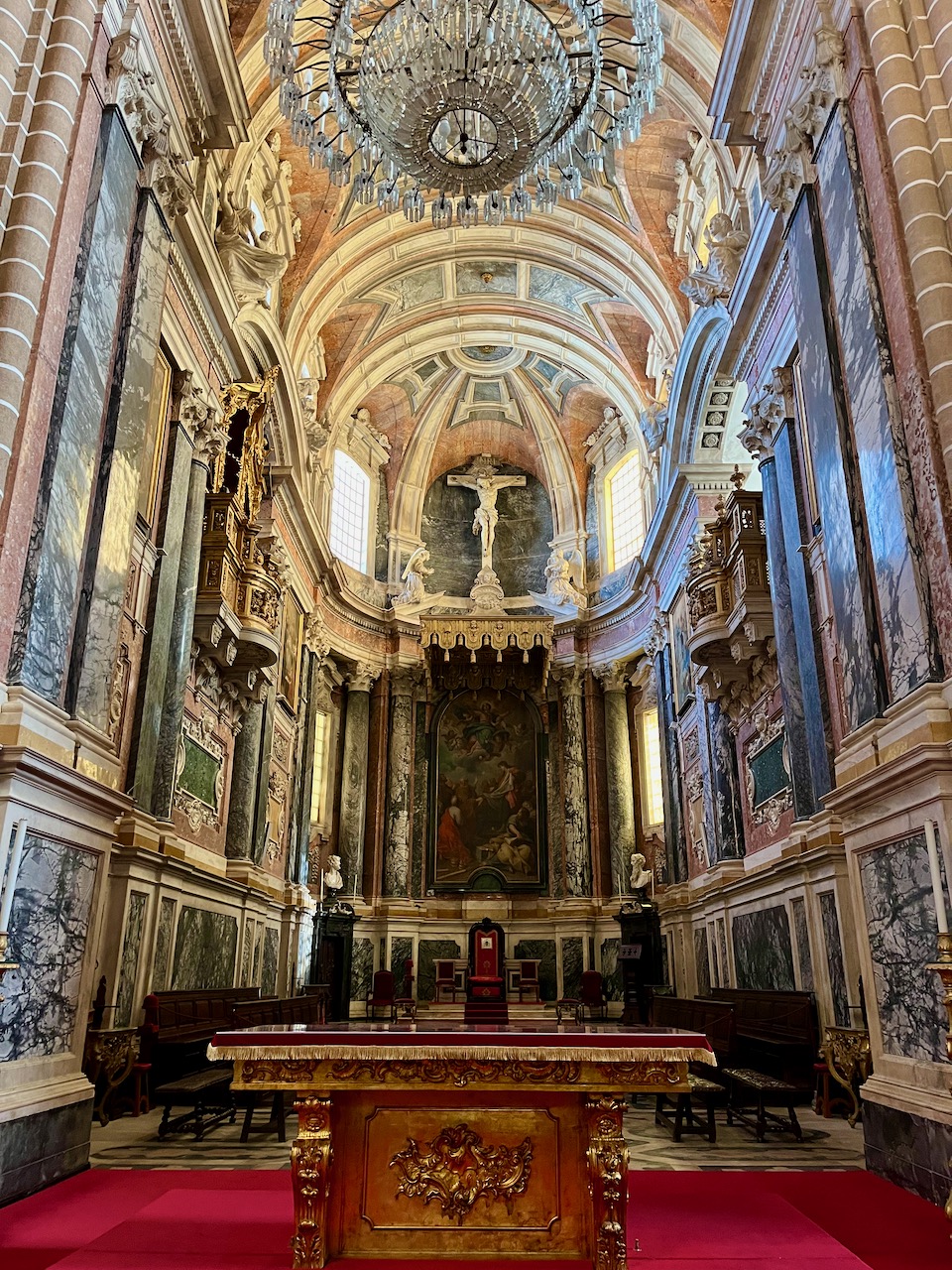
The light in the Cathedral of Evora was especially lovely.
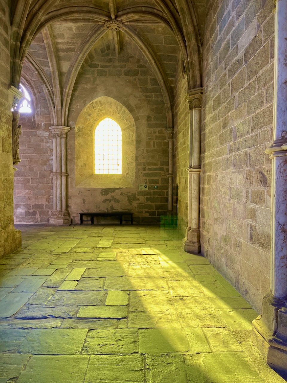
Out in the cloister, this unadorned corner was my favorite spot. The morning sun is simply gorgeous here.
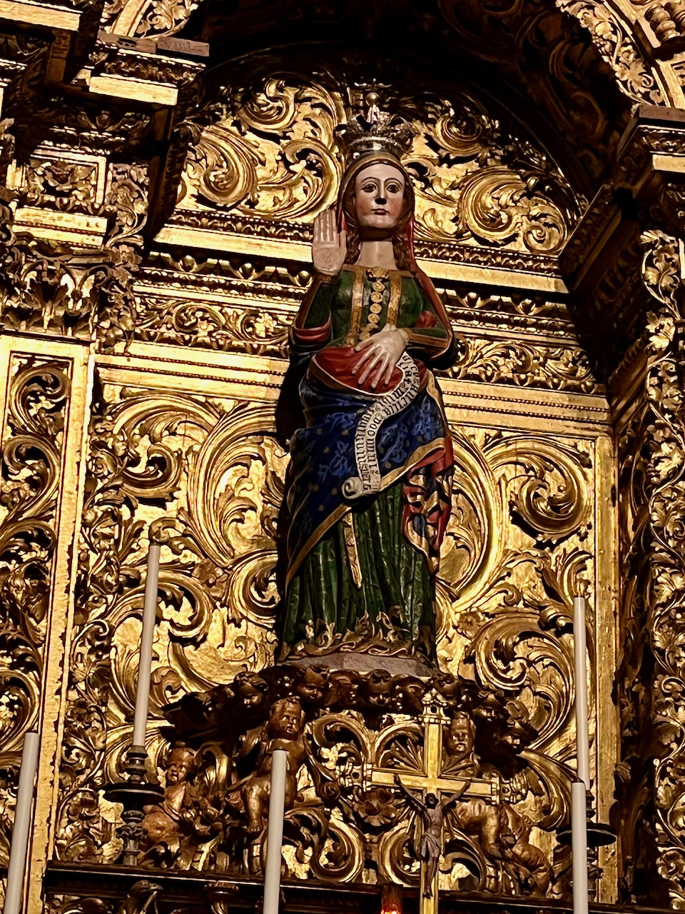
Interestingly, the Cathedral of Evora has a pregnant Virgin Mary. This is the only known statue in all of Portugal showing Mary pregnant. Nowadays Catholic women come to this place to pray for their fertility, and pregnant Catholic women come here to pray for a safe labor and delivery. Honestly, they just need to see a physician.
The next, and final, house of worship we visited was the Chapel of Skeletons. A bunch of crazed monks decided to adorn the inside of an entire chapel with the skeletons of believers. So no, this is not a photo from the latest film adaptation of a Stephen King novel, this is a real place. People evidently don’t like working here, as the place is maintained only by a skeleton crew.

Our weeklong trip was about over. Here we are crossing the Tagus river into Lisbon for our final night with the group.
Everyone in the group except for Mary and me was flying back to the States or Canada the next day, and so our tour guide arranged for Covid tests for everyone. Even though we weren’t flying back, Mary and I took advantage to just make sure we were still Covid negative.
Here’s my sweetheart sitting at an outdoor cafe in downtown Lisbon while we await our test results. They were negative again. In terms of Covid, so far Portugal has been very safe. Fingers crossed for the rest of our stay!
An Idiot in Iberia – Chapter 8
The Jewish diaspora very much included the Iberian Peninsula. In Portugal, Jews suffered persecution beginning back in Roman times and also under the Visigoths. When the Moors took over the territory in 711, many of the Jews saw this as liberation. But it wasn’t long until the Christians conquered the Moors. Still, for several centuries Jews fared much better in Portugal than in Spain.
In 1135 Portuguese King Alonso I appointed Yahia Ben Yahi III, a Jew, as his supervisor of tax collection; this is how accepted Jews were in the early years of Portuguese history. However, by the 1500’s things turned really bad in Portugal. The Spanish Inquisition in Spain was just too powerful. For centuries onward, the Jews in Portugal were subjugated and often had to practice their traditions in secret.
Pictured: a giant menorah in a garden in the village of Belmonte, Portugal.
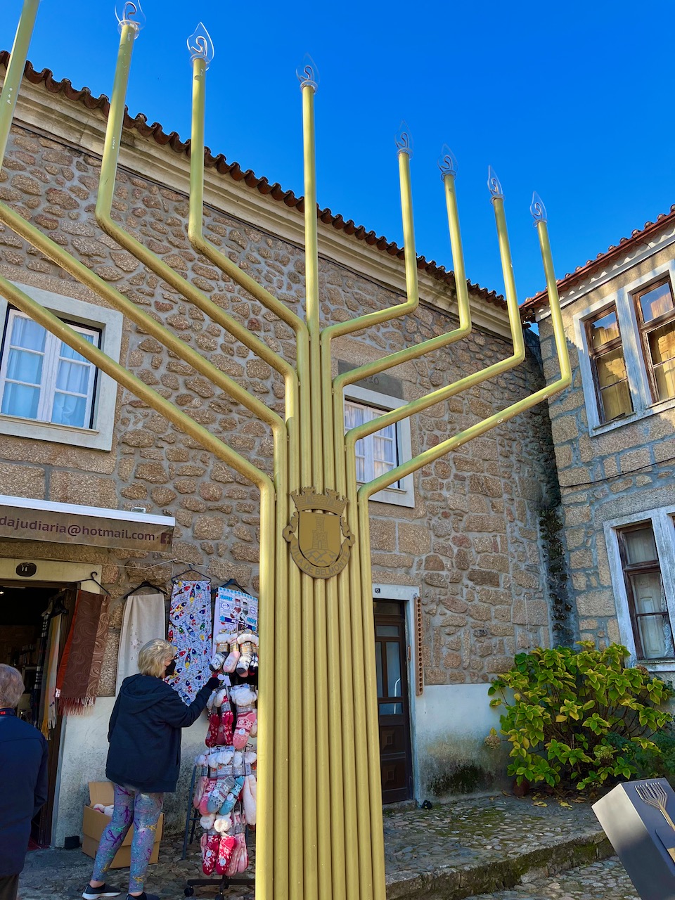
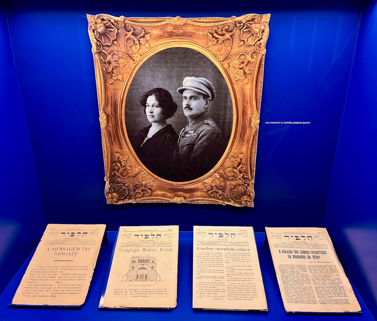
Our tour guide, Beatriz, had one Jewish grandmother, and so the legacy of Jewish subjugation in Portugal is of great interest to her. It should be of great interest to all of us. What are dealing with in the United States to this very day? Continued dehumanization of ethnic groups. Racism. But I digress. Since about the 12th century, a secret community of Jews existed in this small town of Belmonte, Portugal. Publicly they converted to Christianity, privately they did not. Today there’s a museum here chronicling that history.
Pictured: one of many displays featuring relics from the secret Jewish society here. They didn’t begin practicing Judaism in public until the 1970s!
The sun rising on a medieval lane in Belmonte.

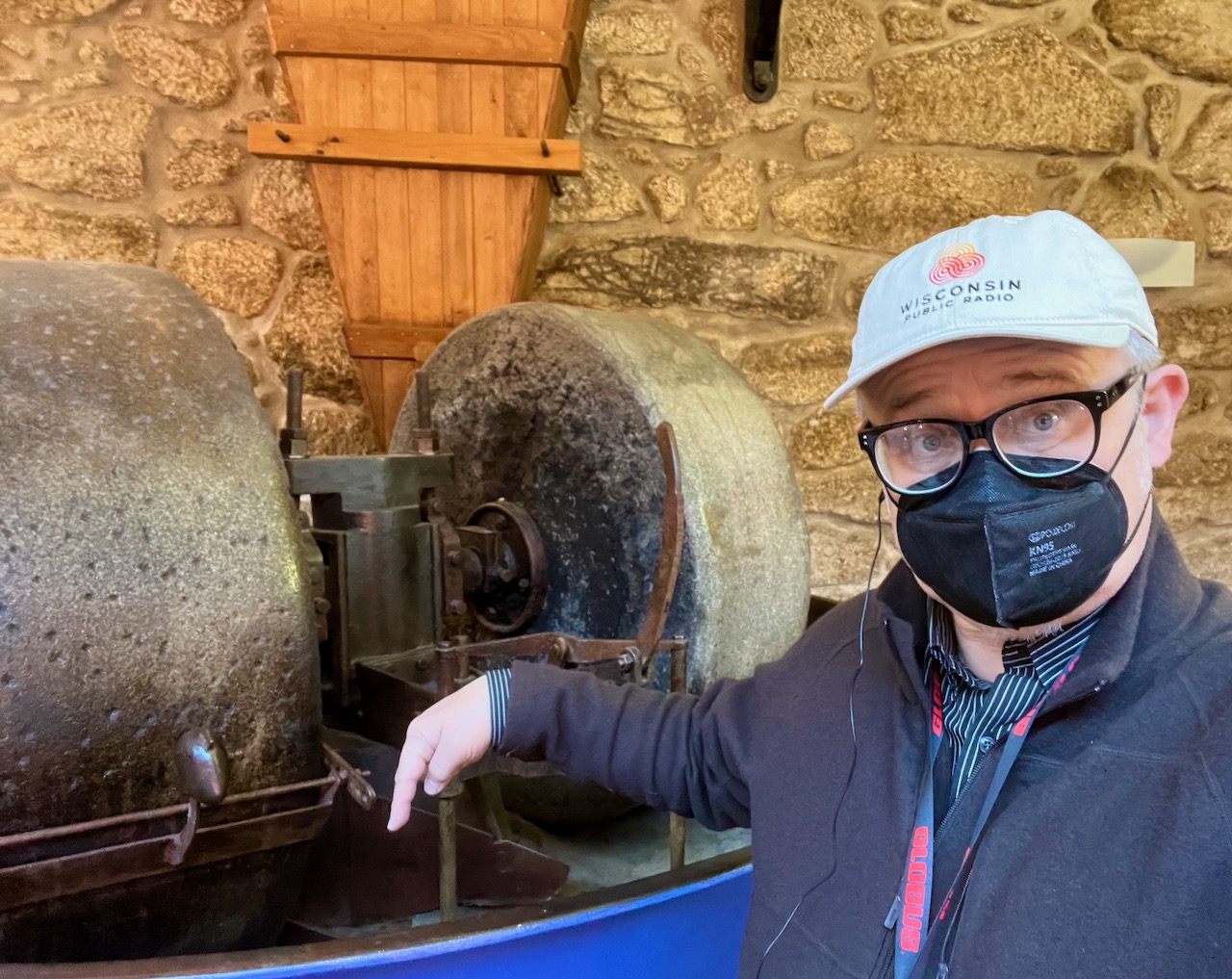
There was a second reason we came to Belmonte. After visiting the Jewish museum, we visited an Olive Oil Museum. I can’t remember all the complicated explanations involved in how olive oil is harvested, processed and stored. However, I do know that this big honking machine here is where olives get pressed. Yes, I licked its bottom.
Studies show that olive trees are not indigenous to the Iberian peninsula, but they’ve been here so long they might as well be. The Phoenicians were likely the first civilization to bring them here from other parts of the Mediterranean. Olives have been cultivated in Portugal by various peoples for probably 4000 years.
A street mural in the small village of Belmonte.

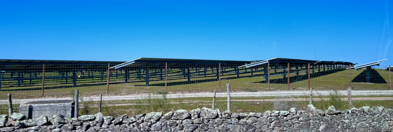
Next our motor-coach drove us toward Castelo de Vide. On the way we passed wind farms and solar farms. I thought this roadside photo was cool because it’s another common juxtaposition you see here of the very old next to the very new. The ancient roadside stone wall, and the modern solar panels collection energy. Portugal is going big on green energy.
In Castelo de Vide we stopped for lunch, where Mary and I sampled our first Portuguese beer, a very nice IPA. This cafe was yet another example of how kind and patient Portuguese shop owners are with ignorant American tourists who only know how to say two words in Portuguese. If you’re looking for a place to vacation, seriously consider Portugal. The people here are absolutely wonderful.

Yes, the Portuguese love their fine wine, their olive oil and their gourmet desserts. But they also LOVE potato chips! So much so they have Pringles vending machines out on the sidewalks.

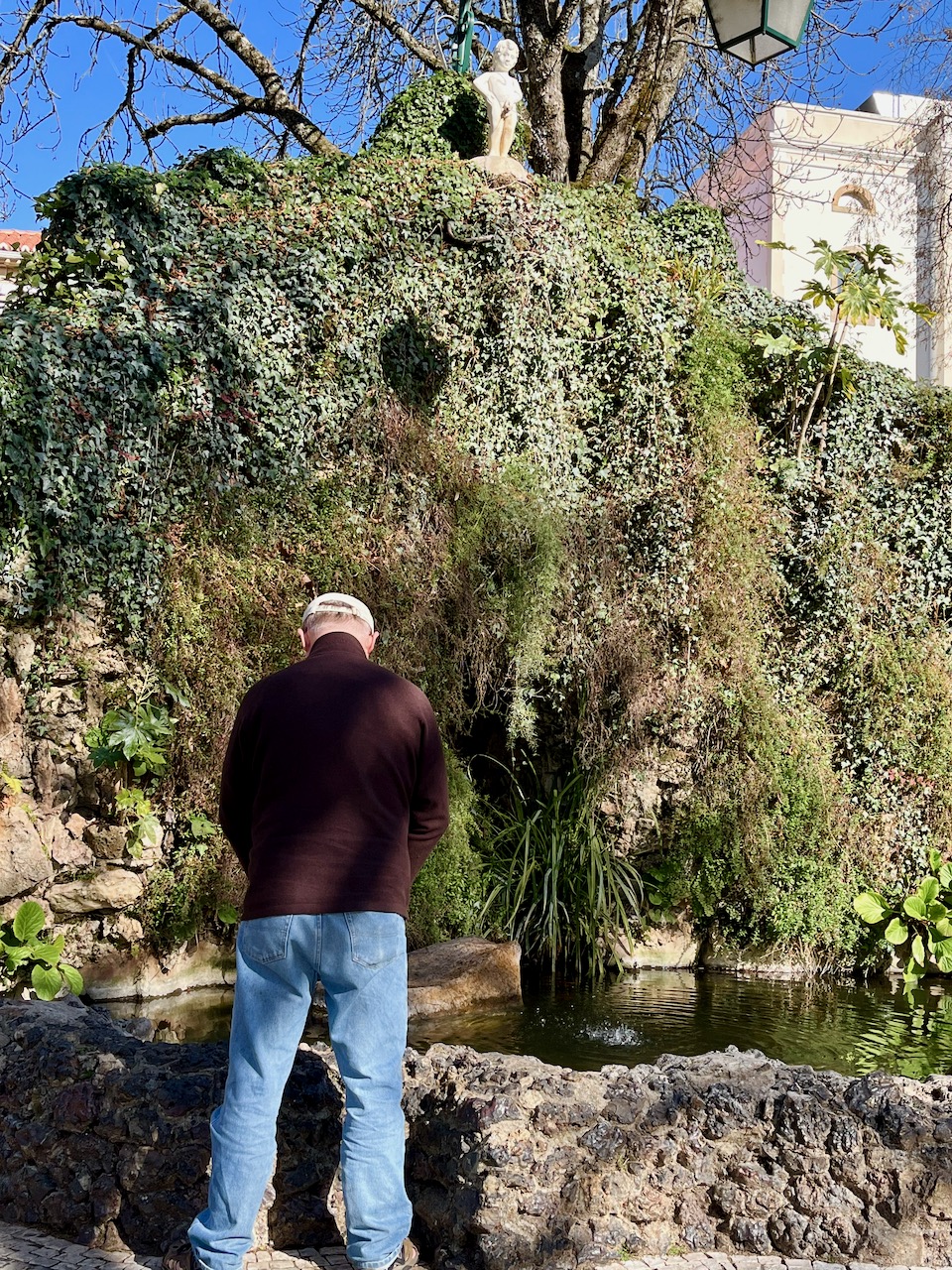
Mary and Yours Truly enjoying a sunny January day in the central park of the small city of Castelo de Vide.

Any art snob can tell you that one of the most famous statues in Europe is in Brussels, called ‘Little Pissing Man’, where a 17th century cherub-like creature fountains a stream of water out his bronze penis. Well, not to be outdone, the Portuguese have a Little Pissing Man in Castelo de Vide.
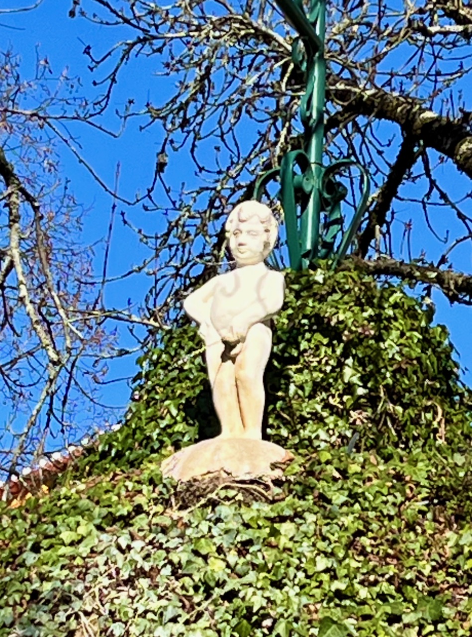
Big Pissing Man beneath Little Pissing Man, Castelo de Vide, Portugal.
Next our motor-coach drove us to the city of Evora. This part of Portugal is famous for its marble quarries. Everything in this city is plated in marble: thresholds, countertops, walls, shower stalls, commodes.
Before checking into our Evora hotel for the night, our tour director took us for a tour of a cork factory. Part of the sprawling Portuguese wine industry is their production of cork. Portuguese as well as most European wine vintners still use corks in their wine bottles, despite a worldwide shortage of cork. (For example, New Zealand has switched to all screw top bottles). But as the factory told us, a cork stopper allows a wine to ‘breathe’ without letting any liquid pass in or out.
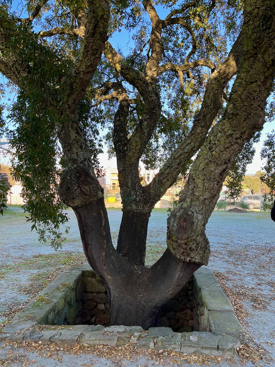
Pictured: a cork tree. This one is probably about a century old. Cork farms have to think long term. The typical cork tree can’t first be harvested until it’s about 30 years old. And after that, it can only be re-harvested about every decade. If you look closely at this tree, years ago the bottom sections of bark was harvested. There are groves of cork trees all over this country.
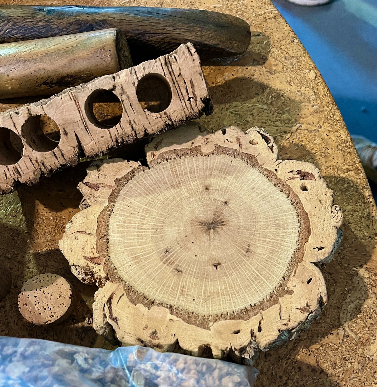
Pictured: Cross section of a cork tree. Contrary to myth, harvesting the bark from cork trees doesn’t kill them. If you look at this photo, you can see a dark ring near the edge of this cutaway. The dark part is the ‘living’ part of the bark, and that’s what cannot be disturbed. The farmers carefully cut away the other layer, which is the dead part of the bark. This is the cork.
That evening, after checking into our hotel, Mary and I wandered the medieval streets of Evora.

In the Evora town square we happened upon a political rally. The Prime Minister of Portugal had driven in for a quick speech. That night was the eve before a 24 hour cooling off period before election day on Sunday.
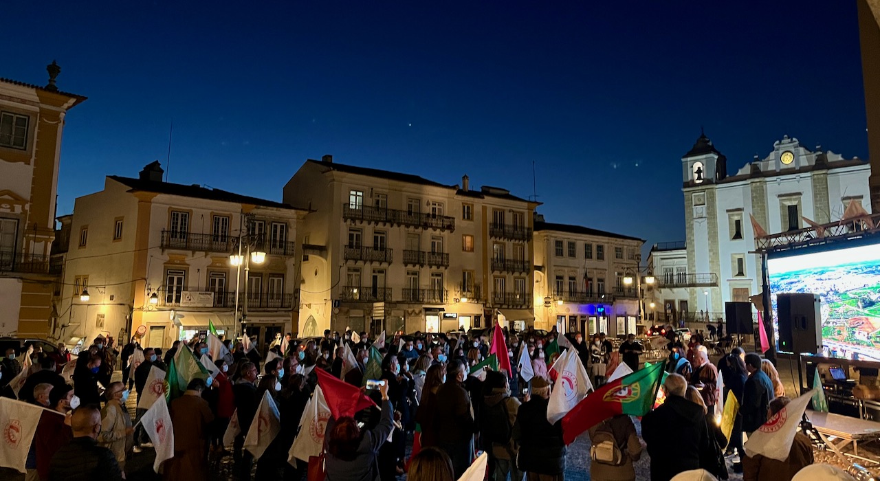
Follow-up: By Monday it became clear that the Prime Minister of Portugal had won re-election in what’s being called a landslide. In fact, his party gained an outright majority in Parliament. Previously, he to govern with a coalition. Political procrastinators are saying that Prime Minister António Costa won his reelection because of the aggressive way his administration battled the Covid pandemic. Portugal has led the world in Covid responsiveness, numbers of infections and deaths. Costa’s policies have saved thousands of lives, and his people are smart enough to have recognized that. Listen up, America!
An Idiot in Iberia – Chapter 7
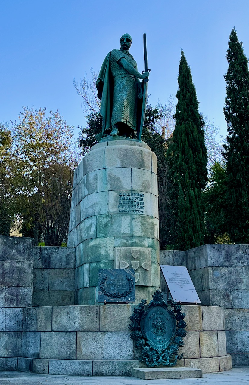
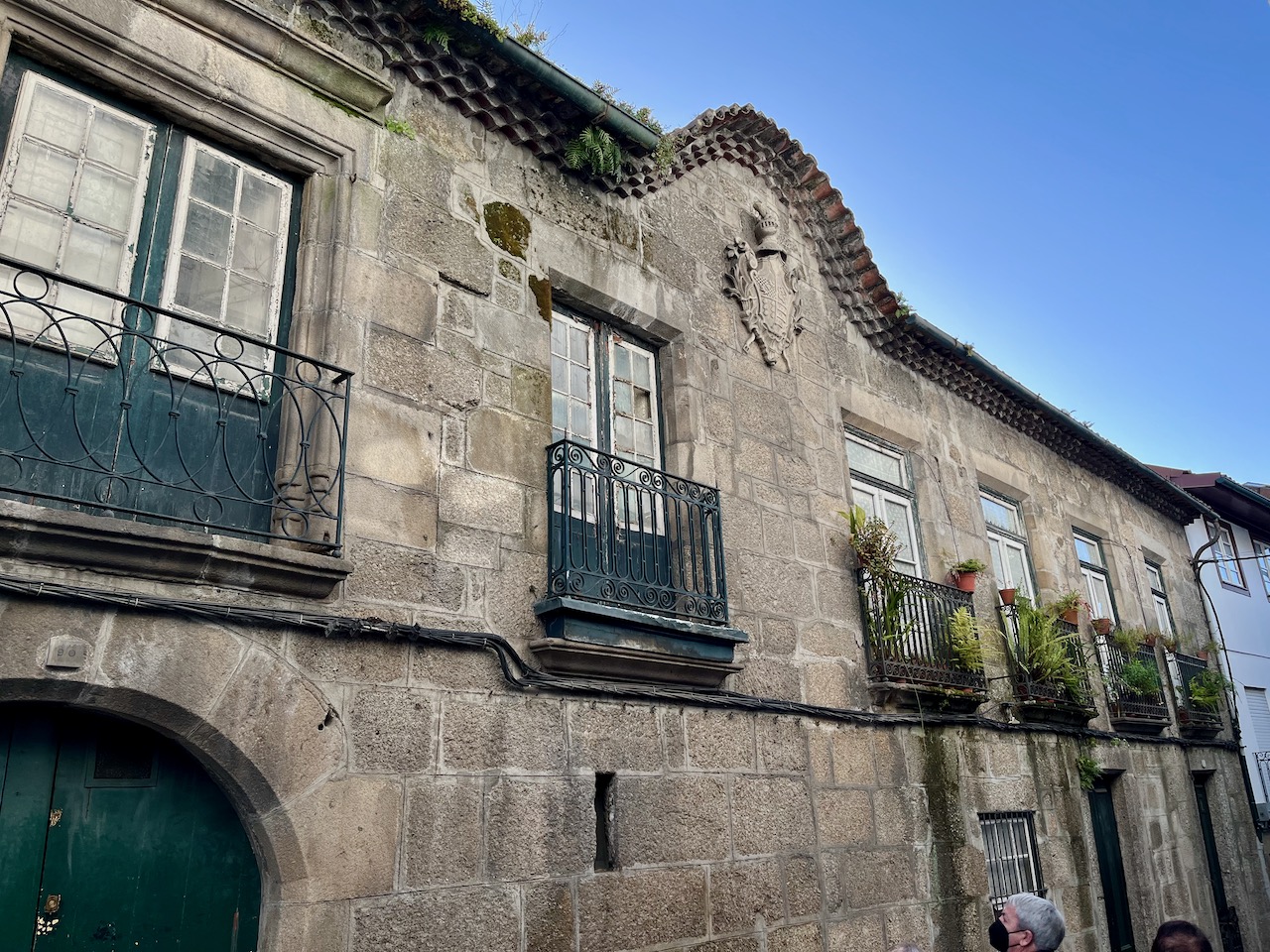
The next day of our guided tour took us to the the supposed ‘Cradle of Portugal’, the northern city of Guimarães. Pictured here is a statue of Afonso Henriques, the first King of Portugal. Alfonso I fought two different forces in order to found Portugal. He fought his widowed mother, Teresa of Portugal, and her lover, Fernando Pérez de Traba. Also, I think some kind of battle went on with Teresa’s sister. This also involved the Pope. All of this is confusing and somewhat incestuous. Suffice to say that King Alfonso bested his Mom’s lover and also the Moors and I guess maybe the Pope too, to finally be proclaimed the first King of Portugal.
Oh, and Alfonso was born here, or near here. It’s all confusing because this happened a long time ago. Alfonso I ruled from 1139 to 1185. And there you have it. Portugal is over 800 years old even if we don’t know all the exact facts about how that happened.
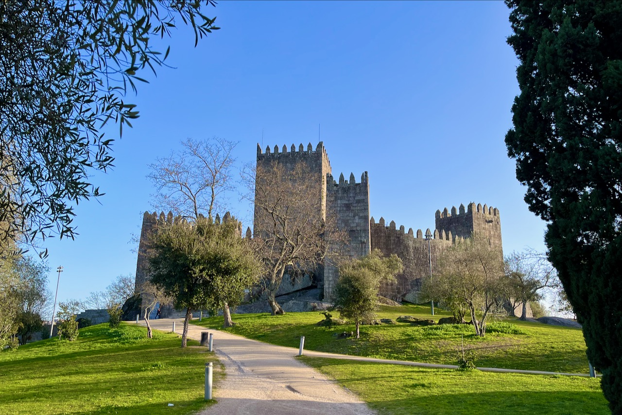
Here’s a lovely shot of the Castelo de Guimarães, which is just behind the statue of Alfonso. The history of this castle is just as sketchy as Alfonso’s founding of Portugal. The castle was built in the 10th century on a Roman foundation, and was once controlled by the Kingdom of Leon, which for a time existed in the northern part of the Iberian Peninsula prior to the creation of Portugal. Then the castle was controlled by Alfonso. Well…never mind, the castle contains a lot of confusing history and I’m just a hack. I thought it looked lovely, but our very knowledgeable guide, Beatriz (more on her in a later chapter) didn’t think it work tromping up there.
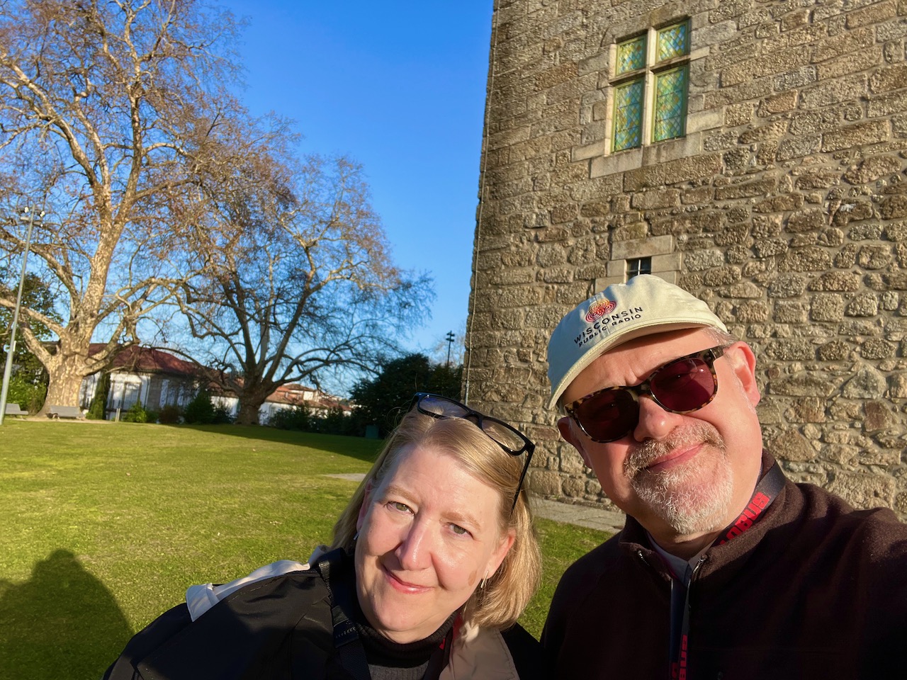
Here’s yet another castle-like structure near Alfonso’s statue, Paço dos Duques de Bragança, which has nothing to do with Alfonso and wasn’t even built until the 1400’s, centuries after Alfonso died. But the sun was shining on it, and so Mary and I took a selfie.
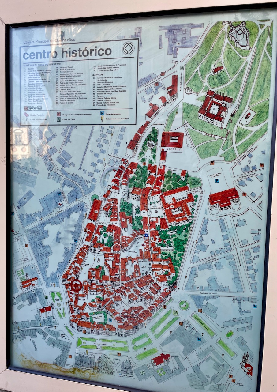
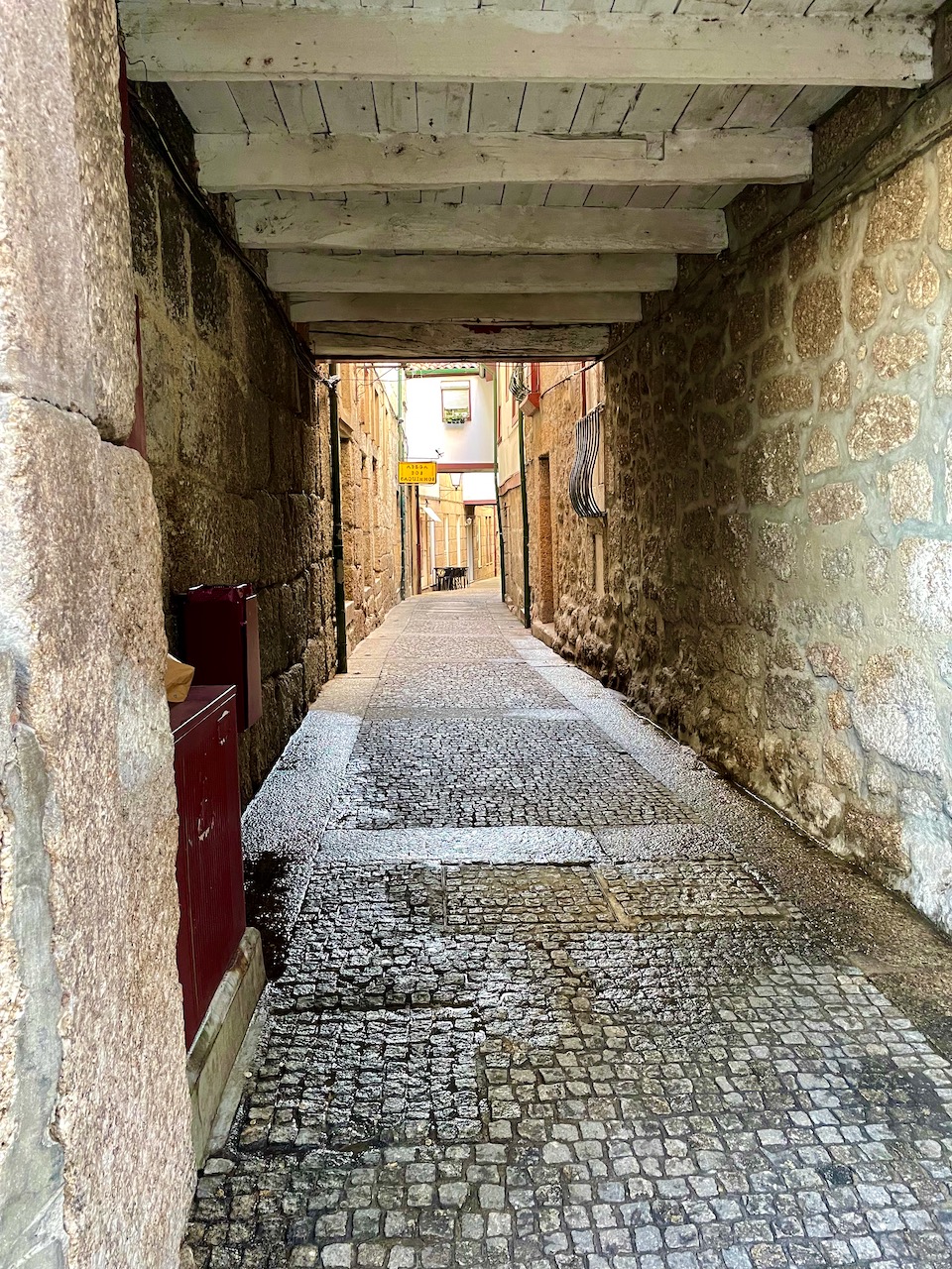
A map of Guimarães. The important thing to note here is how much red is on this map. A huge chunk of downtown Guimarães survives in total from the middle ages—with vestiges surviving from Roman times. This is kind of why I’ve just made a fuss about two ancient buildings I don’t know much about. The town of Guimarães has one of the largest contiguous neighborhoods that has remained intact from the middle ages. And so its entire downtown area (in red) was named a UNESCO World Heritage Site.
One of the preserved medieval streets in the Guimarães UNESCO area. Getting this attribution requires the site or town or building to do certain things to maintain that status. And so a lot restoration is going on, and anything new must conform to what we believe was its original historical condition.

This old building is about to fall down. There are poor families living in here. The building is slated to eventually get restored, but arrangements will have to made for the inhabitants. Portugal is not in the business of just throwing people out onto the street.
Here is an actual Roman road. Yes, the ancient Romans paved this this narrow roadway. Just wide enough for a horse-drawn chariot to pass through.
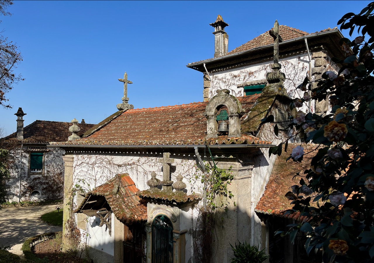
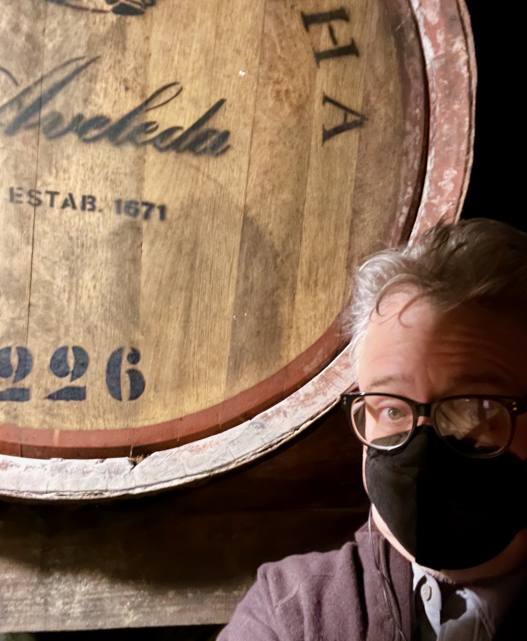
Next our motor-coach drove us to the local Quinta da Aveleda winery. I know, just what we need. Much of the gardens and buildings of this family-owned winery have been preserved in their original state from the 1600’s.
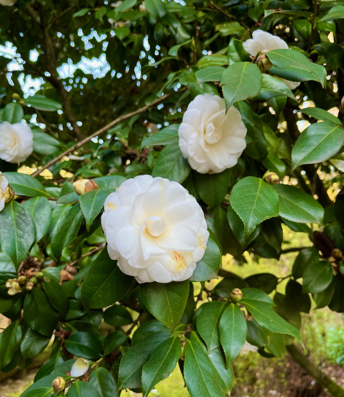
Something I haven’t noted yet. It’s winter here in Portugal and this is the time that their Clematis bloom. These flowers are everywhere and they were here in abundance at the Aveleda winery, in white and red.
Yours Truly skulking about in the cellars at the Quinta da Aveleda winery. I was hoping the tour guide would forget about me…
So the winery hosted us to a wine tasting with two of its green wines. And with those two glasses of wine we got these lovely plates. All this with a ‘wine tasting’. Take note, Napa wine growers!

Next our motor-coach drove us toward the city of Viseu, taking us through multiple valleys of vineyards. Here’s one shot from the highway that Mary got showing how the Portuguese terrace their mountainsides for grape-growing. The wine industry in this country is gargantuan.
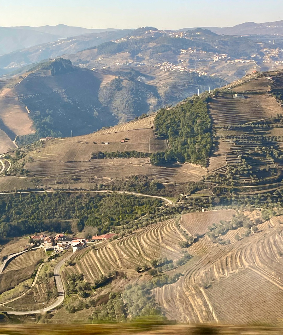
The Duoro River in the north-central part of Portugal, in the heart of the wine-growing region. You can tell how dry it’s been because the river is low.

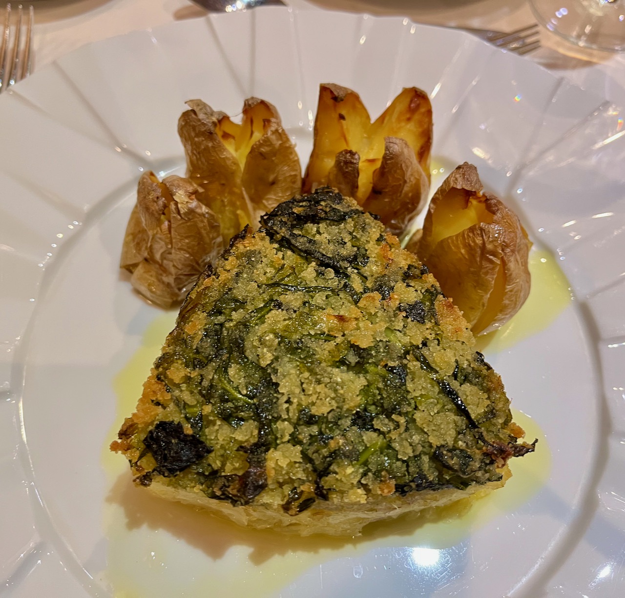
That night in the town of Viseu we enjoyed another Portuguese dinner. I’m told this was cod, but honestly, it was unlike any fish I’ve ever had. Like a white steak. The food in Portugal has been exceptional. And of course, by the time we finished our meals, we were all swimming in wine.
An Idiot in Iberia – Chapter 6
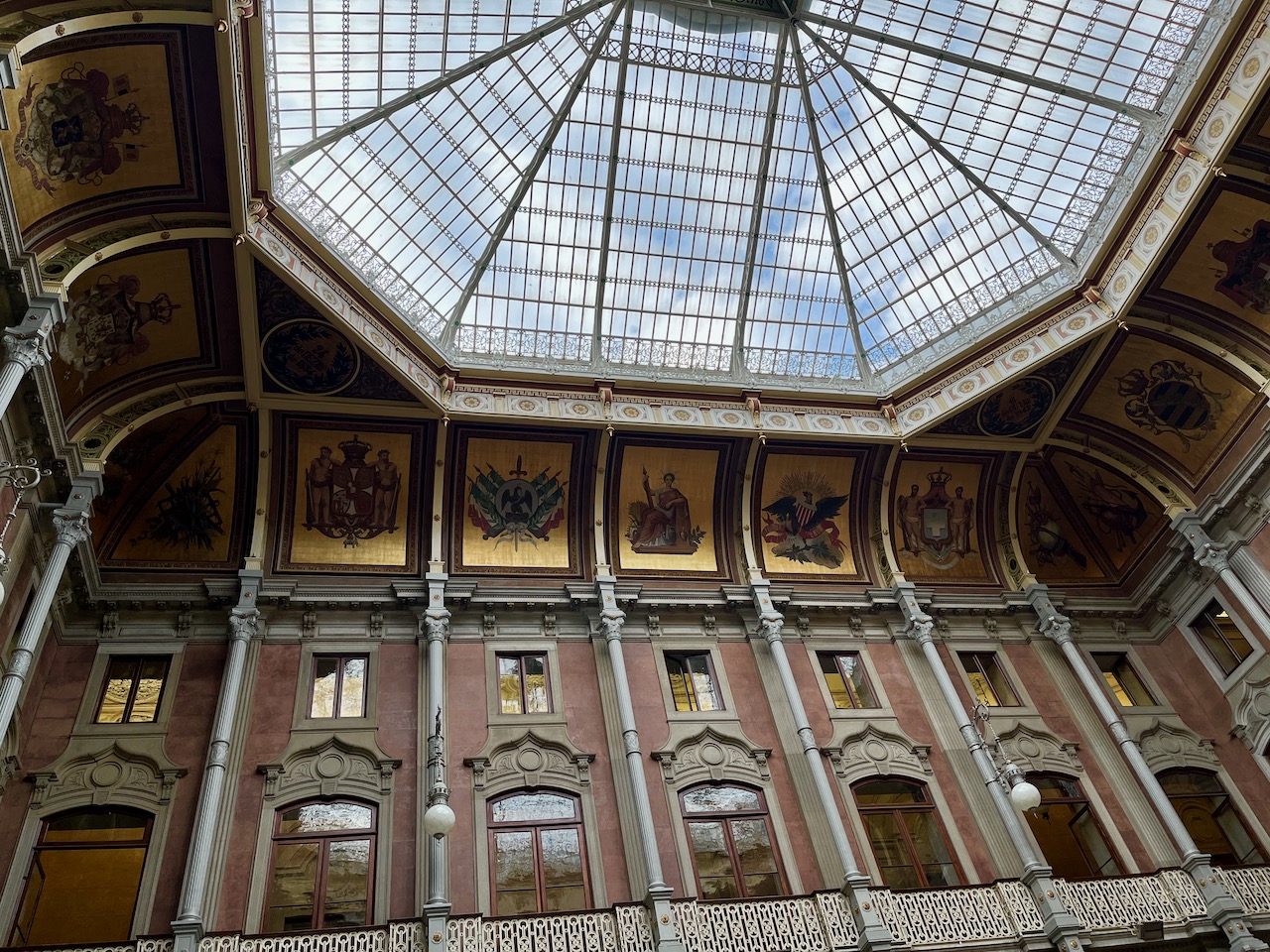
Another day of touring in Portugal, another ancient house of worship. But this time it was not a religious temple, but a temple of commerce. We enjoyed a very informative tour of the Palacio da Bolsa, or ‘Stock Exchange Palace’ in downtown Porto. Indeed, this building did start out as part of a religious establishment, a convent in the 13th century. When fire destroyed most of the convent, Queen Mary II of Portugal donated the surviving parts to the merchants of the city. The merchants rebuilt it into a temple to profit.
It took 67 years to complete construction of this building, finished in 1909. This is the stock exchange room, which housed Portugal’s daily exchange through much of the 20th century. Now it just collects dust and welcomes tourists.
See the emblems along the top in gold? There was an emblem for every country that Portugal did business with. You can see the United States, fourth from the right with the eagle.
This is the court room where the Port Wine Confraternity would meet. Yes, this regal room was dedicated to the wine industry. That’s how important wine is to Portugal, culturally and economically.
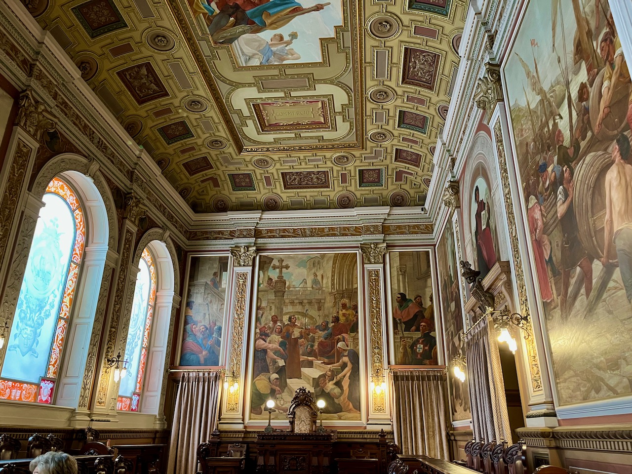
There were so many rooms, I’ve now lost track. I believe this was from the President’s Room. What I do remember is that this room is remarkable because its gorgeous walls utilize hardly any wood. The facade you see in this photo looks like bronze and wood, but it actually just painted plaster.
The French architect Gustavo Eiffel spent time in Portugal, and had a hand in designing two of the bridges spanning the Duoro River. Eiffel worked in this very office.

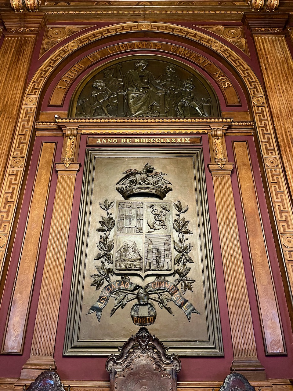
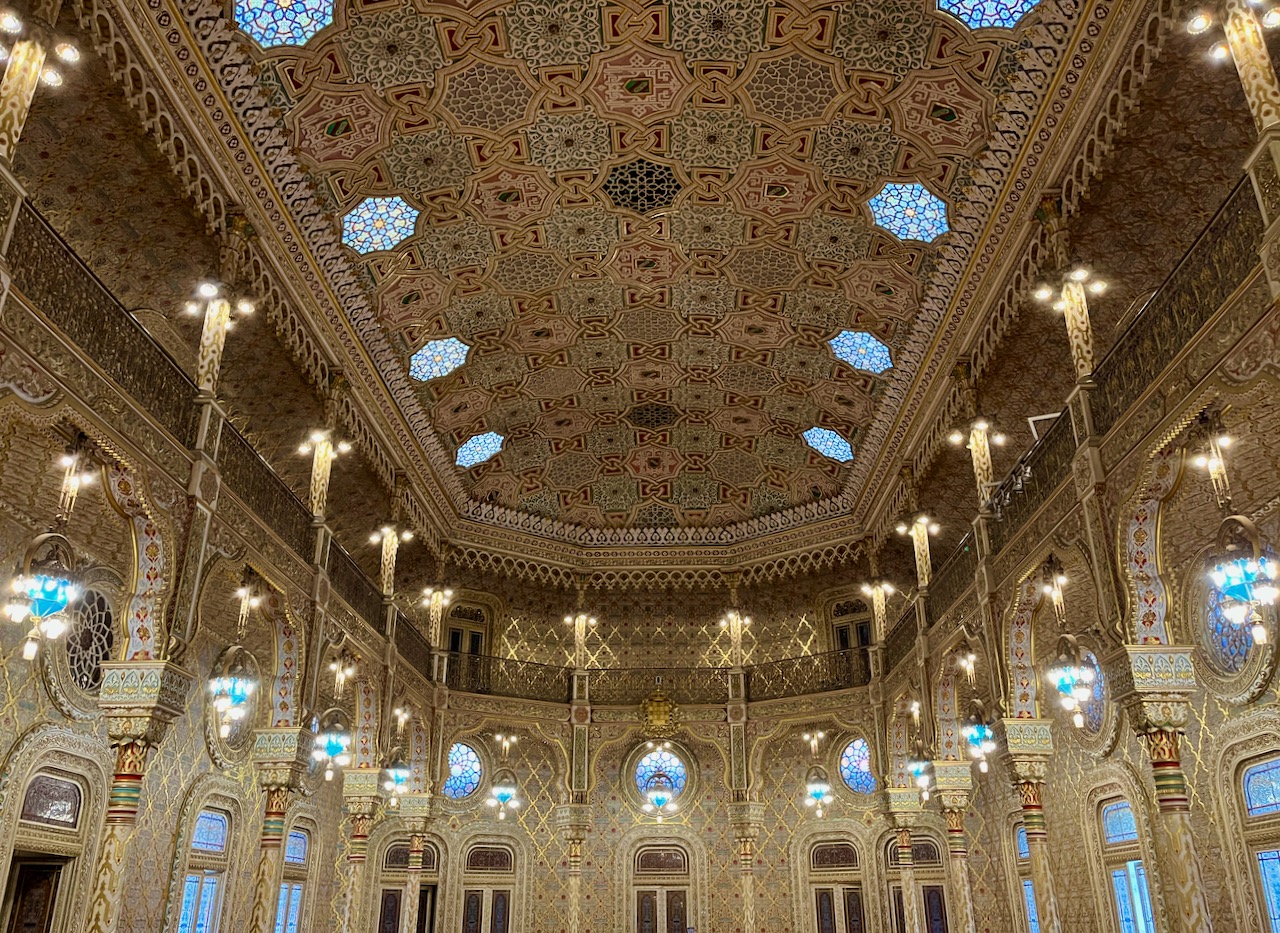
Finally, the so-called ‘Arab Room.’ Moorish architecture and culture has had an indelible impact on modern Portuguese life, and so one of the rooms in the Palacio da Bolsa inevitably had to acknowledge that. Sort of. Alas, it was Portuguese Christians who designed and built this room and not Arabs. And so the decorative Islamic inscriptions on the walls are evidently incorrect.
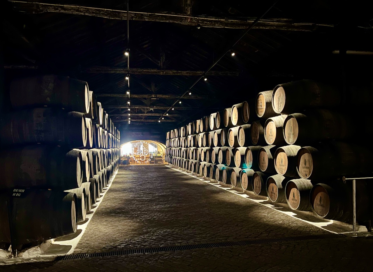
Now to another temple—a temple to wine. Our motor-coach drove us across the river to the suburb of Gaia. Gaia is on the south side of the Duoro River. It’s on the south that all the porto wine makers age their wines. The combination of sun, light, wind, rain and earth make the southern shore much more suited to this process. Note: this is where the wines are aged; they are not grown here. You have to travel out into the rural regions of Portugal for that. Portugal’s wine making business is complicated and multi-faceted.
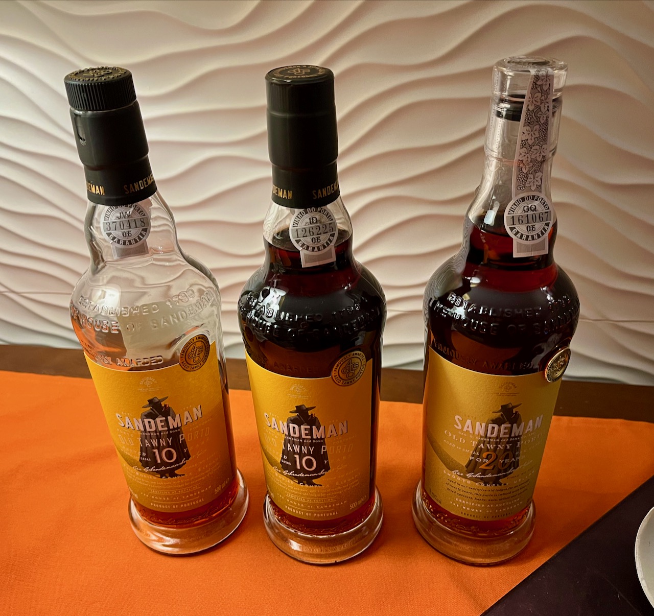
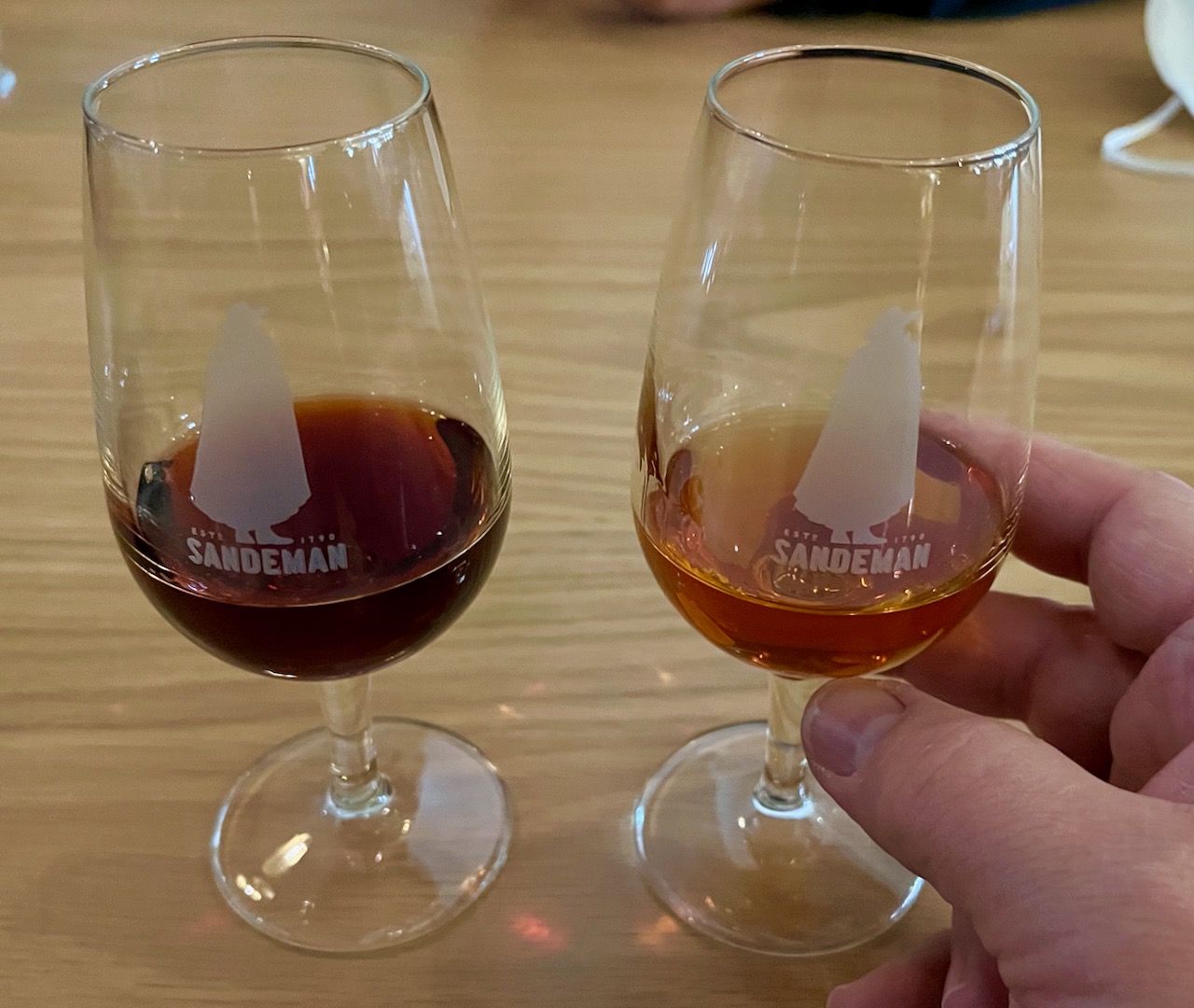
These are the cellars of the Sandeman wine company, established in 1790. Yes, that’s over 230 years ago.
Wine-tasting after our tour. The one of the left is a tawny port, the one on the right is blonde port. I’m a tawny port kind of guy. See the logos on the glasses? Yes, Sandeman’s logo is a don in a hat and cape, exactly like Zorro! In fact, our guide dressed herself like Zorro.
The view outside the winery. In other words, this shot is looking at the northern bank of the river, which would be the city of Porto.
This was our 6th day of absolutely clear weather. It’s nice for tourists, but in truth Portugal is going through a terrible drought right now and needs rain. January is supposed to be the rainy season. Not a drop anywhere.
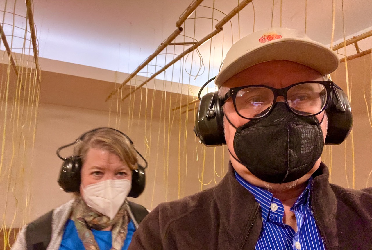
The tour company gave us the afternoon off, and so Mary and I veered from ancient to modern and decided to visit the Serralves Museum of Contemporary Art. Our first artist was Christina Kubisch, and her work was not visual or sculpted, but sonic. You enter a room filled with rows of dangling wires. It turns out these wires are emitting electromagnetic fields. You put on headphones and walk through the row, experiencing different sounds. Fascinating and creepy.
The rest of the museum was more traditional in terms of the displays being visual media. There were also some famous artists that even I recognized, including this one from Robert Mapplethrope: Cross, 1986. I was hoping to see the one where he’s shoving the handle of a bullwhip up his…well, never mind.

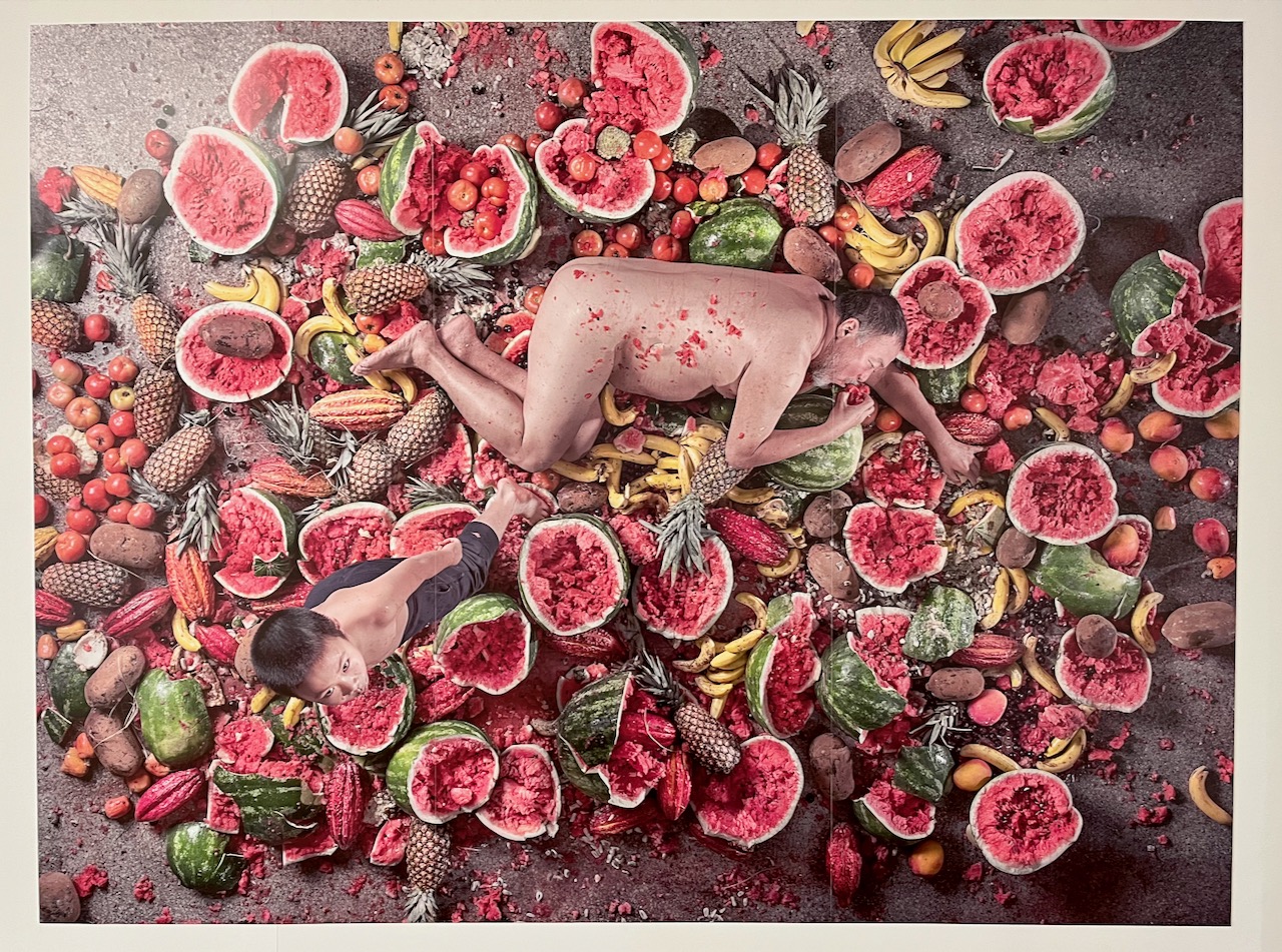
I’ll share one more shot of art from the Serralves, this is a large mural-sized work by Ai Weiwei: Mutuophaqia, 2018. I guess I could’ve found work as a model after all…
After the museum, Mary and I still needed a bit more culture to fill our day and so we Uber’d over to the world famous bookstore, Livraria Lello, known in English as the Lello Bookstore. This store traces its origins all the way back to 1869. Its interior features an amazing central staircase surrounded by ornate Gothic-style ornamentation from floor to ceiling. It also has its own press where it prints exclusive volumes of many world classics in a myriad of languages. Most of the volumes in the shop, of course, are in Portuguese. I picked up exclusively printed editions of Shakespeare’s Sonnets and Poe’s Selected Tales, both in English.
And yes, J.K. Rowling did live in Porto for a couple years in the early 90’s, and it’s said that Rowling took inspiration from this bookshop for her Harry Potter books. That is, it gave her ideas, but evidently didn’t improve her prose.

Part of the Livraria Lello is a museum of sorts with a collection of first editions. Here’s a first edition of Orwell’s 1984.

An Idiot In Iberia – Chapter 5
The outer battlements of the Convent of Christ Castle in Tomar. Don’t be fooled by the name. This convent and castle were created by the Knights Templar.
Not just scholars know about the Knights Templar. You’ve heard of them if you’ve read Dan Brown’s The DaVinci Code or Umberto Eco’s Foucault’s Pendulum or have watched Indiana Jones and the Last Crusade. They were a deeply secretive organization. And they have existed for almost a thousand years. Within this castle resides a few of their relics.
Established in 1118 at the Temple Mount in Jerusalem, the Knight’s Templar went on to be blessed by the Pope in 1139. For almost 300 years they operated a powerful organization that protected pilgrims connected to the Crusades through an innovative system of financing, that presaged many of our modern systems of banking. These activities comprised about 90% of the Templar members.

Much of this Templar Castle now lies in glorious ruins. Much like their organization. Or so we believe.
I’ve mentioned that 90% of the Templars were essentially bankers. What of the remaining 10%? They were the warriors—the ones you saw in Indiana Jones guarding the Holy Grail. These knights wore white with their distinctive Templar crosses across the chest. They were considered the most skilled and fearsome knights in battle. The initiation rituals into the Templars were secretive, which started rumors of strange and mystical practices.
And they built strongholds, up to a 1000 different castles and fortifications throughout Europe. Like this one in Portugal.

The entrance to the inner sanctum, which we were not allowed to enter. We had to sneak in through a side door.
The Templars were in the business of loaning money not only to pilgrims, but to royalty. One monarch fell into deep debt to the Templars, King Philip IV of France. When he couldn’t pay, he captured many of the non-warrior members of the Templars, tortured them into false confessions and burned them at the stake. He convinced the Pope to condemn the Templars. Their secrecy worked against them.
The Templars didn’t dissolve so easily. They changed their name into the Order of Christ. This castle, ostensibly the Convent of Christ Castle in Tomar, Portugal, is actually a stronghold from the Knights Templar, and is one of the best preserved relics of the ancient Templars.

In the inner courtyards we found orange trees growing. There are several inner courtyards, slowly being refurbished. The castle is now a UNESCO World Heritage Site. In a moment I’ll show you why.
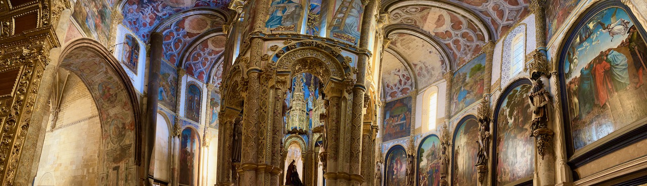
This is the archway leading into the ‘church’ of this convent. But it’s not a traditional church, for there are no pews and it’s not designed in the shape of traditional cathedral which are typically in the form of a cross. This is round, the walls surrounding four central pillars.
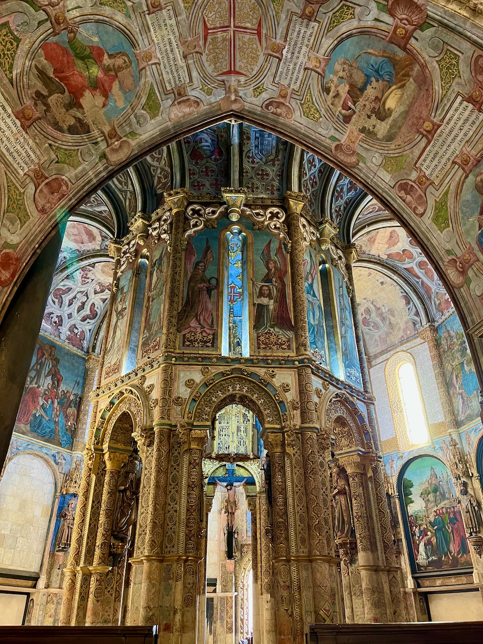
A view of the central pillars rising into the grand ceiling. This sanctuary is in the long process of being restored. If you look at the ceiling to just right of the central columns, you can see the faded stonework, where the artwork is awaiting restoration.
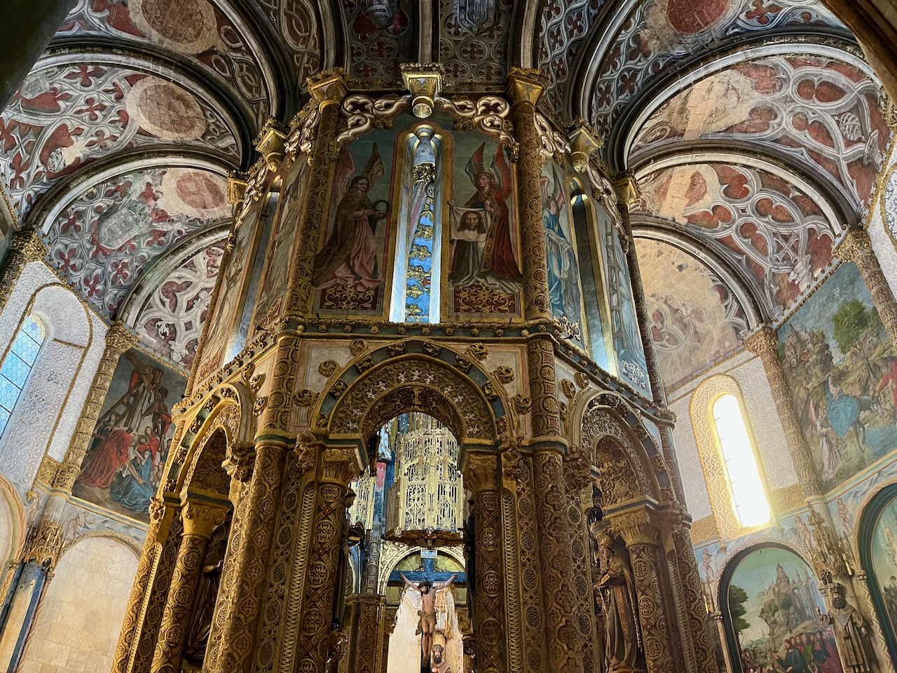
We were only allowed in here for a few minutes, but were very lucky that our allotted time was shortly after sunrise. The morning sun streamed in, illuminating much of the magnificent artwork at the tops of the eastern-facing columns.
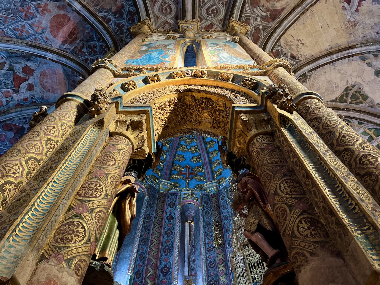
A Renaissance masterpiece resides in this round church. The Martyrdom of St. Sebastian by the Portuguese Renaissance master Gregório Lopes. Now restored.
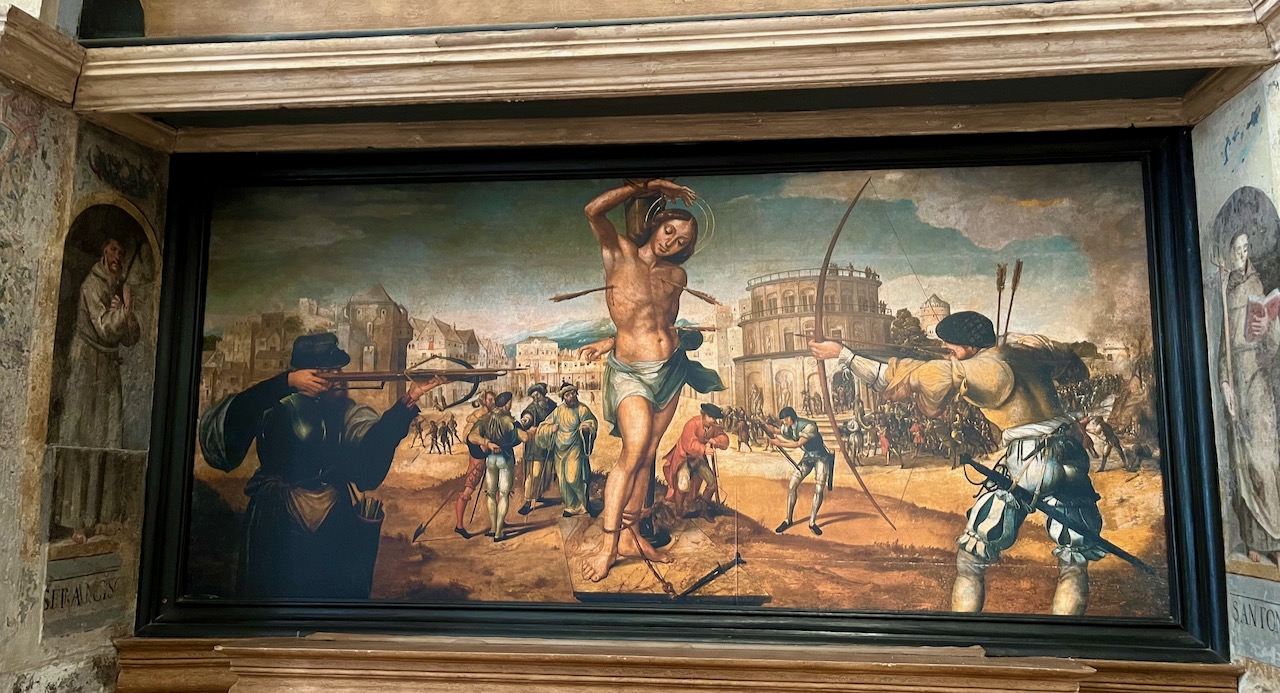
This panoramic shot distorts the dimensions, but hopefully gives a sense of how magnificent this space is, 360 degrees of Renaissance art in all its glory.
Several paintings by Gregório Lopes, now restored to glorious life.

There’s more than just Renaissance masterpieces here. When doing restoration work, the curators discovered this medieval artwork underneath. Turns out that King Manuel I ordered that this church be refurbished in the 1500’s, and so an untold amount of medieval art is now irrevocably lost.

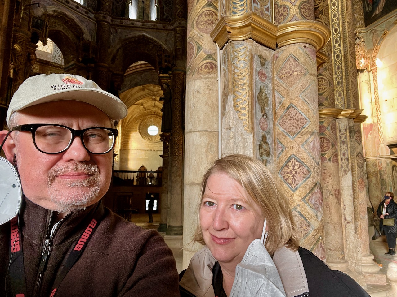
In case you’re wondering, photography was allowed in here, as long as we didn’t use flash. Proof that Yours Truly and Mary stood in the inner sanctum of the Knights Templar.
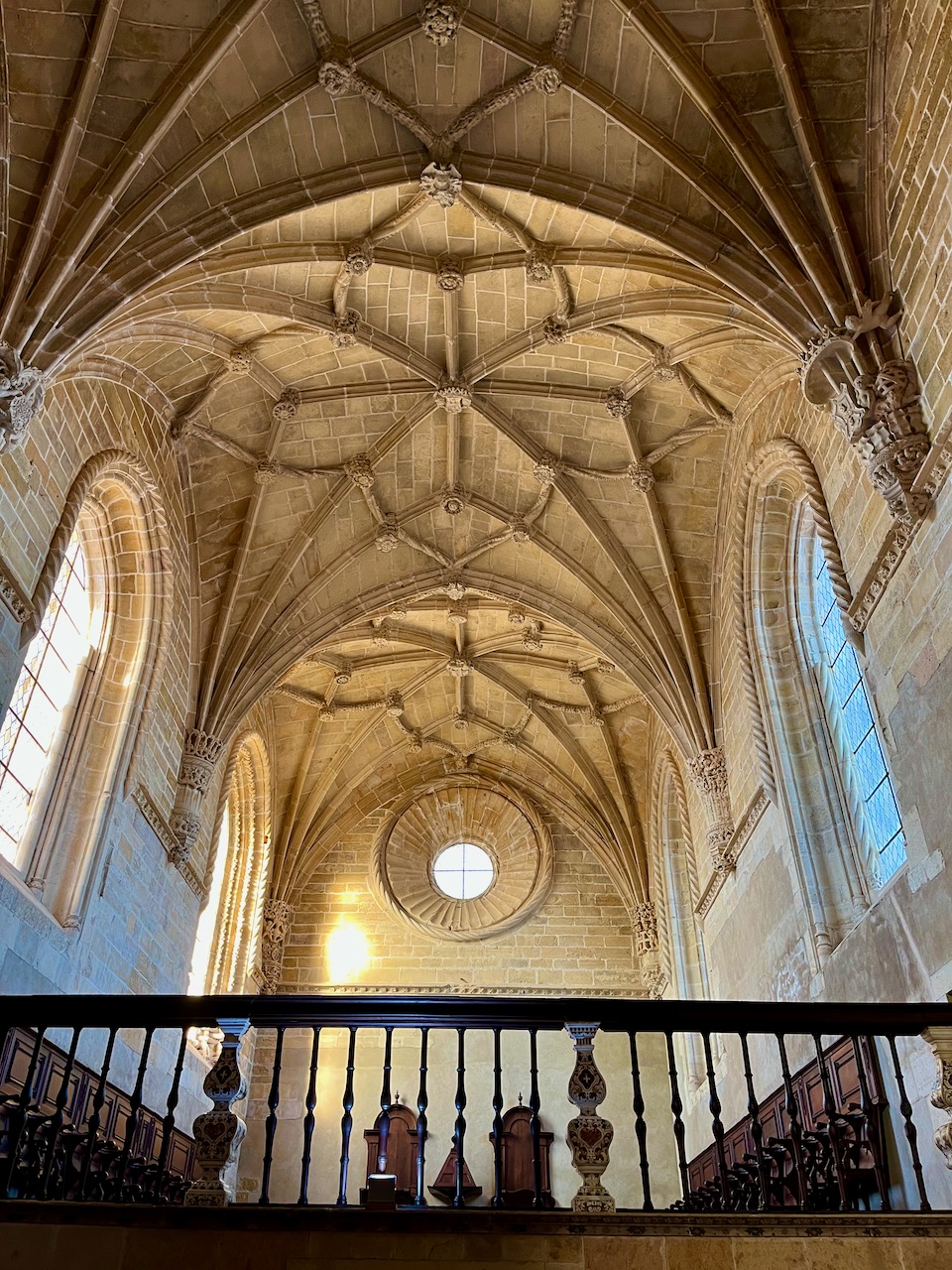
Exiting the round church is not too shabby either. Here’s the ‘chapter house’ that actually holds pews where members of the convent (and members of the Knights Templar?) could worship.
In one of the courtyards you can view the back wall of the chapter house. This wall is full of dozens of symbols carved into granite. They tell multiple stories and hold the kinds of symbology that inspires the imaginations of writers to make up all kinds of crazy shit about the Templars. Or is it made up?

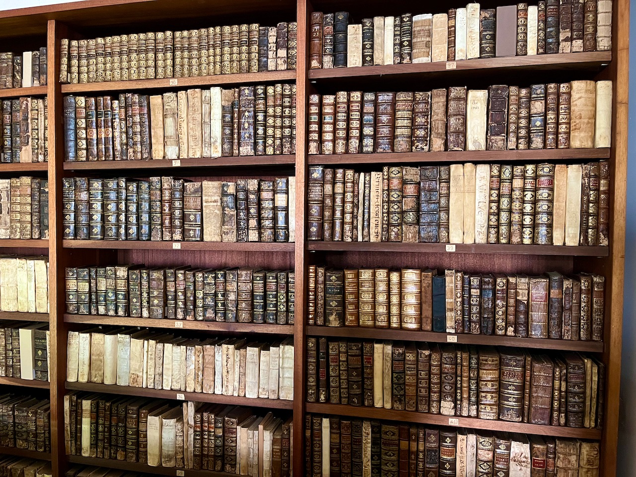
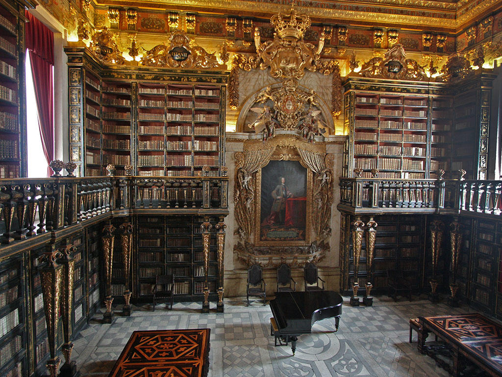
Next our motor-coach drove us to the university town of Coimbra. There resides the fabled Biblioteca Joanina, named in honor of King John V. Construction of this library began in 1717 and now houses 56,000 rare volumes. Students and researchers can apply to look at or read specific volumes, but the whole process is carefully regulated, as these volumes, because of their age, are subject to light, humidity, pests and the touch of human hands.
I was allowed to photograph the books on the first, lower floor. Presumably these are not quite as precious as the ones in the main library.
This photograph I had to borrow from the university. No photographs are allowed in this space. It’s the most gorgeous and awe-inspiriting library I’ve ever had the privilege to stand in. We were allowed only 10 minutes. This place is constructed like a vault. The humidity is controlled. More than that, in order to control the infestation of insects, this library hosts a colony of bats. At night the tables are covered. In the morning, custodians clean up the bat shit.
I would so love to spend the day in here. First I’d had to brush up on my Latin.
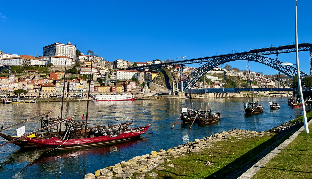
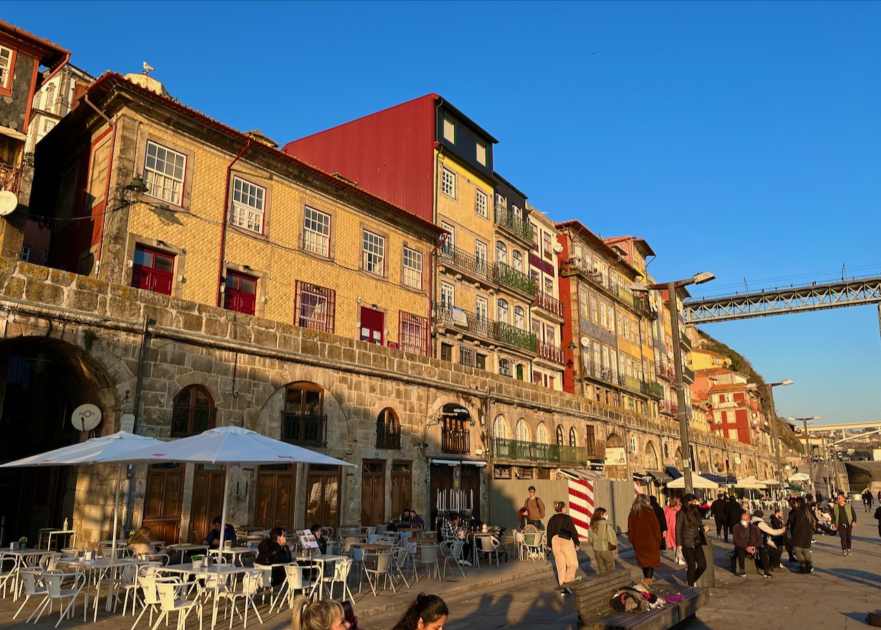
After another drive, our motor-coach delivered us to our hotel in downtown Porto. Porto is the second largest city in Portugal, and sits on the Duoro River near the Atlantic Ocean.
Here’s the typical riverside hustle and bustle on a late afternoon in the middle of winter. The weather was a gorgeous 55 degrees. Street musicians were out, and the cafes were open. And over 90% of everyone you see is vaccinated.
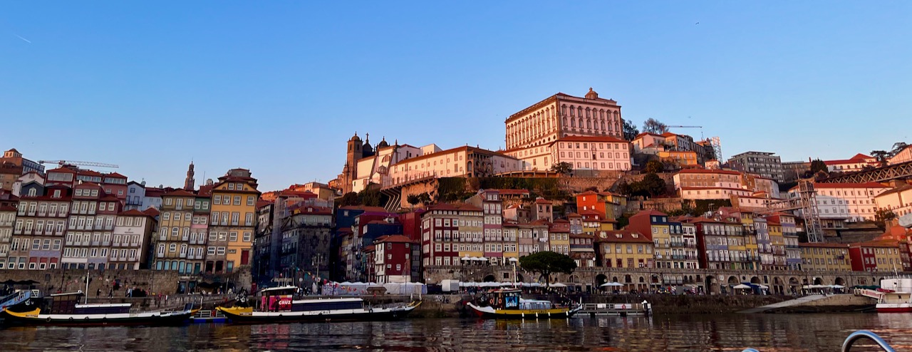
Our tour guide booked us a riverboat cruise. The boat we went on is similar to the ones you see in this shot. This is a photo of the opposite bank of the Duoro River. On the south side of the river is the Porto suburb of Gaia.
Porto has six bridges crossing the Duoro. One of them, which you can see on the left side of this photo, was designed by Téophile Seyrig, an associate of Gustave Eiffel (of Eiffel Tower fame), and built in 1886.

Another two bridges, old and new. A second one designed by Mr. Seyrig and the more modern Ponte de São João completed in 1991.
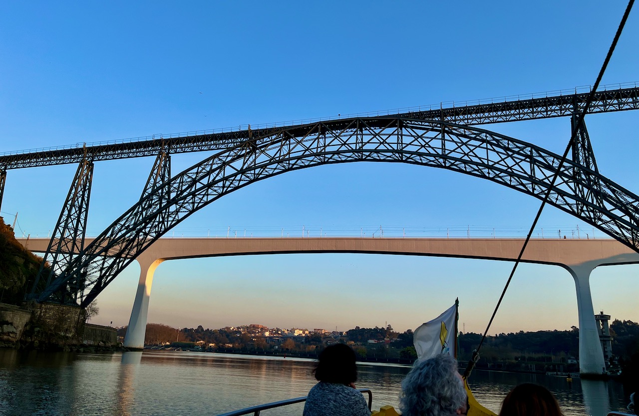
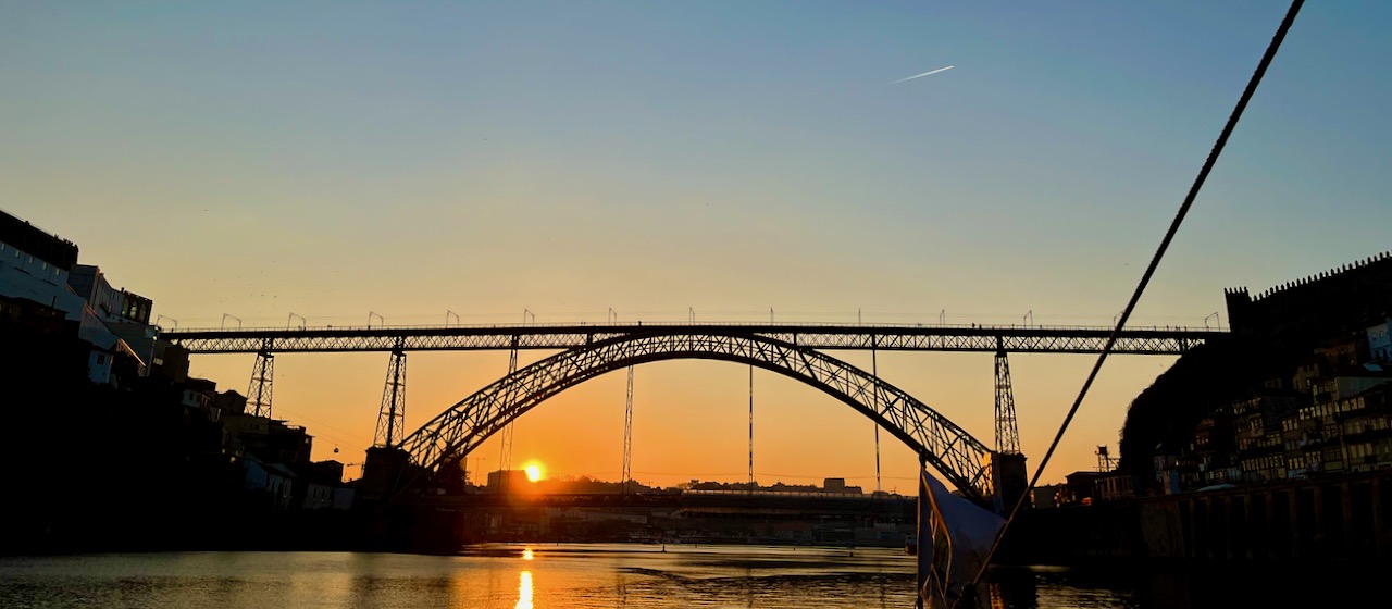
A view of the sunset through the Dom Luís I Bridge bridge on the Duoro River in Porto.
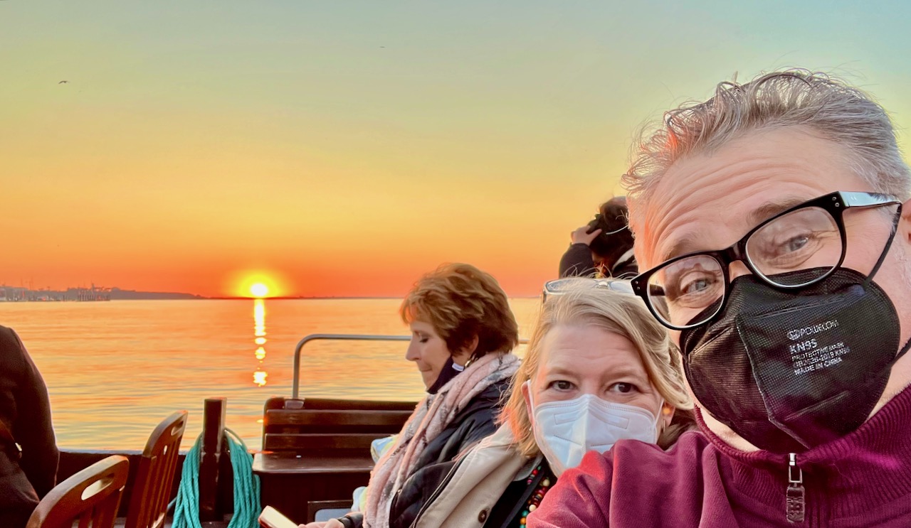
A selfie of Mary and me at sunset over the Atlantic Ocean, beyond the mouth of the Duoro River.
After our riverboat cruise, our tour director booked us dinner in a small cafe. But in order to enter, all 20 of us had to take rapid Covid tests. The rules here in Portugal are strict. Many restaurants accept Mary’s and my United States vaccination statuses. But we are not EU citizens and cannot register our vaccine results with the official EU database. And so some restaurants will only allow tourists like us to enter if we provide negative tests.
Our director told us that tourists from many countries, including Russia and China, have NO hope visiting right now because they did not utilize the Pfizer or Moderna vaccines. These two vaccines were, in fact, developed jointly with the US and the European Union.
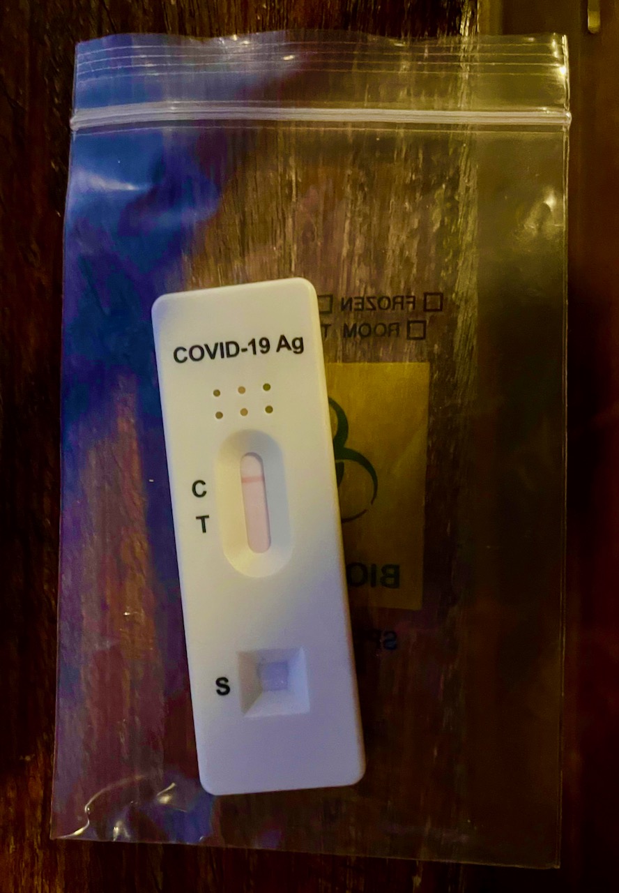
Safely vaccinated and all negative, we enjoyed a night of Portuguese cuisine, wine and flaming appetizers. On the menu tonight you had a choice of pork, salmon or rabbit. Not many chose rabbit.

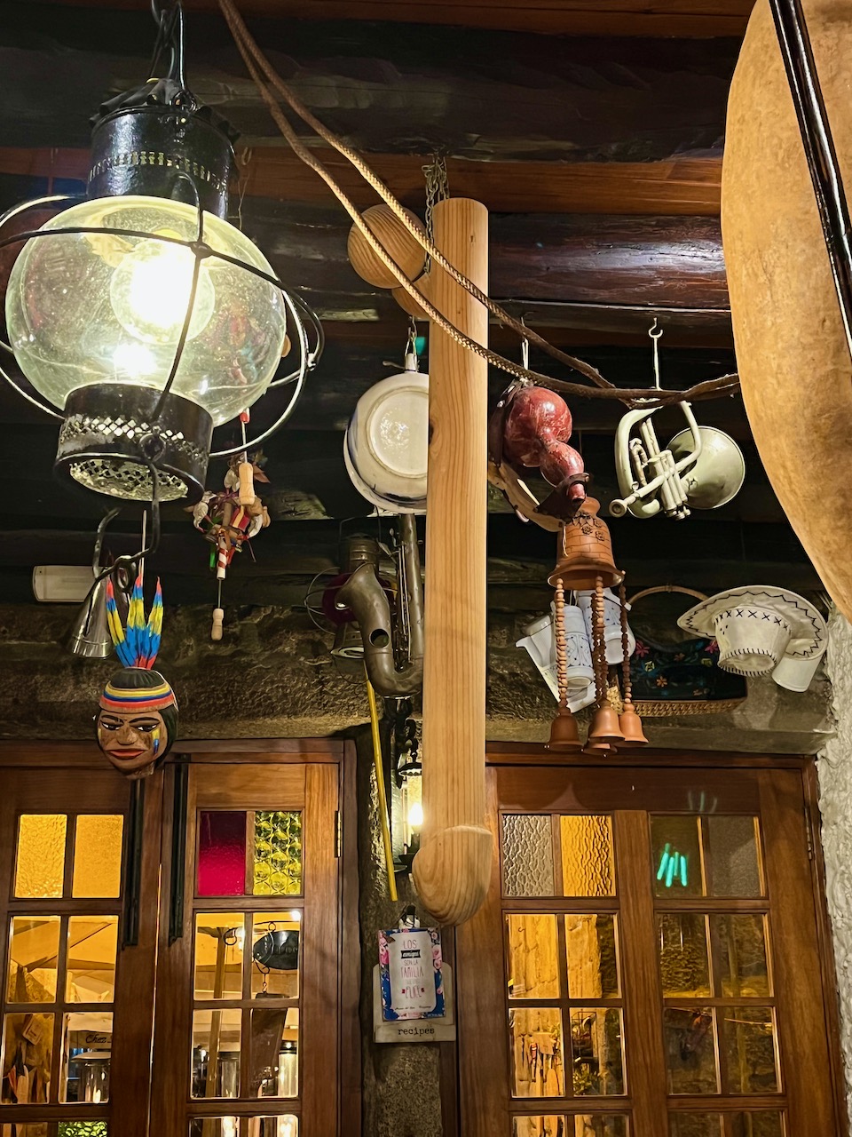
Halfway through my meal, my fellow traveler Medhi pointed to the ceiling and said, “Rich, look what’s hanging over your head!”
After dinner we took a stroll along the nighttime riverfront. Here’s my sweetheart and Yours Truly on the Duoro River at night.
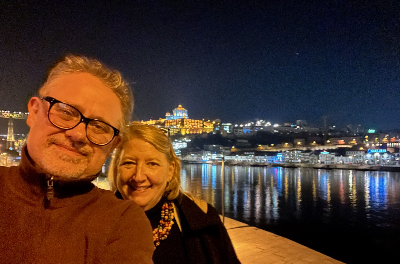
A final shot of the Duoro riverfront in Porto, Portugal.

An Idiot in Iberia – chapter 4
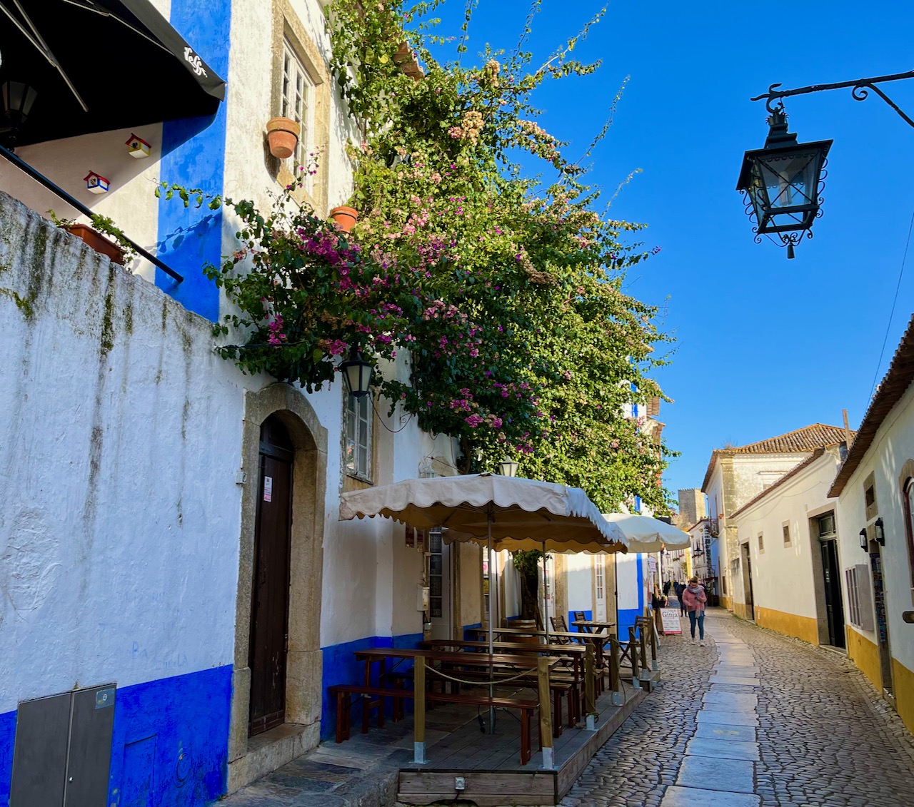
Our next day aboard the tour company’s motor-coach raced us around the central part of Portugal north of Lisbon to make several stops. First on the ticket was an early morning visit to the little medieval town of Óbidos. It was far enough north of Lisbon that it managed to avoid much of the destruction of the 1755 earthquake, and so the medieval charm of its origins has survived. In fact, it’s survived too well, as this tiny hamlet of about 3000 souls has become a Hollywood-like tourist trap. But with winter and Covid, we had it mostly to ourselves.
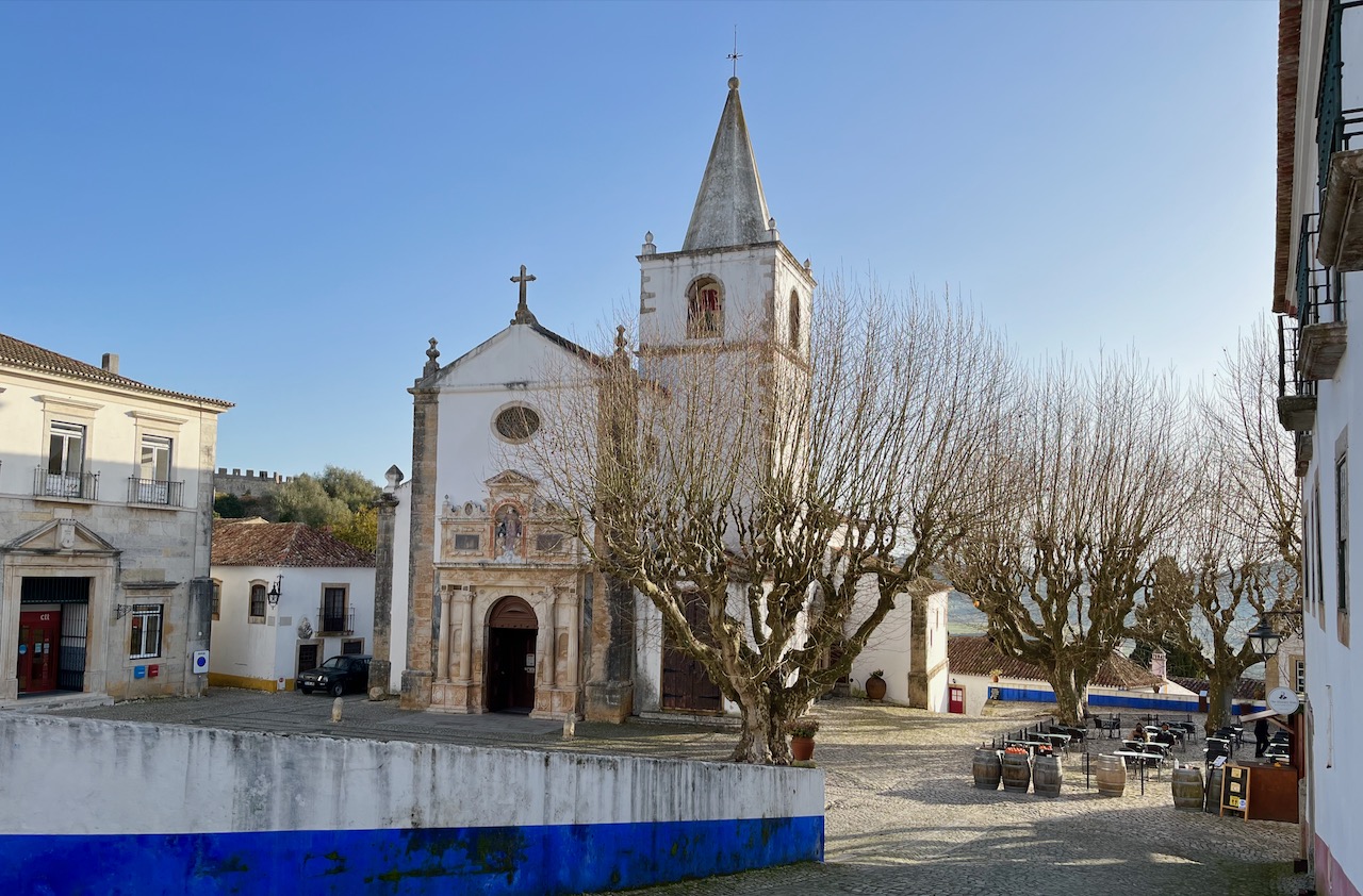
This is the town center, St. Mary’s Square.
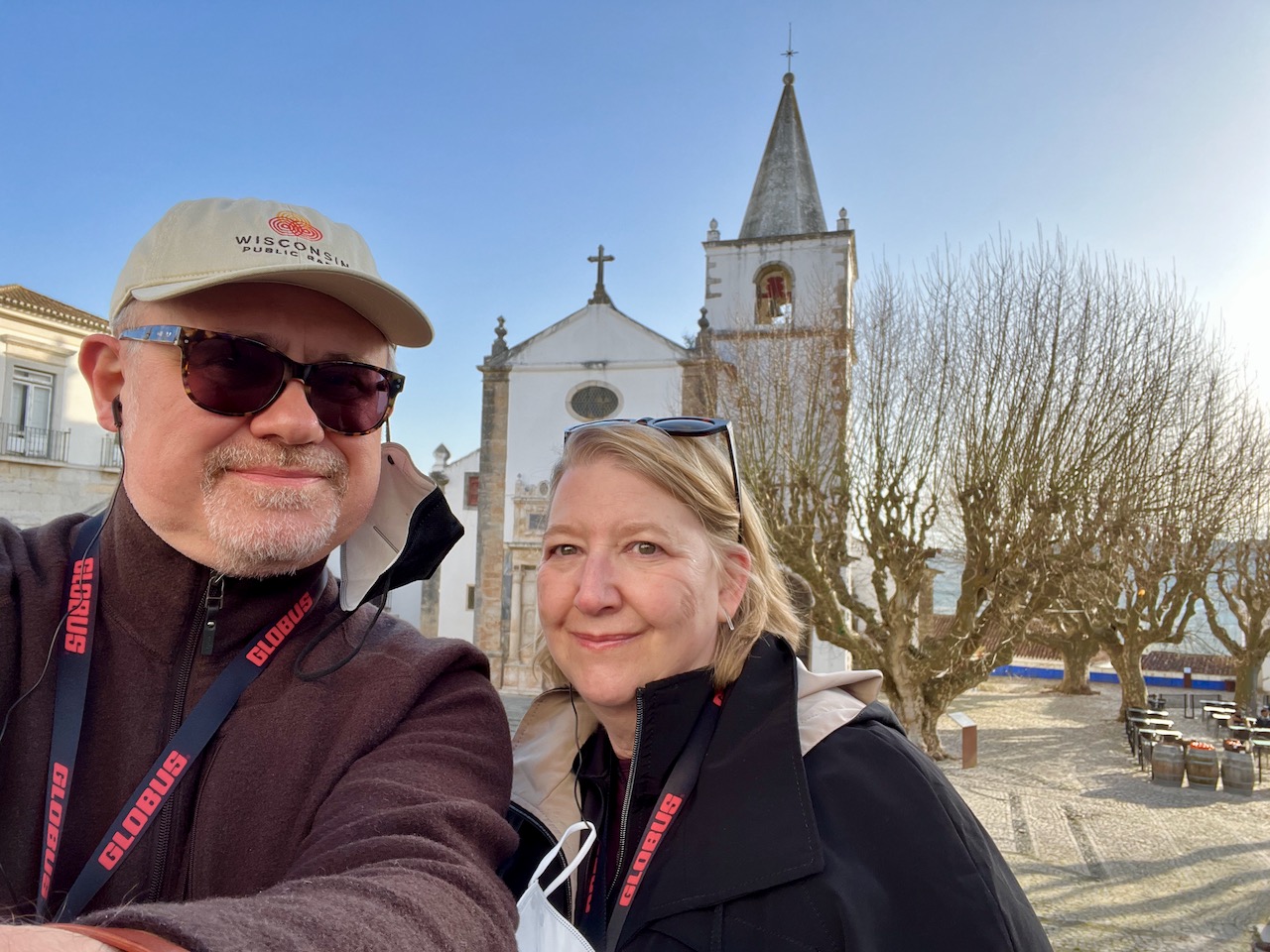
Mary and me in St. Mary’s Square, Óbidos.
An example of what the narrow medieval streets look like in the little town of Óbidos. The name Óbidos comes from the Latin oppidium, which means citadel. There’s archeological evidence in this town that Romans first settled this place, as it sits on a hill with an excellent view of the surrounding countryside.
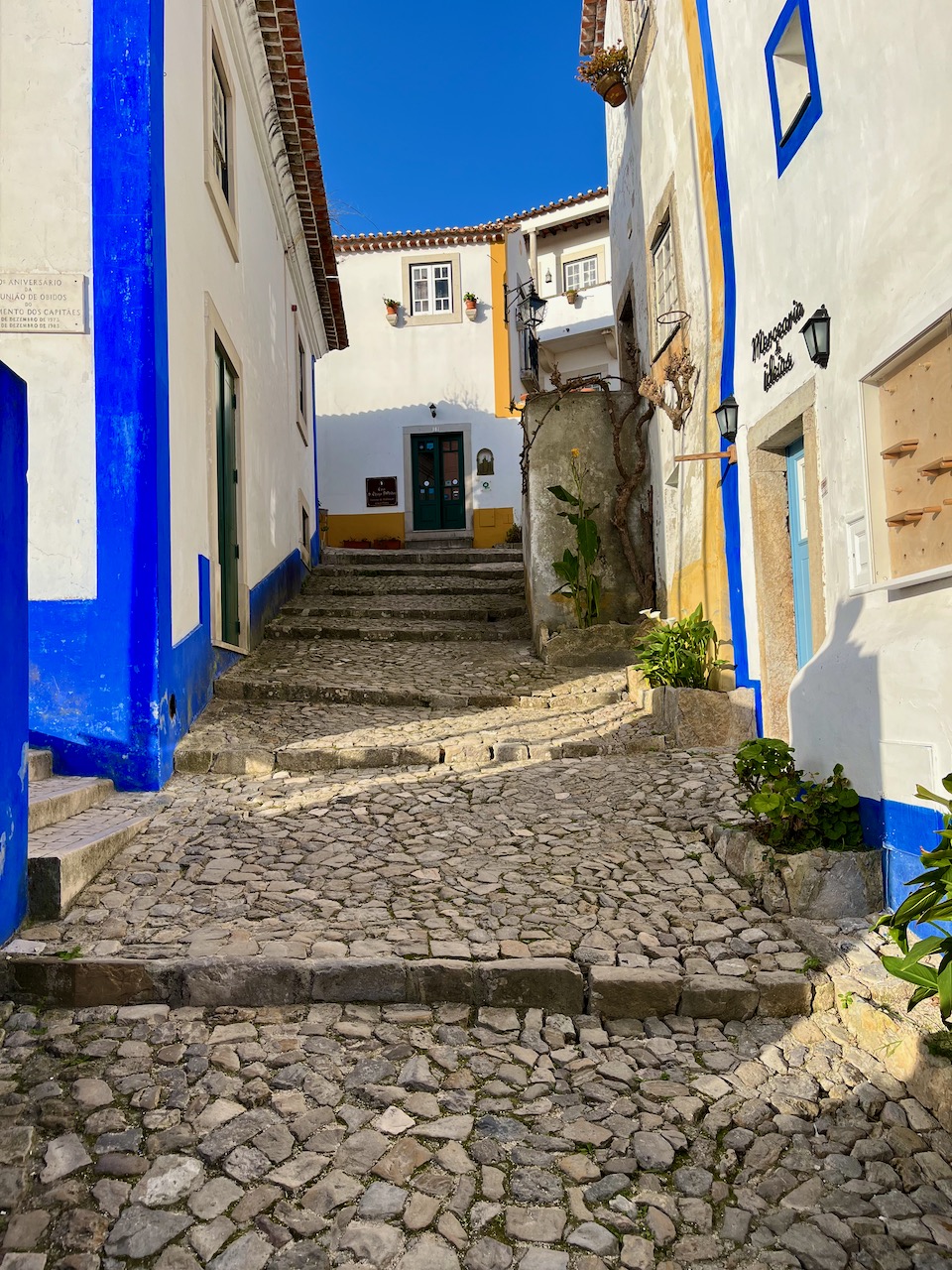
The main drag in Óbidos is only wide enough for one car. And the curbs are often filled with cafe tables or, in this case, an actual flowering tree.
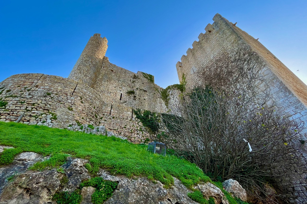
Here is the ‘citadel’ that towers over this town and gives it its name. However, this castle wasn’t built by the Romans, it was constructed by the Moors in about 700 AD. Eventually Christian crusaders captured this castle in 1148.
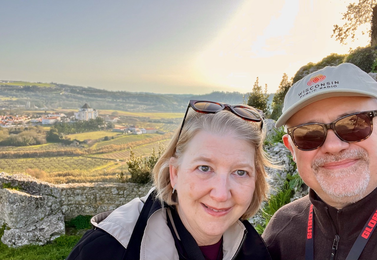
Standing up on part of the castle ruins gives you a gorgeous view of the wine country below. You can also see in this photo a couple of our fellow travelers from the motor-coach.

Mary and me again, atop the castle ruins with that gorgeous Portugal wine country below us.
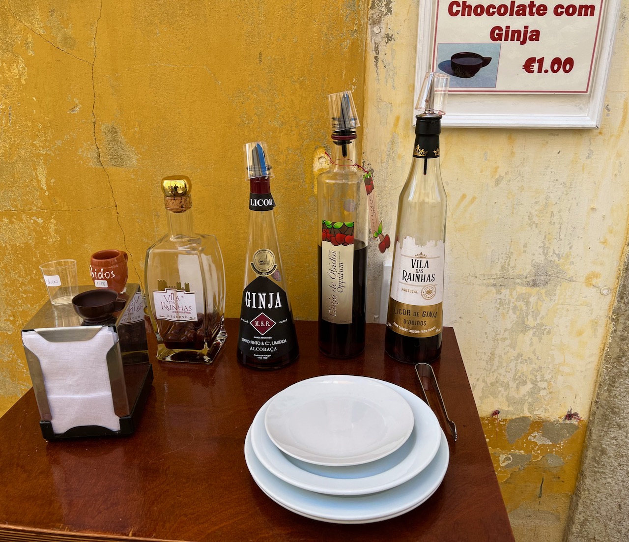
As we made our back through the village, Mary and I stopped to sample some of the local Ginja liquor made from cherries. It’s usually served in a tiny cup made of chocolate. After downing the shot, you eat the chocolate cup.
Yes, Mary and I were downing shots at about 9 o’clock in the morning.
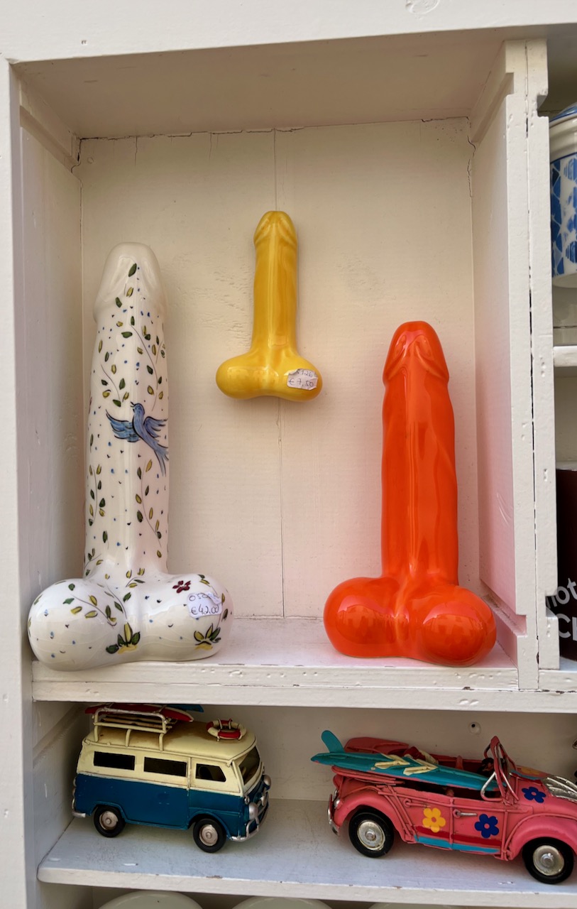
Just a few feet down from the Ginja liquor stand, a vendor was selling toy trucks for children and these giant porcelain phalluses.
Every Portuguese person we have met so far has been absolutely lovely. Still, I just didn’t have it in me to ask what these fragile porcelain penises where for.
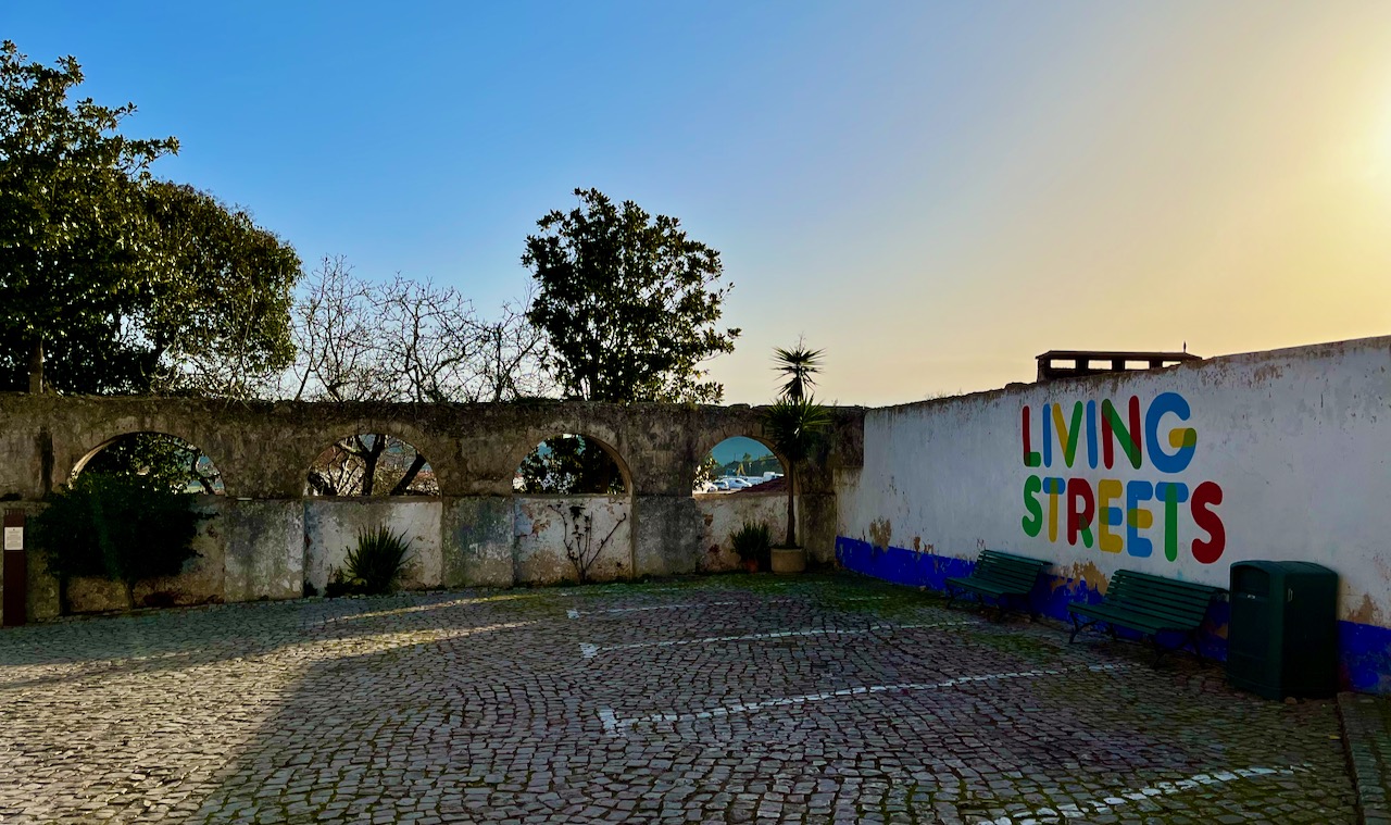
As you leave the village of Óbidos you pass some ancient aqueducts, seen here juxtaposed with a modern painted sign. That’s Portugal in a nutshell: ancient and new residing side-by-side.
These aqueducts are not Roman, but Portuguese, built in the late 1500’s. So yeah, they are still over 400 years old.
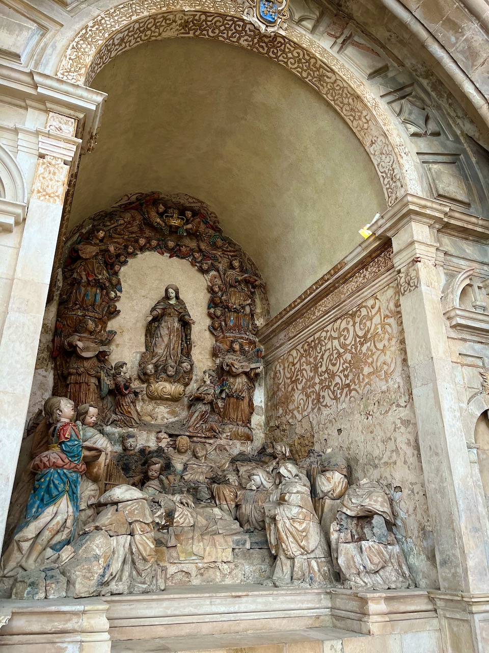
Next we traveled to the town of Alcobaça to see its famous monastery. Here’s Mary standing on the steps of the monastery, wondering if we really must step into yet another ‘sacred’ setting.

The sanctuary of the Alcobaça Monastery is on the scale of a cathedral. It’s an austere place, devoid of all ornamentation. Construction of this massive building began in 1178 and wasn’t completed until 74 years later. It’s a rare example in Portugal of the true Gothic style of church architecture. This cathedral withstood the earthquake of 1755, but was critically damaged by Napoleon’s troops in the early 1800s. As to the spare and empty look of the place? That was the custom of Cistercian monks that ran this joint; they were a very strict and spartan offshoot of the Benedictines.
Pictured: Much of our tour group. We only number about 20, which I’m told is small. We only fill half the motor-coach. While in the coach we must always remained masked, which is a good thing.

In the rear of the Alcobaça Monastery cathedral just beside the sacristy you can find this little alcove. See all the gold gilt along the side of the alcove? This gold used to cover several of the alcoves of the church. The French invaders scraped it all off when they came storming through town in the early 1800’s.
The tour took a break from all this religious business to stop in the beach town of Nazaré so the group could soak up some sun and have lunch. Nazaré is a Portuguese surfing town, and part of Portugal’s ‘silver coast.’ Nazaré is named after Nazareth, where Jesus was born. But this surf town, with all its shops and bars, looked pretty secular to Mary and me.

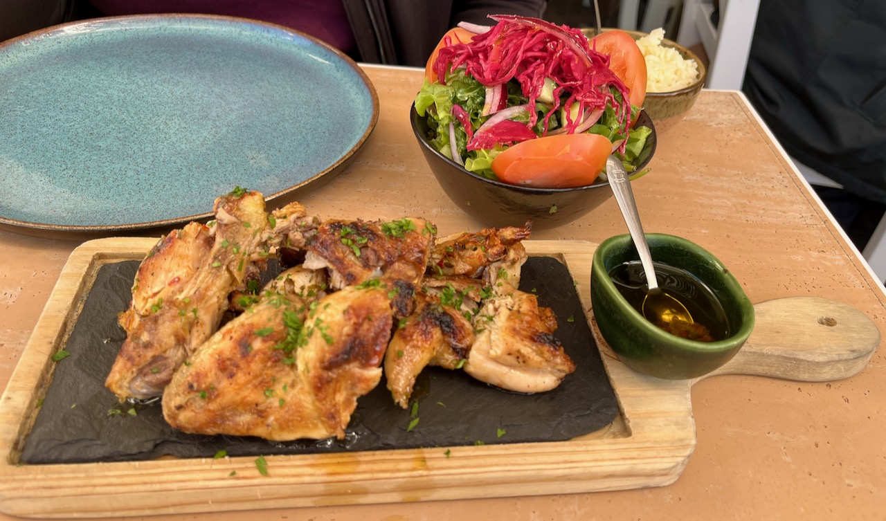
Mary and I enjoyed lunch in Nazaré. This is typical of Portuguese noonday meals. More food than you can hope to eat. The chicken was delightfully spicy. Not pictured: two glasses of green wine.
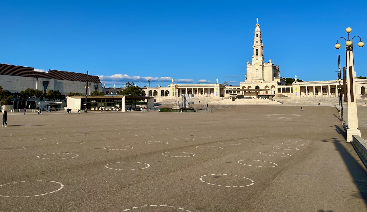
We ended the day visiting the so called holy city of Fátima. Why is it holy? Because back in 1917 three local shepherd children reportedly were visited by the Virgin Mary. The official term for this phenomenon is ‘Marian apparition.’ The Catholic Church later judged this visitation as ‘worthy of belief.’ That started a kind of gold rush of religiosity in this small town. The Pope made visits here. The Sanctuary of Our Lady of Fátima was built (pictured). It stands above a grand plaza that can hold thousands of pilgrims. See the white circles? These are social distancing circles for families of pilgrims so that even in the time of Covid, believers could come to Fátima. People light candles, crawl around on their knees, ask Mother Mary for favors, etc.
We had been in the motor-coach for many miles, it was a nice day, and so I looked for a place to relieve my bladder.
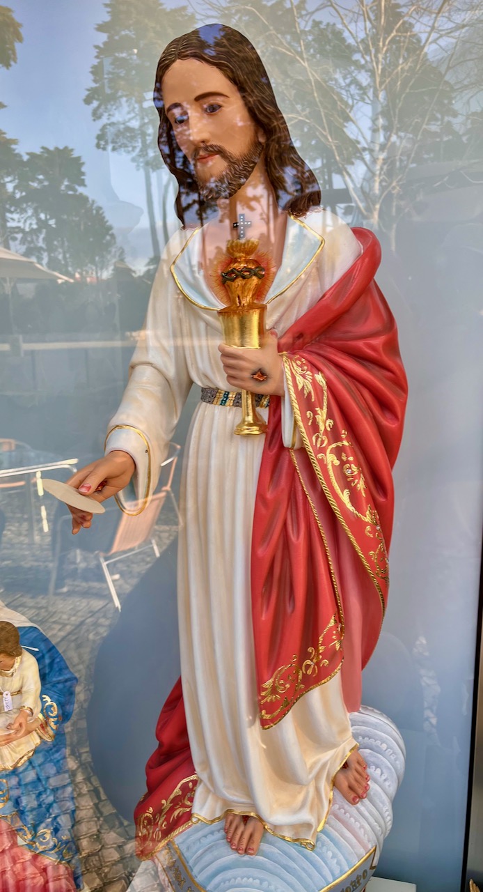
Our motor-coach was parked on a side street in the holy town of Fátima. Up and down the block we found shops and shops selling holy paraphernalia. Here’s one pictured of a plastic Jesus. Sorry, but this single item could fill several pages in the Diagnostic and Statistical Manual of Mental Disorders.
To wit: Jesus is holding a cup of sacramental wine from the Eucharist. Um…this is the blood of Jesus. And so Jesus is offering you a cup of his own blood to drink. But wait, he’s also holding a sacramental wafer. This is body of Jesus. He’s offering you a bite of his own flesh to nosh on. So what we have here is vampirism, cannibalism and body identity integrity disorder. Hold on, there’s more. Jesus’s crucifixion impalement wounds are lovingly painted in gorgeous detail on his hands and feet. Sorry, this smacks of sadomasochism. Finally, if Jesus did exist in about 30 AD in Israel, he was not pasty white. So we can add racism to list of deviances here.
On sale for only 20 euros.
Next chapter: Mysteries of the Knights Templar!
An Idiot in Iberia – Chapter 3
Full disclosure: Mary and I fancy ourselves the consummate travelers and have always researched and developed our own itineraries. This time, however, for the first week of our long Portugal trip, we booked a Globus motor-coach tour. We are trying to teach ourselves the history and culture of this country by cramming in as much history as possible into one week.
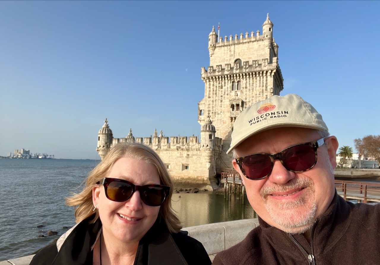
First stop on our second day: Belém Tower stands just off the banks of the Tagus River in downtown Lisbon near the river’s mouth at the Atlantic ocean. Today it’s considered an icon of Portugal’s ‘Age of Discovery’ when Portuguese explorers sailed to the four corners of the globe, colonizing foreign lands, appropriating cultures and enslaving peoples. The tower itself has a varied and complicated history. Originally completed in 1519, it sits on small island. A couple of different Portuguese kings were involved with its construction. It wasn’t up to snuff. After the Spanish captured the tower in a battle, the fortification was enhanced.
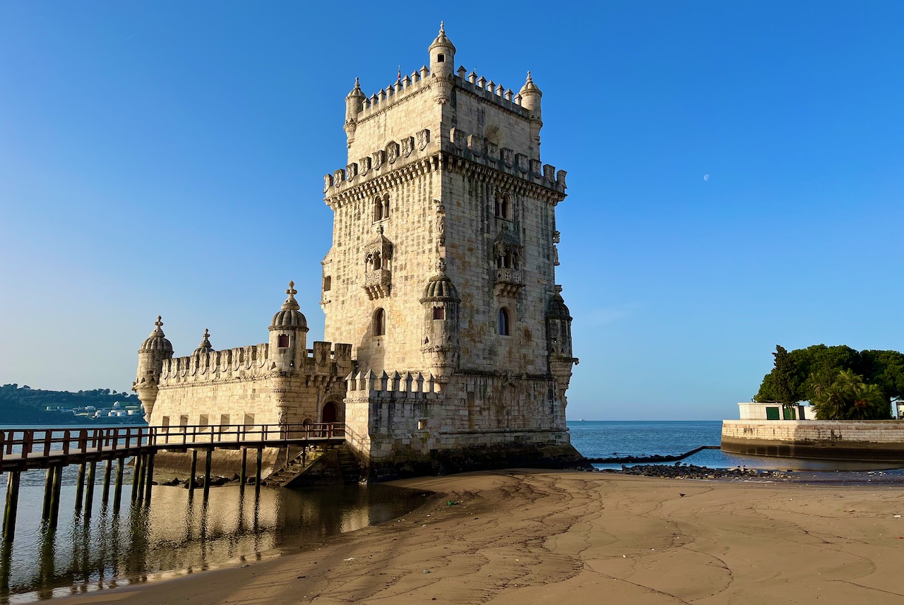
Mary and I in front of Belém Tower. We’re smiling, but in truth the history of the tower doesn’t have much to smile about it. It was used not only as a fortress, but as a prison at various times in its history. More interestingly, it now functions as a kind of geographic marker. Development through the centuries has moved the bank of the Tagus. Right now the tower sits a few feet off the river bank. But hundreds of years ago it was in the middle the river. Later I’ll show you historical evidence of this fact.
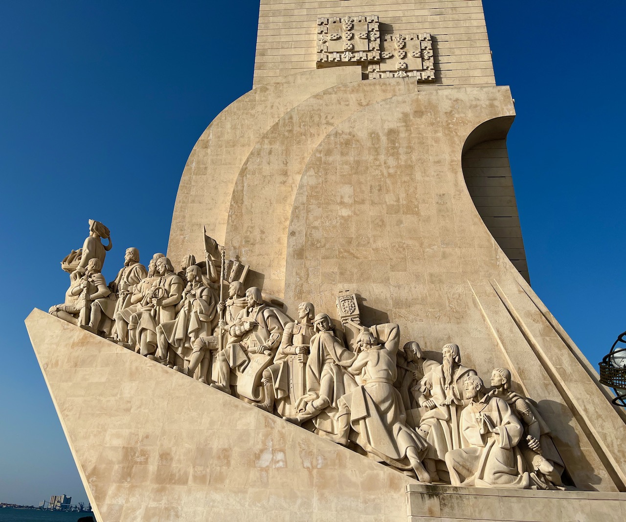
A short stroll up from Belém Tower looms the Padrão dos Descobrimentos, or Monument to the Discoveries. This monument was completed in 1960, and was the Portuguese government’s attempt to whitewash their country’s participation in European colonialism as some kind of grand endeavor of exploration. I mean, yes, European explorers discovered amazing things and essentially created the culture that I enjoy today as a modern American. But it was built on the evils of colonialism. Still, the sculpture is pretty.
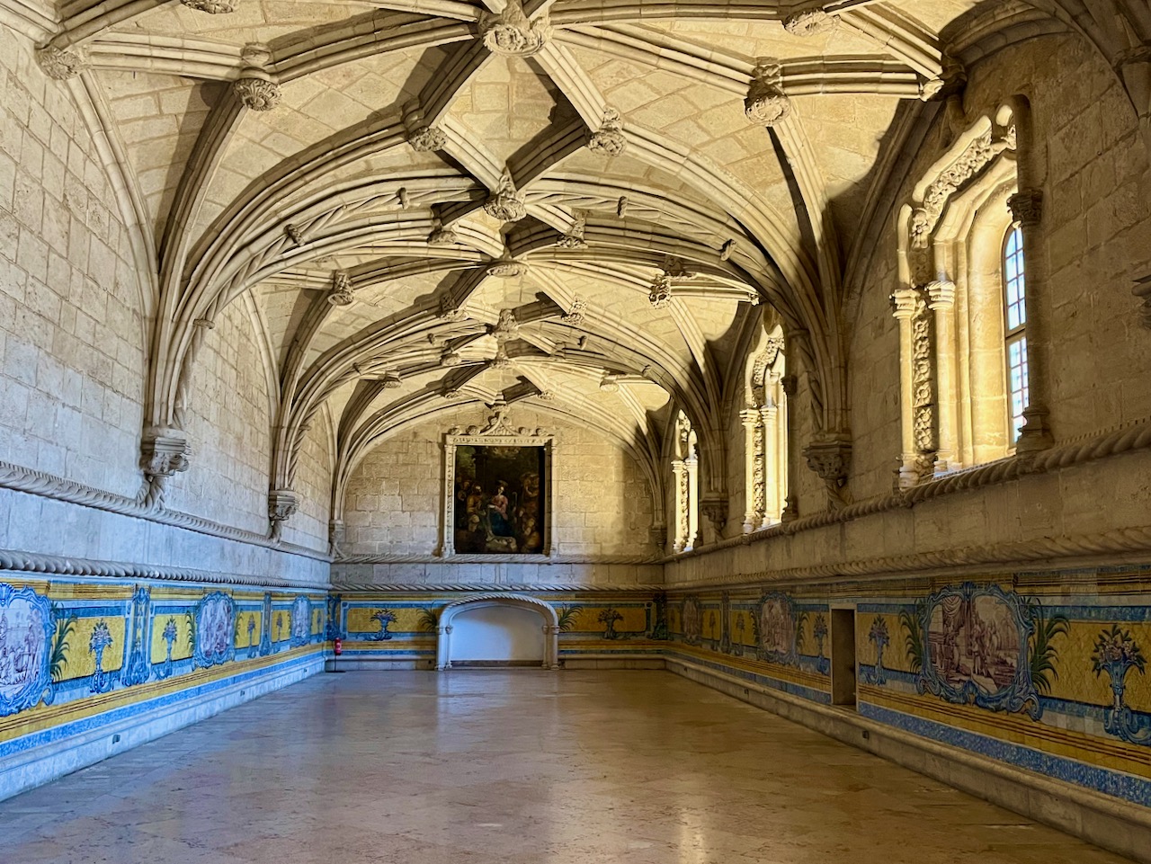
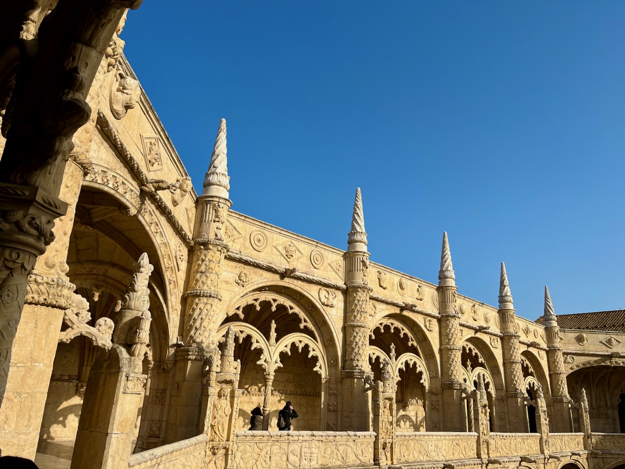
Up the shore from the Monument to the Discoveries sits the grand monstrosity of the Jerónimos Monastery. I’m sharing only a couple photos from this place, as I’ve already grown tired of monasteries and churches. The historical point of this place is that it’s a prime example of the Manueline style of architecture (named after King Manuel I), which can be described as ‘Portuguese Late Gothic,’ a very ornate style of architecture. It features nautical imagery, botanical motifs, as well as many elements appropriated from conquered cultures.
This is the dining hall the monks ate in.
Part of the courtyard of the Jerónimos Monastery showing off many of the elements of Manueline style. Belém Tower, previously pictured, is also an example of Manueline style.
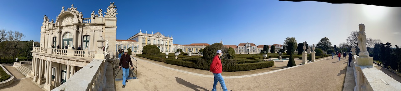
Next we drove to the town of Queluz to tour the Palácio de Queluz, or ‘Palace of Queluz’, to see the other summer residence of the Portuguese royal family. Unlike the Pena Palace (see Chapter 1 of my blog), this summer residence served the dynasty about a hundred years prior to the Pena Palace castle era, dating back to the late 1700’s through the Napoleonic era, when France invaded Portugal in 1807. When Napoleon approached, the Portuguese royal family temporarily fled the country.
Anyhow, I digress. This place was built in the Rococo style of architecture, which is just another name for Late Baroque; for all intents and purposes, it just means Baroque style gone crazy with ornamentation and useless detail.
Honestly, Mary and I enjoyed the gardens surrounding the palace a lot more than the inside. Here’s a shot of the gardens. Even though it’s midwinter in Portugal, things are pretty green.

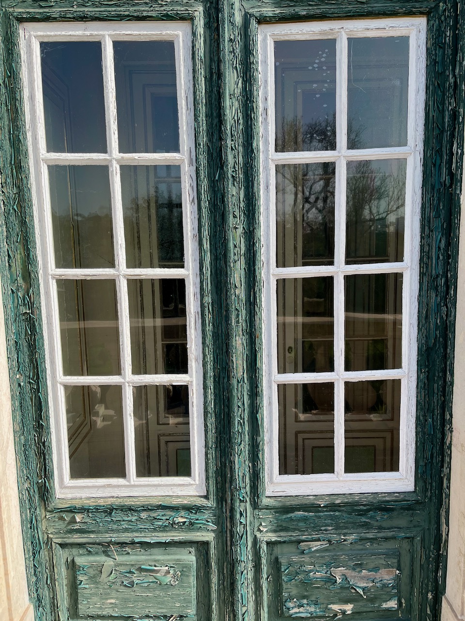
Parts of the palace itself are in disrepair, like these doors which are in desperate need of paint. The place is now owned by the state, and part of it is still utilized today to house visiting dignitaries. I’m guessing their apartments must be better kept?
Our tour of the summer palace took us through innumerable royal apartments, but utterly ignored any areas where the servants and staff worked or resided. To me this museum is mostly another reminder why the age of kings was mostly a bad idea.
Enough pontificating. This painting is fascinating because it’s a 17th century rendering of the Tagus River. And what should be towering in the middle of the river? Belém Tower which Mary and I had just visited yesterday! Here’s direct evidence that hundreds of years ago the Tower was in the middle of the river. Now it’s on the bank.

Recall that I mentioned the royal family fled when the French invaded Portugal? In 1807 the French army invaded Portugal, led by Jean-Andoche Junot, 1st Duke of Abrantes. Abrantes immediately began to prepare the palace for a visit from his conquering hero, Napoleon. It’s said that Napoleon refused to sleep in any bed that had been used by another person. So Abrantes moved in a whole new set of bedroom and bathroom furniture into one of the palace’s state rooms. Alas, Napoleon never made it here, but his chamber pot still remains. Yes, this is, indeed, the chamberpot of Napoleon.
Another painting of note in the Palace of Queluz. King John VI of Portugal, who ruled from 1816 to 1822, is considered to be one of the ugliest monarchs in history. Photographs don’t lie (unless airbrushed or Photoshopped) but a clever royal portraitist could work wonders. Except if the subject was as tragically homely as poor King John.

We finally got out into the Queluz palace gardens. Mary took this panoramic shot. You can see Yours Truly to the left. Like some kind of miracle, the aspect of Mary’s iPhone makes me look marvelously thin.
Mary hamming it up with one of the Lewis Carroll-like statues in the palace gardens.

Next our tour bus drove us to the seaside resort town of Cascais. If you’re well heeled or own a yacht, this is the place to stay. We stayed just long enough to have Sunday brunch. Here I am enjoying a brunch with red wine. The Portuguese offer you wine with just about everything.

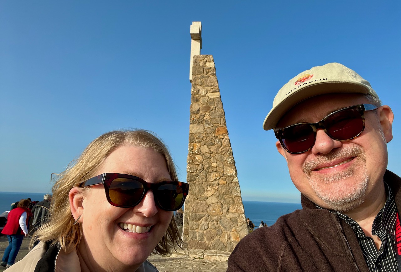
Next our multi-town dash took us a bit south to see the westernmost point of Continental Europe, Cabo da Roca. The Romans had a very cool name for this granite cliff: Promontorium Magnum.

Mary photographing the Atlantic at Cabo da Roca.

Mary and Yours Truly at the westernmost point of continental Europe.
The Atlantic Ocean off the coast of Portugal.
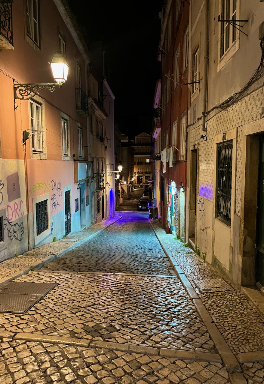
That evening, we hired a pair of local guides, Anette and Christine, to take Mary, me and three other fellow travelers on a ‘Foodie Walk’ through the Barrio Alto neighborhood of downtown Lisbon. We went in search of gourmet Tapas and wine. The three venues we would eventually visit were all down narrow alleyways like the one pictured here.
Our first stop was at a tiny hole in the wall restaurant that serves speciality Portuguese tapas. We sat down for a tapas of Sardine atop a baked potato. Sardines are a specialty of Portuguese cuisine, and I can promise you this will only be the first of many varieties I’ll be trying.
The chef (and owner) recommended this be paired with one of Portugal’s legendary Vinho Verde wines. It translates to ‘Green Wine’ or ‘Young Wine.’ These are young wines from the northeastern region of Portugal. They are bottled only 3 to 5 months after the grapes are harvested. These are not sparkling wines, but are almost effervescent, or just short of ‘semi-sparkling’. So our whole gang of five tourists enjoyed Vinho Verde for the first time. It complimented wonderfully with the sardine tapas, light, refreshing, reminiscent of Sauvignon Blanc, but lighter and brighter.

On our way to our next restaurant we passed an Irish pub of all places. Its place in the alleyway was marked by clotheslines full of women’s bras. We found no hint of the women who owned these bras.

Our next restaurant served us a tapas of marinated pig cheeks atop garlic bread. The chef recommended a red wine.
Ok, only a few days into our Portugal trip, I’ve already lost count of how many glasses of Portuguese wine I’ve drunk. Here’s the thing: most restaurants don’t even give you a choice of which brand or winery to choose from. You simply specify red, white or green, and get served whatever that particular chef is stocking. Wine is like tap water here. And so we had our extremely tender pig cheeks served atop aggressively garlicky toast with a nice glass of red.

On our way to our third restaurant, we passed this bold and beautiful street art in an alleyway. It is art commemorating Portugal’s Carnation Revolution from April 1974. This is when Portugal finally transitioned from a dictatorship to a full-fledged democracy. It’s a long and complicated story, but the culmination of events was marked when revolutionaries approached the soldiers to stuff carnations into the muzzles of their guns.

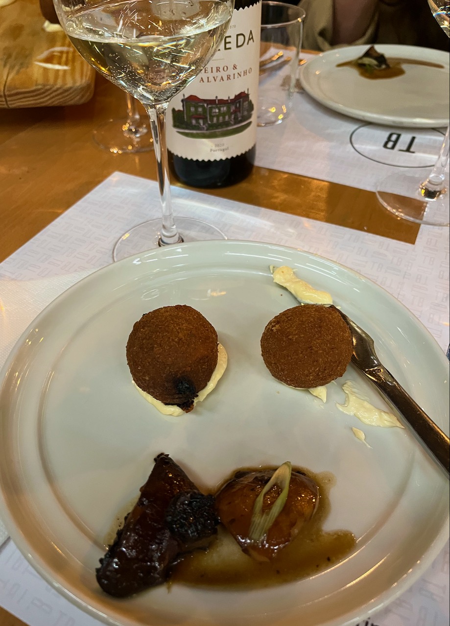
Our night ended with a set of balls. First off, our paired balls were served with sautéed garlic mushrooms. Mary and I are learning that garlic is a staple item in almost all Portuguese cuisine. What’s also staple is history.
The ball on the left was a squid ball. Inside the squid was pitch black; when Portuguese serve squid, they make sure to color it with squid ink. It’s rolled in a fine batter and deep fried. The ball on the right was a ‘Jewish ball’, made out of chicken sausage, celebrating the history of Jews moving into Portugal in medieval times to escape persecution. Jewish families would take chicken and color it with paprika and then make it into sausage. When Christian church leaders would come to Jewish households to see if the Jewish families had converted to Christianity, the easiest way to check was to see if they were now eating pork. The paprika-colored chicken would fool them.
And thus ended our night of food and history. Mary and I learned that the cuisine of Portugal is unique, flavorful and inextricably combined with its history. That history has brought Portugal to a modern democracy that celebrates a population that is very multicultural and multi-lingual. More on all of this in future blogs.
Next chapter: Drinking booze from chocolate cups.
An Idiot in Iberia – Chapter 2
For our second day in Lisbon we took a taxi to the city’s heights, the Castelo de São Jorge. This highest point in the city has been occupied for centuries. First the Celts lived here, then ancient Phoenicians, then Carthaginians, then Romans, then Moors and finally early Christians, who became what we know today as the Portuguese.
This gate leads to a castle and small town that has variously served as village, military base and a royal palace through the centuries.
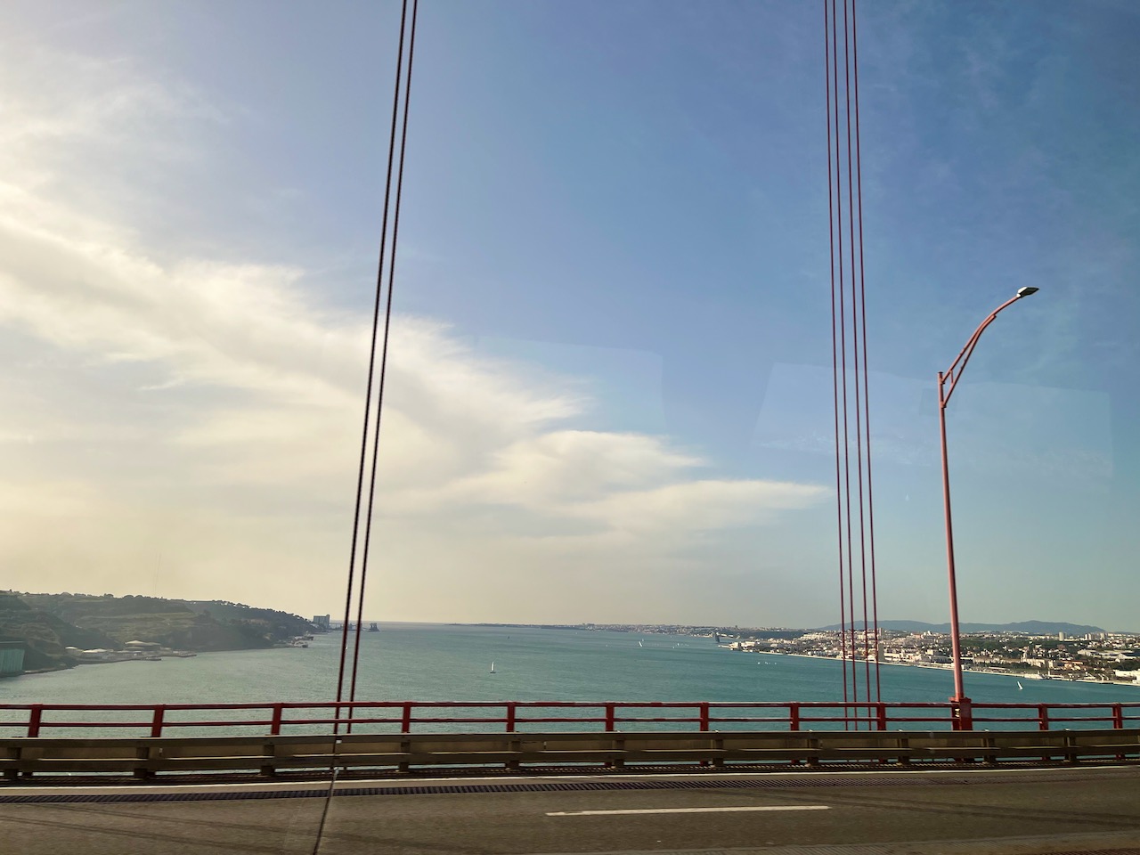
The view from the plaza outside Castelo de São Jorge. To the right you can see the Ponte 25 de Abril Suspension Bridge, which crosses the Tagus River shortly before the river empties into the Atlantic Ocean.

Mary and me on the Castelo de São Jorge plaza with the rooftops of Lisbon and the Tagus River below us.
A view of Lisbon and Lisbon harbor. You can see how wide the Tagus River is before it spills into the ocean. The Tagus Rivers flows a thousand miles from mid-Spain, and is considered a dividing line between northern and southern Portugal.
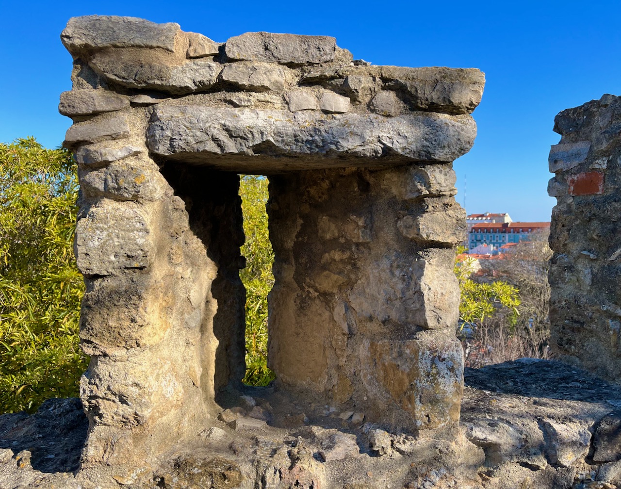
Archways span the walkway outside of São Jorge. This castle’s structure dates back to the first century BC. However, archeologists have confirmed people were living on this hilltop all the way back to the 8th century BC.
The same archways seen from the other direction. I just thought they were really beautiful.
Mary and me in the chilly sunrise above the rooftops of Lisbon.
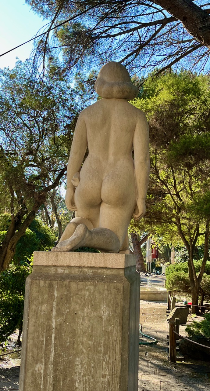
A freakish penis statue with arms and buttocks. Mary would not let me take a photograph of its front.
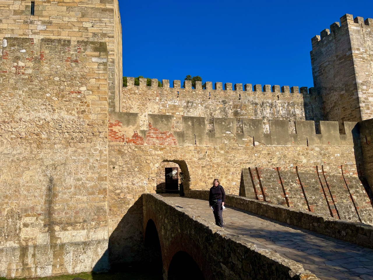
Mary standing on the main entrance to Castelo de São Jorge. These immense walls resisted several sieges against the Moors.
One of two inner courtyards. All kinds of bizarre medieval fuckery went on in these courtyards. At one time they kept a pair of lions in this castle.

In the late 14th century, Portugal King John I dedicated this castle to Saint George (of dragon fame) since this castle proved so successful in resisting several Moors sieges throughout the 1300’s.

The ramparts are diabolically designed, allowing you to shoot arrows through narrow slots while your fellow crusaders pour cauldrons of boiling oil through between the gaps in the ramparts.
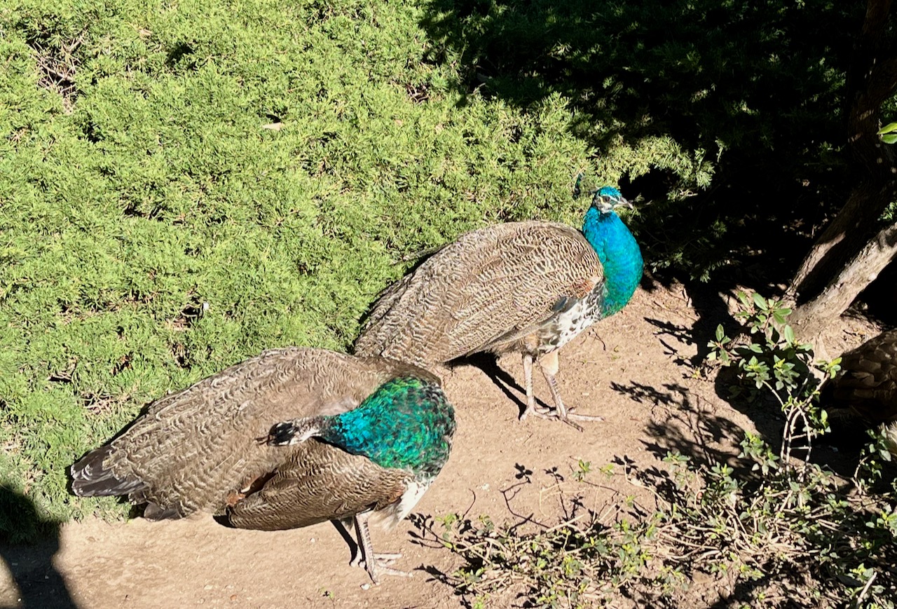
No self-respecting medieval castle would be completed without peacocks.
This castle now contains a modern museum where archeologists have exhumed centuries of clues to reconstruct much of the history of this high ground. The challenge is that so many factions fought over this high ground over the centuries, that the winners would obliterate everything left over from the losers. Here are a couple of ancient Phoenician vases painstakingly reassembled from their crumbled bits.

After touring the castle, Mary and I made our way down to Lisbon harbor through a maze-like tangle of narrow streets and alleyways. Some are so steep the city has given up trying to pave these alleyways into roads, turning them it into long staircases. People live and work in houses and apartments along these stairs.

This shot gives you a sense of Lisbon’s many curvy and steep medieval streets.

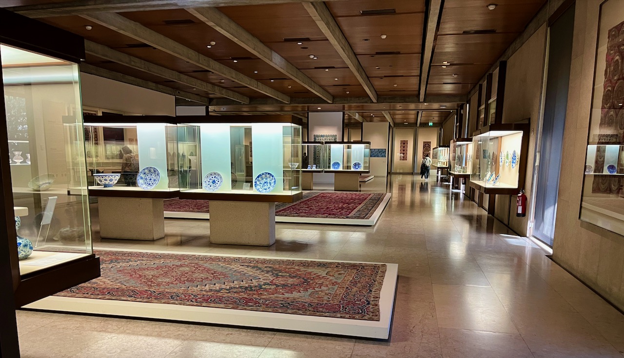
After having cappuccino at the harbor, Mary and I took a subway to the Calouste Gulbenkian Museum of Art in Lisbon. It’s a private art collection, established in 1957. No, compared to some of Europe’s great museums, most people never heard of this place (I hadn’t until Mary read about it in Rick Steves). But it contains treasures from ancient Egypt, paintings from Monet, Manet, Sargent, Rubens and Rembrandt and sculptures from Rodin.
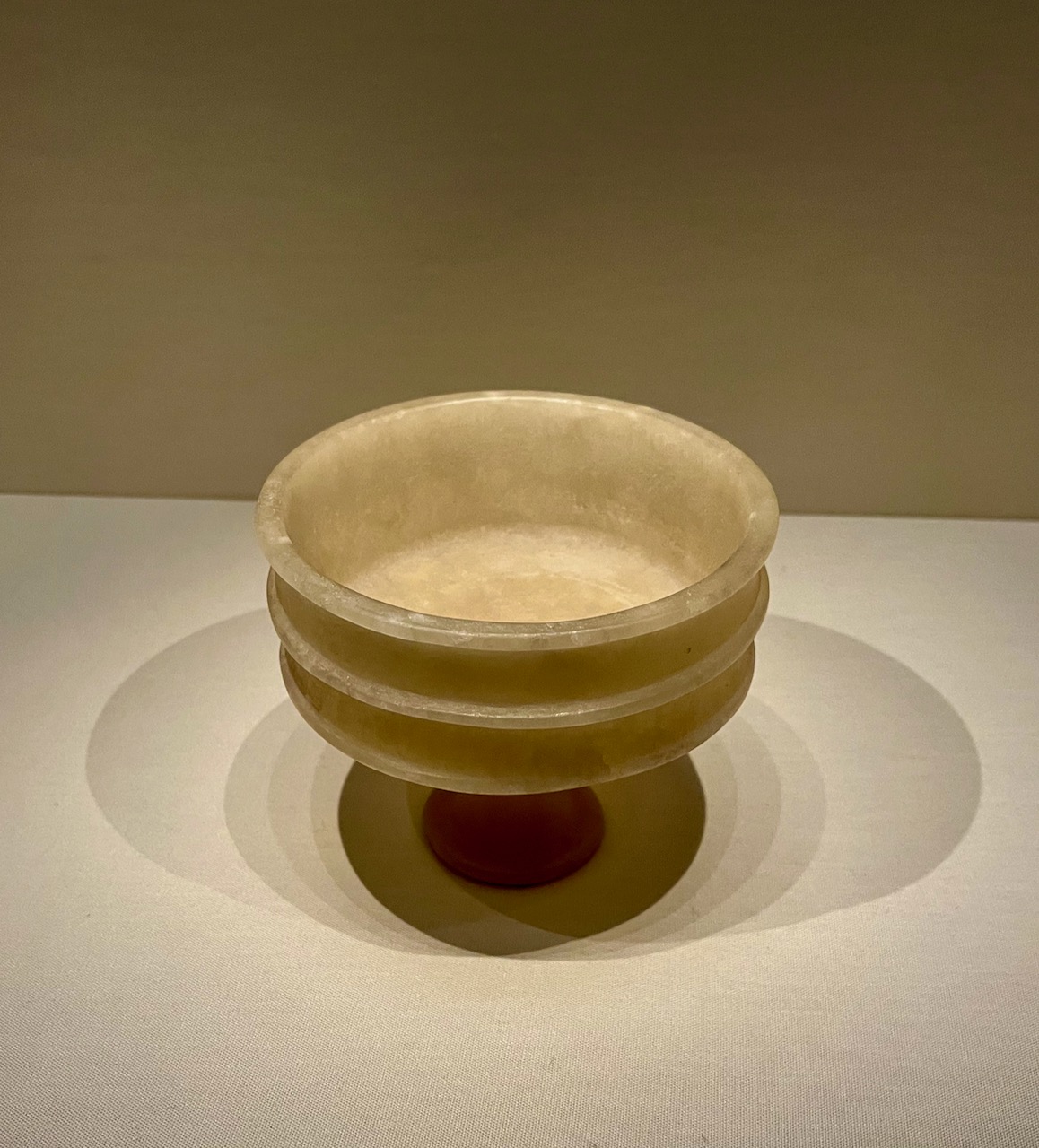
This alabaster cup from ancient Egypt is over four and half thousand years old.
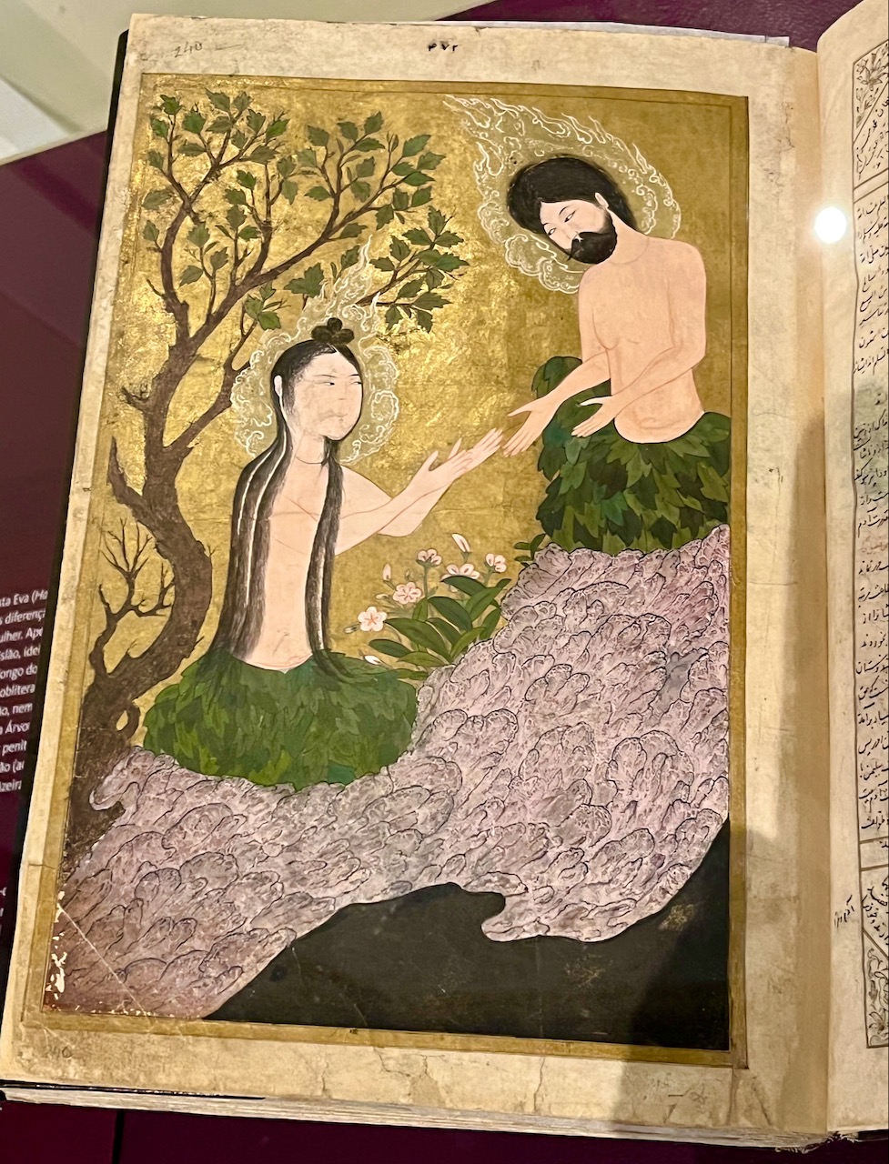
This 15th century Persian book narrates a version of the Adam and Eve story where it’s Adam who is seduced by the serpent, and not Eve.
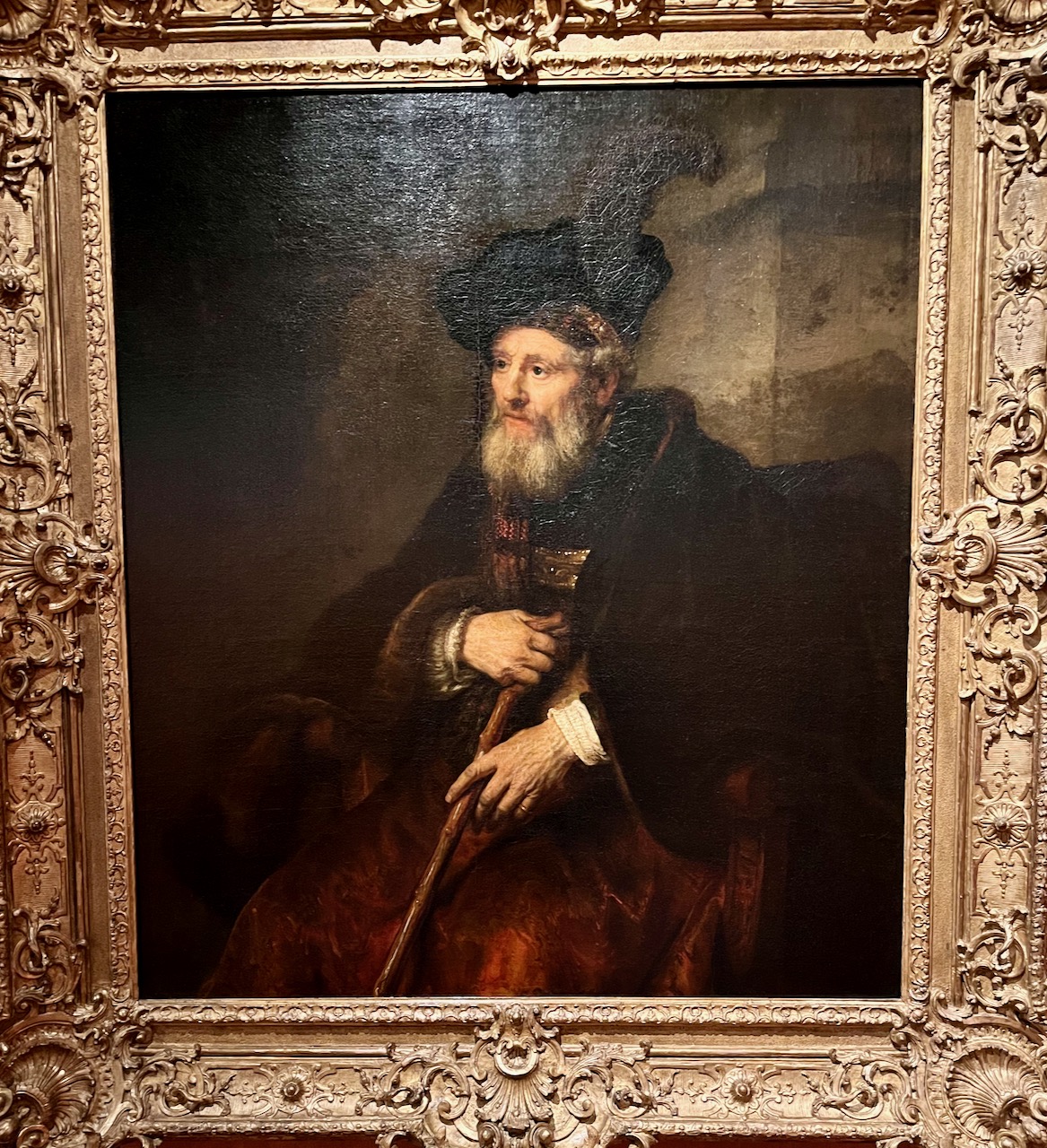
Look! I’m standing right in front of Rembrandt’s famous ‘Portrait of an Old Man’, painted in 1645.
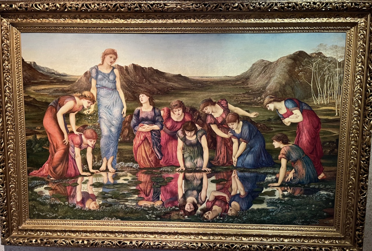
To my delight, I discovered a couple of Pre-Raphaelites. Here’s Edward Burne-Jones’ ‘Mirror of Venus’, painted in 1877.
Mary and I ended our day by enjoying a small repast at the museum’s cafe. They checked our vaccinations statuses, like most places do in Portugal, which makes us very happy. Being the gluttonous artsy-fartsy old codger that I am, I was most happy to enjoy lunch after enjoying art.
Coming in Chapter 3: Revelations about Portugal’s ‘green’ wines.
An Idiot in Iberia – Chapter 1
Many months ago when many of us thought the Covid pandemic would subside, Mary and I booked a trip to Portugal. We’d done the research, and Portugal led most the world in pandemic responsiveness. Then Omicron hit. As this new variant surged we tried to cancel our trip–the tours, the rentals, the flights–but it was too late. It was all or nothing. So we collected together our vaccination records, got tested and flew over. Yes, like many other folks, our overseas flight was canceled the day before departure. Luckily it got rebooked and we made it!
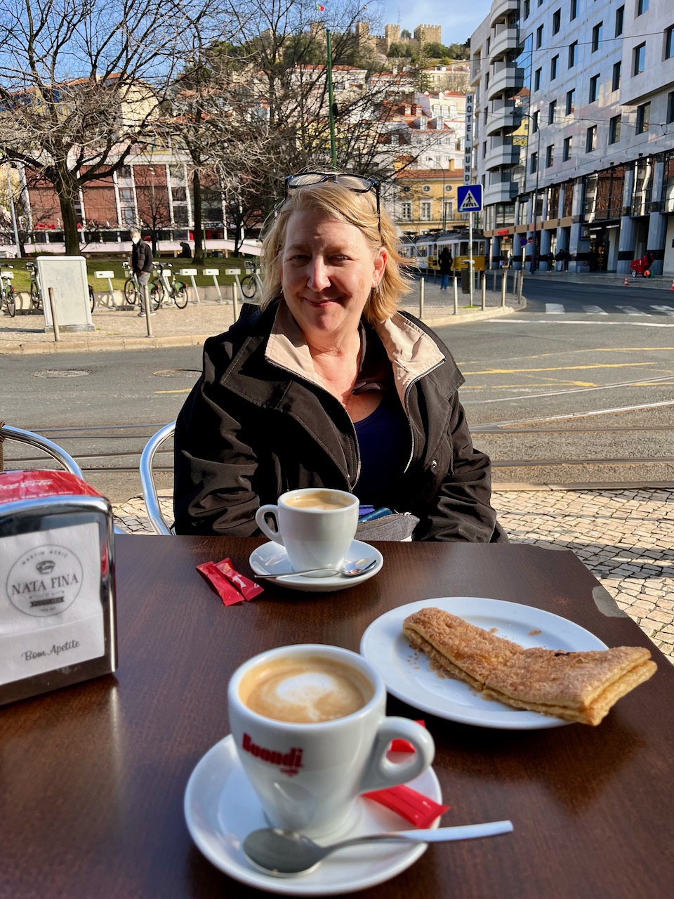
Here’s Mary and Yours Truly sitting at a sidewalk café in downtown Lisbon, enjoying Irish coffees. We needed the caffeine boost to help ward off jet lag.
The red rooftops of Lisbon. Our stroll downtown took us to a bird’s eye view of the city. In the distance, the mouth of the Targus River as it empties into the Atlantic Ocean.
A glimpse from above of one of the many streets, this one unusually straight. Lisbon is full of hills and curves and narrow streets. It’s kind of the San Francisco of Europe. Unlike San Fran, much of Lisbon is crazy ancient. It’s the second oldest ‘capitol’ in Europe after Athens. Lisbon’s founding goes all the way back to the time of Julius Caesar.
Lisbon’s origins may go back to Julius Caesar, but today it is a mash-up of old and new. Here’s a steam-punkish tower rising next to an advertisement for new apartments. We took an elevator up this metal tower, which is how I got the two previous shots.

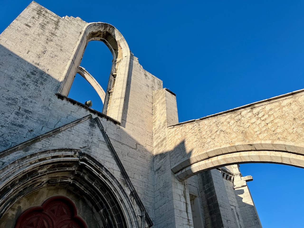
Much of Lisbon prior to the 18th century is forever lost. In 1755 a massive earthquake destroyed virtually all of the city. Here’s a shot of the Carmo Ruins, a convent that was seriously damaged in the earthquake. Today it’s part of a museum. These ruins stand within half a block of a Starbucks and a Burger King.
There are walkways and sidewalks all over Lisbon, but hardly any of them are plain concrete or asphalt. They are tiled. The designs are legion, many with a Moorish influence.

If you want to eat inside a restaurant in Portugal, you must provide proof of Covid vaccination. If you happen to be one of the extremely rare Portuguese who isn’t vaccinated, or some foolish American who managed to land here without a vaccination, you’ll have to eat outside. Many, many restaurants do offer outdoor seating. Though it’s the middle of winter here, the average daily high is in the low 60’s. The weather’s been lovely. Still, we’ve seen a lot of locals wearing scarfs and winter caps and fleeces. They’re just not used to the cold like we Wisconsinites.

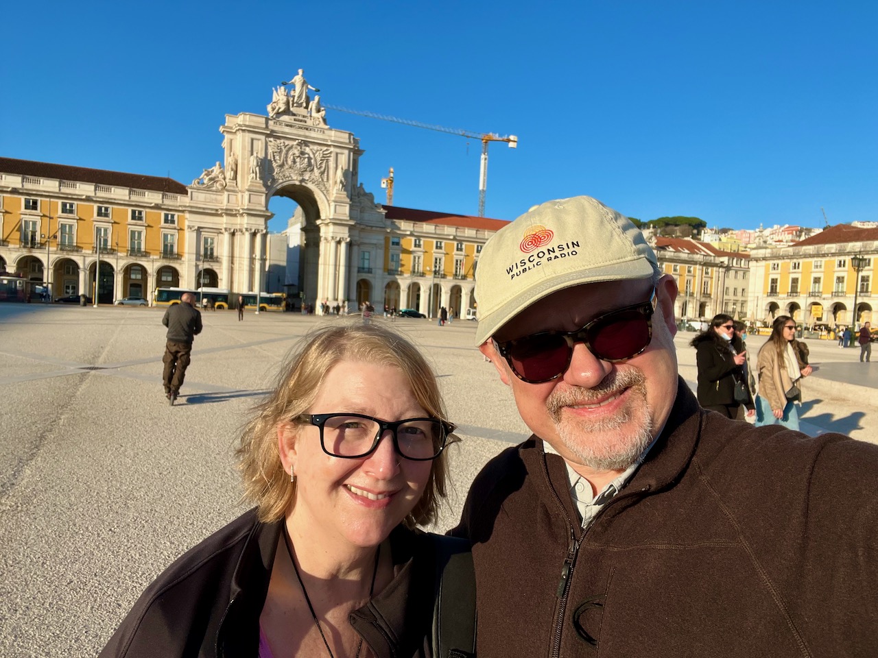
Mary and I hiked to Praça do Comércio, which translates to ‘Commerce Square.’ This is a large plaza right on Lisbon Harbor. This old square used to house an old Royal Palace, which was destroyed in the earthquake of 1755. In its place the then de facto ruler of Portugal, Sebastião José de Carvalho e Melo, 1st Marquis of Pombal, rebuilt the area as a center of commerce. The buildings you see in this photo are post-earthquake, about 250 years old. By European standards, that’s young.
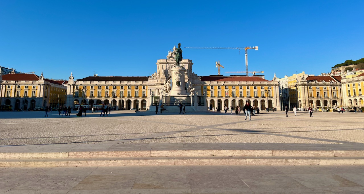
Mary and me basking in the glorious January sun at Praça do Comércio, Lisbon.
Cais das Colunas, the unofficial entrance to Lisbon Harbor on the Targus River. These two columns were erected after the 1755 earthquake and corner a set of marble stairs (which were submerged in the tide when I took this shot).

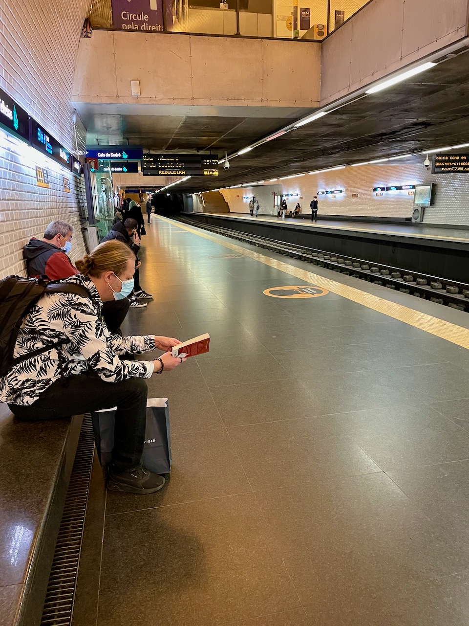
Mary and I are staying at a hotel that’s a couple miles up from downtown Lisbon. After only a day we were able to figure out the Lisbon subway system. It’s super modern, frightfully clean and very fast. From the doorstep of our hotel we can be downtown in 20 minutes.

Since we’re talking about the subway, it stands to reason we had to ride in cars with lots of other people during a pandemic. I’d like to point out that Portugal and its citizens take Covid very seriously. Everybody we see is wearing a mask indoors and covers their noses. Young, old, even white males (like the 2 pictured here). There is no shitty anti-vax, I want my liberty attitude anywhere.
We had to test Covid-negative to get into the country, and every restaurant and hotel checks your vaccination status upon entry. Portugal is not fucking around. Get this: Portugal does NOT recognize American CDC vaccination cards! To Portugal, the United States is like some kind of third-world country. Deservedly so, in my opinion. So how are Mary and I getting into restaurants and hotels? A friend of a friend who lives in Portugal turned us onto an online database where we were able to register and verify our vaccinations and boosters. We now can show our iPhones at every indoor place and are welcomed in as members of civilized society. Portugal is a world leader in Covid management. We are loving this country.
On our second day, after a good night’s sleep to fight the jet lag, Mary and took a train up to the town of Sintra for some sightseeing. The trains are fast, sleek, clean and on time.
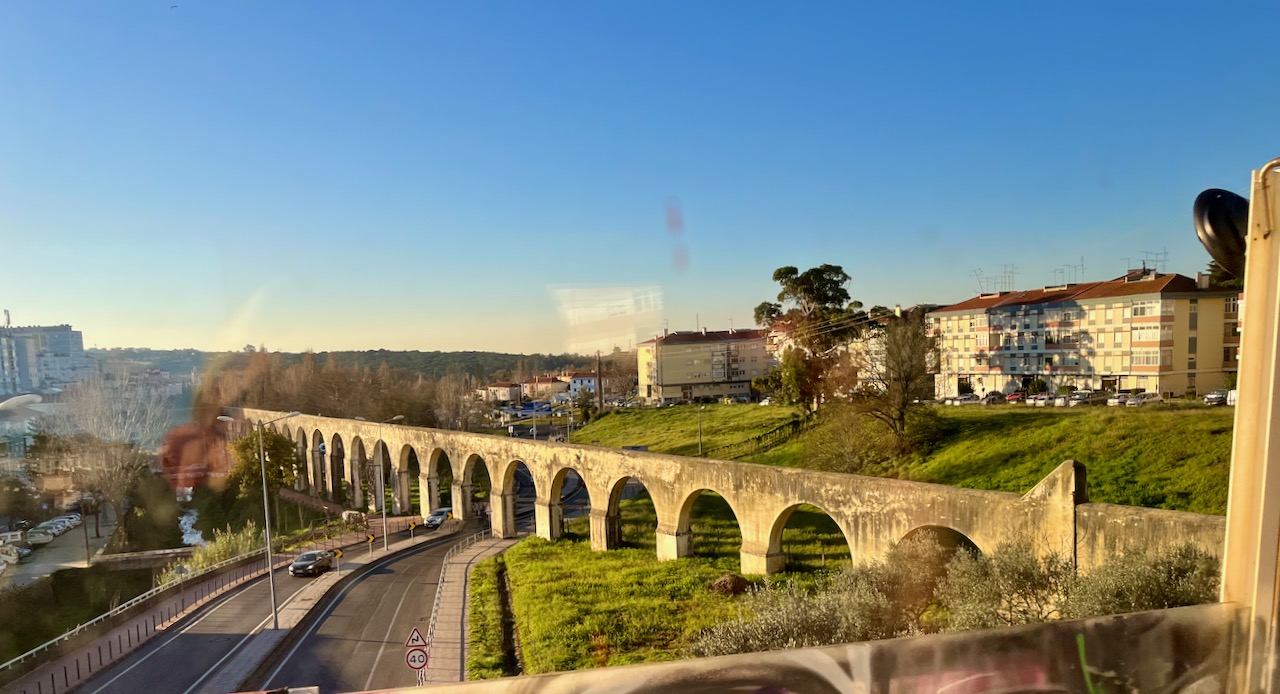
On the way up to Sintra I was able to grab a shot of the Aqueduto das Aguas Livres, aqueducts erected in the middle of the 1700’s.
As a side note, back in the 1800’s Portugal’s most notorious serial killer, Diogo Alves, threw over seventy of his victims from the top of these aqueducts. Until he was caught, many believed these bodies were suicides.
Mary and I arrived in the small tourist town of Sintra. It’s the off season and there’s a pandemic, so the place was not that crowded. We came to visit Pena Palace, the final residence of the disposed Portuguese royal family, who were sent into exile in 1910. The last few generations of the ‘Braganza’ royal family used this place as their summer residence.

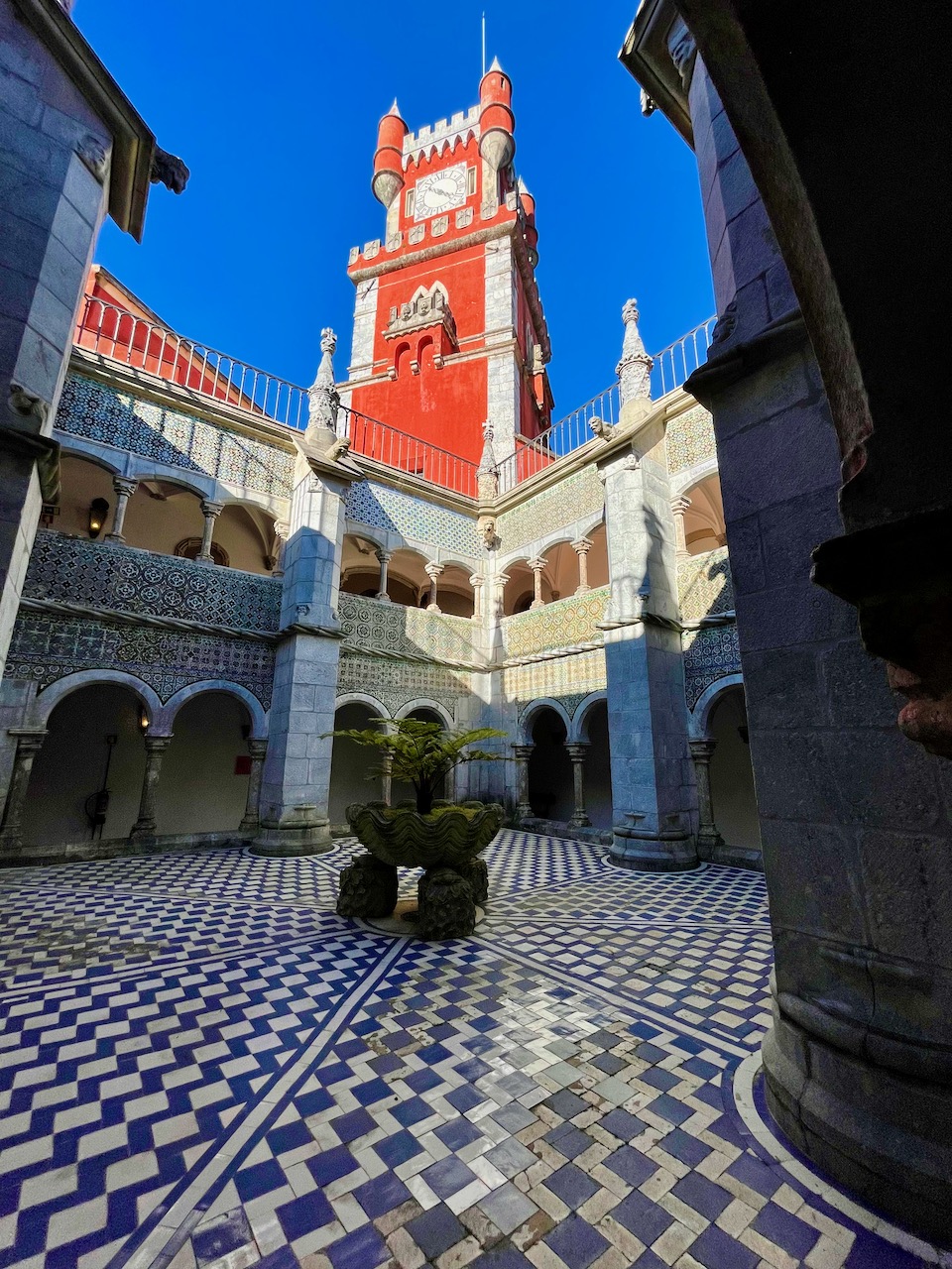
A view from the interior of Pena Palace, looking up at the clock tower. This interior section gives away the palace’s origins. Situated on a mountain, this place was originally a monastery. Just like Lisbon, that annoying 1755 earthquake reduced the monastery to ruins. Less than a hundred years later, in 1838, young King Ferdinand II was looking for something to do. He bought the land and commissioned an amateur architect to design a palace. The resulting gargantuan structure is a hodgepodge of styles–Neo-Gothic, Neo-Manueline, Neo-Islamic and Neo-Renaissance.
A lot of the interior rooms are lovingly preserved so that we can see today how the royals lived. Presumably this is to remind modern Portuguese citizens that Kings, Queens and their families live opulently, usually on the shoulders of their subjects. Here’s the personal office of the penultimate King of Portugal, King Carlos and his son, Manuel, the LAST King of Portugal. Manuel fancied himself a painter and painted gigantic murals of nudes that till this day hang in this office. I opted to photograph only these two (you don’t know this, but you should thank me). King Manuel I was disposed in 1910. Evidently, he wasn’t a very good king, and he wasn’t a very good painter.

A cabinet in one of King Manuel I’s offices. In addition to being a mediocre painter, he had horrendous taste in art.

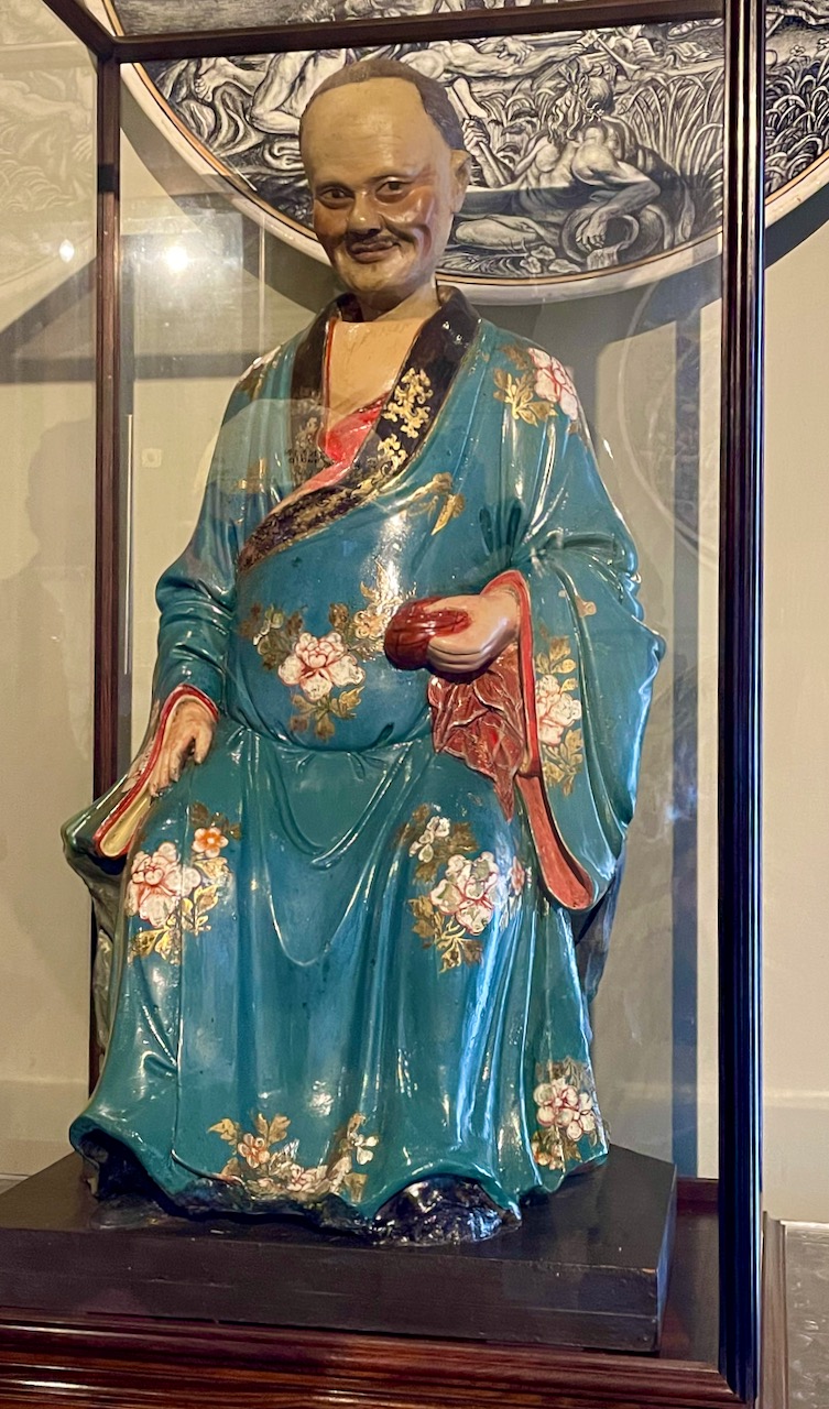
Mary photographed this little gem in one of King Manuel’s rooms. I don’t know if this is Manuel or…I just don’t know.
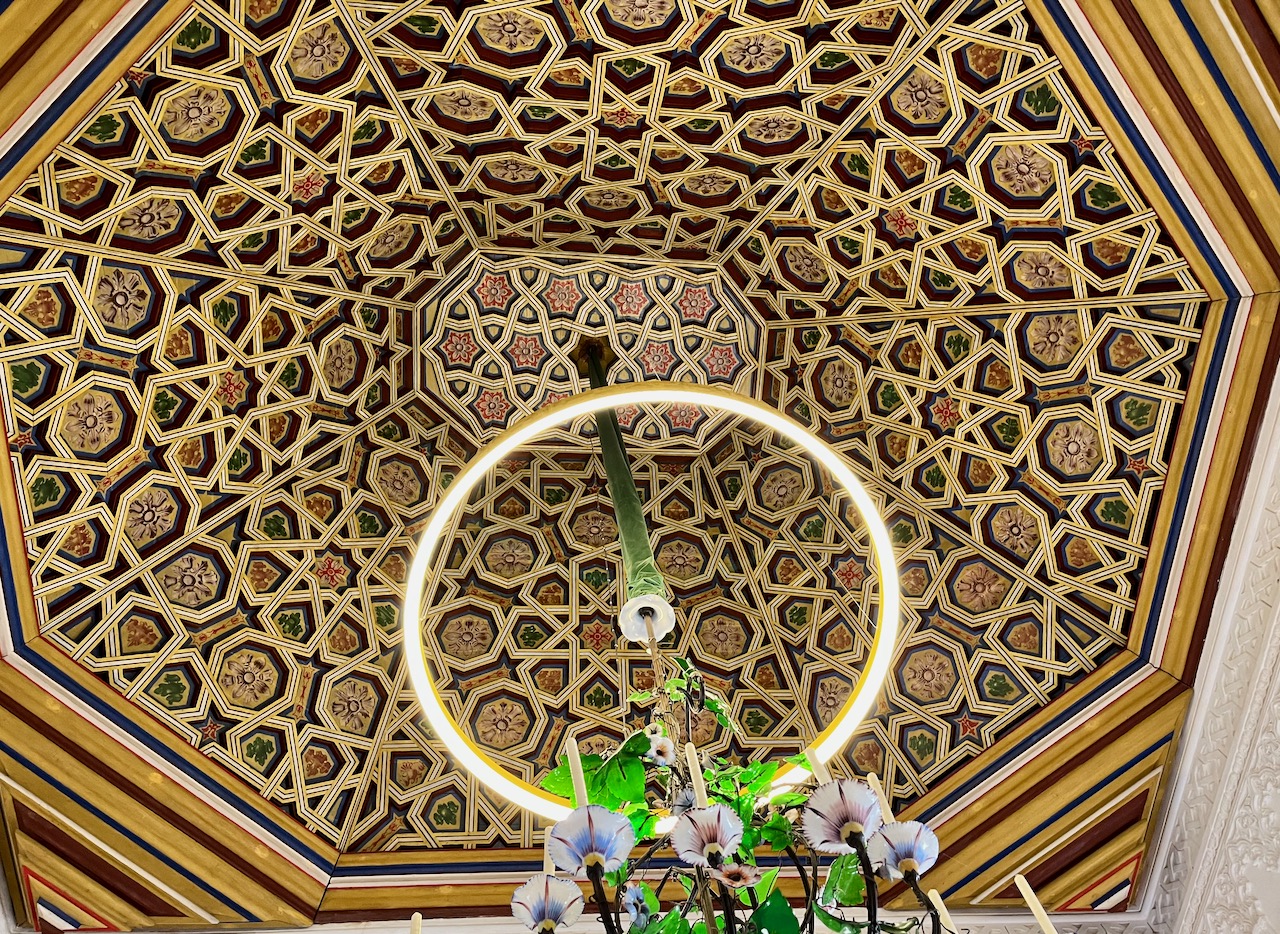
A prime example of the Moorish architectural influence in Pena Palace. A gorgeous domed ceiling.
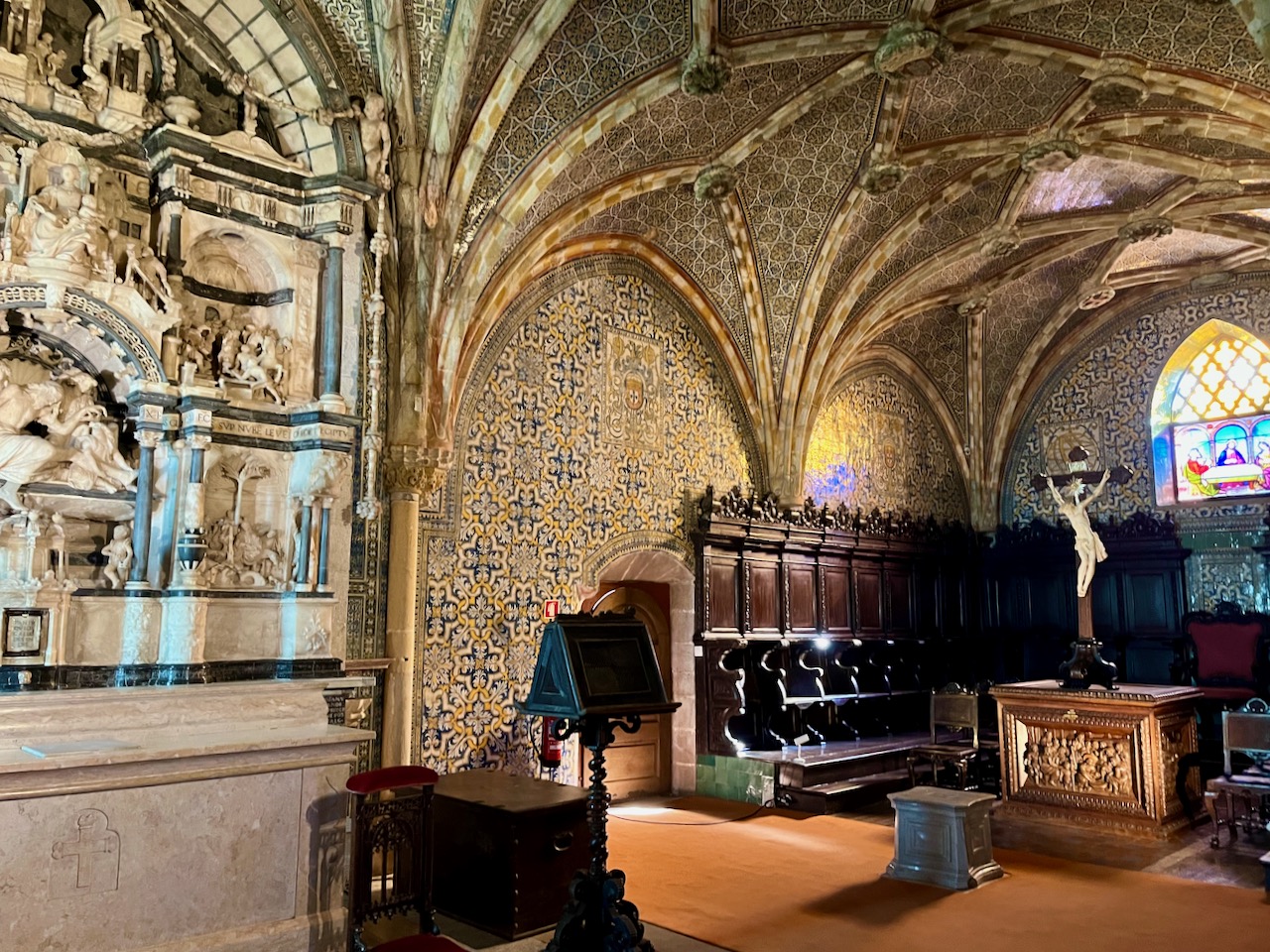
The private chapel where the royal family could go pray and make themselves feel better about being oppressors.
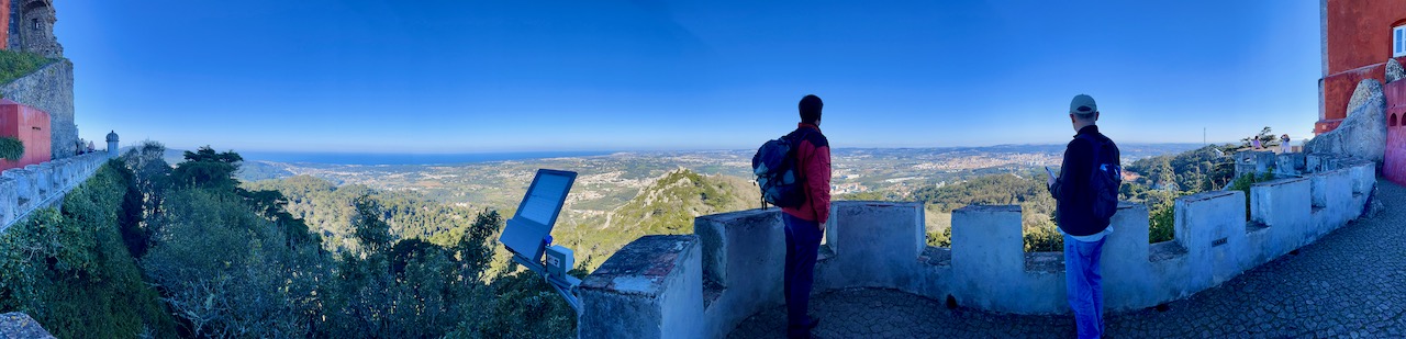
From Pena Palace you can see for miles in every direction. And if you’re brave enough, you can walk along the ramparts. Here’s a nice view of the Portuguese countryside with a view of the Atlantic Ocean.
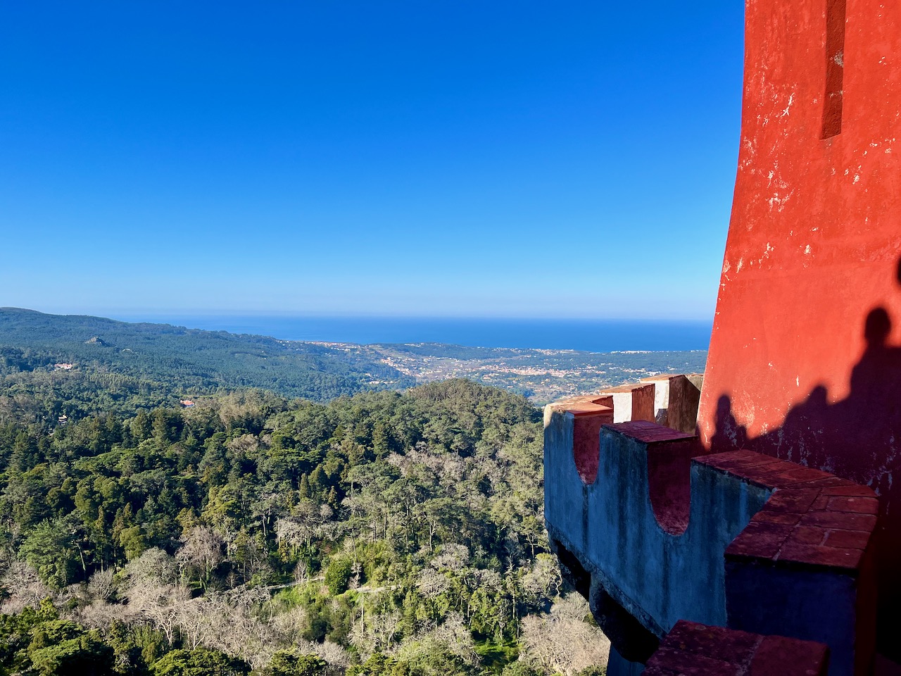
Mary took this marvelous panoramic shot along the ramparts of Pena Palace. Left of center is a solar-powered light. Right of center stands Yours Truly, gazing out over the landscape.
My sweetheart Mary and me atop the heights at Pena Palace.
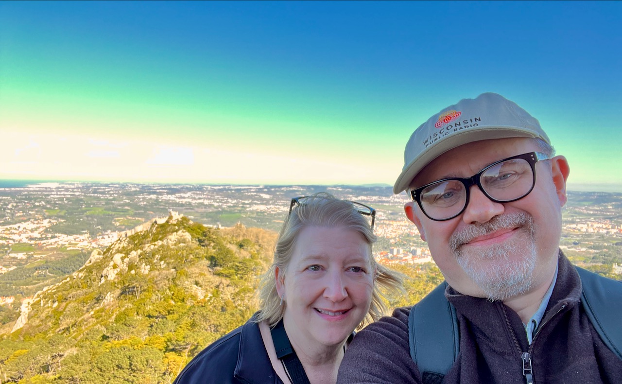
Next Mary and I hiked over to the next mountain to tour the ruins of an ancient Moorish Castle.
To be clear, the term ‘Moors’ refers to the Islamic inhabitants of northern Africa, the Iberian Peninsula and some islands in the Mediterranean. But use of the term has become questionable, used in a broad derogatory sense by Christian Europeans, who’ve used it to refer to all Muslims, whom they hated. Today ‘Moorish’ is used to mean the art, architecture and civilization of Muslims in the 8th to 15th centuries.
The Moors and early Christians fought one another for centuries, murdering millions in the names of their Gods. Speaking of Gods, this little outcropping of rocks greets as you approach the Moorish Castle. It’s not part of the castle, it’s a tomb containing a mix of Christian and Islamic dead. When good old King Ferdinand ripped apart the old monastery to build his castle, they exhumed a bunch of bodies that were in the way. They were marked as both Christian and Muslim and got moved here.

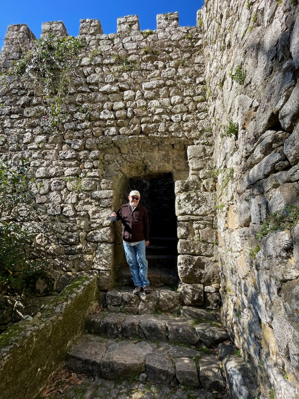
One of the entrances to the Moorish Castle. The place was built in 700 to 800 BC and many of the portions that exist today were restored by King Ferdinand II and the government of Portugal after the monarchy fell. The Moors originally built this sprawling complex as a strategic stronghold. In 1147 it was captured by the Christians.
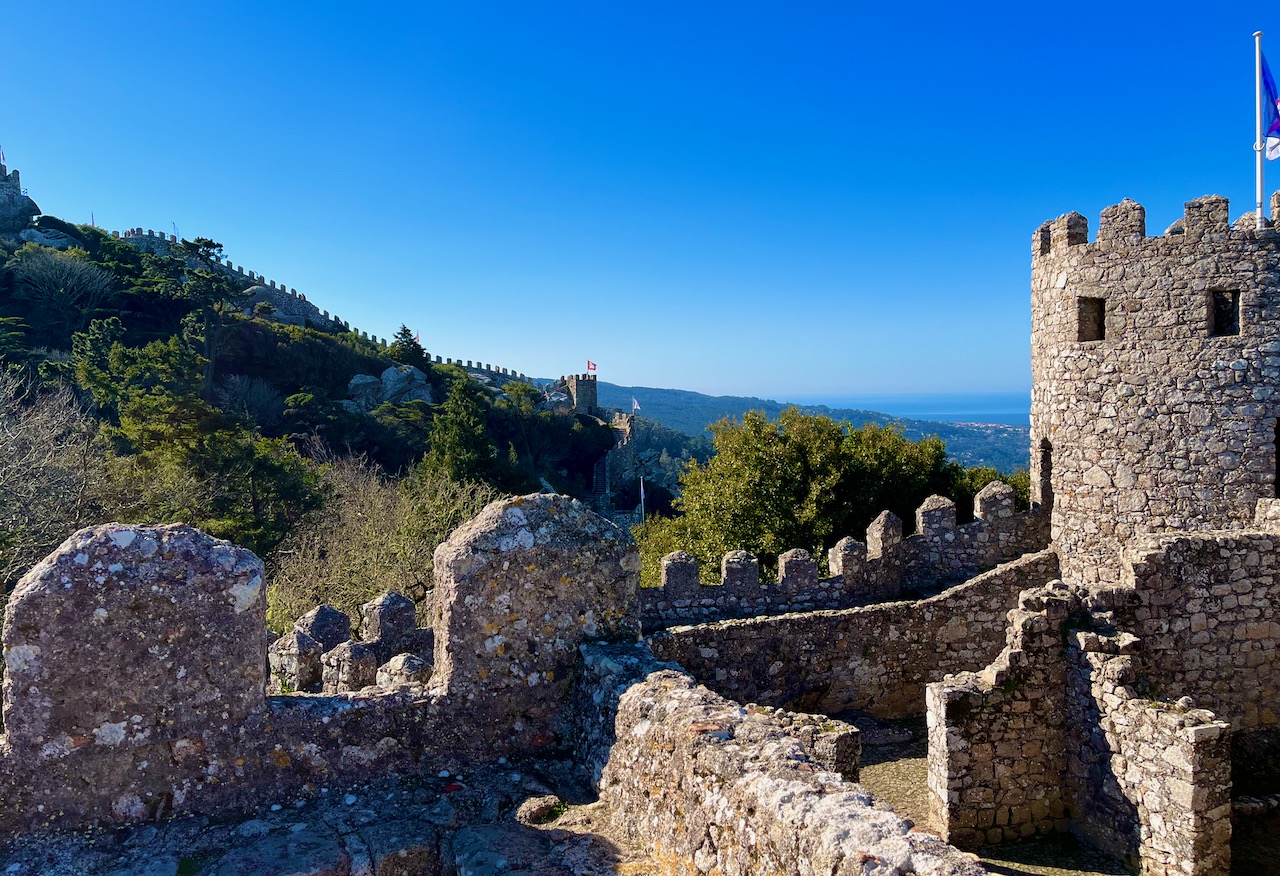
A view of one of the many turrets in the Moorish Castle.
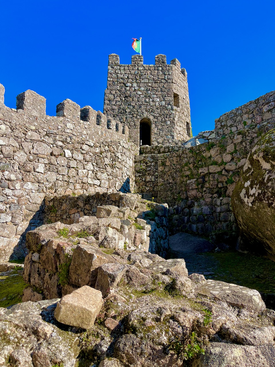
Another view of the Moorish Castle. Along the horizon you can see the line of ramparts. The place is immense.
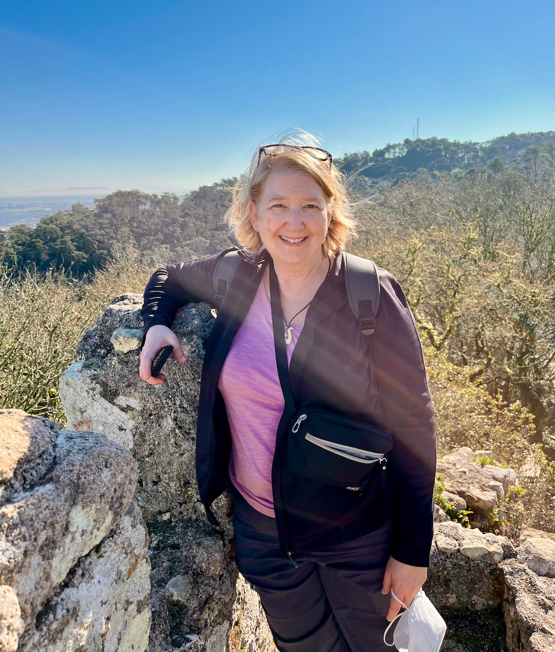
Yours Truly atop the ramparts at the Moorish Castle, a relic dating back over a millennium.

Here is Mary atop the ramparts of the Moorish Castle. Behind her to the left of the photo you might catch a glimpse of the ocean.
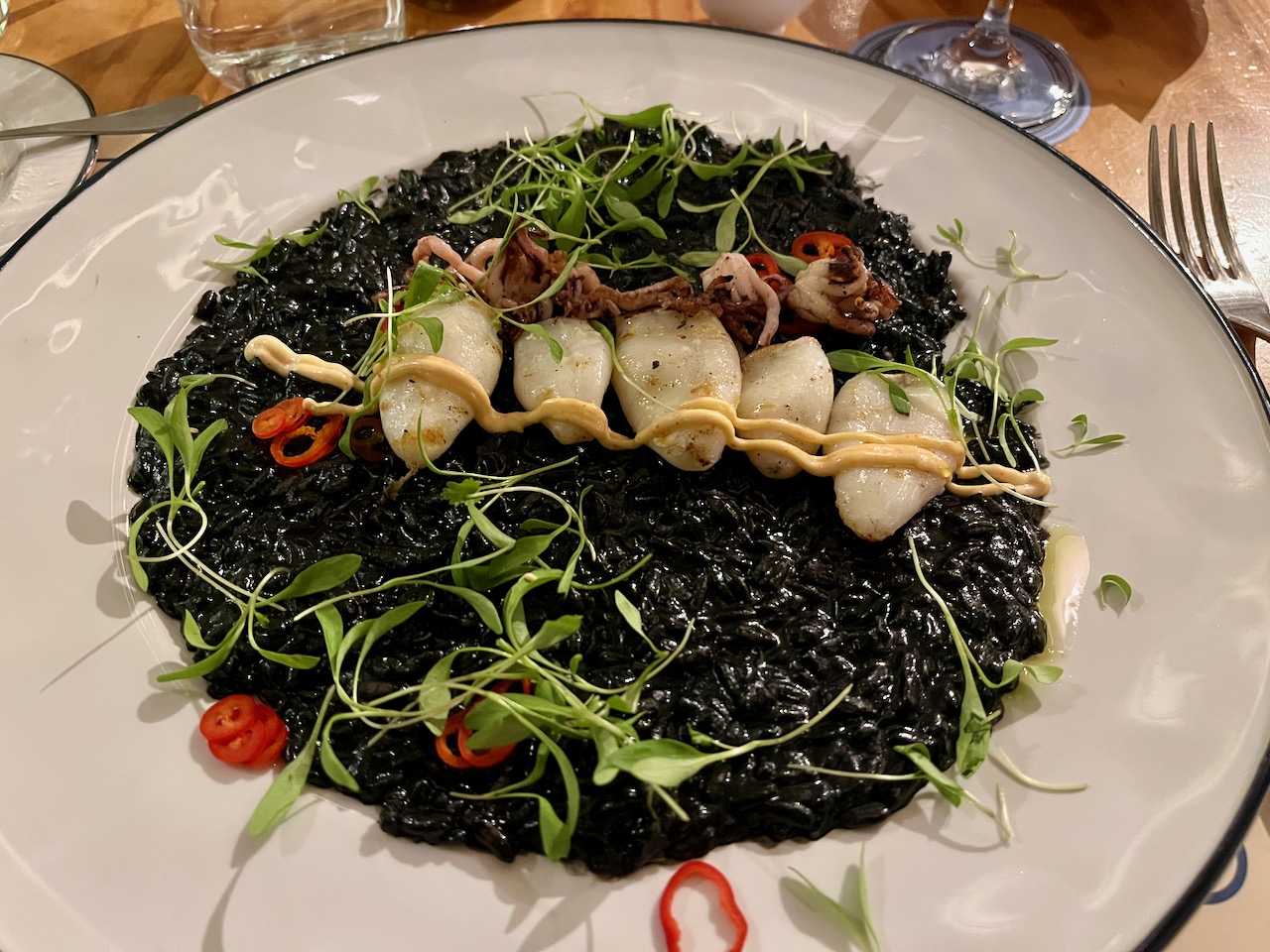
We ended our second day at a restaurant a friend recommended, Bairro do Avillez. Mary had the shrimp done Portuguese style, and I had a local specialty, broiled squid (pictured). They use the ink of the squid to render the rice black. A scrumptious meal, washed down with copious amounts of Portuguese wine.
End of Portugal section.
